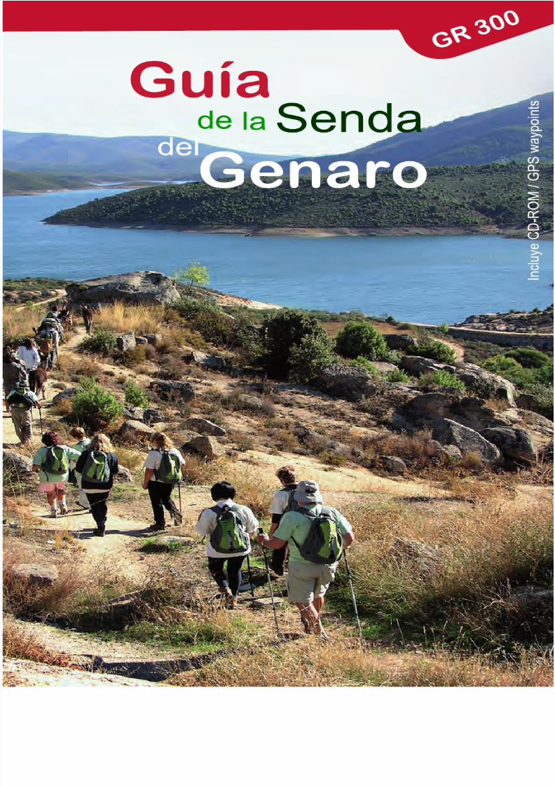
Libro Senda Del Genaro GR300
157
-
Upload
mayayo-carrerasdemontanacom -
Category
Documents
-
view
223 -
download
0
Transcript of Libro Senda Del Genaro GR300
8/3/2019 Libro Senda Del Genaro GR300
http://slidepdf.com/reader/full/libro-senda-del-genaro-gr300 1/156
8/3/2019 Libro Senda Del Genaro GR300
http://slidepdf.com/reader/full/libro-senda-del-genaro-gr300 2/156
8/3/2019 Libro Senda Del Genaro GR300
http://slidepdf.com/reader/full/libro-senda-del-genaro-gr300 3/156
PRÓLOGO.....................................................................................................................4
RECOMENDACIONES SOBRE LA SENDA DE GENARO.............................................7
LA SENDA DE GENARO Y SU SEÑALIZACIÓN.................................................................15
ETAPA1 (El Berrueco - Patones de Arriba)........................................................................23
DATOS DE INTERÉS........................................................................................... 25RUTÓMETRO.................................................................................................... 35
ETAPA 2 (Patones de Arriba - El Atazar).........................................................................47DATOS DE INTERÉS........................................................................................... 49RUTÓMETRO....................................................................................................... 59
ETAPA3 (El Atazar- Robledillo de La Jara).........................................................................71
DATOS DE INTERÉS........................................................................................... 73RUTÓMETRO....................................................................................................... 81
ETAPA4 (Robledillo de La Jara - Cervera de Buitrago).......................................................89
DATOS DE INTERÉS........................................................................................... 91RUTÓMETRO....................................................................................................... 97
ETAPA 5 (Robledillo de La Jara - El Hospitalillo).......................................................101
DATOS DE INTERÉS.......................................................................................... 103RUTÓMETRO...................................................................................................... 111
ETAPA6 (El Hospitalillo - Mangirón)................................................................................117
DATOS DE INTERÉS.......................................................................................... 119RUTÓMETRO.......................................................................................................125
ETAPA7 (El Hospitalillo - El Berrueco)...............................................................................129
DATOS DE INTERÉS.......................................................................................... 131RUTÓMETRO.......................................................................................................137
Variantes RutasBTT ........................................................................................................143
INTRODUCCIÓN.......................................................................................... 145VARIANTE 1 (El Berrueco - Patones de Arriba)...................................................151VARIANTE 2 (Patones de Arriba - El Atazar).......................................................155
Directorio..............................................................................................................................159
ÍNDICE
8/3/2019 Libro Senda Del Genaro GR300
http://slidepdf.com/reader/full/libro-senda-del-genaro-gr300 4/156
4 Prologue
PROLOGUE
We present here the journey that has supposed the creation of the Senda del Genaro, startedmore than 10 years ago. A project that I have had the luck and responsibility of living really close
to, because right now I am assuming the functions as President of the recently created Reservoir Atazar’s Community, picking up from there our feeling orientated to the recuperation of communications and life in common. This project of recuperation and enhancement of the oldlocal roads and of the bridle paths gives the Councils of the Community a different union, morerural and more tourist also it avoids their loss as well as for the ancient forms of life associatedto them, giving an alternative form to know this community linked to the water landscapes thatthe Atazar’s Dam provides, the biggest and most important Dam in the Community of Madrid.
These years have enriched our day by day with experiences and anecdotes. From the beginning
we counted with total support of the Consejeria de Medio Ambiente both for the project and itsexecution. In that occasion we did the road exploration ridding on mares and sleeping in theJuan Gil’s spot in the shores of the reservoir. They resulted as very hard day’s journeys but verywell recompensed with the great advance in the work done. Also the collaboration of theneighbours in the Community allowed us to find old bridle paths, lost and covered with vegetationdue to the lack of use for many decades.
After these starts was installed the collaboration between the El Berrueco’s City Hall and the LaPicota’s juvenile association, to at least once a year revive the paths of our ancestors and travelaround the reservoir for four days and pass through out the six river councils. All was to be done,
but we had plenty of hope and even in the first year it was already 35 hikers that together we dida great job and marked for the first time the path with blue paint and with a cardboard stencil of a doodle that we decided to name “Genaro” leaving the path baptized as Senda del Genaro andserving as base for the project realization.
In this way and year by year at the beginning even clearing out the paths of brambles androckroses with the sticks we had to help us hike, now with the project all done, it is a satisfactionto travel along this clear and well marked roads doing hikes in a wide way, because it is alsofeasible to do it on horses or bicycles.
For me it has supposed a strong challenge and to this day the Senda del Genaro has been doneand executed by the “ Consejeria de Medio Ambiente, Vivienda y Ordenacion de la Comunidadde Madrid”. The end result is what we present to you in this fabulous guide, that with the supportof the Ministery of Industry, Tourism and Commerce we can publish with the most advancetechnological support.
My most deep gratitude to these institutions; the Council Mayors, technicians and neighboursof the Community, as well as for all those that believed in this project, bringing hope and welldoing so that now it is an accessible reality for all.
Jaime Sanz Lozano
President of the Atazar Reservoir Community
8/3/2019 Libro Senda Del Genaro GR300
http://slidepdf.com/reader/full/libro-senda-del-genaro-gr300 5/156
5Prólogo
PRÓLOGO
Presentamos aquí la andadura que ha supuesto la creación de la Senda del Genaro, iniciadahace más de 10 años. Proyecto que he tenido la suerte y responsabilidad de vivir muy de cerca,
por encontrarme en ese momento asumiendo las funciones de Presidente de la recién creadaMancomunidad del Embalse del Atazar, recogiendo desde allí nuestro sentir encaminado a larecuperación de comunicaciones y vida en común. Este proyecto de recuperación y puesta envalor de los antiguos caminos vecinales y de herradura nos proporciona a los municipios de laMancomunidad, una unión diferente más rural y turística, además de evitar su pérdida así comola de las formas de vida ancestrales asociadas a ellos, aportando una forma alternativa para co-nocer esta comarca vinculada a los paisajes del agua, que nos proporciona la presa del Atazar la más grande e importante de la Comunidad de Madrid.
Estos años han ido enriqueciendo de vivencias y anécdotas nuestro día a día. Desde el inicio,contamos con el apoyo total en el proyecto y su ejecución de la Consejería de Medio Ambiente.En aquella ocasión, realizamos la exploración de caminos a lomos de yeguas y pernoctando enel paraje de Juan Gil, a orilla del embalse. Resultaron jornadas durísimas, pero recompensadaspor el notable avance en dicha tarea. Así mismo, la colaboración de vecinos de los municipiosde la Mancomunidad, permitió encontrar caminos de herradura perdidos y cubiertos de vegeta-ción por él en desuso desde hace décadas.
Tras estos inicios, se instauró la colaboración entre el Ayuntamiento de El Berrueco y la asocia-ción juvenil La Picota, para al menos una vez al año, revivir la sendas de nuestros antepasadosy dar la vuelta al embalse durante cuatro días y pasando por los seis municipios ribereños. Todoestaba por hacer, pero sobraba ilusión y ya el primer año fuimos 35 senderistas, que hicimos ungran trabajo ya que marcamos por primera vez la senda, mediante pintura azul sobre plantillade cartón de un muñeco al que dimos en llamar “Genaro”, quedando así bautizada la Senda ysirviendo de base para la realización del proyecto.
De esta manera y año tras año, al principio incluso despejando el camino de zarzas y jaras con
los palos que llevábamos para andar, ahora con el proyecto ejecutado , es una satisfacción re-correr estos caminos limpios y bien marcados haciendo senderismo en amplio sentido, puestambién es factible realizarlo en bici o caballerías.
Para mí ha supuesto un enorme reto, y, al día de hoy, la Senda del Genaro ha sido realizada yejecutada por la Consejería de Medio Ambiente, Vivienda y Ordenación de la Comunidad de Ma-drid. El resultado final, es el que aquí os presentamos esta fabulosa guía, que gracias al apoyodel Mº de Industria, Turismo y Comercio, podemos publicar con el soporte y apoyo tecnológicomás avanzados.
Mi más profundo agradecimiento a dichas instituciones, a los alcaldes, técnicos y vecinos de laMancomunidad, así como a todos las personas que han creído en este proyecto, aportando ilu-sión y buen hacer, para que hoy sea una realidad accesible para todos.
Jaime Sanz Lozano
Presidente de la Mancomunidad
Embalse del Atazar
8/3/2019 Libro Senda Del Genaro GR300
http://slidepdf.com/reader/full/libro-senda-del-genaro-gr300 6/156

8/3/2019 Libro Senda Del Genaro GR300
http://slidepdf.com/reader/full/libro-senda-del-genaro-gr300 7/156
8 Recomendaciones
RECOMENDACIONES SOBRE LA SENDA DELGENARO y SU TOPOGUÍA
Lo cierto es que el catálogo de recomendaciones aluso es variado, y al final de este capítulo reseñare-
mos algunas a modo de BUENAS PRÁCTICAS. Peroantes deseamos plantear algunas consideraciones ala hora de abordar este GR 300, tan singular comopeculiar.
ÉPOCA DE REALIZACIÓN
En principio debemos saber que estamos en unazona de sierra y por tanto la orografía, la altitud y laclimatología pueden llegar a ser extremas. Los au-tóctonos de la zona, montañeros y ciclistas, reco-miendan esta senda como ideal para la primavera yel otoño, ya que la ruta puede resultar muy dura,dadas las temperaturas. Por ejemplo en verano, por la escasez de agua, pese a estar dándole la vuelta aun embalse.
Es necesario, por tanto, recordar que el aprovisiona-miento de agua es complicado en la ruta. Sí que, enlos finales o al comienzo de ella, hay fuentes y ma-nantiales, pero durante el trayecto son más que es-casos. Por tanto, proveerse de agua y de comida.
USOS
Fuera del contexto de fin de semana la senda se en-cuentra muy solitaria, por lo cual, hay tramos quese pueden hacen en bicicleta, aunque ello requiere de
cierta prudencia y precaución. Debemos evitar derra-pajes y conducciones agresivas, sin olvidar que esta-mos, en algunos casos, realizando tramos que sóloestán dedicados a los senderistas. Ya saben, el queavisa…
La senda, en ese sentido, es divertida por sus tramostécnicos y exigencias, aunque también presenta va-riantes para aquellos ciclistas que no deseen com-plicarse la vida.
En todo el recorrido tienen preferencia los senderis-tas, por lo cual se ruega a los usuarios ciclistasprudencia y consideración al cruzarse con ellos,aunque estemos en zonas amplias. Cuando nos en-contremos en zonas estrechas o sendas, se debeparar la bicicleta y ceder el paso a los senderistas, o
dejarles hacer de forma tranquila sus maniobras de
SENDA DEL GENARORECOMMENDATIONS AND TOPOGRAPHYGUIDE
What is true is that the lists of userecommendations are several and at the end
of this chapter we will review one or two asGOOD PRACTICES, but before we wish tobring up some considerations when startingthis GR 300 that is very singular andpeculiar.
SEASON TO MAKE THE ROUTE
As a start lest say that we are in a mountainarea and for that the orography, the altitudeand weather can be extreme, the natives of
the area and the usual hikers and cyclistsrecommend this route as an ideal one to doduring Spring and Autumn because duringthe seasons of Summer and Winter, theroute can be really hard due to thetemperatures, and as an example inSummer due to the shortage of water beingparadoxical that we are travelling around awater reservoir.
For all this it is necessary to remember thatthe water supply is complicated along theroute, there are fountains and water springsat the beginning and end of it but during theroute the fountains are more than scarce.For that have good supplies both of water and food.
USES
Outside the weekend context, the route is
very desolated for which there are parts thatdoing them by bicycle require someprecaution and prudence, they can be donein a peaceful way running away from slipsand aggressive ridding, although don’t forgetthat in some cases you will be doing partsthat are only dedicated to hikers.
The route in this sense is fun because of thetechnical parts and demands, although it
also presents variants for those cyclists thatdon’t desire to complicate things.
Along the route the hiker has preference,because of this, precaution is asked for andalso consideration when coming aroundhikers, even though we come up to them inan open wide area. When we find ourselvesin paths or narrow areas, we have to stopour bicycle and give way to the hikers or letthem do in a peaceful way their security or
8/3/2019 Libro Senda Del Genaro GR300
http://slidepdf.com/reader/full/libro-senda-del-genaro-gr300 8/156
9Recomendaciones
seguridad o ubicación; para vernos bajar por lasenda, lo que puede ser todo un espectáculo. Ante
todo precaución y respeto.
Es muy posible que por la senda os encontréis burros
o caballos, pues estos antiguos trazados han servidocomo viales de comunicación entre pueblos, y las re-atas de estos animales han trasegado por estos laresaños y años. Y aunque no se ha señalizado advir-tiendo esta eventualidad, no será difícil que os en-contréis con dichos animales acompañados de suspropietarios. Por tanto, que nadie se asuste, los due-ños os harán las indicaciones pertinentes para queno ocurra ningún percance.
EL RECORRIDO
Estamos ante un recorrido diverso, en ocasionesduro, por desnivel o climatología, y que, ademástiene la complicación logística de que las etapas sonde ida y vuelta. A veces volver al punto de partida sehace complicado, por tanto, en ocasiones, se ha dedesandar el camino. Esta guía, en su apartado de
Rutómetros, indica las dos direcciones de realización(ida y vuelta).
En el caso de la Senda del Genaro, el recorrido com-pleto es un buen número de kilómetros, y ha sido di-vidido en varias etapas. Si bien para BTT puedenresultar pequeñas o cortas, ahí entrará la pericia delusuario a la hora de diseñar la ruta y sus variantes,o bucles a su medida, necesidades y capacidades.
En todo caso, la Senda la hacemos partir de El Be-rrueco y discurre en dirección a Patones; o sea, deforma contraria a las agujas del reloj y, por tanto, todala señalización en soportes (jalones, flechas), aunquesiempre indica las dos direcciones, de ida y vuelta,siempre hay una que es la “marca”. En este caso, ladirección que prima es la de El Berrueco- Patones-Atazar- Robledillo-Cervera de Buitrago (ida y vuelta)El Hospitalillo-Mangiron (ida y vuelta) y El Hospitalillo-El Berrueco. Puede suceder que veamos mejor lossoportes en una dirección que en la otra.
La Senda del Genaro, amén de los 250 soportes quese han colocado, está complementada con otros tipode señales. Por un lado, las antiguas marcas de lasenda, los “genaros”, esos muñecos de color azulque se pueden ver en muchos puntos del recorrido.
location manoeuvres, maybe so they cansee you go down the track, that can be quitean spectacle, but before all, precaution andrespect.
It is possible that through out the route you
come across horses or donkeys, becausethis old paths have served ascommunication routes in between towns andthe feet of these animals have walked thispaths for years and years, even though thiseventuality is not signposted it won’t bedifficult that you find such animalsaccompanied by their owners. For that, letno one feel afraid, the owners will give youpertinent indications to avoid any mishaps.
THE ROUTE
We are in front of a diverse route, in somecases hard because of the slopes or weather, and that also has the logisticcomplication of the stages being round triproutes, and some times the logistic to returnto the start point is complicated, so in someoccasions we have to retrace our steps,although this guide in its “Rutómetro”
(itinerary map) section indicates bothdirections (Round trip)
In the case of the Senda del Genaro, thecomplete route is a good series of kilometresand it has been divided in several stages,even though for the BTT can be small or short there the expertise of the user comesinto place at the time of designing the routeand variants or loops to its own will,
necessity and capacity.In all cases comment that the Senda beginsat El Berrueco and goes in direction toPatones, that is in a counterclockwise formand for that all the signposting in supports(milestones, arrows) even though alwaysshow round trip directions, there is alwaysone that is the mark and in this case the onethat prevails is the El Berrueco – Patones –Atazar – Robledillo - Cervera de Buitrago
(round trip) El Hospitalillo – Mangiron (roundtrip) and El Hospitalillo – El Berrueco (roundtrip), we say this because it can happen thatwe see better the supports in one directionthan in another.
In all cases the Senda del Genaro asidefrom the 25 long supports we have placed itis complemented with other type of marks,on one side the ancient marks of the route
the “genaros” those blue doodles that can be
8/3/2019 Libro Senda Del Genaro GR300
http://slidepdf.com/reader/full/libro-senda-del-genaro-gr300 9/156
10 Recomendaciones
Luego estarían las marcas homologadas del GR(bandas blancas y rojas), bien expresando continui-dad o camino equivocado, según qué casos. En lamaqueta de usos podemos ver su desarrollo.
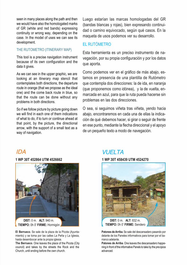
EL RUTÓMETROEsta herramienta es un preciso instrumento de na-vegación, por su propia configuración y por los datosque aporta.
Como podemos ver en el gráfico de más abajo, es-tamos en presencia de una plantilla de Rutómetroque contempla dos direcciones: la de ida, en naranja(que proponemos como idónea), y la de vuelta, en-
marcada en azul, para que la ruta pueda hacerse sinproblemas en las dos direcciones.
O sea, si seguimos viñeta tras viñeta, yendo haciaabajo, encontraremos en cada una de ellas la indica-ción de qué debemos hacer, si girar o seguir de frenteen ese punto, mediante la flecha direccional y el apoyode un pequeño texto a modo de navegación.
seen in many places along the path and thenwe would have also the homologated marksof GR (white and red bands) expressingcontinuity or wrong way, depending on thecase. In the model of uses we can see itsdevelopment.
THE RUTOMETRO (ITINERARY MAP)
This tool is a precise navigation instrumentbecause of its own configuration and thedata it gives.
As we can see in the upper graphic, we arelooking at an itinerary map stencil thatcontemplates both directions, the departureroute in orange (that we propose as the ideal
one) and the come back route in blue, sothat the route can be done without anyproblems in both directions.
So if we follow picture by picture going downwe will find in each one of them indicationsof what to do, if to turn or continue ahead atthat point, by the picture, the directionalarrow, with the support of a small text as away of navigation.
IDA VUELTA
1 WP 30T 452864 UTM 4526662
El Berrueco. Se sale de la plaza de la Picota (Ayunta-miento) y se toma por las calles La Peña y La Iglesia,hasta desembocar ante la propia iglesia.The Berrueco. One leaves the place of the Picota (Citycouncil) and takes by the streets the Rock and theChurch, until ending before the own church.
DIST: 0 m. ALT: 940 m.TIEMPO: 0h 0' FIRME: Hormigón
1 WP 30T 458439 UTM 4524270
Patones de Arriba. Se sale del descansadero pasando por delante de los Paneles informativos para tomar por el ba-rranco adelante.Patones de Arriba. One leaves the descansadero happe-ning in front of the informative Panels to take by the precipiceadvanced.
DIST: 0 m. ALT: 832 m.TIEMPO: 0h 0' FIRME: Sendero
8/3/2019 Libro Senda Del Genaro GR300
http://slidepdf.com/reader/full/libro-senda-del-genaro-gr300 10/156
11Recomendaciones
Esas cuadrículas nos aportan, además, otros datos,como el UTM (longitud-latitud) del punto, que en estecaso es ponderado, para que sirva en los dos senti-dos de la marcha. Es muy posible que cuando al-guien utilice un GPS los números no correspondan
del todo… eso puede deberse a varios factores: loserrores de recepción y parámetros de precisión, oque el Datun del GPS y la cartografía no estén enconcordancia con los utilizados en el trabajo de se-ñalización (WG 84 y Datun European 1979).
Otro punto de toma de datos es el WP, cuyo númerocorresponderá con el que se signe en el track de laruta, y que contiene varios datos: por un lado las
coordenadas UTM ya comentadas; la longitud, quese expresa en metros y parte de 0; por último, en cadacasilla se expresa la cantidad de metros recorrida.
Otra información que se recoge en la casilla marcadacomo WP es la del tiempo de ruta. Este se expresadesde el punto de partida de la etapa, tanto en horascomo en minutos, y es un tiempo aproximado, quese mide sin paradas. A esos horarios estimativos quese expresan en la cuadrícula hay que sumar los tiem-pos de paradas, etc…
CONSEJOS DE BUENAS PRÁCTICAS
* Mantener limpio el entorno, ya que la basura em-pobrece el paisaje.
* Respetar el patrimonio natural y cultural, ya que
es nuestra memoria histórica.* Mantener un cierto respeto por la señalización
de los senderos, ya que ella nos puede ahorrar buenos disgustos.
* Transitar por itinerarios señalizados y procurar seguir las sendas ya marcadas.
* Cerrar las portillas, evitando de este modo peli-
gros para el ganado.* Los senderistas son los más débiles, respétalos
y recuerda que tienen preferencia de paso.
* Evitar los derrapajes y las frenadas bruscas,todos queremos tener la sensación de estar por primera vez en un entorno natural.
Those cells provide beside other data, theUTM point (longitude-latitude) of the pointthat in this case is adjusted so that it worksfor both ways of the hike. It is possible thatwhen someone uses a GPS the numbersdon’t totally correspond… this can be due to
different factors, the reception errors andprecision parameters, or that the GPS Datunand cartography don’t correspond.
Another way of getting data is the WP whichnumber will correspond wit the one thatmarks the path of the route and that containsseveral data: the UTM coordinates alreadymentioned, other data is the longitude thatis expressed in metres and that starts from
0 and in each cell the quantity of metreswalked is given.
Another information that is given in the cellmarked as WP is the travel time. This isgiven from the point of departure of theroute, as well as in hours as in minutes andit is an approximated time that is measuredwithout stops. Because of that to theestimated times given in the cell we have toadd the stops, etc…
GOOD PRACTICE ADVICES
* Keep clean the environment, trash de-
teriorates the landscape.
* Respect the natural and cultural assets,
they are our historical memory.
* Maintain a certain respect for the sign-
posting of the path they can save us
some troubles.
* Walk through signalled itineraries and
try to follow the already marked paths.
* Close gates to avoid danger for the ani-
mals around.
* Hikers are the weakest, respect themand remember they have preference of
way.
* Avoid slips and sudden brakes, we all
want the sensation of being for the first
time in a natural environment.
8/3/2019 Libro Senda Del Genaro GR300
http://slidepdf.com/reader/full/libro-senda-del-genaro-gr300 11/156
CONSEJOS PARA LOS BIKERS
* No salgas a montar sin casco. Tu seguridad eslo más importante (acuérdate del móvil si viajassólo).
* Lleva siempre la bici y el resto del equipo en bue-nas condiciones de uso.
* Procura ser autosuficiente. Lleva herramientas,avituallamiento, vestuario, botiquín, dinero y do-cumentación.
* Acomódate al ritmo de marcha del grupo. Deesta manera evitarás pérdidas y confusiones en
los cruces de caminos.* Sé extremadamente respetuoso con el entorno.
No contamines arrojando basura ni perturbandoel silencio del monte. Cede el paso a senderistas, jinetes y ganados. Procura no salirte de las pistas,caminos y senderos. Cierra las puertas que en-cuentres cerradas.
* Disfruta del paisaje. Observa tu entorno. Hablacon los lugareños, te indicarán fuentes que noconocías o antiguas sendas de caballerías.Ayuda a otros ciclistas que lo necesiten.
* Procura estar en buenas condiciones físicas y nolas sobrepases. No tengas excesos de confianza.Para a descansar aunque no te sientas agotado.Come y bebe durante la marcha o en las paradas.
Estirar antes y después ayuda a evitar problemasmusculares y facilita la recuperación.
* Ojo en la montaña. Consulta las previsiones me-teorológicas antes de salir. Fíjate en las señalesque indiquen cambios de tiempo.
* Planifica tus salidas. Hazte con mapas y datosdel recorrido. Empieza las rutas a la hora esta-blecida. Montar con prisas es fuente de posiblesproblemas. Llama a casa si vas a llegar mástarde de lo previsto.
* Respeta las normas de circulación (cuando cir-cules momentáneamente por carretera abierta altráfico) y las limitaciones de paso en fincas pri-vadas (sobre este último aspecto, nos sorpren-dería saber la cantidad de "derechos de paso"
ADVICE FOR THE CYCLISTS
* Do not go ridding without your helmet.
Your security is the most important
thing. (remember to carry your mobile-
phone if you travel alone)* Always have your bicycle and equip-
ment in excellent use conditions.
* Try to be self-sufficient. Take with you
tools, supplies, clothes, first-aid kit,
money and documentation.
* Adjust to the group’s travel pace. If in
your group the travel pace is slow, soonyou will find someone else with whom
you will be more comfortable with. If the
group’s pace is too strong for you, your
mates will wait for you, and if this
doesn’t happen like that soon you will
encounter another group where you can
travel without any problems. Also this
way you will avoid to get lost and to be
confused at the road crossings.
* Be extremely respectful with the envi-
ronment. Do not contaminate by thro-
wing trash of disturb the mountain
silence. Give way to the hikers, horse-
man and flocks or herds. Try not to step
out of the paths, tracks or roads. Close
the gates that you find closed.* Enjoy the landscape. Observe your su-
rroundings. Talk to the native people
they will indicate about fountains or
water springs you didn’t know about or
ancient cavalry paths. Help other
cyclists that might need help.
* Try to be in good physical conditions
and do not overdo yourself. Do not
have confidence excesses. Stop to rest
even if you do not feel tired. Eat and
drink along the travel or at the stops.
Stretch before and after you can avoid
muscular problems and it makes recu-
peration easier.
12 Recomendaciones
8/3/2019 Libro Senda Del Genaro GR300
http://slidepdf.com/reader/full/libro-senda-del-genaro-gr300 12/156
13Recomendaciones
que existen en muchos caminos, y eso sin hablar de cerramientos totalmente ilegales. De todasmaneras, hay caminos suficientes y se trata depasar un buen rato, no de enfrentarse con guar-das, perros, etc.).
* Watch out in the Mountain. Look at cli-
mate conditions before heading out.
Take notice of the signals that indicate
a change in the weather conditions.
* Plan your exit. Get maps and data of theroute. Start the route at the established
time. Ridding with hurry is possible
manner to get into trouble. Call home if
you expect to come in later than you
thought.
* Respect the traffic regulations (when
you momentarily travel through open to
traffic roads) and the pass limitations of private properties (about this last as-
pect, we can be surprised by the quan-
tity of “right of way” that exist in many
roads apparently private and that wi-
thout talking about the totally illegal clo-
sures. Besides there are sufficient roads
and the point is to have a good time and
not to confront some guard, dog, etc.)
8/3/2019 Libro Senda Del Genaro GR300
http://slidepdf.com/reader/full/libro-senda-del-genaro-gr300 13/156
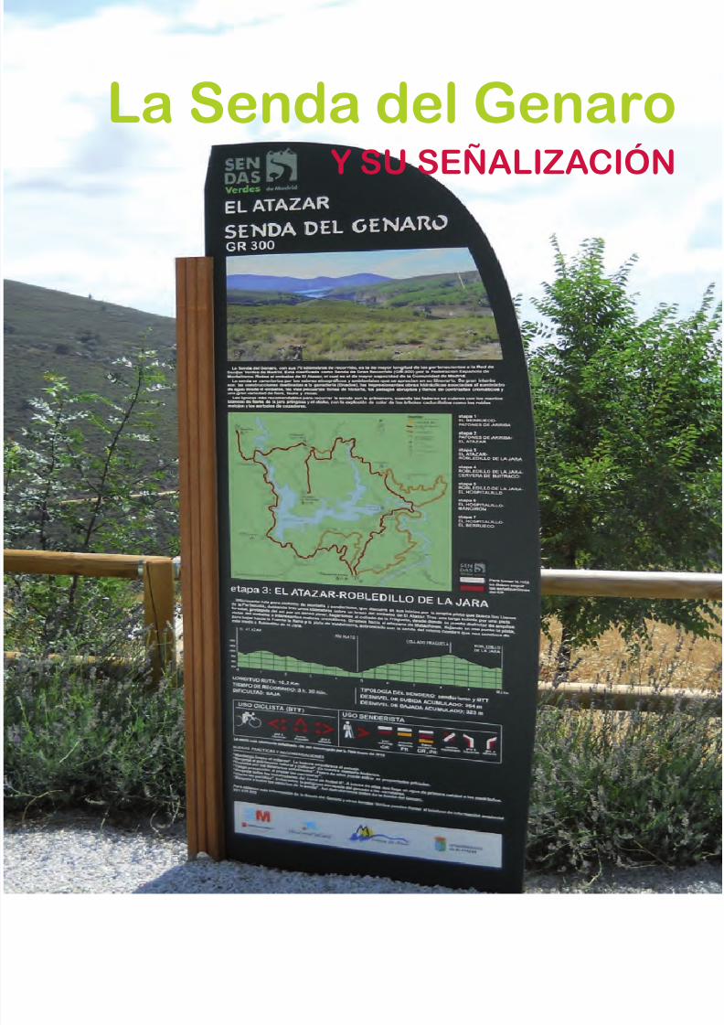
La Senda del Genaro
Y SU SEÑALIZACIÓN
8/3/2019 Libro Senda Del Genaro GR300
http://slidepdf.com/reader/full/libro-senda-del-genaro-gr300 14/156
16 Señalización
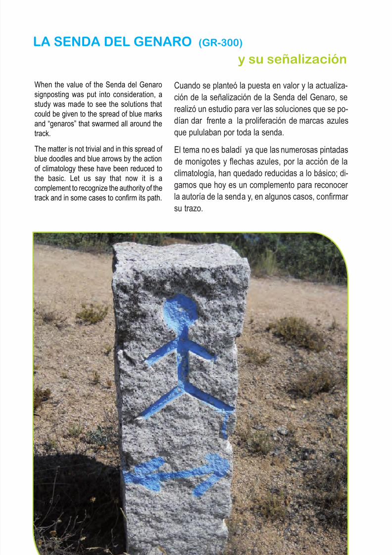
Cuando se planteó la puesta en valor y la actualiza-
ción de la señalización de la Senda del Genaro, serealizó un estudio para ver las soluciones que se po-dían dar frente a la proliferación de marcas azulesque pululaban por toda la senda.
El tema no es baladí ya que las numerosas pintadasde monigotes y flechas azules, por la acción de laclimatología, han quedado reducidas a lo básico; di-gamos que hoy es un complemento para reconocer
la autoría de la senda y, en algunos casos, confirmar su trazo.
When the value of the Senda del Genaro
signposting was put into consideration, astudy was made to see the solutions thatcould be given to the spread of blue marksand “genaros” that swarmed all around thetrack.
The matter is not trivial and in this spread of blue doodles and blue arrows by the actionof climatology these have been reduced tothe basic. Let us say that now it is acomplement to recognize the authority of thetrack and in some cases to confirm its path.
LA SENDA DEL GENARO (GR-300)
y su señalización
Monolito del “Genaro”
8/3/2019 Libro Senda Del Genaro GR300
http://slidepdf.com/reader/full/libro-senda-del-genaro-gr300 15/156
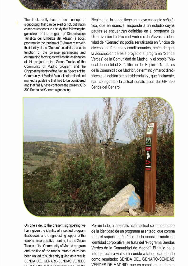
Realmente, la senda tiene un nuevo concepto señalé-tico, que en esencia, responde a un estudio cuyaspautas se encuentran definidas en el programa deDinamización Turística del Embalse del Atazar. La iden-tidad del “Genaro” no podía ser utilizada en función de
diversos parámetros y condicionantes, amén de que,la adscripción de este proyecto al programa “SendaVerdes” de la Comunidad de Madrid, y el propio “Ma-nual de Identidad Señalítica de los Espacios Naturalesde la Comunidad de Madrid”, determinó y marcó direc-trices que debían ser consideradas y , que finalmente,han configurado la actual señalización del GR-300Senda del Genaro.
The track really has a new concept of signposting, that can be liked or not, but that inessence responds to a study that following theguidelines of the program of DinamizacionTuristica del Embalze del Atazar (a boostprogram for the tourism of El Atazar reservoir)
the identity of the “Genaro” couldn’t be used infunction of the diverse parameters anddetermining factors; as well as the assignationof this project to the Green Tracks of theCommunity of Madrid program and theSignposting Identity of the Natural Spaces of theCommunity of Madrid Manual determined andmarked a guideline that had to be consideredand that finally have configure the present GR-300 Senda del Genaro signposting.
Por un lado, a la señalización actual se la ha dotado
de la identidad de un programa asentado, que coronatodo el soporte señalético de la senda a modo deidentidad corporativa: se trata del “Programa SendasVerdes de la Comunidad de Madrid”. El título de lainfraestructura vial se ha unido a tal entidad dandocomo resultado: SENDA DEL GENARO-SENDASVERDES DE MADRID, que es complementado conla bandera de la Comunidad Autónoma.
17Señalización
On one side, to the present signposting wehave given the identity of a settled programthat crowns all the signposting support of thetrack as a corporative identity, it is the GreenTracks of the Community of Madrid programand the title of the road’s infrastructure hasbeen united to such entity giving as a result:SENDA DEL GENARO-SENDAS VERDESDE MADRID, that is complemented with theAutonomous Community’s flag.
Señalización Sendas Verdes (Senda del Genaro)
8/3/2019 Libro Senda Del Genaro GR300
http://slidepdf.com/reader/full/libro-senda-del-genaro-gr300 16/156
El pictograma del Senderista preside casi todos lossoportes señaléticos, ya que el recorrido de ElGenaro está considerado como un trazado eminen-temente senderista; sus tramos originariamente fue-ron calzadas para reatas de acémilas utilizadas en
el transporte de mercancías.
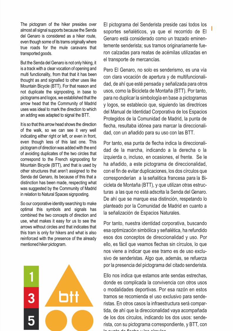
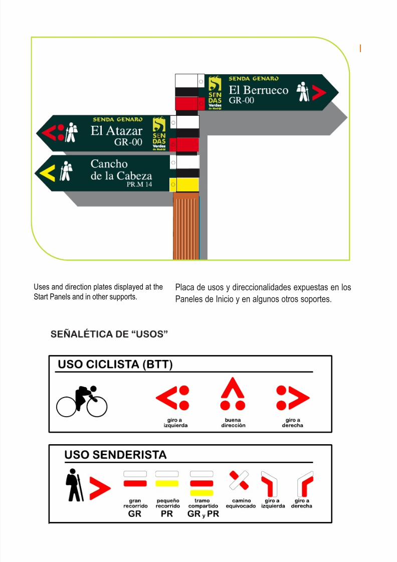
Pero El Genaro, no solo es senderismo, es una víacon clara vocación de apertura y de multifuncionali-dad, de ahí que esté pensada y señalizada para otrosusos, como la Bicicleta de Montaña (BTT). Por tanto,para no duplicar la simbología en base a pictogramasy logos, se establecio que, siguiendo las directricesdel Manual de Identidad Corporativa de los EspaciosProtegidos de la Comunidad de Madrid, la punta deflecha, resultaba idónea para marcar la direccionali-dad, con un añadido para su uso con las BTT.
Por tanto, esa punta de flecha indica la direccionali-dad de la marcha, indicando a la derecha o laizquierda o, incluso, en ocasiones, el frente. Se leha añadido, a este pictograma de direccionalidad,
con el fin de evitar duplicaciones, los dos círculos quecorresponderían a la señalitica francesa para la Bi-cicleta de Montaña (BTT), y que utilizan otras estruc-turas a las que no está adscrita la Senda del Genaro.De ahí que se marque esa distinción, respetando loplanteado por la Comunidad de Madrid en cuanto ala señalización de Espacios Naturales.
Por tanto, nuestra identidad corporativa, buscando
esa optimización simbólica y señalética, ha refundidoesos dos conceptos de direccionalidad y uso. Por ello, es fácil que veamos flechas sin círculos, lo quenos viene a indicar que ese tramo es de uso exclu-sivo de senderistas. Algo que, además, se refuerzapor la presencia del pictograma del citado senderista.
Ello nos indica que estamos ante sendas estrechas,donde es complicada la convivencia con otros usos
o modalidades deportivas. Por esa razón en estostramos se recomienda el uso exclusivo para sende-ristas. En otros casos la infraestructura será compar-tida, de ahí que la direccionalidad vaya acompañadade los dos círculos, indicando los dos usos: sende-rista, con su pictograma correspondiente, y BTT, conla punta de flecha y los círculos.
The pictogram of the hiker presides over almost all signal supports because the Sendadel Genaro is considered as a hiker route,even though some of its trams originally wheretrue roads for the mule caravans thattransported goods.
But the Senda del Genaro is not only hiking, itis a track with a clear vocation of opening andmulti functionality, from that that it has beenthought as and signalled to other uses likeMountain Bicycle (BTT). For that reason andnot duplicate the signposting, in base topictograms and logos, we established that thearrow head that the Community of Madriduses was ideal to mark the direction to which
an adding was adapted to signal the BTT.It is so that this arrow head shows the directionof the walk, so we can see it very wellindicating either right or left, or even in front,even though less of this last one. Thispictogram of direction was added with the endof avoiding duplicates of the two circles thatcorrespond to the French signposting for Mountain Bicycle (BTT), and that is used byother structures that aren’t assigned to theSenda del Genaro, its because of this that adistinction has been made, respecting whatwas suggested by the Community of Madridin relation to Natural Spaces signposting.
So our corporative identity searching to makeoptimal this symbols and signals hascombined the two concepts of direction anduse, what makes it easy for us to see thearrows without circles and that indicates that
this tram is only for hikers and what is alsoreinforced with the presence of the alreadymentioned hiker pictogram.
18 Señalización
Señalética de “Centros BTT”
8/3/2019 Libro Senda Del Genaro GR300
http://slidepdf.com/reader/full/libro-senda-del-genaro-gr300 17/156
19Señalización
Pudiera darse el caso de que un tramo fuera sólopara uso ciclista. En ese caso desaparecería el pic-tograma del senderista y unicamente figuraría lapunta de flecha (dirección) y los círculos, estando ve-dada la presencia de senderistas por el peligro que
ello pudiera entrañar. Esa eventualidad no se da enel caso de la Senda del Genaro.
Por último, la placa señalítica, a la manera de loshitos, se remata con las dos o tres plaquitas, segúnel caso, que nos indica la tipología del sendero. Enel caso de la Senda del Genaro, se trata de un GranRecorrido (GR) por lo cual, es preceptivo que tengaesas dos bandas: blanca y roja. En caso de coinci-dencia con otro tipo de sendero, como un PequeñoRecorrido (PR), llevaría añadida una plaquita más,en este caso de color amarilla. La signatura o matrí-cula es la que brinda la Federación de Montaña co-rrespondiente: en el caso de la Senda del Genaro esel GR 300.
He aquí una secuencia de lo que venimos expli-
cando.
All that, would also tell us that we are beforenarrow paths where the coexistence withother uses or sport modalities would becomplicated, so this way it is being explainedthat the track is recommended for hiker use;in other cases the infrastructure will be
shared for that, the direction will beaccompanied by the two circles indicatingboth uses, hiking with its pictogram and BTTwit the arrow head and the circles.
It could come up the case where a tram wasconsidered only for bicycle use, in that casethe hiker pictogram would disappear and wewould only have the head arrow (direction)and the circles, being forbidden the
presence of hikers on that part due to thedanger it could represent, all though thateventuality doesn’t come up along theSenda del Genaro.
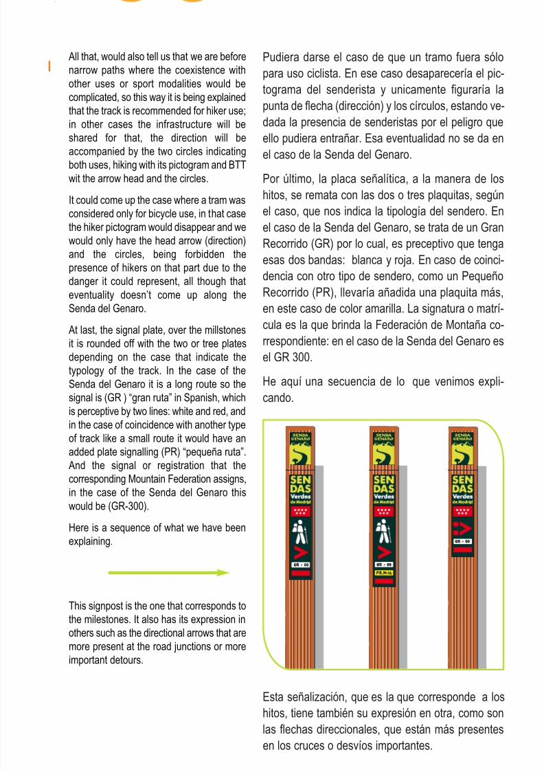
At last, the signal plate, over the millstonesit is rounded off with the two or tree platesdepending on the case that indicate thetypology of the track. In the case of theSenda del Genaro it is a long route so thesignal is (GR ) “gran ruta” in Spanish, whichis perceptive by two lines: white and red, andin the case of coincidence with another typeof track like a small route it would have anadded plate signalling (PR) “pequeña ruta”.And the signal or registration that thecorresponding Mountain Federation assigns,in the case of the Senda del Genaro thiswould be (GR-300).
Here is a sequence of what we have been
explaining.
This signpost is the one that corresponds tothe milestones. It also has its expression inothers such as the directional arrows that aremore present at the road junctions or moreimportant detours.
Esta señalización, que es la que corresponde a loshitos, tiene también su expresión en otra, como sonlas flechas direccionales, que están más presentesen los cruces o desvíos importantes.
8/3/2019 Libro Senda Del Genaro GR300
http://slidepdf.com/reader/full/libro-senda-del-genaro-gr300 18/156
20 Señalización
Placa de usos y direccionalidades expuestas en los
Paneles de Inicio y en algunos otros soportes.
Uses and direction plates displayed at the
Start Panels and in other supports.
8/3/2019 Libro Senda Del Genaro GR300
http://slidepdf.com/reader/full/libro-senda-del-genaro-gr300 19/156
21Señalización
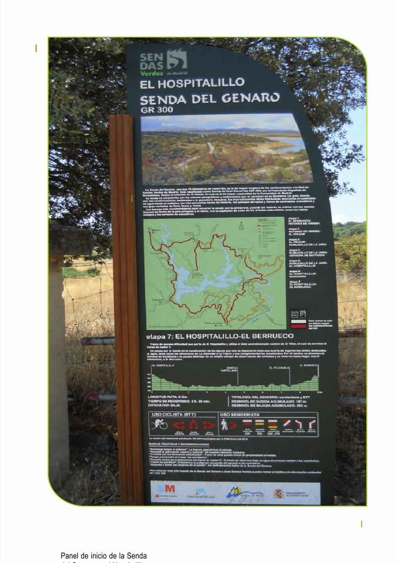
Panel de inicio de la Sendadel Genaro en el Hospitalillo
8/3/2019 Libro Senda Del Genaro GR300
http://slidepdf.com/reader/full/libro-senda-del-genaro-gr300 20/156
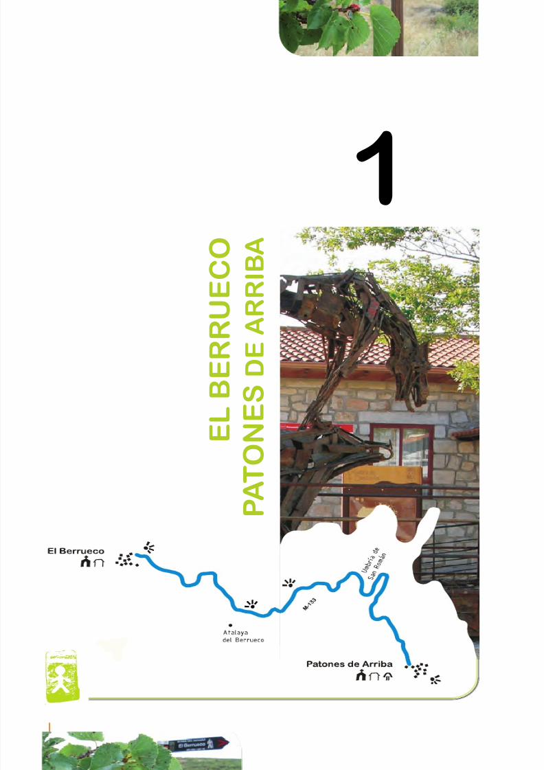
etapa 1EL BERRUECO
PATONES DE ARRIBA
8/3/2019 Libro Senda Del Genaro GR300
http://slidepdf.com/reader/full/libro-senda-del-genaro-gr300 21/156
1
E L B E R R U E C
O
P A T O N E S D E A R R I B
A
24 etapa 1
8/3/2019 Libro Senda Del Genaro GR300
http://slidepdf.com/reader/full/libro-senda-del-genaro-gr300 22/156
Descripción
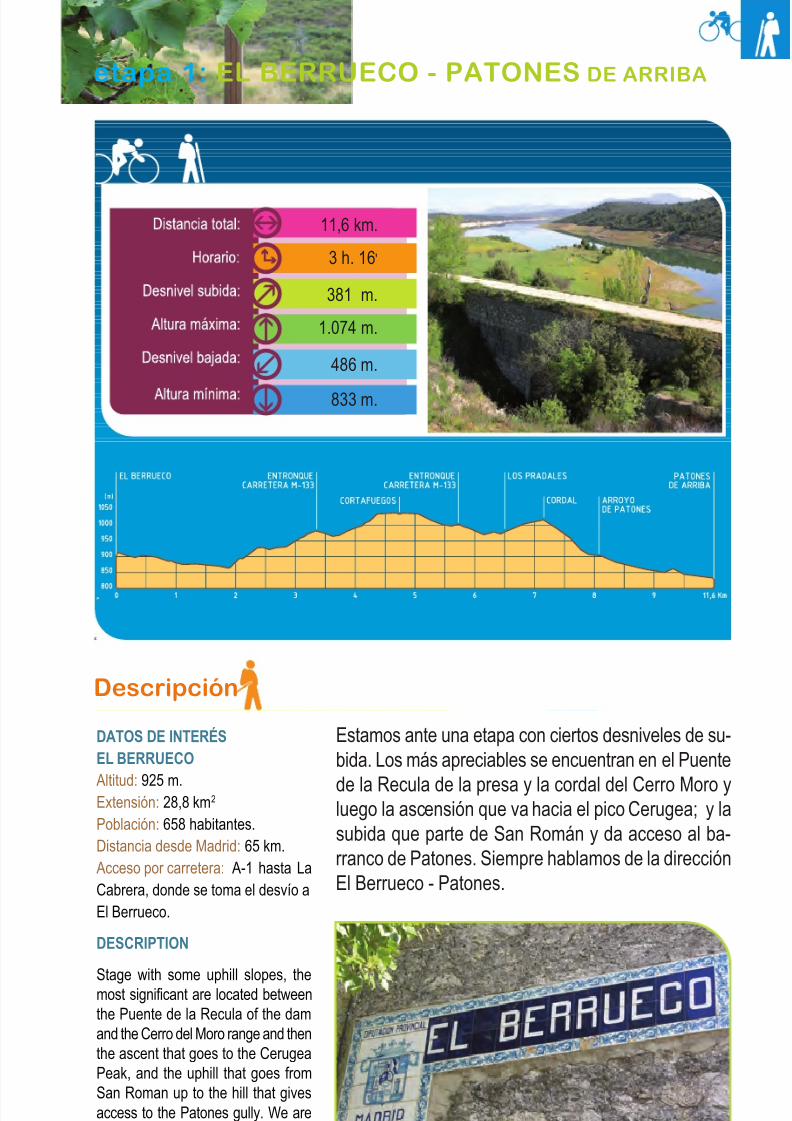
DATOS DE INTERÉSEL BERRUECO
Altitud: 925 m.Extensión: 28,8 km2
Población: 658 habitantes.Distancia desde Madrid: 65 km.Acceso por carretera: A-1 hasta LaCabrera, donde se toma el desvío aEl Berrueco.
DESCRIPTION
Stage with some uphill slopes, themost significant are located betweenthe Puente de la Recula of the damand the Cerro del Moro range and thenthe ascent that goes to the CerugeaPeak, and the uphill that goes fromSan Roman up to the hill that givesaccess to the Patones gully. We arealways talking about the path from ElBerrueco to Patones.
Estamos ante una etapa con ciertos desniveles de su-bida. Los más apreciables se encuentran en el Puente
de la Recula de la presa y la cordal del Cerro Moro yluego la ascensión que va hacia el pico Cerugea; y lasubida que parte de San Román y da acceso al ba-rranco de Patones. Siempre hablamos de la direcciónEl Berrueco - Patones.
25El Berrueco - Patones de Arriba
etapa 1: EL BERRUECO - PATONES DE ARRIBA
11,6 km.
3 h. 16'
381 m.
1.074 m.
486 m.
833 m.
8/3/2019 Libro Senda Del Genaro GR300
http://slidepdf.com/reader/full/libro-senda-del-genaro-gr300 23/156
The road surfaces are diverse, a first part of the stage is a network of tracks and wideroads until the detour of Cerugea, passing toa path from this point until the arrival toPatones de Arriba.
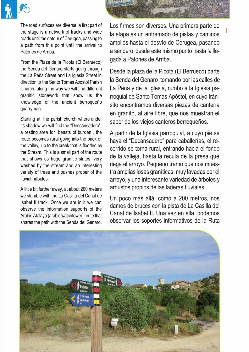
From the Plaza de la Picota (El Berrueco)the Senda del Genaro starts going throughthe La Peña Street and La Iglesia Street indirection to the Santo Tomas Apostol ParishChurch, along the way we will find differentgranitic stonework that show us theknowledge of the ancient berroqueñoquarryman.
Starting at the parish church where under
its shadow we will find the “Descansadero”,a resting area for beasts of burden , theroute becomes rural going into the back of the valley, up to the creek that is flooded bythe Stream. This is a small part of the routethat shows us huge granitic slates, verywashed by the stream and an interestingvariety of trees and bushes proper of thefluvial hillsides.
A little bit further away, at about 200 meterswe stumble with the La Casilla del Canal deIsabel II track. Once we are in it we canobserve the information supports of theArabic Atalaya (arabic watchtower) route thatshares the path with the Senda del Genaro.
Los firmes son diversos. Una primera parte dela etapa es un entramado de pistas y caminosamplios hasta el desvío de Cerugea, pasandoa sendero desde este mismo punto hasta la lle-
gada a Patones de Arriba.Desde la plaza de la Picota (El Berrueco) partela Senda del Genaro tomando por las calles deLa Peña y de la Iglesia, rumbo a la Iglesia pa-rroquial de Santo Tomas Apóstol, en cuyo trán-sito encontramos diversas piezas de canteríaen granito, al aire libre, que nos muestran el
saber de los viejos canteros berroqueños.A partir de la Iglesia parroquial, a cuyo pie sehaya el “Decansadero” para caballerías, el re-corrido se torna rural, entrando hacia el fondode la valleja, hasta la recula de la presa queriega el arroyo. Pequeño tramo que nos mues-tra amplias losas graníticas, muy lavadas por elarroyo, y una interesante variedad de árboles y
arbustos propios de las laderas fluviales.
Un poco más allá, como a 200 metros, nosdamos de bruces con la pista de La Casilla delCanal de Isabel II. Una vez en ella, podemosobservar los soportes informativos de la Ruta
26 etapa 1
El Berrueco desde El Camino de La Casilla
8/3/2019 Libro Senda Del Genaro GR300
http://slidepdf.com/reader/full/libro-senda-del-genaro-gr300 24/156
de la Atalaya Arabe, que comparte trazado conla Senda del Genaro.
Se prosigue por la pista, dirección Sureste, te-niendo como paisaje el Embalse del Atazar,
cuyos contornos se nos van haciendo cada vezmás nítidos a medida que nos vamos acer-cando al lugar de Riajales. Justo enfrente, ycomo referencia, tenemos las cuerdas de CerroMoro y el Cerro de Cerugea, y parte del reco-rrido que sigue la Senda del Genaro.
Se traspasa una portilla canadiense y se conti-núa por la pista principal, que discurre elevadacon relación, tanto a la conducción de agua delVillar, perteneciente al Canal de Isabel II, comodel propio Embalse.
Los distintos soportes señaléticos, como las“marcas” del Genaro que aún perviven, nos vanmarcando los giros y los rumbos, sin que ape-nas haya posibilidad de pérdida alguna.
Llegamos a la zona de la almenara de LosRiajales (Canal del Villar); salvamos el arroyode la Dehesilla por medio de un alto puente dehormigón a la vez que contemplamos un brazodel embalse y las construcciones propias delCanal.
Una vez al otro lado del puente, se presentan
dos alternativas: por la izquierda, la traza de losantiguos arrieros, que abandona la cómodapista para irse por terrenos más agrestes. Por otro lado encontramos la otra variante, dedicadaa las bicicletas que sigue, tras haber cruzado elpuente pista arriba, con un fuerte y mantenidoascenso.
El sendero secular que da vida a la Senda del
Genaro, gira, como ya comentamos, a la iz-quierda, y se abre paso por entre las jaras, muycerca de la orilla del embalse, rumbo Noroeste.El trazado discurre entre jaras y pequeños ene-brales, y se distingue por las roturas de los ple-gamientos rocosos de gneis, motivo por el quepodemos adivinar cuál era el trazo de la senda,ya que, de este modo, se facilitaba el paso delas caballerías que por aquí transitaban camino
de Patones.27El Berrueco - Patones de Arriba
We continue through the track Southeastdirection, having as scenery the Atazar reservoir which outline becomes clearer aswe get closer to the Riajales. Just in frontand as a reference we have the Cerro Moroand the Cerro de Cerugea hills and a part of
the route that the Senda del Genaro follows.
We go through a Canadian gate andcontinue through the main track that is a bitelevated in relation to the Del Villar water channel that belongs to the Canal de IsabelII as well as from the reservoir.
The different signposting supports as well asthe Genaro “marks” that still last, guide usmarking the turns and ways to follow without
almost any possibility of getting lost.
We get to the area of the Los Riajalesbeacon (Del Villar Channel), we cross theDehesilla stream using a high and concretebridge while we contemplate one of thereservoir arms and the typical constructionsof the channel.
Once we get to the other side of the bridge,we come across two alternatives: to the left
the path of the old mule drivers thatabandons the comfortable track to gothrough more rugged terrains like the pathsthat hang over this part of the reservoir,which some times along the reservoir’sshores to directly go uphill. The other variant,the one dedicated to bicycles continues after crossing the bridge through the track goingup with a hard and long ascent to the alreadymentioned hill.
The lay track that gives life to the Senda delGenaro, turns like we already said to the leftand opens in between the rockroses veryclose to the reservoir’s shores going on aNorth-west direction. The path interweavesbetween rockroses and junipers and itsdistinguished by the fractures of the gneissrocky folding, motive which by we can guesswhat was the use of the path because thisway the pass of cavalry that transited ontheir way to Patones was easier toaccomplish.
The path after a few meters changes coursean takes the al classic southern directionleaving to our back the reservoir once that itenters through a clear and steep stream bedin which underwater pass that will flood thearea. It is an area of meadows and trees thatconstitutes an oasis between the rockrose
and juniper.
8/3/2019 Libro Senda Del Genaro GR300
http://slidepdf.com/reader/full/libro-senda-del-genaro-gr300 25/156
El sendero, a los pocos metros, cambia derumbo y toma ya la clásica dirección sureña.Dejando a la espalda el embalse, se interna por una clara y empinada vaguada por la cual cir-culan las subterráneas aguas que encharcan la
zona. Pradería y diversidad arbórea constituyentodo un oasis entre tanta jara y enebros.
Todavía hoy, por en medio de la verde pradera,es apreciable el trazo del camino que zigza-guea, pradería arriba, para buscar una pista queparte la ascensión en dos, a la altura de LasCrucias. Por el ramal derecho de este ancho ca-mino que cruzamos, daríamos con la variantede BTT. Sin embargo, nuestro camino sigue,vaguada arriba, por un trazado que se empina,haciendo más difícil encontrar la huella delcamino, dada la alta presencia de enebros.La ascensión concluye al pie de la convergenciade caminos y variantes, en una amplia zonaque nos ofrece interesantes vistas sobre ElBerrueco y el Embalse del Atazar.
El camino ahora se entrevera por otro pequeñotramo con sabor añejo; muros de piedra y zar-zas y algún que otro imponente enebro, verte-bran la calleja que se abre camino por estealtozano. Ciclistas y senderistas afrontan juntosuna dura subida por una pista ancha que, en suparte alta, ofrece a los usuarios el cobijo de unode los descansaderos ecuestre-senderistas que jalonan la Senda del Genaro.
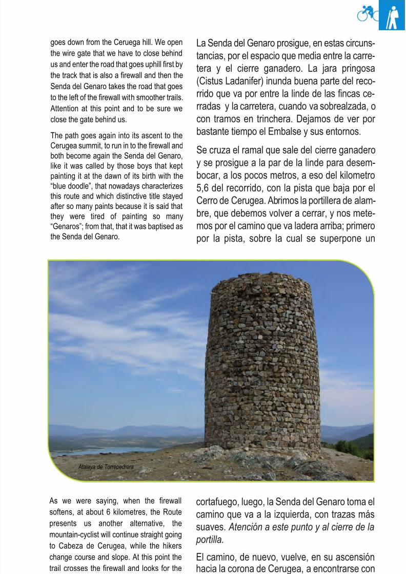
Tras recorrer unos 3,8 kilómetros de trazado en-contramos un desvío para visitar la Torre árabede Torrepedrera, o de El Berrueco, como tam-bién se la denomina, la cual dista unos 400 me-tros de este punto.
Es éste un buen lugar para un pequeño tentem-
pié, a la sombra del “Descansadero”, mientrascontemplamos la estampa que forman, en lon-tananza, El Berrueco y el Embalse.
Una vez visitada la Atalaya volvemos al reco-rrido, prosiguiendo el corto ascenso hasta lacuerda de Cerro Moro, tomando contacto conuna pista sobre la cual viramos a la derecha paradesembocar en la carretera M-133 (Pk. 3,4).
28 etapa 1
Even today in the middle of the meadow wecan see the path that zigzags going upsearching for a track that divides the ascentat Las Crucias. By the right branch of thiswide road we would get to the BTT variant,
although our way will continue to follow thestream bed, going uphill through the slope,where it gets harder and harder to find theprint of the road due to the high presence of
juniper all around. The ascent concludes atthe road and variants convergence in a widearea that offers interesting views over ElBerrueco and the Atazar reservoir.
The road now interweaves through another
small tram with an ancient taste, stone wallsand bramble and one or two impressive
juniper that structure the path that opens upin this small hill. Cyclists and hikers facetogether a hard uphill in a wide track thatalso offers the users the shelter of one of theequestrian-hiker resting area that mark outthe Senda del Genaro.
About 3,8 kilometres of the route that alsoconstitute the point of detour to visit theTorrepedrera or El Berrueco Arabic tower,which is at about 400 from the detour, this isa great place to enjoy a little snack under theshadow of the “Descansadero” while wecontemplate the vignette of the landscapearound us.
Ones we have visited the Atalaya, we go
back to the GR 300 track following the smallascent to the Cerro de Moro range takingcontact with a path in which we will turn rightto end up at the M-133, Pk. 3.4 road.
The Senda del Genaro continues in thiscircumstances through the space betweenthe paved road and the cattle closure; theslimy rockrose (cistus ladanifer) floods agood part of the route that goes in between
the boundary of the enclosed private farmsand the road, when it is a little more elevatedor with ditch sections. We stop seeing thereservoir and its surroundings for a longtime.
We cross the branch that comes out from thecattle gate and continue side by side to theboundary to at a few more meters at aboutthe kilometre 5,6 to run into the route that
8/3/2019 Libro Senda Del Genaro GR300
http://slidepdf.com/reader/full/libro-senda-del-genaro-gr300 26/156
29El Berrueco - Patones de Arriba
La Senda del Genaro prosigue, en estas circuns-tancias, por el espacio que media entre la carre-tera y el cierre ganadero. La jara pringosa(Cistus Ladanifer) inunda buena parte del reco-rrido que va por entre la linde de las fincas ce-rradas y la carretera, cuando va sobrealzada, ocon tramos en trinchera. Dejamos de ver por bastante tiempo el Embalse y sus entornos.
Se cruza el ramal que sale del cierre ganaderoy se prosigue a la par de la linde para desem-bocar, a los pocos metros, a eso del kilometro5,6 del recorrido, con la pista que baja por el
Cerro de Cerugea. Abrimos la portillera de alam-bre, que debemos volver a cerrar, y nos mete-mos por el camino que va ladera arriba; primeropor la pista, sobre la cual se superpone un
cortafuego, luego, la Senda del Genaro toma elcamino que va a la izquierda, con trazas mássuaves. Atención a este punto y al cierre de la
portilla.
El camino, de nuevo, vuelve, en su ascensiónhacia la corona de Cerugea, a encontrarse conel cortafuegos, y ambos continúan ya comoSenda del Genaro. Así la denominaron aquellos
goes down from the Ceruega hill. We openthe wire gate that we have to close behindus and enter the road that goes uphill first bythe track that is also a firewall and then theSenda del Genaro takes the road that goes
to the left of the firewall with smoother trails.Attention at this point and to be sure weclose the gate behind us.
The path goes again into its ascent to theCerugea summit, to run in to the firewall andboth become again the Senda del Genaro,like it was called by those boys that keptpainting it at the dawn of its birth with the“blue doodle”, that nowadays characterizesthis route and which distinctive title stayedafter so many paints because it is said thatthey were tired of painting so many“Genaros”; from that, that it was baptised asthe Senda del Genaro.
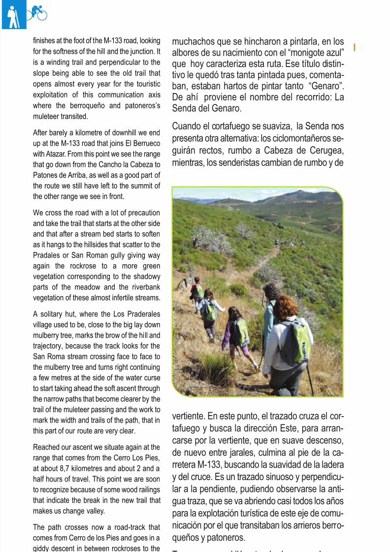
As we were saying, when the firewallsoftens, at about 6 kilometres, the Routepresents us another alternative, themountain-cyclist will continue straight goingto Cabeza de Cerugea, while the hikerschange course and slope. At this point thetrail crosses the firewall and looks for theEast to start up through the slope that in asoft descent again in between rockroses
Atalaya de Torrepedrera
8/3/2019 Libro Senda Del Genaro GR300
http://slidepdf.com/reader/full/libro-senda-del-genaro-gr300 27/156
30 etapa 1
muchachos que se hincharon a pintarla, en losalbores de su nacimiento con el “monigote azul”que hoy caracteriza esta ruta. Ese título distin-tivo le quedó tras tanta pintada pues, comenta-ban, estaban hartos de pintar tanto “Genaro”.
De ahí proviene el nombre del recorrido: LaSenda del Genaro.
Cuando el cortafuego se suaviza, la Senda nospresenta otra alternativa: los ciclomontañeros se-guirán rectos, rumbo a Cabeza de Cerugea,mientras, los senderistas cambian de rumbo y de
finishes at the foot of the M-133 road, lookingfor the softness of the hill and the junction. Itis a winding trail and perpendicular to theslope being able to see the old trail thatopens almost every year for the touristic
exploitation of this communication axiswhere the berroqueño and patoneros’smuleteer transited.
After barely a kilometre of downhill we endup at the M-133 road that joins El Berruecowith Atazar. From this point we see the rangethat go down from the Cancho la Cabeza toPatones de Arriba, as well as a good part of the route we still have left to the summit of
the other range we see in front.
We cross the road with a lot of precautionand take the trail that starts at the other sideand that after a stream bed starts to softenas it hangs to the hillsides that scatter to thePradales or San Roman gully giving wayagain the rockrose to a more greenvegetation corresponding to the shadowy
parts of the meadow and the riverbankvegetation of these almost infertile streams.
A solitary hut, where the Los Praderalesvillage used to be, close to the big lay downmulberry tree, marks the brow of the hill andtrajectory, because the track looks for theSan Roma stream crossing face to face tothe mulberry tree and turns right continuinga few metres at the side of the water curse
to start taking ahead the soft ascent throughthe narrow paths that become clearer by thetrail of the muleteer passing and the work tomark the width and trails of the path, that inthis part of our route are very clear.
Reached our ascent we situate again at therange that comes from the Cerro Los Pies,at about 8,7 kilometres and about 2 and a
half hours of travel. This point we are soonto recognize because of some wood railingsthat indicate the break in the new trail thatmakes us change valley.
The path crosses now a road-track thatcomes from Cerro de los Pies and goes in agiddy descent in between rockroses to thenarrow hollow of the Patones gully. Thedown slope is very hard at some points that
can be softened by turns of the road that the
vertiente. En este punto, el trazado cruza el cor-tafuego y busca la dirección Este, para arran-carse por la vertiente, que en suave descenso,de nuevo entre jarales, culmina al pie de la ca-rretera M-133, buscando la suavidad de la laderay del cruce. Es un trazado sinuoso y perpendicu-lar a la pendiente, pudiendo observarse la anti-gua traza, que se va abriendo casi todos los añospara la explotación turística de este eje de comu-nicación por el que transitaban los arrieros berro-queños y patoneros.
Tras un escaso kilómetro de descenso desem-bocamos en la citada carretera M-133, que une
El Berrueco con el Atazar.
8/3/2019 Libro Senda Del Genaro GR300
http://slidepdf.com/reader/full/libro-senda-del-genaro-gr300 28/156
31El Berrueco - Patones de Arriba
Desde este lugar vemos las cuerdas que bajandesde el Cancho la Cabeza hacia Patones deArriba y, como no, buena parte del recorrido quenos queda hasta lo alto de la otra cordal, quevemos enfrente.
Se cruza la carretera con precaución y se tomala senda que nace en la otra orilla y que, trasuna vaguada, se va suavizando a medida quese ciñe a las laderas que se derraman al ba-rranco de los Pradales o de San Román.La jarada paso, de nuevo, a una vegetación másverde, correspondiente a las umbrías de la pra-dera y la vegetación de ribera de estos cuasiestériles arroyos.
Un solitario chozo, donde estaba la aldea deLos Pradales, cercano a la gran morera tum-bada, marca el cambio de rasante y de trayec-toria. Aquí, la senda busca el cruce del arroyode San Román, frente por frente a la morera, yvira hacia la derecha, siguiendo unos metros a
la vera del cauce, para ir tomando, más ade-lante, el suave ascenso por estrechos senderosque se hacen más claros por la huella del tra-siego arriero y del trabajo, para marcar los an-chos y trazas de la senda, que en esta parte delrecorrido son muy claros.
Culminada la ascensión en travesía, nos situa-mos, de nuevo, en plena cuerda que viene
desde el Cerro los Pies, a unos 8,7 kilómetrosy con unas 2 horas y media de recorrido. Estepunto se distingue facilmente, pues unas baran-dillas de madera nos indican la rompiente delnuevo trazado, que nos hace cambiar de valle.
La senda discurre en descenso vertiginoso por entre un emboscado de jaras, hacia el estrechocuenco del barranco de Patones. La bajada es
brava en algunos tramos, y se logra suavizar mediante revueltas del camino que la mano delhombre ha tallado en el estrato de pizarra quepredomina en la zona.
Hemos pasado del estrato granítico al de lavieja pizarra.
Poco a poco se va ganando el fondo del valle,para llegar a las menguadas aguas del arroyo de
hand of man has made in the stratum of theslate that prevails in the area. We havepassed from the granitic stratum to the oldslate one.
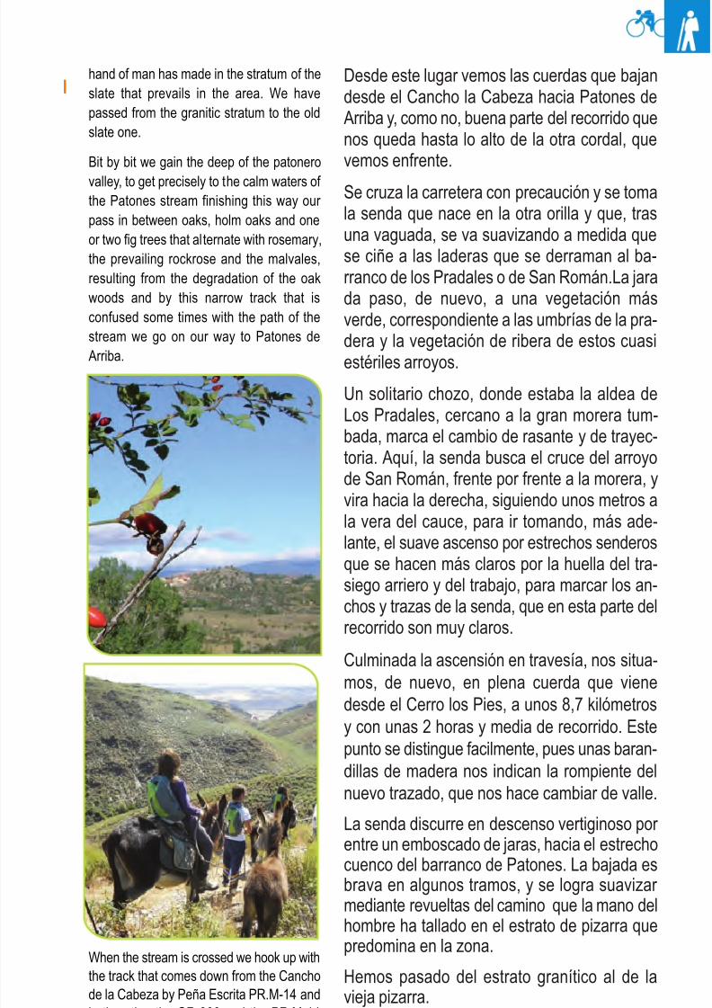
Bit by bit we gain the deep of the patonero
valley, to get precisely to the calm waters of the Patones stream finishing this way our pass in between oaks, holm oaks and oneor two fig trees that alternate with rosemary,the prevailing rockrose and the malvales,resulting from the degradation of the oakwoods and by this narrow track that isconfused some times with the path of thestream we go on our way to Patones de
Arriba.
When the stream is crossed we hook up withthe track that comes down from the Canchode la Cabeza by Peña Escrita PR.M-14 andboth paths, the GR 300 and the PR.M-14make accompany the brook in its way downto Patones; both, path and brook coil and
8/3/2019 Libro Senda Del Genaro GR300
http://slidepdf.com/reader/full/libro-senda-del-genaro-gr300 29/156
32 etapa 1
Patones, con sauces, fresnos y alguna que otrahiguera que alternan con el romero, la predomi-nante jara y el torbisco, resultantes de la degra-dación de los encinares. La estrecha senda seconfunde a veces con el cauce del arroyo, ca-
mino de Patones de Arriba.Cuando se cruza el arroyo, se enlaza con lasenda que baja del Cancho de la Cabeza por Peña Escrita (PR.M-14) y ambos senderos (elGR 300 y el PR.M-14) acompañan al riachueloen su bajada hacia Patones. Sendero y ria-chuelo se enroscan y entrelazan buscando loamplio del valle de Patones.
Este tramo es muy fresco pues, a lo cerrado delbarranco, se une la densa vegetación, que noes muy alta pero nos protege de las inclemen-cias del cerrado valle. Poco a poco, el senderose va haciendo más claro y ancho, sobre manera
a la altura del primer desvío que nos topamos, aeso de los 10,8 km. Una pista llega de la zona deValdepinillo y por ella viene la variante de BTT.
Se prosigue aguas abajo, desechando todoaquel sendero que nos quiera llevar por lamargen izquierda de la ladera. El valle se abrey, de nuevo, otro sendero nos invita a entrar en el pueblo patonero. Nuestra ruta sigue,
intertwine looking for the Patones valley.
This part is very fresh because to the closureof the gully we add the dens vegetations. Itisn’t very high but it protects us from theharshness of the closed valley. Bit by bit the
path gets clearer and wider, specially at thefirst road that we encounter at about 10,8 km,a track that comes form the Valdepinillo areaand from where the bicycles join us again.
We continue following the water curse down,throwing out every other path that wants totake us by the left margin of the hillside. Thevalley opens and again another path thatinvites us to go in town, our route continues
side by side the diminished brook untilarriving to the circus that the meeting of thePatones valley and the one that comes fromthe Collado de los Melones conform.
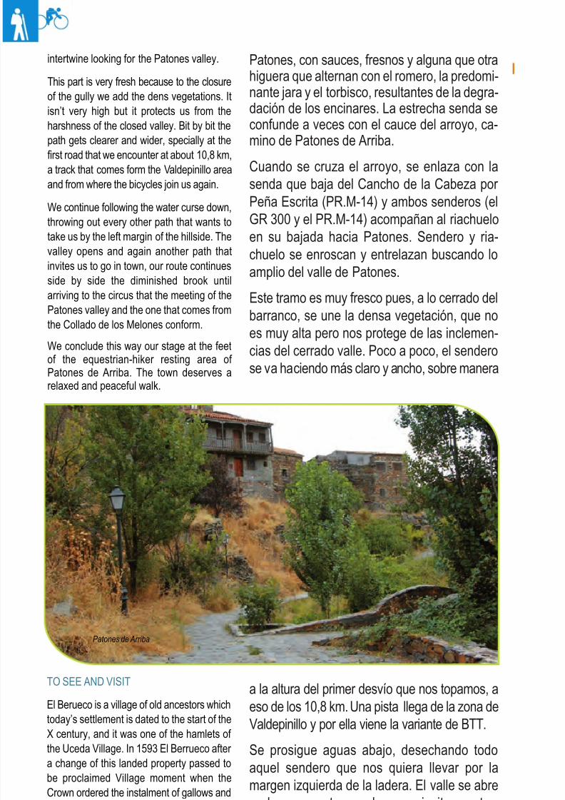
We conclude this way our stage at the feetof the equestrian-hiker resting area of Patones de Arriba. The town deserves arelaxed and peaceful walk.
TO SEE AND VISIT
El Berueco is a village of old ancestors whichtoday’s settlement is dated to the start of theX century, and it was one of the hamlets of the Uceda Village. In 1593 El Berrueco after a change of this landed property passed tobe proclaimed Village moment when theCrown ordered the instalment of gallows andpillory that we can still see at the square infront of the City Hall.
Patones de Arriba
8/3/2019 Libro Senda Del Genaro GR300
http://slidepdf.com/reader/full/libro-senda-del-genaro-gr300 30/156
33El Berrueco - Patones de Arriba
acompañando al menguado riachuelo, hastadesembocar en el circo que forman el encuentrode los valles de Patones y el que baja del Co-llado de los Melones.
Concluye de esta manera la etapa, al pie deldescansadero ecuestre-senderista de Patonesde Arriba. El pueblo bien vale un paseo relajadoy tranquilo.
PARA VER Y VISITAR
El Berrueco es una villa de viejos ancestroscuyo asentamiento actual se cifra en el albor delsiglo X; era una de las aldeas de la Villa deUceda. En 1593 El Berrueco, tras un cambio deheredades, pasó a proclamarse Villa, momentoen que la Corona ordenó la instalación de unahorca y picota, que aún podemos ver en laplaza, ante el Ayuntamiento.
Iglesia de Santo Tomás Apóstol. Es la iglesiaparroquial y fue construida en varias fases,
como casi siempre, sobre una ermita anterior.Su construcción es de una gran simplicidad yparece datar del siglo XIV. Podemos destacar la planta rectangular, de una sola nave, rema-tada con una torre cuadrada. La portada es deestilo románico-mudéjar. En su interior destacala Pila de agua bendita, con gallones renacen-tistas.
Crucero de la Iglesia. Delante del impresionantetemplo parroquial encontramos el Crucero,compuesto por tres grandes cruces de piedra,y del cual se desconoce su origen y uso, aun-que la memoria histórica del pueblo lo vinculacon distintos ritos relacionados con las activida-des agrícolas.
La Picota o Rollo. Es un punto de referencia del
pueblo. Situada ante el Ayuntamiento, marca eldevenir de éste, constituyendo un elementosingular, por ser el único que se conservaen toda la zona. Esta columna, que se datacomo del año 1000, pasó en el siglo XVI a lalabor de picota, siendo por tanto signo de la jurisdicción penal. Su emplazamiento, antigua-mente, estaba situado ante la iglesia parroquial.
Santo Tomas Apostol Church
It is the Parish church that was built inseveral faces and as always, over theconstruction of a hermitage before it. Itsconstruction is of great simplicity and seems
to be dated to the XIV century. We canhighlight the rectangular single nave floor finished up with a square tower; the façade of romanic-mudejar style. In its interior the hollywater stoup with Renaissance decorations.
Crucero de la Iglesia: “Church’s crosses”
In front of the impressive parish temple wefind the Crucero, composed by tree big stonecrosses and of which its origin and use isunknown all though the historical memory of the town links it to agricultural activities.
La Picota: “The Pillory”
It is a reference point of the town. It islocated in front of the City Hall it marks thetransformation of it, constituting a singular element because it is the only one preserver around the area. This column that is dated
to the year 1000 passed in the XVI centuryto become a pillory being by that a sign of the penitentiary jurisdiction. Its emplacementin ancient times was located in front of theparish church.
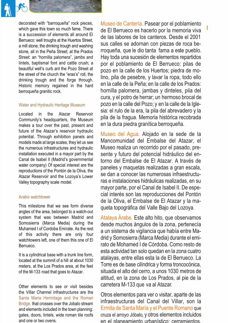
Museo de Canteria: “Quarry Museum”
Walking around El Berrueco is like walkingin the memory of the quarry labour memories. Since 2001 its streets are
Patones de Arriba
8/3/2019 Libro Senda Del Genaro GR300
http://slidepdf.com/reader/full/libro-senda-del-genaro-gr300 31/156
34 etapa 1
Museo de Cantería. Pasear por el poblamientode El Berrueco es hacerlo por la memoria vivade las labores de los canteros. Desde el 2001sus calles se adornan con piezas de roca be-rroqueña, que le dio tanta fama a este pueblo.
Hay toda una sucesión de elementos repartidospor el poblamiento de El Berrueco: pilas depozo en la calle de los Huertos; piedra de mo-lino, pila de pesebre, y lavar la ropa, todo elloen la calle de la Peña; en la calle de los Prados:hornilla palomera, jambas y dinteles, pila delcura, y el potro de herrar; un hermoso brocal depozo en la calle del Pozo; y en la calle de la Igle-
sia: el rulo de la era, la pila del abrevadero y lapila de la fragua. Memoria histórica recobradaen la dura piedra granítica berroqueña.
Museo del Agua. Alojado en la sede de laMancomunidad del Embalse del Atazar, elMuseo realiza un recorrido por el pasado, pre-sente y futuro del potencial hidráulico del en-torno del Embalse de El Atazar. A través de
paneles y maquetas realizadas a gran escala,se dan a conocer las numerosas infraestructu-ras e instalaciones hidráulicas realizadas, en sumayor parte, por el Canal de Isabel II. De espe-cial interés son las reproducciones del Pontónde la Oliva, el Embalse de El Atazar y la ma-queta topográfica del Valle Bajo del Lozoya.
Atalaya Árabe. Este alto hito, que observamos
desde muchos ángulos de la zona, pertenecíaa un sistema de vigilancia que había entre Ma-drid y Somosierra (Marca Media) durante el emi-rato de Mohamed I de Córdoba. Como resto deesta actividad tan solo quedan en la zona cuatroatalayas, entre ellas esta la de El Berrueco. LaTorre es de base cilíndrica y forma troncocónica,situada el alto del cerro, a unos 1030 metros dealtitud, en la zona de Los Prados, al pie de la
carretera M-133 que va al Atazar.
Otros elementos para ver o visitar, aparte de lasinfraestructuras del Canal del Villar, son laErmita de Santa María y el Puente Romano quecruza el arroyo Jóbalo, y otros elementos incluidosen el planeamiento urbanístico: cerramientos,puertas y dinteles, amplios tejados de teja ro-mana y algún que otro horno.
decorated with “barroqueña” rock pieces,which gave this town so much fame. Thereis a succession of elements all around ElBerrueco: well troughs at the Huertos Street,a mill stone; the drinking trough and washingstone, all in the Peña Street; at the Prados
Street: an “hornilla palomera”, jambs andlintels, baptismal font and cattle crush; abeautiful well’s curb ant the Pozo Street atthe street of the church the “eras’s” roll, thedrinking trough and the forge through.Historic memory regained in the hardberroqueña granitic rock.
Water and Hydraulic Heritage Museum
Located in the Atazar Reservoir Community’s headquarters, the Museummakes a tour over the past, present andfuture of the Atazar’s reservoir hydraulicpotential. Through exhibition panels andmodels made at large scales, they let us seethe numerous infrastructures and hydraulicinstallation executed in a mayor part by theCanal de Isabel II (Madrid’s governmentalwater company) Of special interest are the
reproductions of the Pontón de la Oliva, theAtazar Reservoir and the Lozoya’s Lower Valley topography scale model.
Arabic watchtower
This milestone that we see form diverseangles of the area, belonged to a watch-outsystem that was between Madrid andSomosierra (Marca Media) during theMuhamed I of Cordoba Emirate. As the restof this activity there are only four watchtowers left, one of them this one of ElBerrueco.
It is a cylindrical base with a trunk line form,located at the summit of a hill at about 1030meters, at the Los Prados area, at the feetof the M-133 road that goes to Atazar.
Other elements to see or visit besidesthe Villar Channel infrastructures are theSanta Maria Hermitage and the RomanBridge, that crosses over the Jobalo streamand elements included in the town planning:gates, doors, lintels, wide roman tile roofsand one or two ovens.
8/3/2019 Libro Senda Del Genaro GR300
http://slidepdf.com/reader/full/libro-senda-del-genaro-gr300 32/156
35El Berrueco - Patones de Arriba
Itinerario: Senda del Genaro
Municipios: Berrueco - PatonesPunto de Salida: El Berrueco
Distancia: 11.6 km
GR: 300
Nota: Etapa con variante BTTPunto de llegada: Patones de ArribaMapa: IGN-MTN25: 484-II- IV
485-I- III
etapa
Rutómetro
EL BERRUECO
PATONES DE ARRIBA
IDA / DEPARTURE VUELTA / RETURN
1 WP 30T 452864 UTM 4526662
El Berrueco. Se sale de la plaza de la Picota (Ayunta-miento) y se toma por las calles La Peña y La Iglesia,hasta desembocar ante la propia iglesia.The Berrueco. El Berrueco. We leave from the Plaza dela Picota (City Hall) and take the La Peña and La Iglesiastreets until we end up at the church.
DIST: 0 m. ALT: 940 m.TIEMPO: 0h 0' FIRME: Hormigón
1 WP 30T 458439 UTM 4524270
Patones de Arriba. Se sale del descansadero pasandopor delante de los paneles informativos para tomar por elbarranco adelante.Patones de Arriba. We exit the resting area passing infront of us the route information panels to take the gullyahead of us.
DIST: 0 m. ALT: 832 m.TIEMPO: 0h 0' FIRME: Sendero
2 WP 30T 453129 UTM 4526828
El Berrueco. Una vez ante la iglesia, se sale por el ca-mino que va hacia el embalse, pasando al lado del des-cansadero de la Senda del Genaro.The Berrueco. El Berrueco. Once we are at the church,we take the path that goes to the reservoir, passing beside
the “descansadero” of the Senda del Genaro.
DIST: 500 m. ALT: 935 m.TIEMPO: 0h 10' FIRME: Sendero
2 WP 30T 458350 UTM 4524626
Se sigue por el fondo del barranco, dejando atrás el pue-blo de Patones.We continue through the bottom of the gully, leaving be-hind us the town of Patones.
DIST: 300 m. ALT: 840 m.TIEMPO: 0h 2' FIRME: Sendero
8/3/2019 Libro Senda Del Genaro GR300
http://slidepdf.com/reader/full/libro-senda-del-genaro-gr300 33/156
36 etapa 1
5 WP 30T 453354 UTM 4526682
Entronque con el camino de la Casilla. Se sigue por él,dirección a la Atalaya árabe que vemos al fondo.We are at the crossroad with La Casilla road. We followthis road in direction to the watchtower we can see in the
background.
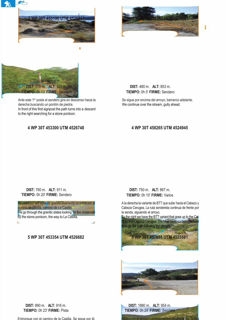
DIST: 890 m. ALT: 916 m.TIEMPO: 0h 23' FIRME: Pista
5 WP 30T 457698 UTM 4525581
Cruzamos el arroyo y emprendemos la subida por la otravertiente del barranco. ¡Desvío Importante!.
We cross the stream and start the uphill through the other gully’s variant. Important detour!
DIST: 1880 m. ALT: 954 m.TIEMPO: 0h 24' FIRME: Sendero
4 WP 30T 453300 UTM 4526748
Se pasa por las lajas de granito buscando el cruce por elpontón de piedra, camino de La Casilla.We go through the granitic slates looking for the crossroadby the stone pontoon, the way to La Casilla.
DIST: 760 m. ALT: 911 m.TIEMPO: 0h 20' FIRME: Sendero
4 WP 30T 458265 UTM 4524945
A la derecha la variante de BTT que sube hacia el Cabezo yCabeza Cerugea. La ruta senderista continua de frente por la senda, siguiendo el arroyo.To the right we have the BTT variant that goes up to the Ca-bezo and Cabeza Cerugea. The hiker route continues in frontthrough the path following the stream.
DIST: 750 m. ALT: 867 m.TIEMPO: 0h 10' FIRME: Varios
Ante este 1er poste el sendero gira en descenso hacia laderecha buscando un pontón de piedra.In front of this first signpost the path turns into a descentto the right searching for a stone pontoon.
DIST: 600 m. ALT: 928 m.TIEMPO: 0h 13' FIRME: Sendero
3 WP 30T 458342 UTM 4524701
Se sigue por encima del arroyo, barranco adelante.We continue over the stream, gully ahead.
DIST: 480 m. ALT: 853 m.TIEMPO: 0h 5' FIRME: Sendero
3 WP 30T 453196 UTM 4526837
8/3/2019 Libro Senda Del Genaro GR300
http://slidepdf.com/reader/full/libro-senda-del-genaro-gr300 34/156
37El Berrueco - Patones de Arriba
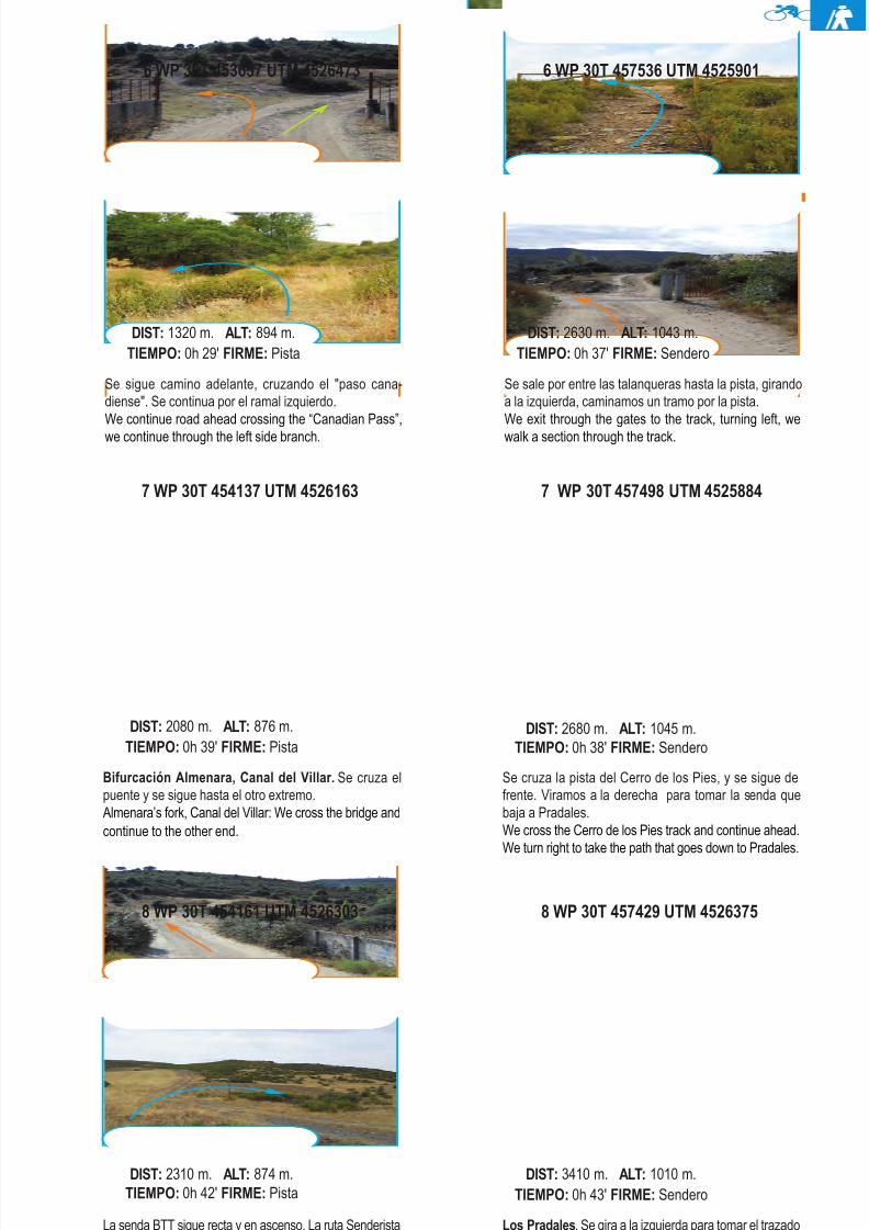
8 WP 30T 454161 UTM 4526303
La senda BTT sigue recta y en ascenso. La ruta Senderistadiscurre por el ramal izquierdo, sobre el embalse.The BTT route continues straight ahead in an uphill. Thehiker route continues through the left branch, over the re-
servoir.
DIST: 2310 m. ALT: 874 m.TIEMPO: 0h 42' FIRME: Pista
8 WP 30T 457429 UTM 4526375
Los Pradales. Se gira a la izquierda para tomar el trazadoque va a media ladera hacia la carretera M-133.Los Pradales. We turn left to take the path that goes half hillside to the M-133 road.
DIST: 3410 m. ALT: 1010 m.TIEMPO: 0h 43' FIRME: Sendero
7 WP 30T 454137 UTM 4526163
Bifurcación Almenara, Canal del Villar. Se cruza elpuente y se sigue hasta el otro extremo.Almenara’s fork, Canal del Villar: We cross the bridge andcontinue to the other end.
DIST: 2080 m. ALT: 876 m.TIEMPO: 0h 39' FIRME: Pista
7 WP 30T 457498 UTM 4525884
Se cruza la pista del Cerro de los Pies, y se sigue defrente. Viramos a la derecha para tomar la senda quebaja a Pradales.We cross the Cerro de los Pies track and continue ahead.We turn right to take the path that goes down to Pradales.
DIST: 2680 m. ALT: 1045 m.TIEMPO: 0h 38' FIRME: Sendero
6 WP 30T 453657 UTM 4526473
Se sigue camino adelante, cruzando el "paso cana-diense". Se continua por el ramal izquierdo.We continue road ahead crossing the “Canadian Pass”,we continue through the left side branch.
DIST: 1320 m. ALT: 894 m.TIEMPO: 0h 29' FIRME: Pista
Se sale por entre las talanqueras hasta la pista, girandoa la izquierda, caminamos un tramo por la pista.We exit through the gates to the track, turning left, wewalk a section through the track.
DIST: 2630 m. ALT: 1043 m.TIEMPO: 0h 37' FIRME: Sendero
6 WP 30T 457536 UTM 4525901
8/3/2019 Libro Senda Del Genaro GR300
http://slidepdf.com/reader/full/libro-senda-del-genaro-gr300 35/156
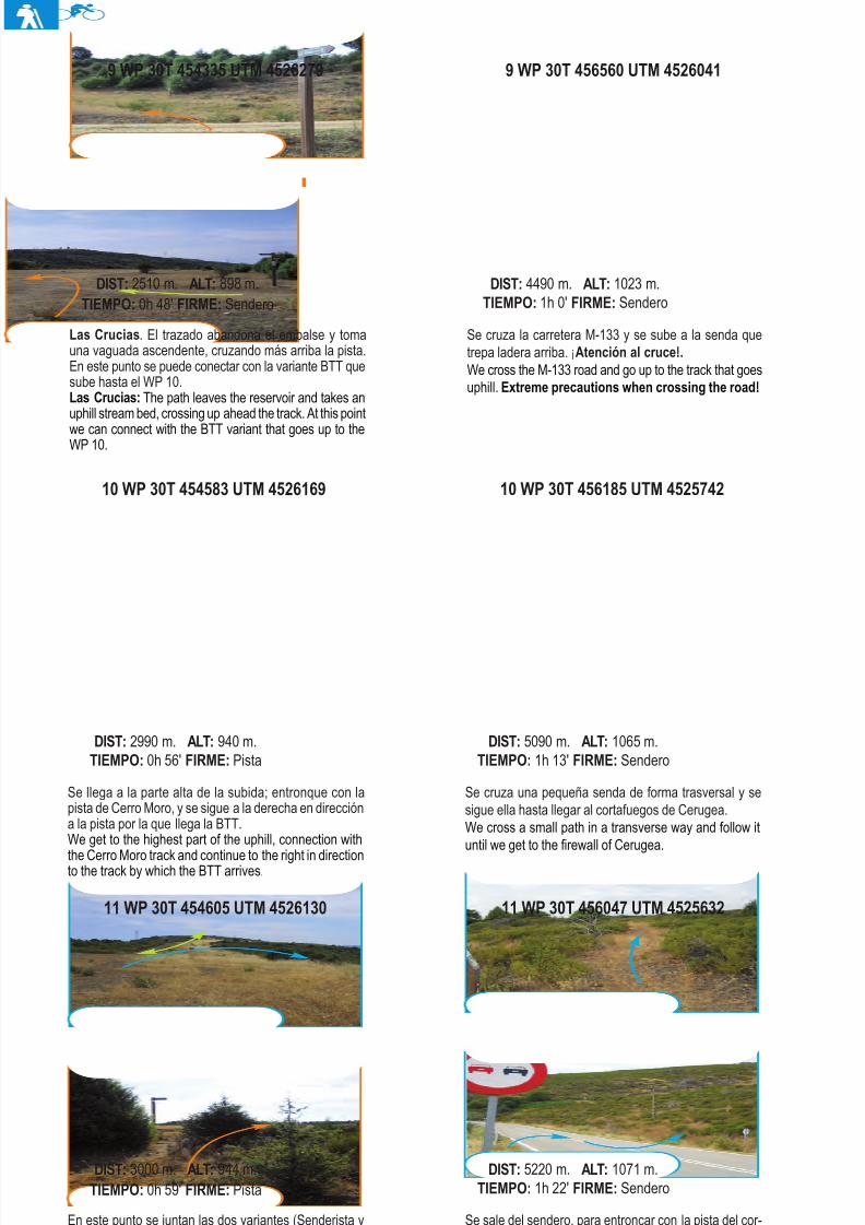
11 WP 30T 454605 UTM 4526130
En este punto se juntan las dos variantes (Senderista yBTT). Se sigue la traza que se adentra en un tramo decamino entre viejos muros de piedra.At this point the two variants come together (BTT and Hiker).
We follow the track that goes into a path in between stonewalls.
DIST: 3000 m. ALT: 944 m.TIEMPO: 0h 59' FIRME: Pista
11 WP 30T 456047 UTM 4525632
Se sale del sendero, para entroncar con la pista del cor-tafuegos de Cerugea. Se vira a la izquierda y nos encon-tramos con la variante BTT.We exit the path to connect with the Cerugea’s firewall
track. We turn left and we find the BTT variant.
DIST: 5220 m. ALT: 1071 m.TIEMPO: 1h 22' FIRME: Sendero
10 WP 30T 454583 UTM 4526169
Se llega a la parte alta de la subida; entronque con lapista de Cerro Moro, y se sigue a la derecha en direccióna la pista por la que llega la BTT.We get to the highest part of the uphill, connection with
the Cerro Moro track and continue to the right in directionto the track by which the BTT arrives.
DIST: 2990 m. ALT: 940 m.TIEMPO: 0h 56' FIRME: Pista
10 WP 30T 456185 UTM 4525742
Se cruza una pequeña senda de forma trasversal y sesigue ella hasta llegar al cortafuegos de Cerugea.We cross a small path in a transverse way and follow ituntil we get to the firewall of Cerugea.
DIST: 5090 m. ALT: 1065 m.TIEMPO: 1h 13' FIRME: Sendero
9 WP 30T 454335 UTM 4526279
Las Crucias. El trazado abandona el embalse y tomauna vaguada ascendente, cruzando más arriba la pista.En este punto se puede conectar con la variante BTT quesube hasta el WP 10.Las Crucias: The path leaves the reservoir and takes anuphill stream bed, crossing up ahead the track. At this point
we can connect with the BTT variant that goes up to theWP 10.
DIST: 2510 m. ALT: 898 m.TIEMPO: 0h 48' FIRME: Sendero
9 WP 30T 456560 UTM 4526041
Se cruza la carretera M-133 y se sube a la senda quetrepa ladera arriba. ¡Atención al cruce!.We cross the M-133 road and go up to the track that goesuphill. Extreme precautions when crossing the road!
DIST: 4490 m. ALT: 1023 m.TIEMPO: 1h 0' FIRME: Sendero
38 etapa 1
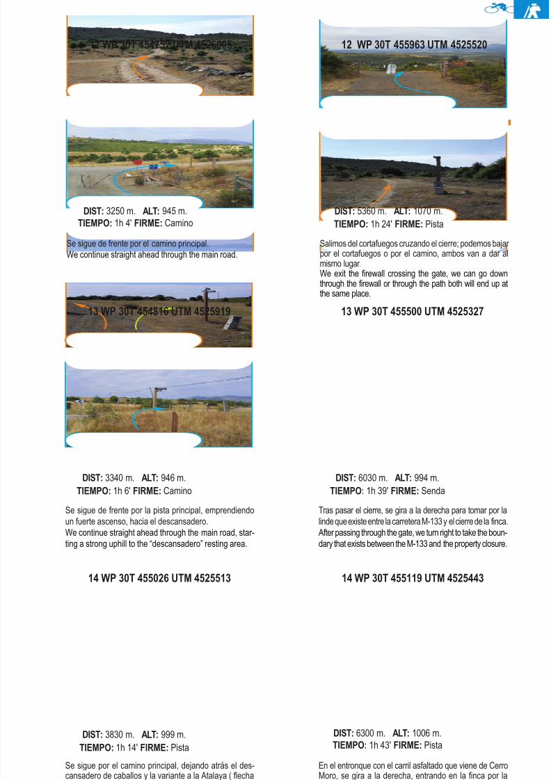
8/3/2019 Libro Senda Del Genaro GR300
http://slidepdf.com/reader/full/libro-senda-del-genaro-gr300 36/156
14 WP 30T 455026 UTM 4525513
Se sigue por el camino principal, dejando atrás el des-cansadero de caballos y la variante a la Atalaya ( flechanaranja).We follow the main road, leaving behind the horse restingarea and the Watchtower variant (orange arrow)
DIST: 3830 m. ALT: 999 m.TIEMPO: 1h 14' FIRME: Pista
14 WP 30T 455119 UTM 4525443
En el entronque con el carril asfaltado que viene de CerroMoro, se gira a la derecha, entrando en la finca por laportilla "canadiense".At the crossing with the paved line that comes from CerroMoro, we turn right going inside the property by the Ca-
nadian gate.
DIST: 6300 m. ALT: 1006 m.TIEMPO: 1h 43' FIRME: Pista
13 WP 30T 454816 UTM 4525919
Se sigue de frente por la pista principal, emprendiendoun fuerte ascenso, hacia el descansadero.We continue straight ahead through the main road, star-
ting a strong uphill to the “descansadero” resting area.
DIST: 3340 m. ALT: 946 m.TIEMPO: 1h 6' FIRME: Camino
13 WP 30T 455500 UTM 4525327
Tras pasar el cierre, se gira a la derecha para tomar por lalinde que existe entre la carretera M-133 y el cierre de la finca.After passing through the gate, we turn right to take the boun-
dary that exists between the M-133 and the property closure.
DIST: 6030 m. ALT: 994 m.TIEMPO: 1h 39' FIRME: Senda
12 WP 30T 454752 UTM 4526005
Se sigue de frente por el camino principal.We continue straight ahead through the main road.
DIST: 3250 m. ALT: 945 m.TIEMPO: 1h 4' FIRME: Camino
Salimos del cortafuegos cruzando el cierre; podemos bajar por el cortafuegos o por el camino, ambos van a dar almismo lugar.
We exit the firewall crossing the gate, we can go downthrough the firewall or through the path both will end up atthe same place.
DIST: 5360 m. ALT: 1070 m.TIEMPO: 1h 24' FIRME: Pista
39El Berrueco - Patones de Arriba
12 WP 30T 455963 UTM 4525520
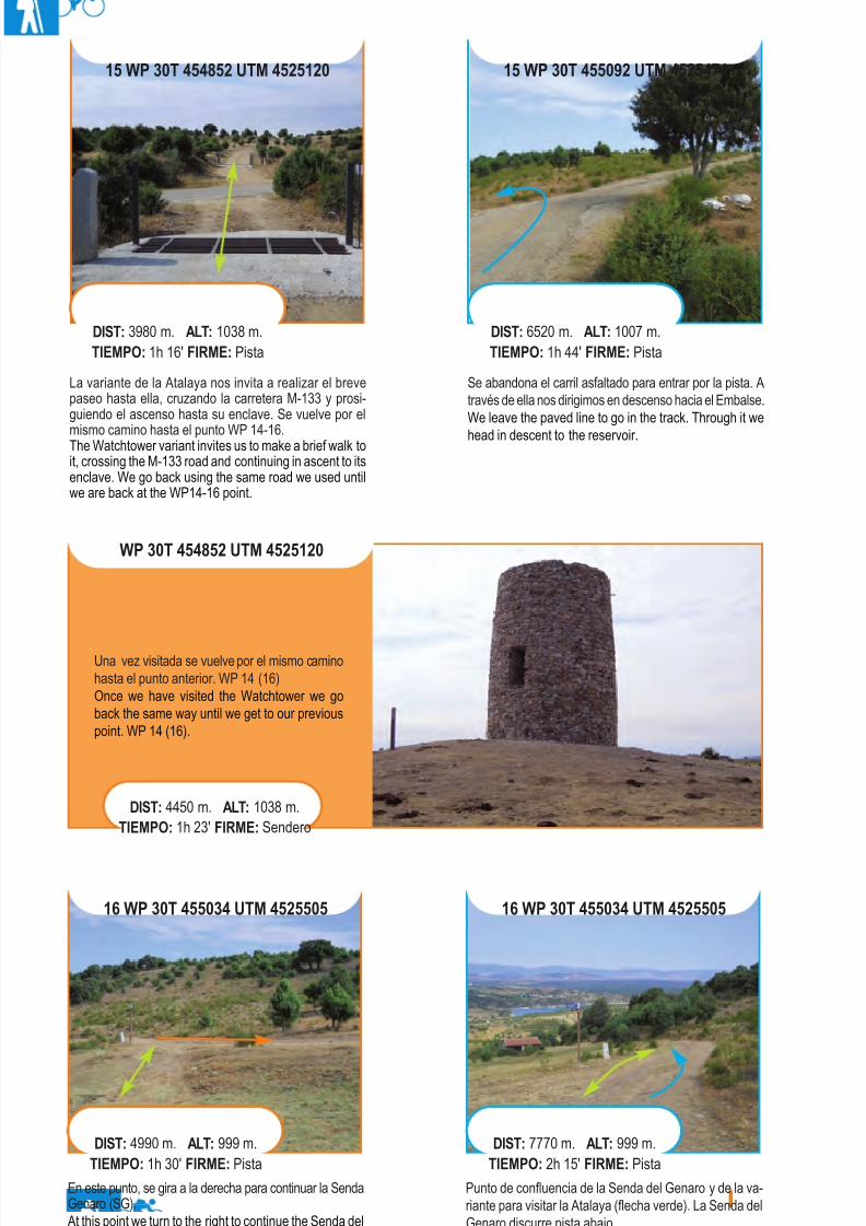
8/3/2019 Libro Senda Del Genaro GR300
http://slidepdf.com/reader/full/libro-senda-del-genaro-gr300 37/156
16 WP 30T 455034 UTM 4525505
En este punto, se gira a la derecha para continuar la SendaGenaro (SG).At this point we turn to the right to continue the Senda delGenaro (SG).
DIST: 4990 m. ALT: 999 m.TIEMPO: 1h 30' FIRME: Pista
16 WP 30T 455034 UTM 4525505
WP 30T 454852 UTM 4525120
DIST: 4450 m. ALT: 1038 m.TIEMPO: 1h 23' FIRME: Sendero
La variante de la Atalaya nos invita a realizar el brevepaseo hasta ella, cruzando la carretera M-133 y prosi-guiendo el ascenso hasta su enclave. Se vuelve por el
mismo camino hasta el punto WP 14-16.The Watchtower variant invites us to make a brief walk toit, crossing the M-133 road and continuing in ascent to itsenclave. We go back using the same road we used untilwe are back at the WP14-16 point.
DIST: 3980 m. ALT: 1038 m.TIEMPO: 1h 16' FIRME: Pista
15 WP 30T 455092 UTM 4525471
Se abandona el carril asfaltado para entrar por la pista. Através de ella nos dirigimos en descenso hacia el Embalse.We leave the paved line to go in the track. Through it wehead in descent to the reservoir.
DIST: 6520 m. ALT: 1007 m.TIEMPO: 1h 44' FIRME: Pista
Una vez visitada se vuelve por el mismo caminohasta el punto anterior. WP 14 (16)Once we have visited the Watchtower we goback the same way until we get to our previouspoint. WP 14 (16).
DIST: 7770 m. ALT: 999 m.TIEMPO: 2h 15' FIRME: Pista
Punto de confluencia de la Senda del Genaro y de la va-riante para visitar la Atalaya (flecha verde). La Senda delGenaro discurre pista abajo.Point of confluence of the Senda del Genaro and of thevariant to visit the Watchtower (green arrow). The Sendadel Genaro goes downhill through the track.
40 etapa 1
15 WP 30T 454852 UTM 4525120
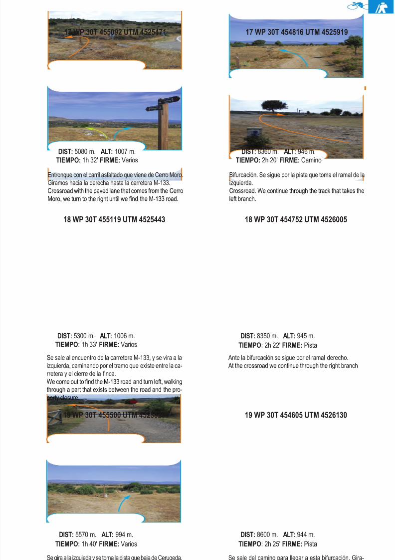
8/3/2019 Libro Senda Del Genaro GR300
http://slidepdf.com/reader/full/libro-senda-del-genaro-gr300 38/156
19 WP 30T 455500 UTM 4525327
Se gira a la izquieda y se toma la pista que baja de Cerugeda.We turn left and take the track that comes down from theCerugeda.
DIST: 5570 m. ALT: 994 m.TIEMPO: 1h 40' FIRME: Varios
19 WP 30T 454605 UTM 4526130
Se sale del camino para llegar a esta bifurcación. Gira-mos a la derecha para tomar la ruta senderista y segui-mos de frente si queremos ir por la variante BTT.We exit the road to get to this crossroad. We turn right to
take the hiker’s route and continue ahead if we want to gothrough the BTT variant.
DIST: 8600 m. ALT: 944 m.TIEMPO: 2h 25' FIRME: Pista
18 WP 30T 455119 UTM 4525443
Se sale al encuentro de la carretera M-133, y se vira a laizquierda, caminando por el tramo que existe entre la ca-rretera y el cierre de la finca.We come out to find the M-133 road and turn left, walking
through a part that exists between the road and the pro-perty closure.
DIST: 5300 m. ALT: 1006 m.TIEMPO: 1h 33' FIRME: Varios
18 WP 30T 454752 UTM 4526005
Ante la bifurcación se sigue por el ramal derecho.At the crossroad we continue through the right branch
DIST: 8350 m. ALT: 945 m.TIEMPO: 2h 22' FIRME: Pista
17 WP 30T 455092 UTM 4525471
Entronque con el carril asfaltado que viene de Cerro Moro.Giramos hacia la derecha hasta la carretera M-133.Crossroad with the paved lane that comes from the CerroMoro, we turn to the right until we find the M-133 road.
DIST: 5080 m. ALT: 1007 m.TIEMPO: 1h 32' FIRME: Varios
Bifurcación. Se sigue por la pista que toma el ramal de laizquierda.Crossroad. We continue through the track that takes theleft branch.
DIST: 8360 m. ALT: 946 m.TIEMPO: 2h 20' FIRME: Camino
41El Berrueco - Patones de Arriba
17 WP 30T 454816 UTM 4525919
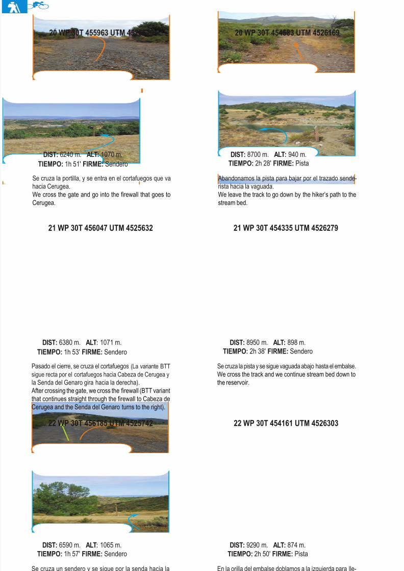
8/3/2019 Libro Senda Del Genaro GR300
http://slidepdf.com/reader/full/libro-senda-del-genaro-gr300 39/156
22 WP 30T 456185 UTM 4525742
Se cruza un sendero y se sigue por la senda hacia lacarretera.We cross a path and continue through our path to theroad.
DIST: 6590 m. ALT: 1065 m.TIEMPO: 1h 57' FIRME: Sendero
22 WP 30T 454161 UTM 4526303
En la orilla del embalse doblamos a la izquierda para lle-gar a la pista que baja del punto WP 19.At the shore of the reservoir we turn to the left to get tothe track that comes down from the WP 19 point.
DIST: 9290 m. ALT: 874 m.TIEMPO: 2h 50' FIRME: Pista
21 WP 30T 456047 UTM 4525632
Pasado el cierre, se cruza el cortafuegos (La variante BTTsigue recta por el cortafuegos hacia Cabeza de Cerugea yla Senda del Genaro gira hacia la derecha).After crossing the gate, we cross the firewall (BTT variant
that continues straight through the firewall to Cabeza deCerugea and the Senda del Genaro turns to the right).
DIST: 6380 m. ALT: 1071 m.TIEMPO: 1h 53' FIRME: Sendero
21 WP 30T 454335 UTM 4526279
Se cruza la pista y se sigue vaguada abajo hasta el embalse.We cross the track and we continue stream bed down tothe reservoir.
DIST: 8950 m. ALT: 898 m.TIEMPO: 2h 38' FIRME: Sendero
Se cruza la portilla, y se entra en el cortafuegos que vahacia Cerugea.We cross the gate and go into the firewall that goes toCerugea.
DIST: 6240 m. ALT: 1070 m.TIEMPO: 1h 51' FIRME: Sendero
20 WP 30T 454583 UTM 4526169
Abandonamos la pista para bajar por el trazado sende-rista hacia la vaguada.We leave the track to go down by the hiker’s path to thestream bed.
DIST: 8700 m. ALT: 940 m.TIEMPO: 2h 28' FIRME: Pista
42 etapa 1
20 WP 30T 455963 UTM 4525520
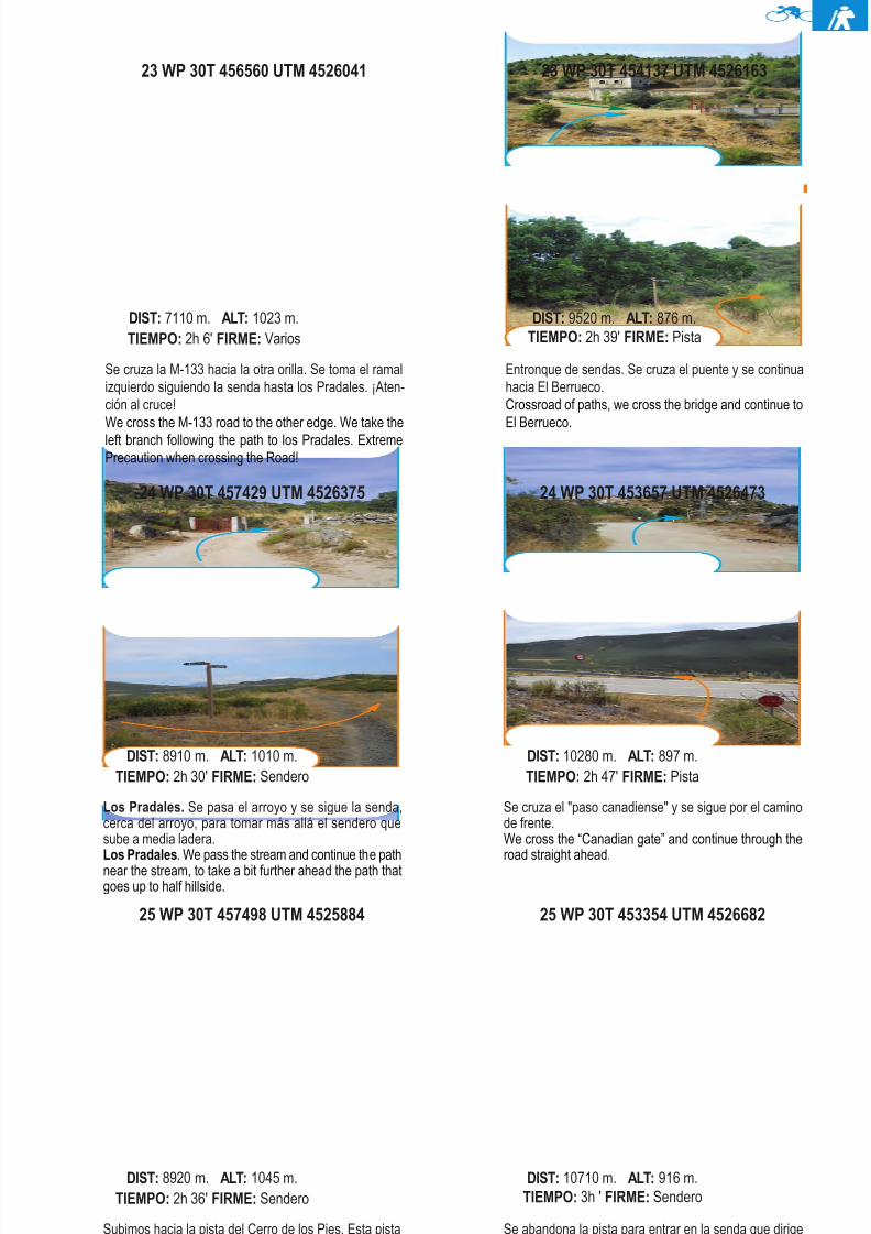
8/3/2019 Libro Senda Del Genaro GR300
http://slidepdf.com/reader/full/libro-senda-del-genaro-gr300 40/156
25 WP 30T 457498 UTM 4525884
Subimos hacia la pista del Cerro de los Pies. Esta pistase cruza y se toma la senda que baja hacia el barrancode Patones.We go up to the Cerro de los Pies’ track. This track crosses
and takes the path that goes down to the Patones’ gully.
DIST: 8920 m. ALT: 1045 m.TIEMPO: 2h 36' FIRME: Sendero
25 WP 30T 453354 UTM 4526682
Se abandona la pista para entrar en la senda que dirigesu rumbo a El Berueco.We leave the track to go in the path that directs its courseto El Berrueco.
DIST: 10710 m. ALT: 916 m.TIEMPO: 3h ' FIRME: Sendero
24 WP 30T 457429 UTM 4526375
Los Pradales. Se pasa el arroyo y se sigue la senda,cerca del arroyo, para tomar más allá el sendero quesube a media ladera.Los Pradales. We pass the stream and continue the pathnear the stream, to take a bit further ahead the path thatgoes up to half hillside.
DIST: 8910 m. ALT: 1010 m.TIEMPO: 2h 30' FIRME: Sendero
24 WP 30T 453657 UTM 4526473
Se cruza el "paso canadiense" y se sigue por el caminode frente.We cross the “Canadian gate” and continue through theroad straight ahead.
DIST: 10280 m. ALT: 897 m.TIEMPO: 2h 47' FIRME: Pista
23 WP 30T 456560 UTM 4526041
Se cruza la M-133 hacia la otra orilla. Se toma el ramalizquierdo siguiendo la senda hasta los Pradales. ¡Aten-ción al cruce!We cross the M-133 road to the other edge. We take theleft branch following the path to los Pradales. ExtremePrecaution when crossing the Road!
DIST: 7110 m. ALT: 1023 m.TIEMPO: 2h 6' FIRME: Varios
Entronque de sendas. Se cruza el puente y se continuahacia El Berrueco.Crossroad of paths, we cross the bridge and continue toEl Berrueco.
DIST: 9520 m. ALT: 876 m.TIEMPO: 2h 39' FIRME: Pista
43El Berrueco - Patones de Arriba
23 WP 30T 454137 UTM 4526163
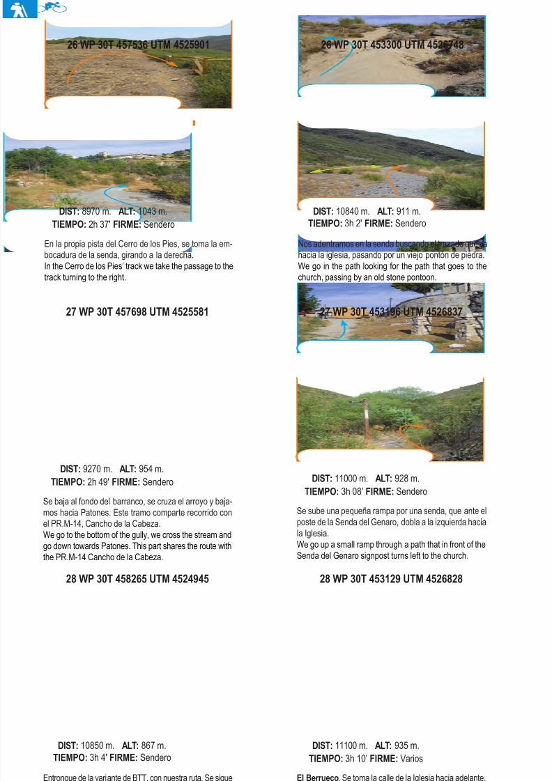
8/3/2019 Libro Senda Del Genaro GR300
http://slidepdf.com/reader/full/libro-senda-del-genaro-gr300 41/156
28 WP 30T 458265 UTM 4524945
Entronque de la variante de BTT, con nuestra ruta. Se siguepor la senda adelante hacia Patones. Ambos usos compar-ten trazado.Connection of our route with the BTT variant, we continue
through the path in front to Patones. Both uses share route.
DIST: 10850 m. ALT: 867 m.TIEMPO: 3h 4' FIRME: Sendero
28 WP 30T 453129 UTM 4526828
El Berrueco. Se toma la calle de la Iglesia hacia adelante.El Berrueco: We take the Church’s Street ahead.
DIST: 11100 m. ALT: 935 m.TIEMPO: 3h 10' FIRME: Varios
27 WP 30T 457698 UTM 4525581
Se baja al fondo del barranco, se cruza el arroyo y baja-mos hacia Patones. Este tramo comparte recorrido conel PR.M-14, Cancho de la Cabeza.We go to the bottom of the gully, we cross the stream and
go down towards Patones. This part shares the route withthe PR.M-14 Cancho de la Cabeza.
DIST: 9270 m. ALT: 954 m.TIEMPO: 2h 49' FIRME: Sendero
27 WP 30T 453196 UTM 4526837
Se sube una pequeña rampa por una senda, que ante elposte de la Senda del Genaro, dobla a la izquierda haciala Iglesia.
We go up a small ramp through a path that in front of theSenda del Genaro signpost turns left to the church.
DIST: 11000 m. ALT: 928 m.TIEMPO: 3h 08' FIRME: Sendero
En la propia pista del Cerro de los Pies, se toma la em-bocadura de la senda, girando a la derecha.In the Cerro de los Pies’ track we take the passage to thetrack turning to the right.
DIST: 8970 m. ALT: 1043 m.TIEMPO: 2h 37' FIRME: Sendero
26 WP 30T 453300 UTM 4526748
Nos adentramos en la senda buscando el trazado que vahacia la iglesia, pasando por un viejo pontón de piedra.We go in the path looking for the path that goes to thechurch, passing by an old stone pontoon.
DIST: 10840 m. ALT: 911 m.TIEMPO: 3h 2' FIRME: Sendero
44 etapa 1
26 WP 30T 457536 UTM 4525901
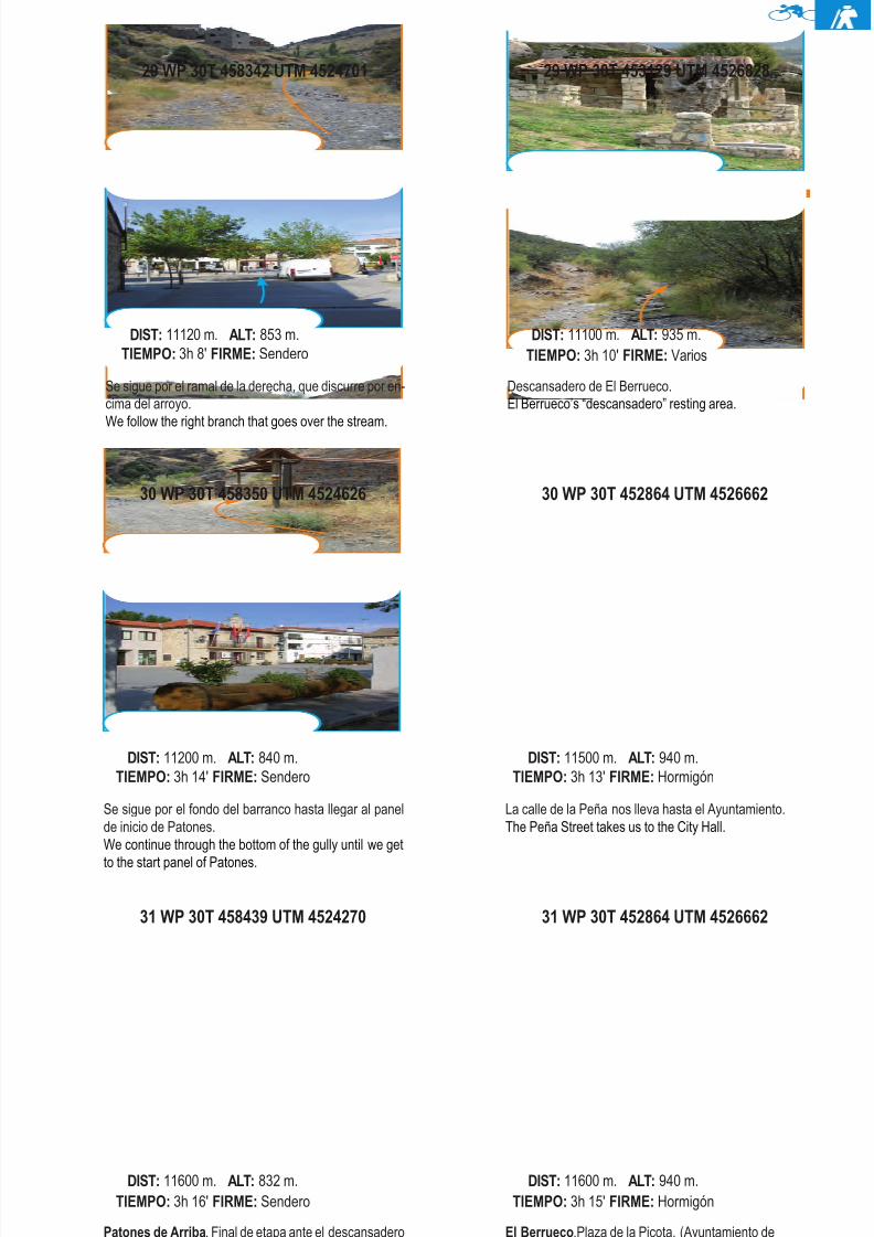
8/3/2019 Libro Senda Del Genaro GR300
http://slidepdf.com/reader/full/libro-senda-del-genaro-gr300 42/156
31 WP 30T 458439 UTM 4524270
Patones de Arriba. Final de etapa ante el descansaderoy los paneles de rutas.Patones de Arriba: End of the stage at the resting areaand the route panels.
DIST: 11600 m. ALT: 832 m.TIEMPO: 3h 16' FIRME: Sendero
31 WP 30T 452864 UTM 4526662
El Berrueco.Plaza de la Picota, (Ayuntamiento deEl Berrueco). Fin de la etapa.El Berrueco. Plaza de la Picota ( City Hall) end of thestage.
DIST: 11600 m. ALT: 940 m.TIEMPO: 3h 15' FIRME: Hormigón
30 WP 30T 458350 UTM 4524626
Se sigue por el fondo del barranco hasta llegar al panelde inicio de Patones.We continue through the bottom of the gully until we get
to the start panel of Patones.
DIST: 11200 m. ALT: 840 m.TIEMPO: 3h 14' FIRME: Sendero
30 WP 30T 452864 UTM 4526662
La calle de la Peña nos lleva hasta el Ayuntamiento.The Peña Street takes us to the City Hall.
DIST: 11500 m. ALT: 940 m.TIEMPO: 3h 13' FIRME: Hormigón
29 WP 30T 458342 UTM 4524701
Se sigue por el ramal de la derecha, que discurre por en-cima del arroyo.We follow the right branch that goes over the stream.
DIST: 11120 m. ALT: 853 m.TIEMPO: 3h 8' FIRME: Sendero
Descansadero de El Berrueco.El Berrueco’s “descansadero” resting area.
DIST: 11100 m. ALT: 935 m.TIEMPO: 3h 10' FIRME: Varios
45El Berrueco - Patones de Arriba
29 WP 30T 453129 UTM 4526828
8/3/2019 Libro Senda Del Genaro GR300
http://slidepdf.com/reader/full/libro-senda-del-genaro-gr300 43/156
etapa 2PATONES DE ARRIBA
EL ATAZAR
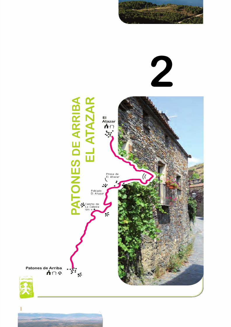
8/3/2019 Libro Senda Del Genaro GR300
http://slidepdf.com/reader/full/libro-senda-del-genaro-gr300 44/156
2
P A T O N E
S D E A R R I
B A
E L A T A Z A R
48 etapa 2
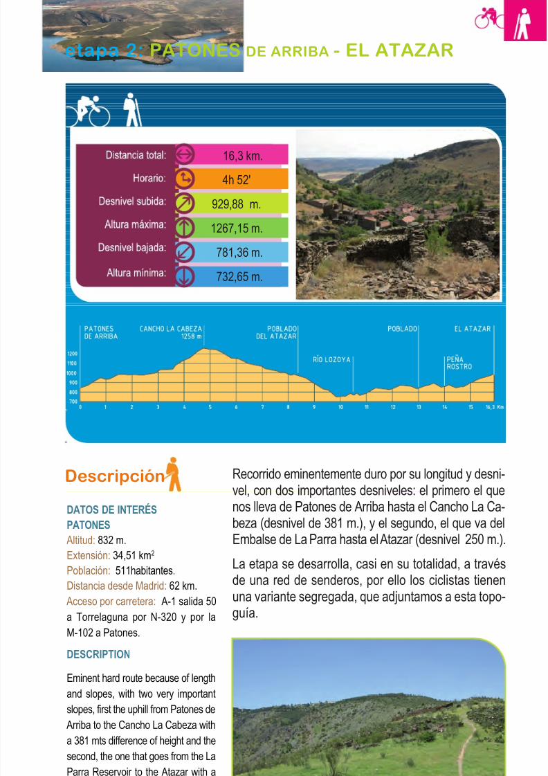
8/3/2019 Libro Senda Del Genaro GR300
http://slidepdf.com/reader/full/libro-senda-del-genaro-gr300 45/156
Descripción
DATOS DE INTERÉS
PATONES
Altitud: 832 m.Extensión: 34,51 km2
Población: 511habitantes.
Distancia desde Madrid: 62 km.
Acceso por carretera: A-1 salida 50
a Torrelaguna por N-320 y por la
M-102 a Patones.
DESCRIPTION
Eminent hard route because of lengthand slopes, with two very important
slopes, first the uphill from Patones de
Arriba to the Cancho La Cabeza with
a 381 mts difference of height and the
second, the one that goes from the La
Parra Reservoir to the Atazar with a
250 meters difference of height.
Recorrido eminentemente duro por su longitud y desni-vel, con dos importantes desniveles: el primero el quenos lleva de Patones de Arriba hasta el Cancho La Ca-beza (desnivel de 381 m.), y el segundo, el que va del
Embalse de La Parra hasta el Atazar (desnivel 250 m.).La etapa se desarrolla, casi en su totalidad, a travésde una red de senderos, por ello los ciclistas tienenuna variante segregada, que adjuntamos a esta topo-guía.
49Patones de Arriba - El Atazar
etapa 2: PATONES DE ARRIBA - EL ATAZAR
16,3 km.
4h 52'
929,88 m.
1267,15 m.
781,36 m.
732,65 m.
Camino del Poblado de El Atazar
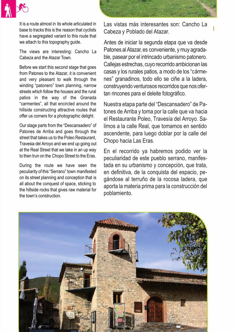
8/3/2019 Libro Senda Del Genaro GR300
http://slidepdf.com/reader/full/libro-senda-del-genaro-gr300 46/156
It is a route almost in its whole articulated in
base to tracks this is the reason that cyclists
have a segregated variant to this route that
we attach to this topography guide.
The views are interesting: Cancho La
Cabeza and the Atazar Town.
Before we start this second stage that goes
from Patones to the Atazar, it is convenient
and very pleasant to walk through the
winding “patonero” town planning, narrow
streets which follow the houses and the rural
patios in the way of the Granada
“carmentes”, all that encircled around the
hillside constructing attractive routes that
offer us corners for a photographic delight.
Our stage parts from the “Descansadero” of
Patones de Arriba and goes through the
street that takes us to the Poleo Restaurant,
Travesia del Arroyo and we end up going out
at the Real Street that we take in an up way
to then trun on the Chopo Street to the Eras.
During the route we have seen the
peculiarity of this “Serrano” town manifested
on its street planning and conception that is
all about the conquest of space, sticking to
the hillside rocks that gives raw material for
the town’s construction.
Las vistas más interesantes son: Cancho La
Cabeza y Poblado del Atazar.
Antes de iniciar la segunda etapa que va desde
Patones al Atazar, es conveniente, y muy agrada-
ble, pasear por el intrincado urbanismo patonero.Callejas estrechas, cuyo recorrido ambicionan las
casas y los rurales patios, a modo de los “cárme-
nes” granadinos, todo ello se ciñe a la ladera,
construyendo venturosos recorridos que nos ofer-
tan rincones para el deleite fotográfico.
Nuestra etapa parte del “Descansadero” de Pa-
tones de Arriba y toma por la calle que va hacia
el Restaurante Poleo, Travesía del Arroyo. Sa-
limos a la calle Real, que tomamos en sentido
ascendente, para luego doblar por la calle del
Chopo hacia Las Eras.
En el recorrido ya habremos podido ver lapeculiaridad de este pueblo serrano, manifes-tada en su urbanismo y concepción, que trata,
en definitiva, de la conquista del espacio, pe-gándose al terruño de la rocosa ladera, queaporta la materia prima para la construcción delpoblamiento.
50 etapa 2
Iglesia de Patones de Arriba
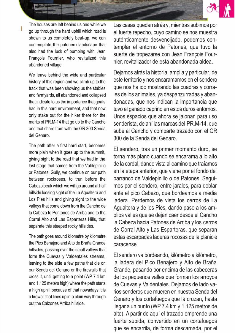
8/3/2019 Libro Senda Del Genaro GR300
http://slidepdf.com/reader/full/libro-senda-del-genaro-gr300 47/156
Las casas quedan atrás y, mientras subimos por
el fuerte repecho, cuyo camino se nos muestra
auténticamente desvencijado, podemos con-
templar el entorno de Patones, que tuvo la
suerte de tropezarse con Jean François Four-
nier, revitalizador de esta abandonada aldea.
Dejamos atrás la historia, amplia y particular, de
este territorio y nos encaramamos en el sendero
que nos ha ido mostrando las cuadras y corra-
les de los animales, ya despanzurradas y aban-
donadas, que nos indican la importancia que
tuvo el ganado caprino en estos duros entornos.
Unos espacios que ahora se jalonan para usosenderista, de ahí las marcas del PR.M-14, que
sube al Cancho y comparte trazado con el GR
300 de la Senda del Genaro.
El sendero, tras un primer momento duro, se
torna más plano cuando se encarama a lo alto
de la cordal, dando vista al camino que traíamos
en la etapa anterior, que viene por el fondo del
barranco de Valdepinillo o de Patones. Segui-
mos por el sendero, entre jarales, para doblar
ante el pico Cabezo, que bordeamos a media
ladera. Perdemos de vista los cerros de La
Agualtera y de los Pies, dando paso a los am-
plios valles que se dejan caer desde el Cancho
la Cabeza hacia Patones de Arriba y los cerros
de Corral Alto y Las Esparteras, que separan
estas escarpadas laderas rocosas de la planicie
caracense.
El sendero va bordeando, kilómetro a kilómetro,
la ladera del Pico Benajero y Alto de Braña
Grande, pasando por encima de las cabeceras
de los pequeños valles que forman los arroyos
de Cuevas y Valdentales. Dejamos de lado va-
rios senderos que mueren en nuestra Senda delGenaro y los cortafuegos que la cruzan, hasta
llegar a un punto (WP 7.4 km y 1.125 metros de
alto). A partir de aquí el trazado emprende una
fuerte subida, convertido en un cortafuegos
que se encarrila, de forma descarnada, por el
Ladero de Calzones arriba.
51Patones de Arriba - El Atazar
The houses are left behind us and while we
go up through the hard uphill which road is
shown to us completely beat-up, we can
contemplate the patonero landscape that
also had the luck of bumping with Jean
François Fournier, who revitalized thisabandoned village.
We leave behind the wide and particular
history of this region and we climb up to the
track that was been showing us the stables
and farmyards, all abandoned and collapsed
that indicate to us the importance that goats
had in this hard environment, and that now
only stake out for the hiker there for themarks of PR.M-14 that go up to the Cancho
and that share tram with the GR 300 Senda
del Genaro.
The path after a first hard start, becomes
more plain when it goes up to the summit,
giving sight to the road that we had in the
last stage that comes from the Valdepinillo
or Patones’ Gully, we continue on our pathbetween rockroses, to trun before the
Cabezo peak which we will go around at half
hillside loosing sight of the La Agualtera and
Los Pies hills and giving sight to the wide
valleys that come down from the Cancho de
la Cabeza to Pontones de Arriba and to the
Corral Alto and Las Esparteras Hills, that
separate this steeped rocky hillsides.
The path goes around kilometre by kilometre
the Pico Benajero and Alto de Braña Grande
hillsides, passing over the small valleys that
form the Cuevas y Valdentales streams,
leaving to the side a few paths that die on
our Senda del Genaro or the firewalls that
cross it, until getting to a point (WP 7.4 km
and 1.125 meters high) where the path starts
a high uphill because of that nowadays it isa firewall that lines up in a plain way through
out the Calzones Arriba hillside.
8/3/2019 Libro Senda Del Genaro GR300
http://slidepdf.com/reader/full/libro-senda-del-genaro-gr300 48/156
Tras este fuerte repecho, donde el jaral es todo
un universo que, sin embargo, no impede al re-
corrido aportarnos amplias vistas al Sur (en días
claros se adivinan las opulentas torres madrile-
ñas) vemos, más cercanas a nuestro emplaza-miento, las tierras planas de Guadalajara.
El sendero dibuja un ángulo de 90 grados, to-
mando rumbo Norte (WP8, 4,03 km) para me-
terse por entre el roquedo, buscando el cobijo
del pinar, que se desparrama mansamente por
la ladera sur del Cancho la Cabeza. Es un
tramo de sendero que serpentea por entre los-
pinos, buscando el ventoso collado, ya en la
cuerda del Cancho de la Cabeza, que nos
queda, con su vértice geodésico, a la izquierda.
Las vistas sobre el Embalse del Atazar son im-
presionantes. Miremos hacia donde miremos el
detalle de la contemplación puede ser increíble.
Desde esta atalaya natural podemos ver casi
todo el desarrollo de la Senda del Genaro. Dehecho, si miramos al Norte y tomamos como re-
ferencia el Atazar, se pueden observar los tra-
zados de los dos recorridos, tanto el senderista,
que sube por encima del barranco del Lozoya,
como el ciclista, que sube hacia las pistas que
bordean la Cabeza del Madroñal.
Una vez concluida tan estática contemplación,la Senda del Genaro vuelve desde el Cancho
La Cabeza hasta el punto por el cual habíamos
accedido. Ahora seguimos, de frente, por el
cordal adelante, en plano, hasta concluir ante
un nuevo cortafuego, (WP11, 5,5 km). Se gira
a la izquierda y se baja por él hasta, de nuevo,
entroncar con la pista que viene de la zona del
Cerro de la Oliva. Se vira en este punto a la iz-
quierda y se prosigue por la pista, en suave
descenso y por medio del pinar, que no aban-
donaremos, para concluir en las instalaciones
del Poblado del Atazar, a unos 7,5 km del inicio,
con 2 horas largas de caminata y sin apenas
descansos.
52 etapa 2
After this hard uphill, where the rockrose is
a whole universe, even though the path
doesn’t stop giving us wide views to the
South. In clear weather days u can make out
the opulent Madrid’s towers, more closer to
our location we can see the plain lands of
Guadalajara.
The path makes a 90 grade angle taking
North (WP8, 4,03 km) to go in between the
rocks searching for the pine forest cover that
gently spreads through out the Cancho de la
Cabeza south hillside. It is a part of the path
that twists between the pine forest looking
for the windy pass at the Cancho de la
Cabeza summit, that remains with its
geodesic crown to the left.
The views over the Atazar reservoir, are
impressive, it doesn’t matter where we look
the detail of the contemplation it is
unbelievable. Practically from this natural
watchtower we can see almost all the Senda
del Genaro development. In fact if we look
to the North and take as reference the
Atazar, we can see the outlines of the two
routes, the hiker route that goes over the
Lozoya gully and the cycle route that goes
up to the tracks that go around the Cabeza
del Madroñal.
Once concluded our ecstatic contemplation,
the Senda del Genaro, returns from the
Cancho La Cabez to the point where we
gained access, and now we continue ahead
through the hill infront, in plain until we meet
a new firewall, (WP11; 5,5km) we turn left
and go down through it until we find again
the track that comes from the Cerro de la
Oliva area, we turn to the left at this point
and continue on the track with a light
descent in between the pine forest that we
wont abandon after arriving to the Atazar
Village installations at about 7,5 km from the
start and with 2 hours of long walks without
almost any recess.
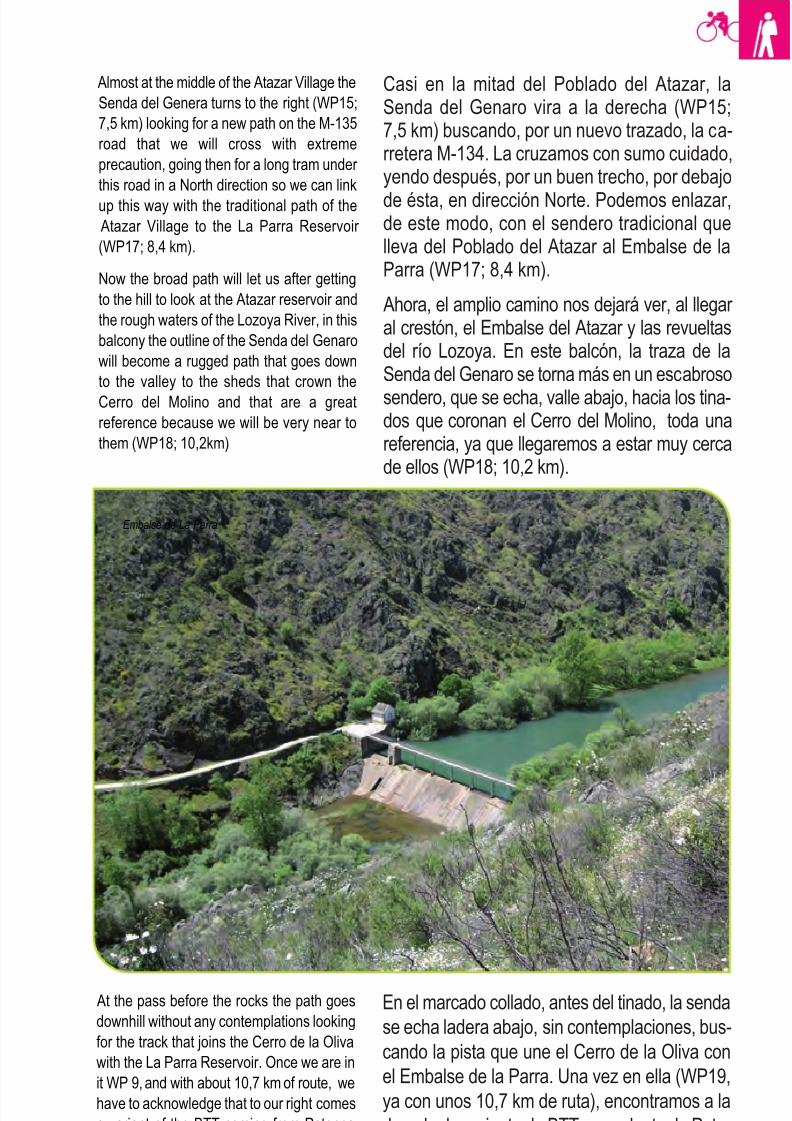
8/3/2019 Libro Senda Del Genaro GR300
http://slidepdf.com/reader/full/libro-senda-del-genaro-gr300 49/156
53Patones de Arriba - El Atazar
Casi en la mitad del Poblado del Atazar, laSenda del Genaro vira a la derecha (WP15;7,5 km) buscando, por un nuevo trazado, la ca-rretera M-134. La cruzamos con sumo cuidado,yendo después, por un buen trecho, por debajo
de ésta, en dirección Norte. Podemos enlazar,de este modo, con el sendero tradicional quelleva del Poblado del Atazar al Embalse de laParra (WP17; 8,4 km).
Ahora, el amplio camino nos dejará ver, al llegar al crestón, el Embalse del Atazar y las revueltasdel río Lozoya. En este balcón, la traza de laSenda del Genaro se torna más en un escabroso
sendero, que se echa, valle abajo, hacia los tina-dos que coronan el Cerro del Molino, toda unareferencia, ya que llegaremos a estar muy cercade ellos (WP18; 10,2 km).
En el marcado collado, antes del tinado, la senda
se echa ladera abajo, sin contemplaciones, bus-
cando la pista que une el Cerro de la Oliva con
el Embalse de la Parra. Una vez en ella (WP19,
ya con unos 10,7 km de ruta), encontramos a la
derecha la variante de BTT procedente de Pato-
nes de Arriba. En este punto, dependiendo de
cómo vaya de crecido el río Lozoya, tenemos
Almost at the middle of the Atazar Village the
Senda del Genera turns to the right (WP15;
7,5 km) looking for a new path on the M-135
road that we will cross with extreme
precaution, going then for a long tram under
this road in a North direction so we can link
up this way with the traditional path of the
Atazar Village to the La Parra Reservoir
(WP17; 8,4 km).
Now the broad path will let us after getting
to the hill to look at the Atazar reservoir and
the rough waters of the Lozoya River, in this
balcony the outline of the Senda del Genaro
will become a rugged path that goes down
to the valley to the sheds that crown the
Cerro del Molino and that are a great
reference because we will be very near to
them (WP18; 10,2km)
At the pass before the rocks the path goes
downhill without any contemplations looking
for the track that joins the Cerro de la Oliva
with the La Parra Reservoir. Once we are in
it WP 9, and with about 10,7 km of route, we
have to acknowledge that to our right comes
a variant of the BTT coming from Patones
de Arriba and that in this point depending of
how the rise of the river is we have two
Embalse de La Parra
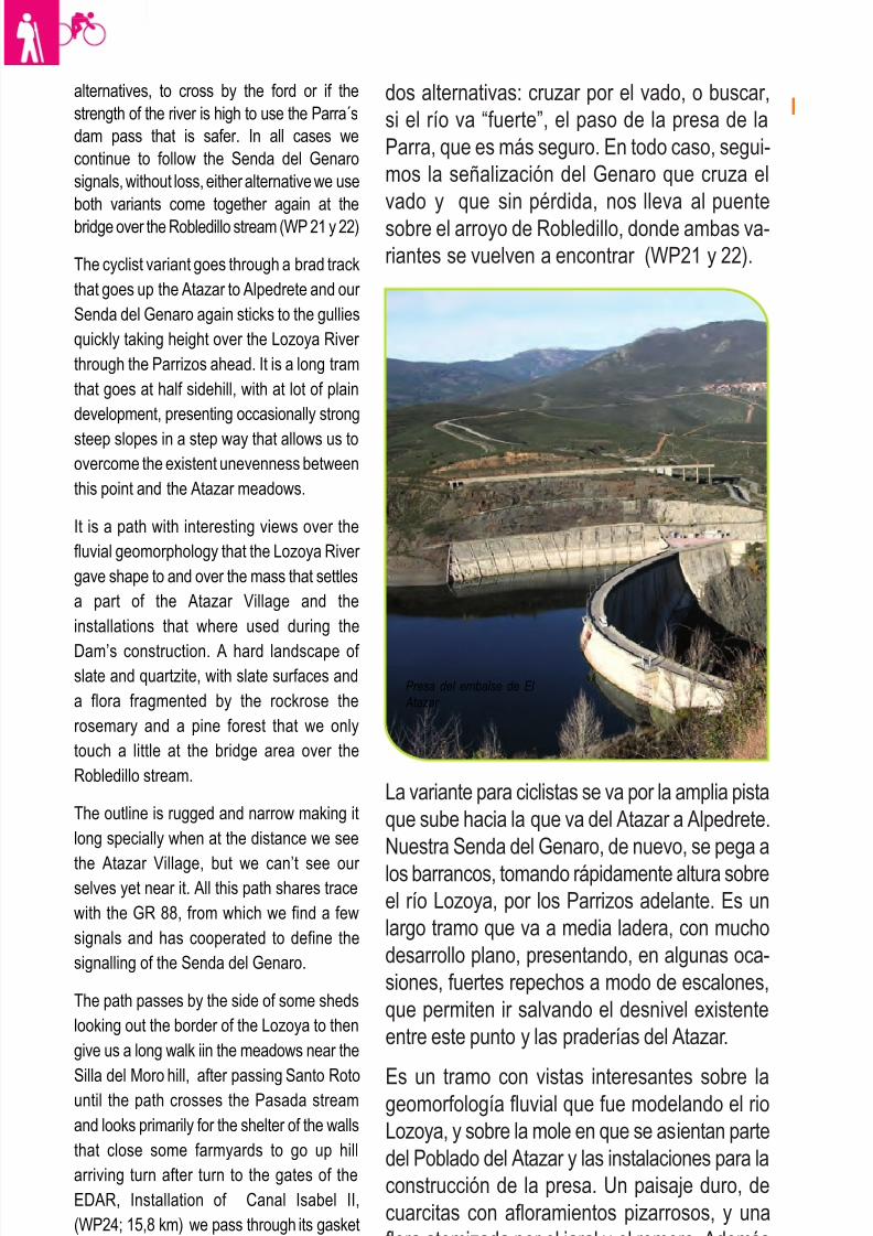
8/3/2019 Libro Senda Del Genaro GR300
http://slidepdf.com/reader/full/libro-senda-del-genaro-gr300 50/156
54 etapa 2
dos alternativas: cruzar por el vado, o buscar,
si el río va “fuerte”, el paso de la presa de la
Parra, que es más seguro. En todo caso, segui-
mos la señalización del Genaro que cruza el
vado y que sin pérdida, nos lleva al puente
sobre el arroyo de Robledillo, donde ambas va-
riantes se vuelven a encontrar (WP21 y 22).
alternatives, to cross by the ford or if the
strength of the river is high to use the Parra´s
dam pass that is safer. In all cases we
continue to follow the Senda del Genaro
signals, without loss, either alternative we use
both variants come together again at the
bridge over the Robledillo stream (WP 21 y 22)
The cyclist variant goes through a brad track
that goes up the Atazar to Alpedrete and our
Senda del Genaro again sticks to the gullies
quickly taking height over the Lozoya River
through the Parrizos ahead. It is a long tram
that goes at half sidehill, with at lot of plain
development, presenting occasionally strong
steep slopes in a step way that allows us to
overcome the existent unevenness between
this point and the Atazar meadows.
It is a path with interesting views over the
fluvial geomorphology that the Lozoya River
gave shape to and over the mass that settles
a part of the Atazar Village and the
installations that where used during the
Dam’s construction. A hard landscape of slate and quartzite, with slate surfaces and
a flora fragmented by the rockrose the
rosemary and a pine forest that we only
touch a little at the bridge area over the
Robledillo stream.
The outline is rugged and narrow making it
long specially when at the distance we see
the Atazar Village, but we can’t see our selves yet near it. All this path shares trace
with the GR 88, from which we find a few
signals and has cooperated to define the
signalling of the Senda del Genaro.
The path passes by the side of some sheds
looking out the border of the Lozoya to then
give us a long walk iin the meadows near the
Silla del Moro hill, after passing Santo Rotountil the path crosses the Pasada stream
and looks primarily for the shelter of the walls
that close some farmyards to go up hill
arriving turn after turn to the gates of the
EDAR, Installation of Canal Isabel II,
(WP24; 15,8 km) we pass through its gasket
to go up to the track that crosses in front of
us, we take the right branch road of the
La variante para ciclistas se va por la amplia pista
que sube hacia la que va del Atazar a Alpedrete.
Nuestra Senda del Genaro, de nuevo, se pega a
los barrancos, tomando rápidamente altura sobreel río Lozoya, por los Parrizos adelante. Es un
largo tramo que va a media ladera, con mucho
desarrollo plano, presentando, en algunas oca-
siones, fuertes repechos a modo de escalones,
que permiten ir salvando el desnivel existente
entre este punto y las praderías del Atazar.
Es un tramo con vistas interesantes sobre lageomorfología fluvial que fue modelando el rio
Lozoya, y sobre la mole en que se asientan parte
del Poblado del Atazar y las instalaciones para la
construcción de la presa. Un paisaje duro, de
cuarcitas con afloramientos pizarrosos, y una
flora atomizada por el jaral y el romero. Además
vemos un pinar, que solo tocamos un poquito en
la zona del puente, sobre el arroyo Robledillo.
Presa del embalse de El
Atazar
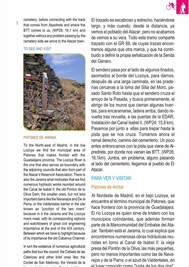
8/3/2019 Libro Senda Del Genaro GR300
http://slidepdf.com/reader/full/libro-senda-del-genaro-gr300 51/156
55Patones de Arriba - El Atazar
El trazado es escabroso y estrecho, haciéndose
largo, y más cuando, desde la distancia, ya
vemos el poblado del Atazar, pero no acabamos
de vernos a su vera. Todo este tramo comparte
trazado con el GR 88, de cuyas trazas encon-
tramos alguna que otra marca, y que ha contri-
buido a definir la propia señalización de la Senda
del Genaro.
El sendero pasa por al lado de algunos tinados,
asomados al borde del Lozoya, para darnos,
después de una larga caminata, en las prade-
rías cercanas a la loma del Silla del Moro, pa-
sado Santo Roto hasta que el sendero cruza elarroyo de la Pasada, y busca primeramente, el
abrigo de los muros que cierran algunas huer-
tas, para encaramarse, ladera arriba, dando re-
vuelta tras revuelta, a las puertas de la EDAR,
Instalación del Canal Isabel II, (WP24; 15,8 km).
Pasamos por junto a ellas para trepar hasta la
pista que se nos cruza. Tomamos ahora el
ramal derecho, camino del cementerio. Un pocoantes entroncamos con la pista que viene de Al-
predrete, por donde nos vienen las BTT, (WP26;
16,1km). Juntos, sin problema, alguno pasando
al lado del cementerio, llegamos al pueblo de El
Atazar.
PARA VER Y VISITAR
Patones de Arriba
Al Nordeste de Madrid, en el bajo Lozoya, se
encuentra el término municipal de Patones, que
hace frontera con la provincia de Guadalajara.
El río Lozoya es quien sirve de lindero con los
municipios colindantes, que además forman
parte de la Mancomunidad del Embalse del Ata-
zar. También está el Jarama, lo cual explica que
encontremos numerosas obras hidráulicas reu-
nidas en torno al Canal de Isabel II: la vieja
presa del Pontón de la Oliva, las más pequeñas,
pero no menos importantes como las de Nava-
rejos y de la Parra; o el azud de Valdentales, en
el lugar conocido como "junta de los dos ríos".
En él se unen el Jarama y el Lozoya, con sus
correspondientes sifones y almenaras, de gran
cemetery, before connecting with the track
that comes from Alpedrete and where the
BTT comes to us, (WP26; 16,1 km) and
together without any problem passing by the
cemetery side we arrive to the Atazar town.
TO SEE AND VISIT
PATONES DE ARRIBA
To the North-east of Madrid, in the low
Lozoya we find the municipal area of
Patones that makes frontier with the
Guadalajara province. The Lozoya River is
the one that also serves as boundary with
the adjoining councils that also form part of
the Atazar’s Reservoir Association. There is
also the Jarama what motivates that we find
numerous hydraulic works reunited around
the Canal de Isabel II; the old Ponton de la
Oliva Dam; the smaller ones, but not less
important dams like the Navarejos and De la
Parra; or the Valdentales barrier in the site
known as “junction of the two rivers”
because in it the Jarama and the Lozoya
rivers meet, with its corresponding siphons
and watchtowers of great civil engineering
importance at the end of the XIX century.
Between which we have to highlight becauseof its importance the old Cabarrus Channel.
In turn the existence of numerous agricultural
paths that tour the council: the Cañada de las
Calerizas and other brief ones like: the
Cordel de San Ildefonso, the Vereda de la
Huerta del Verde or the Colada del Arroyo
de Patones, from which the Senda del
Genaro goes down.
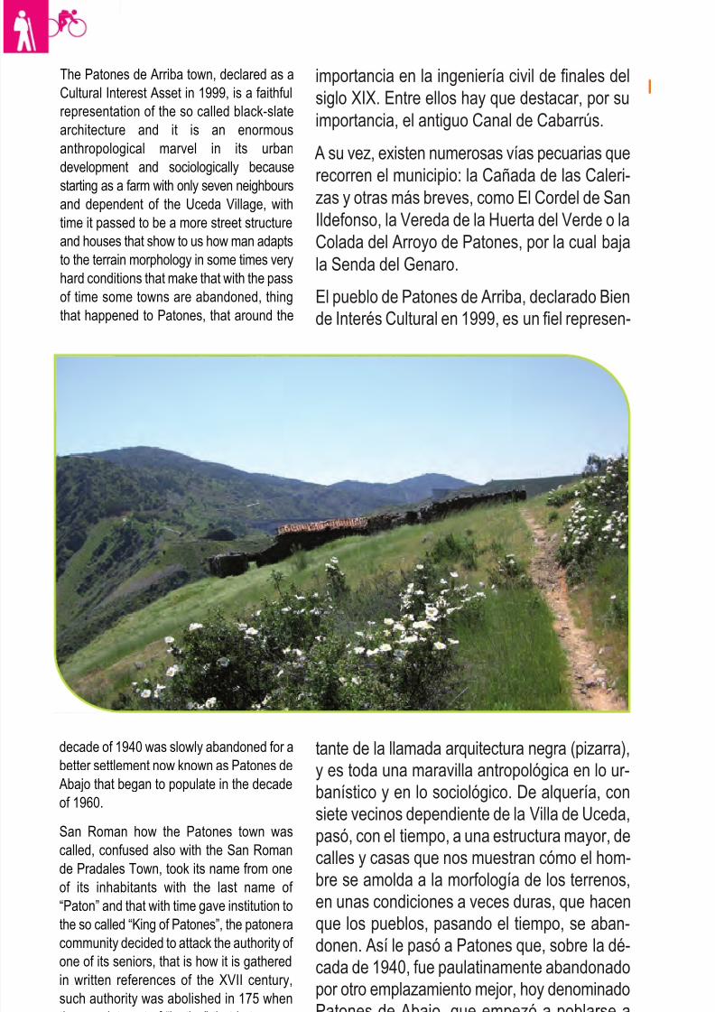
8/3/2019 Libro Senda Del Genaro GR300
http://slidepdf.com/reader/full/libro-senda-del-genaro-gr300 52/156
56 etapa 2
importancia en la ingeniería civil de finales del
siglo XIX. Entre ellos hay que destacar, por su
importancia, el antiguo Canal de Cabarrús.
A su vez, existen numerosas vías pecuarias que
recorren el municipio: la Cañada de las Caleri-zas y otras más breves, como El Cordel de San
Ildefonso, la Vereda de la Huerta del Verde o la
Colada del Arroyo de Patones, por la cual baja
la Senda del Genaro.
El pueblo de Patones de Arriba, declarado Bien
de Interés Cultural en 1999, es un fiel represen-
tante de la llamada arquitectura negra (pizarra),
y es toda una maravilla antropológica en lo ur-
banístico y en lo sociológico. De alquería, con
siete vecinos dependiente de la Villa de Uceda,
pasó, con el tiempo, a una estructura mayor, de
calles y casas que nos muestran cómo el hom-
bre se amolda a la morfología de los terrenos,en unas condiciones a veces duras, que hacen
que los pueblos, pasando el tiempo, se aban-
donen. Así le pasó a Patones que, sobre la dé-
cada de 1940, fue paulatinamente abandonado
por otro emplazamiento mejor, hoy denominado
Patones de Abajo, que empezó a poblarse a
partir de la década de 1960.
The Patones de Arriba town, declared as a
Cultural Interest Asset in 1999, is a faithful
representation of the so called black-slate
architecture and it is an enormous
anthropological marvel in its urban
development and sociologically because
starting as a farm with only seven neighbours
and dependent of the Uceda Village, with
time it passed to be a more street structure
and houses that show to us how man adapts
to the terrain morphology in some times very
hard conditions that make that with the pass
of time some towns are abandoned, thing
that happened to Patones, that around the
decade of 1940 was slowly abandoned for a
better settlement now known as Patones de
Abajo that began to populate in the decade
of 1960.
San Roman how the Patones town was
called, confused also with the San Roman
de Pradales Town, took its name from one
of its inhabitants with the last name of “Paton” and that with time gave institution to
the so called “King of Patones”, the patonera
community decided to attack the authority of
one of its seniors, that is how it is gathered
in written references of the XVII century,
such authority was abolished in 175 when
the appointment of “justice” that is to say a
Mayor was requested.
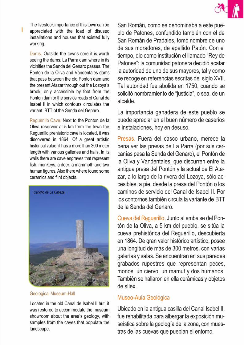
8/3/2019 Libro Senda Del Genaro GR300
http://slidepdf.com/reader/full/libro-senda-del-genaro-gr300 53/156
57Patones de Arriba - El Atazar
San Román, como se denominaba a este pue-
blo de Patones, confundido también con el de
San Román de Pradales, tomó nombre de uno
de sus moradores, de apellido Patón. Con el
tiempo, dio como institución el llamado “Rey de
Patones”: la comunidad patonera decidió acatar
la autoridad de uno de sus mayores, tal y como
se recoge en referencias escritas del siglo XVII.
Tal autoridad fue abolida en 1750, cuando se
solicitó nombramiento de “justicia”, o sea, de un
alcalde.
La importancia ganadera de este pueblo se
puede apreciar en el buen número de caseriose instalaciones, hoy en desuso.
Presas. Fuera del casco urbano, merece la
pena ver las presas de La Parra (por sus cer-
canías pasa la Senda del Genaro), el Pontón de
la Oliva y Vandentales, que discurren entre la
antigua presa del Pontón y la actual de El Ata-
zar, a lo largo de la rivera del Lozoya, sólo ac-
cesibles, a pie, desde la presa del Pontón o los
caminos de servicio del Canal de Isabel II. Por
los contornos también circula la variante de BTT
de la Senda del Genaro.
Cueva del Reguerillo. Junto al embalse del Pon-
tón de la Oliva, a 5 km del pueblo, se sitúa la
cueva prehistórica del Reguerillo, descubierta
en 1864. De gran valor histórico artístico, poseeuna longitud de más de 300 metros, con varias
galerías y salas. Se encuentran en sus paredes
grabados rupestres que representan peces,
monos, un ciervo, un mamut y dos humanos.
También se hallaron en ella cerámicas y objetos
de sílex.
Museo-Aula Geológica
Ubicado en la antigua casilla del Canal Isabel II,
fue rehabilitada para albergar la exposición mu-
seística sobre la geología de la zona, con mues-
tras de las cuevas que pueblan el entorno.
The livestock importance of this town can be
appreciated with the load of disused
installations and houses that existed fully
working.
Dams. Outside the towns core it is worth
seeing the dams. La Parra dam where in itsvicinities the Senda del Genaro passes. The
Ponton de la Oliva and Vandentales dams
that pass between the old Ponton dam and
the present Atazar through out the Lozoya’s
brook, only accessible by foot from the
Ponton dam or the service roads of Canal de
Isabel II in which contours circulates the
variant BTT of the Senda del Genaro.
Reguerillo Cave. Next to the Ponton de laOliva reservoir at 5 km from the town the
Reguerillo prehistoric cave is located, it was
discovered in 1864. Of a great artistic
historical value, it has a more than 300 meter
length with various galleries and halls. In its
walls there are cave engraves that represent
fish, monkeys, a deer, a mammoth and two
human figures. Also there where found some
ceramics and flint objects.
Geological Museum-Hall
Located in the old Canal de Isabel II hut, itwas restored to accommodate the museum
showroom about the area’s geology, with
samples from the caves that populate the
landscape.
Cancho de La Cabeza
8/3/2019 Libro Senda Del Genaro GR300
http://slidepdf.com/reader/full/libro-senda-del-genaro-gr300 54/156
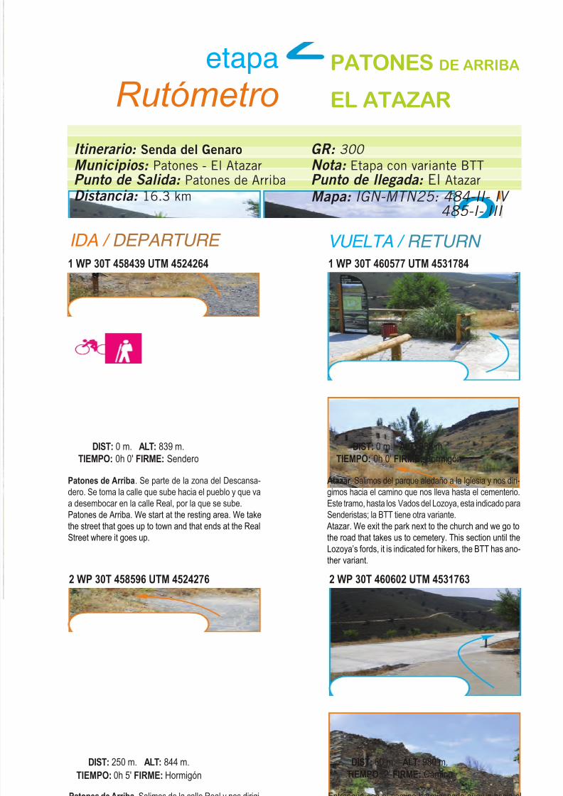
8/3/2019 Libro Senda Del Genaro GR300
http://slidepdf.com/reader/full/libro-senda-del-genaro-gr300 55/156
Itinerario: Senda del Genaro
Municipios: Patones - El AtazarPunto de Salida: Patones de Arriba
Distancia: 16.3 km
GR: 300
Nota: Etapa con variante BTTPunto de llegada: El Atazar
Mapa: IGN-MTN25: 484-II- IV
485-I- III
etapa
Rutómetro
PATONES DE ARRIBA
EL ATAZAR
IDA / DEPARTURE VUELTA / RETURN
1 WP 30T 458439 UTM 4524264
Patones de Arriba. Se parte de la zona del Descansa-
dero. Se toma la calle que sube hacia el pueblo y que va
a desembocar en la calle Real, por la que se sube.
Patones de Arriba. We start at the resting area. We take
the street that goes up to town and that ends at the Real
Street where it goes up.
DIST: 0 m. ALT: 839 m.
TIEMPO: 0h 0' FIRME: Sendero
1 WP 30T 460577 UTM 4531784
Atazar . Salimos del parque aledaño a la Iglesia y nos diri-
gimos hacia el camino que nos lleva hasta el cementerio.
Este tramo, hasta los Vados del Lozoya, esta indicado para
Senderistas; la BTT tiene otra variante.
Atazar. We exit the park next to the church and we go to
the road that takes us to cemetery. This section until the
Lozoya’s fords, it is indicated for hikers, the BTT has ano-
ther variant.
DIST: 0 m. ALT: 988 m.
TIEMPO: 0h 0' FIRME: Hormigón
2 WP 30T 458596 UTM 4524276
Patones de Arriba. Salimos de la calle Real y nos dirigi-
mos a la calle del Chopo, que sube hasta las Eras.
Patones de Arriba. We exit the Real Street and head to
the Chopo Street that goes up to the “Eras”.
DIST: 250 m. ALT: 844 m.
TIEMPO: 0h 5' FIRME: Hormigón
2 WP 30T 460602 UTM 4531763
Entronque con el camino hormigonado que va hacia el
cementerio.
Crossroad with the concrete road that goes to the
cemetery.
DIST: 60 m. ALT: 980 m.
TIEMPO: 2' FIRME: Camino
59Patones de Arriba - El Atazar
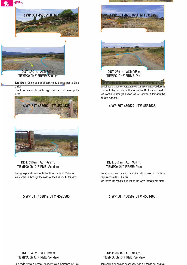
8/3/2019 Libro Senda Del Genaro GR300
http://slidepdf.com/reader/full/libro-senda-del-genaro-gr300 56/156
5 WP 30T 458812 UTM 4525505
La senda trepa al cordal, dando vista al barranco de Pa-
tones, para luego, pasar a la vertiente SE del Cabezo.
The path goes up the hill giving sight to the Patones gully
to then pass the SE del Cabezo slope.
DIST: 1930 m. ALT: 979 m.
TIEMPO: 0h 32' FIRME: Sendero
5 WP 30T 460597 UTM 4531460
Tomando la senda de descenso, hacia el fondo de los pra-
dos, nos dirigimos a la depuradora. Seguiremos por encima
de los barrancos, camino del Embalse de La Parra.
Taking the downhill path to the bottom of the meadows we
go towards the water-treatment plant. We will continue tooverpass the gullies on our way to the La Parra reservoir.
DIST: 490 m. ALT: 940 m.
TIEMPO: 0h 10' FIRME: Sendero
4 WP 30T 458602 UTM 4524435
Se sigue por el camino de las Eras hacia El Cabezo.
We continue through the road of the Eras to El Cabezo.
DIST: 590 m. ALT: 899 m.
TIEMPO: 0h 12' FIRME: Sendero
4 WP 30T 460522 UTM 4531535
Se abandona el camino para virar a la izquierda, hacia la
depuradora de El Atazar.
We leave the road to turn left to the water-treatment plant.
DIST: 350 m. ALT: 954 m.
TIEMPO: 0h 7' FIRME: Pista
Las Eras. Se sigue por el camino que trepa por la Eras
arriba.
The Eras. We continue through the road that goes up the
Eras.
DIST: 350 m. ALT: 859 m.
TIEMPO: 0h 7' FIRME: Sendero
3 WP 30T 460606 UTM 4531595
Por el ramal de la izquierda discurre la variante BTT y si
seguimos de frente avanzaremos por la variante senderista.
Through the branch on the left is the BTT variant and if
we continue straight ahead we will advance through the
hiker’s variant.
DIST: 250 m. ALT: 958 m.
TIEMPO: 0h 5' FIRME: Pista
60 etapa 2
3 WP 30T 458521 UTM 4524278
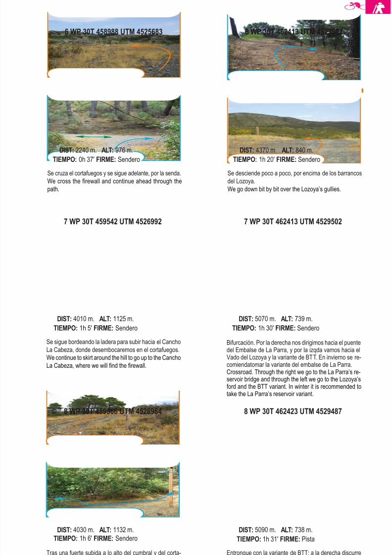
8/3/2019 Libro Senda Del Genaro GR300
http://slidepdf.com/reader/full/libro-senda-del-genaro-gr300 57/156
8 WP 30T 459566 UTM 4526984
Tras una fuerte subida a lo alto del cumbral y del corta-
fuegos, se gira a la izquierda, hacia la cumbre del Cancho
la Cabeza.
After a strong uphill at the summit of the hill and the fire-
wall, we turn left to the Cancho de la Cabeza summit.
DIST: 4030 m. ALT: 1132 m.
TIEMPO: 1h 6' FIRME: Sendero
8 WP 30T 462423 UTM 4529487
Entronque con la variante de BTT; a la derecha discurre
el GR 300 hacia el Vado del río Lozoya.
Connexion with the BTT variant, to the right goes the GR
300 going to the Lozoya’s River ford.
DIST: 5090 m. ALT: 738 m.
TIEMPO: 1h 31' FIRME: Pista
7 WP 30T 459542 UTM 4526992
Se sigue bordeando la ladera para subir hacia el Cancho
La Cabeza, donde desembocaremos en el cortafuegos.
We continue to skirt around the hill to go up to the Cancho
La Cabeza, where we will find the firewall.
DIST: 4010 m. ALT: 1125 m.
TIEMPO: 1h 5' FIRME: Sendero
7 WP 30T 462413 UTM 4529502
Bifurcación. Por la derecha nos dirigimos hacia el puentedel Embalse de La Parra, y por la izqda vamos hacia elVado del Lozoya y la variante de BTT. En invierno se re-comiendatomar la variante del embalse de La Parra.Crossroad. Through the right we go to the La Parra’s re-servoir bridge and through the left we go to the Lozoya’s
ford and the BTT variant. In winter it is recommended totake the La Parra’s reservoir variant.
DIST: 5070 m. ALT: 739 m.
TIEMPO: 1h 30' FIRME: Sendero
6 WP 30T 458988 UTM 4525683
Se cruza el cortafuegos y se sigue adelante, por la senda.
We cross the firewall and continue ahead through the
path.
DIST: 2240 m. ALT: 976 m.
TIEMPO: 0h 37' FIRME: Sendero
Se desciende poco a poco, por encima de los barrancos
del Lozoya.
We go down bit by bit over the Lozoya’s gullies.
DIST: 4370 m. ALT: 840 m.
TIEMPO: 1h 20' FIRME: Sendero
61Patones de Arriba - El Atazar
6 WP 30T 462413 UTM 4529502
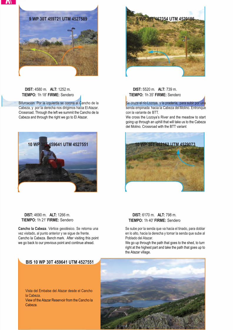
8/3/2019 Libro Senda Del Genaro GR300
http://slidepdf.com/reader/full/libro-senda-del-genaro-gr300 58/156
10 WP 30T 459641 UTM 4527551
Cancho la Cabeza. Vértice geodésico. Se retorna una
vez visitado, al punto anterior y se sigue de frente.
Cancho la Cabeza. Bench mark. After visiting this point
we go back to our previous point and continue ahead.
DIST: 4690 m. ALT: 1266 m.
TIEMPO: 1h 21' FIRME: Sendero
10 WP 30T 462162 UTM 4529073
Se sube por la senda que va hacia el tinado, para doblar
en lo alto, hacia la derecha y tomar la senda que sube al
Poblado del Atazar.
We go up through the path that goes to the shed, to turn
right at the highest part and take the path that goes up to
the Atazar village.
DIST: 6170 m. ALT: 798 m.
TIEMPO: 1h 40' FIRME: Sendero
Bifurcación. Por la izquierda se corona el Cancho de la
Cabeza, y por la derecha nos dirigimos hacia El Atazar.
Crossroad. Through the left we summit the Cancho de la
Cabeza and through the right we go to El Atazar.
DIST: 4580 m. ALT: 1252 m.
TIEMPO: 1h 18' FIRME: Sendero
9 WP 30T 462354 UTM 4529186
Se cruza el río Lozoya, y la pradería, para subir por una
senda empinada hacia la Cabeza del Molino. Entronque
con la variante de BTT.
We cross the Lozoya’s River and the meadow to start
going up through an uphill that will take us to the Cabeza
del Molino. Crossroad with the BTT variant.
DIST: 5520 m. ALT: 739 m.
TIEMPO: 1h 35' FIRME: Sendero
62 etapa 2
9 WP 30T 459721 UTM 4527589
BIS 10 WP 30T 459641 UTM 4527551
Vista del Embalse del Atazar desde el Cancho
la Cabeza.
View of the Atazar Reservoir from the Cancho la
Cabeza.
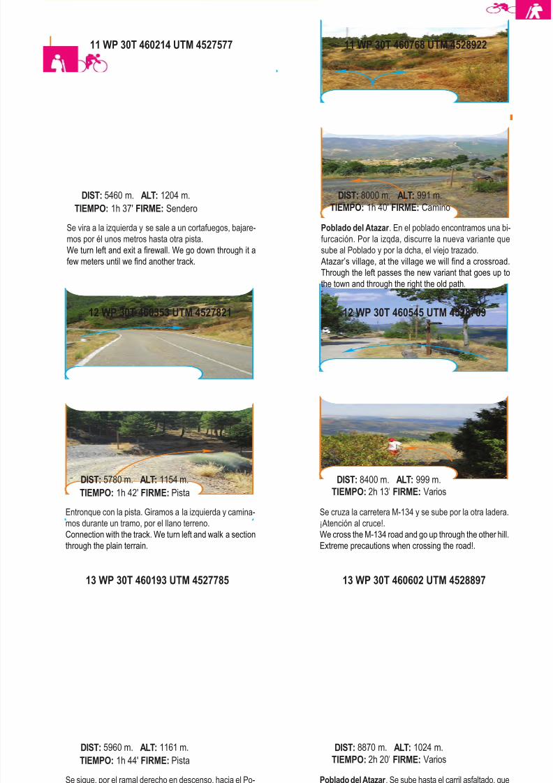
8/3/2019 Libro Senda Del Genaro GR300
http://slidepdf.com/reader/full/libro-senda-del-genaro-gr300 59/156
13 WP 30T 460193 UTM 4527785
Se sigue, por el ramal derecho en descenso, hacia el Po-
blado del Atazar.
We continue through the right branch in a descent to the
Atazar village.
DIST: 5960 m. ALT: 1161 m.
TIEMPO: 1h 44' FIRME: Pista
13 WP 30T 460602 UTM 4528897
Poblado del Atazar . Se sube hasta el carril asfaltado, que
va hacia el poblado y se sigue hacia el Cancho la Cabeza.
Atazar’s Village, we go up to the paved road that goes to
the village and continue to the Cancho la Cabeza.
DIST: 8870 m. ALT: 1024 m.
TIEMPO: 2h 20' FIRME: Varios
12 WP 30T 460353 UTM 4527821
Entronque con la pista. Giramos a la izquierda y camina-
mos durante un tramo, por el llano terreno.
Connection with the track. We turn left and walk a section
through the plain terrain.
DIST: 5780 m. ALT: 1154 m.
TIEMPO: 1h 42' FIRME: Pista
12 WP 30T 460545 UTM 4528709
Se cruza la carretera M-134 y se sube por la otra ladera.
¡Atención al cruce!.
We cross the M-134 road and go up through the other hill.
Extreme precautions when crossing the road!.
DIST: 8400 m. ALT: 999 m.
TIEMPO: 2h 13' FIRME: Varios
11 WP 30T 460214 UTM 4527577
Se vira a la izquierda y se sale a un cortafuegos, bajare-
mos por él unos metros hasta otra pista.
We turn left and exit a firewall. We go down through it a
few meters until we find another track.
DIST: 5460 m. ALT: 1204 m.
TIEMPO: 1h 37' FIRME: Sendero
Poblado del Atazar . En el poblado encontramos una bi-
furcación. Por la izqda, discurre la nueva variante que
sube al Poblado y por la dcha, el viejo trazado.
Atazar’s village, at the village we will find a crossroad.
Through the left passes the new variant that goes up tothe town and through the right the old path.
DIST: 8000 m. ALT: 991 m.
TIEMPO: 1h 40' FIRME: Camino
63Patones de Arriba - El Atazar
11 WP 30T 460768 UTM 4528922
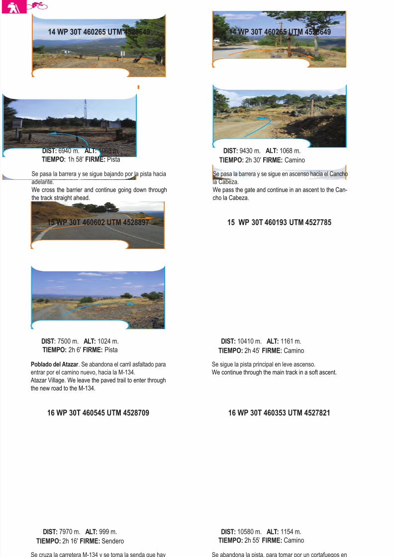
8/3/2019 Libro Senda Del Genaro GR300
http://slidepdf.com/reader/full/libro-senda-del-genaro-gr300 60/156
16 WP 30T 460545 UTM 4528709
Se cruza la carretera M-134 y se toma la senda que hay
por el otro costado. ¡Atención al cruce!.
We cross the M-134 and take the path that is on the other
side. Extreme precautions when crossing the road!.
DIST: 7970 m. ALT: 999 m.
TIEMPO: 2h 16' FIRME: Sendero
16 WP 30T 460353 UTM 4527821
Se abandona la pista, para tomar por un cortafuegos en
ascenso.
We leave the track to take a firewall in an uphill.
DIST: 10580 m. ALT: 1154 m.
TIEMPO: 2h 55' FIRME: Camino
15 WP 30T 460602 UTM 4528897
Poblado del Atazar . Se abandona el carril asfaltado para
entrar por el camino nuevo, hacia la M-134.
Atazar Village. We leave the paved trail to enter through
the new road to the M-134.
DIST: 7500 m. ALT: 1024 m.
TIEMPO: 2h 6' FIRME: Pista
15 WP 30T 460193 UTM 4527785
Se sigue la pista principal en leve ascenso.
We continue through the main track in a soft ascent.
DIST: 10410 m. ALT: 1161 m.
TIEMPO: 2h 45' FIRME: Camino
Se pasa la barrera y se sigue bajando por la pista hacia
adelante.
We cross the barrier and continue going down through
the track straight ahead.
DIST: 6940 m. ALT: 1068 m.
TIEMPO: 1h 58' FIRME: Pista
14 WP 30T 460265 UTM 4528649
Se pasa la barrera y se sigue en ascenso hacia el Cancho
la Cabeza.
We pass the gate and continue in an ascent to the Can-
cho la Cabeza.
DIST: 9430 m. ALT: 1068 m.
TIEMPO: 2h 30' FIRME: Camino
64 etapa 2
14 WP 30T 460265 UTM 4528649
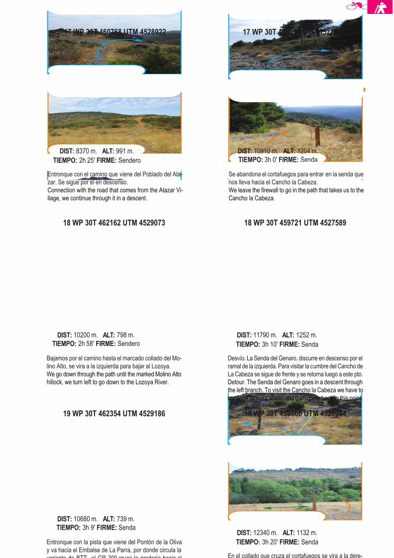
8/3/2019 Libro Senda Del Genaro GR300
http://slidepdf.com/reader/full/libro-senda-del-genaro-gr300 61/156
19 WP 30T 462354 UTM 4529186
Entronque con la pista que viene del Pontón de la Oliva
y va hacia el Embalse de La Parra, por donde circula la
variante de BTT; el GR 300 cruza la pradería hacia el
vado del río Lozoya.
Connection with the track that comes from Ponton de la
Oliva and goes to the La Parra reservoir, where the BTT
variant circulates; the GR 300 crosses the prairie to the
Lozoya’s river ford.
DIST: 10680 m. ALT: 739 m.
TIEMPO: 3h 9' FIRME: Senda
19 WP 30T 459566 UTM 4526984
En el collado que cruza el cortafuegos se vira a la dere-
cha iniciandose así un fuerte descenso.
At the hill where the firewall crosses we turn right begin-
ning a strong downhill.
DIST: 12340 m. ALT: 1132 m.
TIEMPO: 3h 20' FIRME: Senda
18 WP 30T 462162 UTM 4529073
Bajamos por el camino hasta el marcado collado del Mo-
lino Alto, se vira a la izquierda para bajar al Lozoya.
We go down through the path until the marked Molino Alto
hillock, we turn left to go down to the Lozoya River.
DIST: 10200 m. ALT: 798 m.
TIEMPO: 2h 58' FIRME: Sendero
18 WP 30T 459721 UTM 4527589
Desvío. La Senda del Genaro, discurre en descenso por el
ramal de la izquierda. Para visitar la cumbre del Cancho de
La Cabeza se sigue de frente y se retorna luego a este pto.
Detour. The Senda del Genaro goes in a descent through
the left branch. To visit the Cancho la Cabeza we have tocontinue straight ahead and then come back to this point.
DIST: 11790 m. ALT: 1252 m.
TIEMPO: 3h 10' FIRME: Senda
17 WP 30T 460768 UTM 4528922
Entronque con el camino que viene del Poblado del Ata-
zar. Se sigue por él en descenso.
Connection with the road that comes from the Atazar Vi-
llage, we continue through it in a descent.
DIST: 8370 m. ALT: 991 m.
TIEMPO: 2h 25' FIRME: Sendero
Se abandona el cortafuegos para entrar en la senda que
nos lleva hacia el Cancho la Cabeza.
We leave the firewall to go in the path that takes us to the
Cancho la Cabeza.
DIST: 10910 m. ALT: 1204 m.
TIEMPO: 3h 0' FIRME: Senda
65Patones de Arriba - El Atazar
17 WP 30T 460214 UTM 4527577
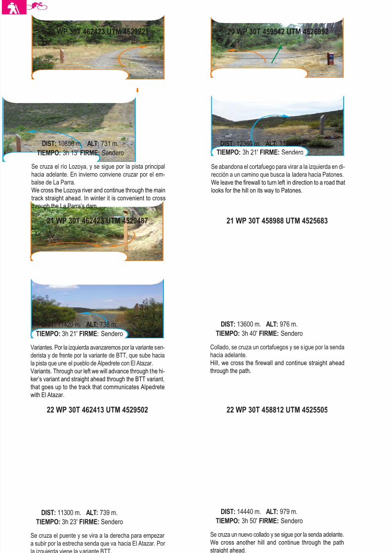
8/3/2019 Libro Senda Del Genaro GR300
http://slidepdf.com/reader/full/libro-senda-del-genaro-gr300 62/156
22 WP 30T 462413 UTM 4529502
Se cruza el puente y se vira a la derecha para empezar
a subir por la estrecha senda que va hacia El Atazar. Por
la izquierda viene la variante BTT.
We cross the bridge and turn right to start going up
through the narrow path that goes to El Atazar. To our left
is the BTT variant.
DIST: 11300 m. ALT: 739 m.
TIEMPO: 3h 23' FIRME: Sendero
22 WP 30T 458812 UTM 4525505
Se cruza un nuevo collado y se sigue por la senda adelante.
We cross another hill and continue through the path
straight ahead.
DIST: 14440 m. ALT: 979 m.
TIEMPO: 3h 50' FIRME: Sendero
21 WP 30T 462423 UTM 4529487
Variantes. Por la izquierda avanzaremos por la variante sen-
derista y de frente por la variante de BTT, que sube hacia
la pista que une el pueblo de Alpedrete con El Atazar.
Variants. Through our left we will advance through the hi-
ker’s variant and straight ahead through the BTT variant,
that goes up to the track that communicates Alpedretewith El Atazar.
DIST: 11420 m. ALT: 738 m.
TIEMPO: 3h 21' FIRME: Sendero
21 WP 30T 458988 UTM 4525683
Collado, se cruza un cortafuegos y se sigue por la senda
hacia adelante.
Hill, we cross the firewall and continue straight ahead
through the path.
DIST: 13600 m. ALT: 976 m.
TIEMPO: 3h 40' FIRME: Sendero
Se cruza el río Lozoya, y se sigue por la pista principal
hacia adelante. En invierno conviene cruzar por el em-
balse de La Parra.
We cross the Lozoya river and continue through the maintrack straight ahead. In winter it is convenient to cross
through the La Parra’s dam.
DIST: 10850 m. ALT: 731 m.
TIEMPO: 3h 13' FIRME: Sendero
20 WP 30T 459542 UTM 4526992
Se abandona el cortafuego para virar a la izquierda en di-
rección a un camino que busca la ladera hacia Patones.
We leave the firewall to turn left in direction to a road that
looks for the hill on its way to Patones.
DIST: 12360 m. ALT: 1125 m.
TIEMPO: 3h 21' FIRME: Sendero
66 etapa 2
20 WP 30T 462423 UTM 4529221
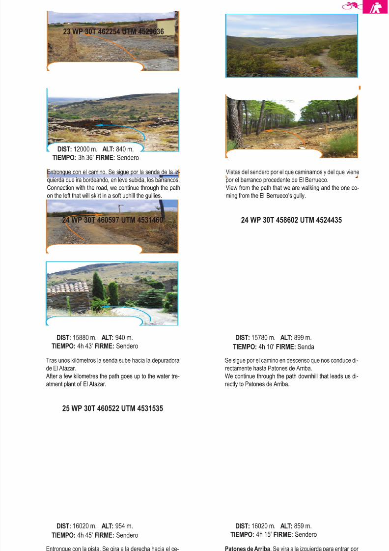
8/3/2019 Libro Senda Del Genaro GR300
http://slidepdf.com/reader/full/libro-senda-del-genaro-gr300 63/156
25 WP 30T 460522 UTM 4531535
Entronque con la pista. Se gira a la derecha hacia el ce-
menterio de El Atazar.
Connexion with the track, we turn right to the El Atazar
cemetery.
DIST: 16020 m. ALT: 954 m.
TIEMPO: 4h 45' FIRME: Sendero
Patones de Arriba. Se vira a la izquierda para entrar por
la calle del Chopo hacia la Calle Real.
Patones de Arriba. We turn left to go in through the Chopo
Street to the Real Street.
DIST: 16020 m. ALT: 859 m.
TIEMPO: 4h 15' FIRME: Sendero
24 WP 30T 460597 UTM 4531460
Tras unos kilómetros la senda sube hacia la depuradora
de El Atazar.
After a few kilometres the path goes up to the water tre-
atment plant of El Atazar.
DIST: 15880 m. ALT: 940 m.
TIEMPO: 4h 43' FIRME: Sendero
24 WP 30T 458602 UTM 4524435
Se sigue por el camino en descenso que nos conduce di-
rectamente hasta Patones de Arriba.
We continue through the path downhill that leads us di-
rectly to Patones de Arriba.
DIST: 15780 m. ALT: 899 m.
TIEMPO: 4h 10' FIRME: Senda
23 WP 30T 462254 UTM 4529636
Entronque con el camino. Se sigue por la senda de la iz-
quierda que ira bordeando, en leve subida, los barrancos.
Connection with the road, we continue through the path
on the left that will skirt in a soft uphill the gullies.
DIST: 12000 m. ALT: 840 m.
TIEMPO: 3h 36' FIRME: Sendero
Vistas del sendero por el que caminamos y del que viene
por el barranco procedente de El Berrueco.
View from the path that we are walking and the one co-
ming from the El Berrueco’s gully.
67Patones de Arriba - El Atazar
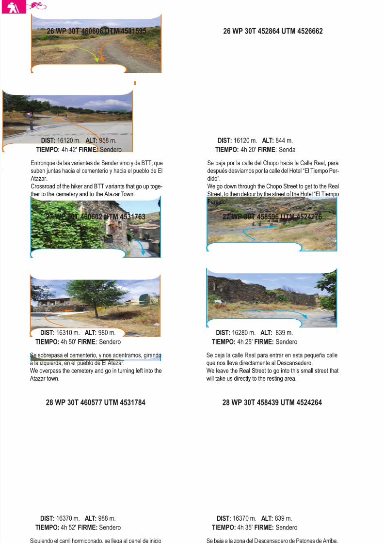
8/3/2019 Libro Senda Del Genaro GR300
http://slidepdf.com/reader/full/libro-senda-del-genaro-gr300 64/156
28 WP 30T 460577 UTM 4531784
Siguiendo el carril hormigonado, se llega al panel de inicio
de la Senda del Genaro. Fin de etapa.
Following the concrete trail we get to the start panel of
the Senda del Genaro. End of the stage.
DIST: 16370 m. ALT: 988 m.
TIEMPO: 4h 52' FIRME: Sendero
28 WP 30T 458439 UTM 4524264
Se baja a la zona del Descansadero de Patones de Arriba.
Fin de etapa.
We go down to the Patones de Arriba resting area. End
of the Stage.
DIST: 16370 m. ALT: 839 m.
TIEMPO: 4h 35' FIRME: Sendero
27 WP 30T 460602 UTM 4531763
Se sobrepasa el cementerio, y nos adentramos, girando
a la izquierda, en el pueblo de El Atazar.
We overpass the cemetery and go in turning left into the
Atazar town.
DIST: 16310 m. ALT: 980 m.
TIEMPO: 4h 50' FIRME: Sendero
27 WP 30T 458596 UTM 4524276
Se deja la calle Real para entrar en esta pequeña calle
que nos lleva directamente al Descansadero.
We leave the Real Street to go into this small street that
will take us directly to the resting area.
DIST: 16280 m. ALT: 839 m.
TIEMPO: 4h 25' FIRME: Sendero
Entronque de las variantes de Senderismo y de BTT, que
suben juntas hacia el cementerio y hacia el pueblo de El
Atazar.
Crossroad of the hiker and BTT variants that go up toge-
ther to the cemetery and to the Atazar Town.
DIST: 16120 m. ALT: 958 m.
TIEMPO: 4h 42' FIRME: Sendero
26 WP 30T 452864 UTM 4526662
Se baja por la calle del Chopo hacia la Calle Real, para
después desviarnos por la calle del Hotel “El Tiempo Per-
dido”.
We go down through the Chopo Street to get to the Real
Street, to then detour by the street of the Hotel “El Tiempo
Perdido”
DIST: 16120 m. ALT: 844 m.
TIEMPO: 4h 20' FIRME: Senda
68 etapa 2
26 WP 30T 460606 UTM 4531595

8/3/2019 Libro Senda Del Genaro GR300
http://slidepdf.com/reader/full/libro-senda-del-genaro-gr300 65/156
etapa 3EL ATAZAR
ROBLEDILLO DE LA JARA
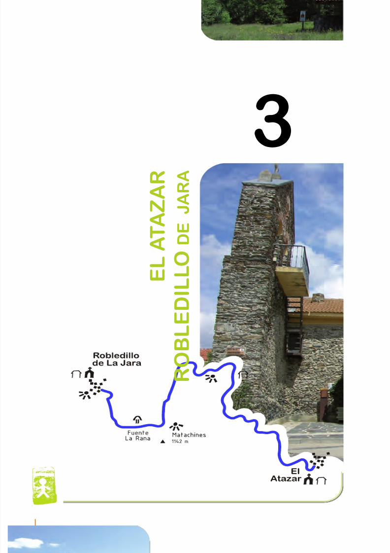
8/3/2019 Libro Senda Del Genaro GR300
http://slidepdf.com/reader/full/libro-senda-del-genaro-gr300 66/156
3
E L A T A Z A
R
R O B L E D I L L O D
E
J A R A
72 etapa 3
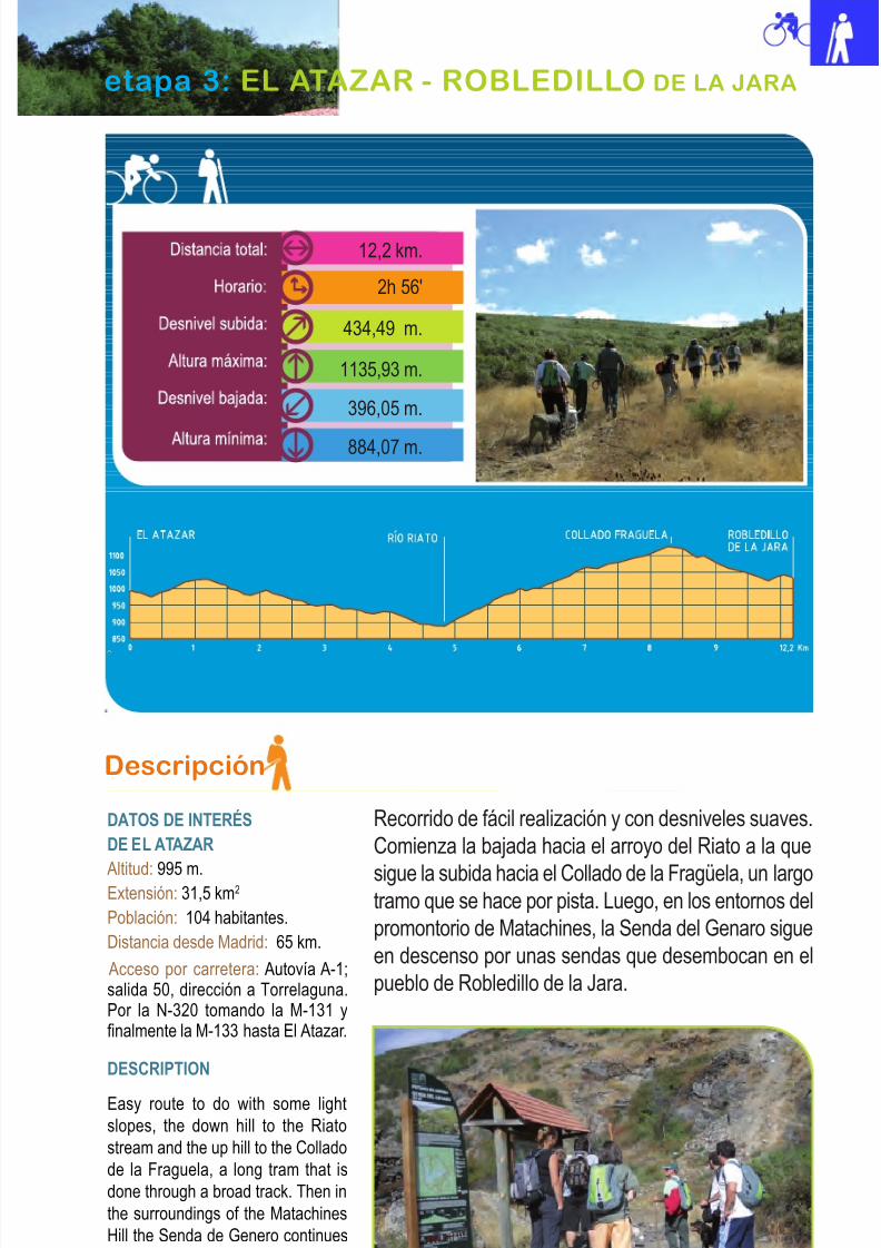
8/3/2019 Libro Senda Del Genaro GR300
http://slidepdf.com/reader/full/libro-senda-del-genaro-gr300 67/156
8/3/2019 Libro Senda Del Genaro GR300
http://slidepdf.com/reader/full/libro-senda-del-genaro-gr300 68/156
The most interesting views are given by the
own Atazar town, the down hill to the Riato
Stream, the Matachines Area and Robledillo
de la Jara.
The start panel of the stage that we are
going to begin is in a yard with views to thevalley where two beautiful routes begin, one
that goes to Alpedrete and one that goes to
Puebla de la Sierra. So, we are going to
discard both of these proposals and head to
the Atazar’s parish church.
Even thought the GR was marked by the
Avenida de la Presa, in reality the most
pedagogical way to go is to go to the church’sarea to the right to climb to the Eras, because
there in the succession of the wheat Eras
steps we find a series of panels that inform
about the uses and customs of the area. If we
go down through this street we will meet at the
lower part with the GR 300 Senda del Genaro,
that comes through the before mentioned
“Avenida de la Presa”, and at that point the
track or road that goes to the Riato begins
(WP3; 620 mts)
Las vistas más interesantes nos las aporta
el propio pueblo del Atazar, la bajada hacia
el arroyo del Riato, la zona de Matachines y
Robledillo de la Jara.
El Panel de Inicio de la etapa que comenzamosestá en un jardín con vista al valle, donde co-
mienzan dos bellas rutas: la que va a Alpedrete
y la que se dirige hacia Puebla de la Sierra.
Damos pues, la espalda a dichas propuestas y
enfilamos hacia la Iglesia parroquial del Atazar.
Aunque el GR discurre por la Avenida de la
Presa, en realidad, lo más pedagógico es con-
tinuar, en la zona de la iglesia, hacia la derecha,
para subir a las Eras. Allí, en la sucesión de
escalonamientos de eras para el trigo, encon-
tramos una serie de paneles que nos informan
de los usos y costumbres de la zona. Si baja-
mos por esta calle daremos, en la parte inferior,
con el GR 300, Senda del Genaro, que viene
por la citada Avenida de la Presa. En ese mismo
punto comienza la pista o camino que va al
Riato (WP3; 620 mts).
74 etapa 3
Descansadero del Riato
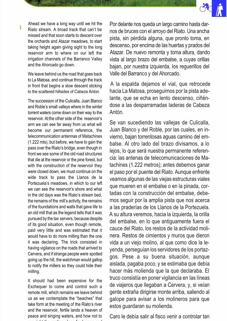
8/3/2019 Libro Senda Del Genaro GR300
http://slidepdf.com/reader/full/libro-senda-del-genaro-gr300 69/156
Por delante nos queda un largo camino hasta dar-
nos de bruces con el arroyo del Riato. Una ancha
pista, sin pérdida alguna, que pronto toma, en
descenso, por encima de las huertas y prados del
Atazar. De nuevo remonta y toma altura, dando
vista al largo brazo del embalse, a cuyas orillas
bajan, por nuestra izquierda, los reguerillos del
Valle del Barranco y del Ahorcado.
A la espalda dejamos el vial, que retrocede
hacia La Matosa, proseguimos por la pista ade-
lante, que se echa en lento descenso, ciñén-
dose a las desparramadas laderas de Cabeza
Antón.
Se van sucediendo las vallejas de Culicalla,
Juan Blanco y del Roble, por las cuales, en in-
vierno, bajan torrentosas aguas camino del em-
balse. Al otro lado del brazo divisamos, a lo
lejos, lo que será nuestra permanente referen-
cia: las antenas de telecomunicaciones de Ma-
tachines (1.222 metros); antes debemos ganar
el paso por el puente del Riato. Aunque enfrente
veamos algunas de las viejas estructuras viales
que mueren en el embalse o en la pinada, cor-
tadas con la construcción del embalse, debe-
mos seguir por la amplia pista que nos acerca
a las praderías de los Llanos de la Portezuela.
A su altura veremos, hacia la izquierda, la orilla
del embalse, en lo que antiguamente fuera el
cauce del Riato, los restos de la actividad moli-
nera. Restos de cimientos y muros que dieron
vida a un viejo molino, al que como dice la le-
yenda, perseguían los servidores de los portaz-
gos. Pese a su buena situación, aunque
aislada, pagaba poco, y se estimaba que debía
hacer más molienda que la que declaraba. El
truco consistía en poner vigilancia en las líneas
de viajeros que llegaban a Cervera, y, si veían
gente extraña dirigirse monte arriba, saliendo al
galope para avisar a los molineros para que
estos guardaran su molienda.
Caro le debía salir al fisco venir a controlar tan
aislado molino, cuyos restos dejamos atrás a la
75 Atazar - Robledillo de La Jara
Ahead we have a long way until we hit the
Riato stream. A broad track that can’t be
missed and that soon starts to descent over
the orchards and Atazar meadows, to start
taking height again giving sight to the long
reservoir arm to where on our left the
irrigation channels of the Barranco Valley
and the Ahorcado go down.
We leave behind us the road that goes back
to La Matosa, and continue through the track
in front that begins a slow descent sticking
to the scattered hillsides of Cabeza Anton.
The succession of the Culicalla, Juan Blanco
and Roble’s small valleys where in the winter
torrent waters come down on their way to thereservoir. At the other side of the reservoir’s
arm we can see far away from us what will
become our permanent reference, the
telecommunication antennas of Matachines
(1.222 mts), but before, we have to gain the
pass over the Riato’s bridge, even though in
front we see some of the old road structures
that die at the reservoir or the pine forest, but
with the construction of the reservoir they
were closed down, we must continue on the
wide track to pass the Llanos de la
Portezuela’s meadows, in which to our left
we can see the reservoir’s shore and what
in the old days was the Riato’s stream bed,
the remains of the mill’s activity, the remains
of the foundations and walls that gave life to
an old mill that as the legend tells that it was
pursued by the tax servers, because despite
of its good situation, even though remote,paid very little and was estimated that it
would have to do more milling than the one
it was declaring. The trick consisted in
having vigilance on the roads that arrived to
Cervera, and if strange people were spotted
going up the hill, the watchman would gallop
to notify the millers so they could hide their
milling.
It should had been expensive for theExchequer to come and control such a
remote mill, which remains we leave behind
us as we contemplate the “beaches” that
take form at the meeting of the Riato’s river
and the reservoir, fertile lands a heaven of
peace and singing waters, and how not to
our right the resting place for horses and
hikers.
8/3/2019 Libro Senda Del Genaro GR300
http://slidepdf.com/reader/full/libro-senda-del-genaro-gr300 70/156
par que vamos contemplando las “playas” que
se forman en la zona de encuentro del rio Riato
y el embalse. Fértiles praderías remansadas de
placidez y cantarinas aguas, y, como no, a
nuestra derecha, el Descansadero para caba-
llos y senderistas.
Cruzamos el citado río por el puente (WP4;
5,6 km) y acontecen varios cambios: uno, que
dejamos de ver el Embalse por un trecho; dos,
que nos metemos en el denso pinar de repobla-
ción; y tres, que comienza un continuado as-
censo hasta el collado Fragüela.
El camino, aunque sigue en ascenso por la misma
dirección que traíamos, pronto vira en dirección
Sur. Tomando ese rumbo, un tanto al revés de
cómo veníamos, ahora veremos, por entre los
pinos, tramos de la pista que traíamos. El Cancho
la Cabeza o la Escrita, se presentan como refe-
rencia, al fondo de nuestro horizonte y, a la iz-
quierda, la mole de Cabeza Antón, que preside
toda la zona con sus 1.366 metros de altitud.
Se sigue pista arriba para ganar altura a base derevueltas. Poco a poco vamos alcanzando por en-cima de los barrancos de Pajar, Vallejo de TierraCardena. El punto final a esta larga subida queconcluye, con otra última revuelta, dirección Norte.Un poco más allá damos vista al Collado de Fra-
güela ( WP5; 9,3 km). Hasta este punto venían juntas las dos actividades primordiales de laSenda del Genaro: la senderista y la BTT. A partir de este momento nacerán dos variantes. La BTTtomará por la carretera adelante, dirección a Ro-bledillo de la Jara y los senderistas, doblarán enel Collado Fragüela, a la izquierda, para tomar elcarril asfaltado que se dirige a la antena de Co-municaciones de Matachines. Ahora circulamospor la cumbral del cordal. A la derecha, toda lallanura que lleva a Robledillo, Cervera y demástierras norteñas; y a la izquierda, la pinada, elpueblo del Atazar, al abrigo de Cabeza Antón; yel Poblado del Atazar. En el roquedo que pre-side, en los recodos del Lozoya, el discurrir dela Presa del Atazar.
76 etapa 3
We cross the river through the bridge ( WP4;
5.6 km) and a few things happen, one that
we can’t see the reservoir for a stretch,
second that we go in the dense reforestation
pine forest and third that a continued ascent
to the Fraguela pass.
The road even though it takes ascent in the
same direction we were following, soon will
turn to the South, taking this direction, a bit
backwards to where we came, now we will
see in between the pines stretches of the
track we were following and the Cancho la
Cabeza or the Escrita, as reference in the
background of our horizon, to our left the
Cabeza Anton’s mass that prevails over the
area with its 1.366 mts .
We continue the track up that gains altitude
at the turns and gradually we gain over the
Pajar and Vallejo de Tierra Cardena’s
ravines, the end point to this long climb
where another turn puts us again in direction
to the North, a little further we see the
Fraguela pass (WP5; 9,3 km). Until this point
the two main activities of the Senda del
Genaro came together, the hiking and the
BTT, from this moment on there will be two
variables, the BTT will go to the road ahead
in direction to Robledillo de la Jara.
The hikers will go around the Fraguela pass
to the left to take the paved road that goes
to the Matachines’ Communication antenna,
now we circulate on the summit, to the right
side all the prairie to Robledillo and Cervera
and other north lands, to the right the pine
forest and the Atazar town under the shelter
of the Cabeza Anton and the Atazar
settlement at the wind-cut stones that
preside the Lozoya’s bends and the Atazar
Dam.
We leave behind the fire control watch tower
and start a small ascent leaven on the left
the Horcajuelos track. Befor we arrive to the
antenna we will see on our left a line of
electric posts that goes down to the valley.
That is the reference that has to be taken in
account and which is also marked at the
entrance between the rockrose and the
wood gate that shows us where the track
goes. (WP7; 10 km)
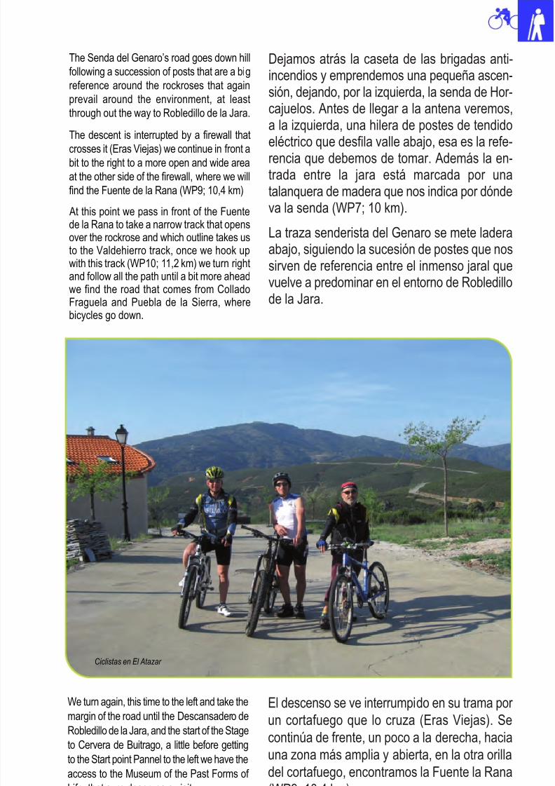
8/3/2019 Libro Senda Del Genaro GR300
http://slidepdf.com/reader/full/libro-senda-del-genaro-gr300 71/156
77 Atazar - Robledillo de La Jara
Dejamos atrás la caseta de las brigadas anti-incendios y emprendemos una pequeña ascen-sión, dejando, por la izquierda, la senda de Hor-cajuelos. Antes de llegar a la antena veremos,a la izquierda, una hilera de postes de tendido
eléctrico que desfila valle abajo, esa es la refe-rencia que debemos de tomar. Además la en-trada entre la jara está marcada por unatalanquera de madera que nos indica por dóndeva la senda (WP7; 10 km).
La traza senderista del Genaro se mete laderaabajo, siguiendo la sucesión de postes que nossirven de referencia entre el inmenso jaral quevuelve a predominar en el entorno de Robledillode la Jara.
El descenso se ve interrumpido en su trama por
un cortafuego que lo cruza (Eras Viejas). Se
continúa de frente, un poco a la derecha, hacia
una zona más amplia y abierta, en la otra orilla
del cortafuego, encontramos la Fuente la Rana
(WP9; 10,4 km).
The Senda del Genaro’s road goes down hill
following a succession of posts that are a big
reference around the rockroses that again
prevail around the environment, at least
through out the way to Robledillo de la Jara.
The descent is interrupted by a firewall thatcrosses it (Eras Viejas) we continue in front a
bit to the right to a more open and wide area
at the other side of the firewall, where we will
find the Fuente de la Rana (WP9; 10,4 km)
At this point we pass in front of the Fuentede la Rana to take a narrow track that opensover the rockrose and which outline takes usto the Valdehierro track, once we hook upwith this track (WP10; 11,2 km) we turn right
and follow all the path until a bit more aheadwe find the road that comes from ColladoFraguela and Puebla de la Sierra, wherebicycles go down.
We turn again, this time to the left and take the
margin of the road until the Descansadero de
Robledillo de la Jara, and the start of the Stage
to Cervera de Buitrago, a little before getting
to the Start point Pannel to the left we have the
access to the Museum of the Past Forms of
Life, that sure deserves a visit.
Ciclistas en El Atazar
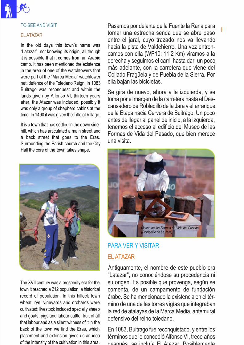
8/3/2019 Libro Senda Del Genaro GR300
http://slidepdf.com/reader/full/libro-senda-del-genaro-gr300 72/156
The XVII century was a prosperity era for the
town it reached a 212 population, a historical
record of population. In this hillock town
wheat, rye, vineyards and orchards werecultivated; livestock included specially sheep
and goats, pigs and labour cattle, fruit of all
that labour and as a silent witness of it in the
back of the town we find the Eras, which
placement and extension gives us an idea
of the intensity of the cultivation in this area.
78 etapa 3
Pasamos por delante de la Fuente la Rana paratomar una estrecha senda que se abre pasoentre el jaral, cuyo trazado nos va llevandohacia la pista de Valdehierro. Una vez entron-camos con ella (WP10; 11,2 Km) viramos a la
derecha y seguimos el carril hasta dar, un pocomás adelante, con la carretera que viene delCollado Fragüela y de Puebla de la Sierra. Por ella bajan las bicicletas.
Se gira de nuevo, ahora a la izquierda, y setoma por el margen de la carretera hasta el Des-cansadero de Robledillo de la Jara y el arranquede la Etapa hacia Cervera de Buitrago. Un poco
antes de llegar al panel de inicio, a la izquierda,tenemos el acceso al edificio del Museo de lasFormas de Vida del Pasado, que bien mereceuna visita.
TO SEE AND VISIT
EL ATAZAR
In the old days this town’s name was
“Latazar”, not knowing its origin, all though
it is possible that it comes from an Arabiccamp. It has been mentioned the existence
in the area of one of the watchtowers that
were part of the “Marca Media” watchtower
net, defence of the Toledano Reign. In 1083
Buitrago was reconquest and within the
lands given by Alfonso VI, thirteen years
after, the Atazar was included, possibly it
was only a group of shepherd cabins at the
time. In 1490 it was given the Title of Village.
It is a town that has settled in the down side-
hill, which has articulated a main street and
a back street that goes to the Eras.
Surrounding the Parish church and the City
Hall the core of the town takes shape.
PARA VER Y VISITAR
EL ATAZAR
Antiguamente, el nombre de este pueblo era"Latazar", no conociéndose su procedencia nisu origen. Es posible que provenga, según secomenta, de un campamento de fundaciónárabe. Se ha mencionado la existencia en el tér-
mino de una de las torres vigías que integrabanla red de atalayas de la Marca Media, antemuraldefensivo del reino toledano.
En 1083, Buitrago fue reconquistado, y entre lostérminos que le concedió Alfonso VI, trece añosdespués, se incluía El Atazar. Posiblementesólo era una agrupación de cabañas de pasto-res. En 1490 recibió el título de Villazgo.
Museo de las Formas de Vida del Pasado(Robledillo de La Jara)
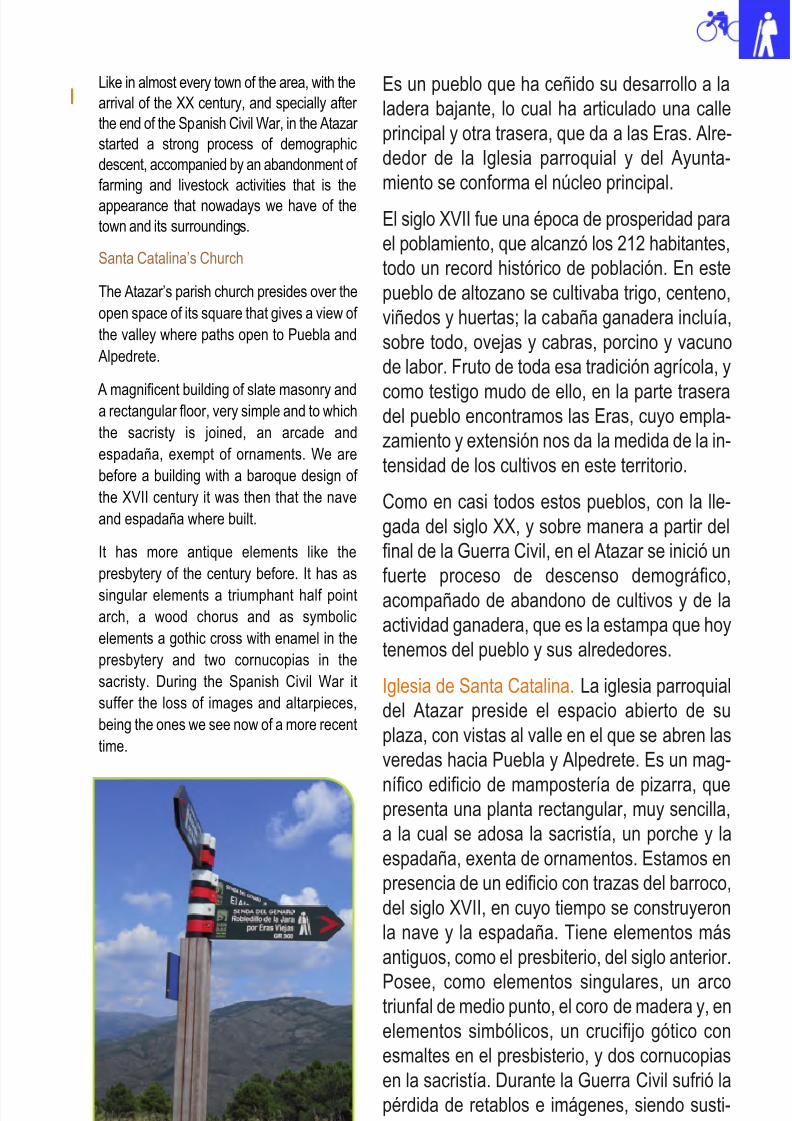
8/3/2019 Libro Senda Del Genaro GR300
http://slidepdf.com/reader/full/libro-senda-del-genaro-gr300 73/156
79 Atazar - Robledillo de La Jara
Es un pueblo que ha ceñido su desarrollo a la
ladera bajante, lo cual ha articulado una calle
principal y otra trasera, que da a las Eras. Alre-
dedor de la Iglesia parroquial y del Ayunta-
miento se conforma el núcleo principal.
El siglo XVII fue una época de prosperidad para
el poblamiento, que alcanzó los 212 habitantes,
todo un record histórico de población. En este
pueblo de altozano se cultivaba trigo, centeno,
viñedos y huertas; la cabaña ganadera incluía,
sobre todo, ovejas y cabras, porcino y vacuno
de labor. Fruto de toda esa tradición agrícola, y
como testigo mudo de ello, en la parte traseradel pueblo encontramos las Eras, cuyo empla-
zamiento y extensión nos da la medida de la in-
tensidad de los cultivos en este territorio.
Como en casi todos estos pueblos, con la lle-
gada del siglo XX, y sobre manera a partir del
final de la Guerra Civil, en el Atazar se inició un
fuerte proceso de descenso demográfico,
acompañado de abandono de cultivos y de la
actividad ganadera, que es la estampa que hoy
tenemos del pueblo y sus alrededores.
Iglesia de Santa Catalina. La iglesia parroquial
del Atazar preside el espacio abierto de su
plaza, con vistas al valle en el que se abren las
veredas hacia Puebla y Alpedrete. Es un mag-
nífico edificio de mampostería de pizarra, quepresenta una planta rectangular, muy sencilla,
a la cual se adosa la sacristía, un porche y la
espadaña, exenta de ornamentos. Estamos en
presencia de un edificio con trazas del barroco,
del siglo XVII, en cuyo tiempo se construyeron
la nave y la espadaña. Tiene elementos más
antiguos, como el presbiterio, del siglo anterior.
Posee, como elementos singulares, un arcotriunfal de medio punto, el coro de madera y, en
elementos simbólicos, un crucifijo gótico con
esmaltes en el presbisterio, y dos cornucopias
en la sacristía. Durante la Guerra Civil sufrió la
pérdida de retablos e imágenes, siendo susti-
tuidas por las actuales.
Like in almost every town of the area, with the
arrival of the XX century, and specially after
the end of the Spanish Civil War, in the Atazar
started a strong process of demographic
descent, accompanied by an abandonment of
farming and livestock activities that is the
appearance that nowadays we have of the
town and its surroundings.
Santa Catalina’s Church
The Atazar’s parish church presides over the
open space of its square that gives a view of
the valley where paths open to Puebla and
Alpedrete.
A magnificent building of slate masonry anda rectangular floor, very simple and to which
the sacristy is joined, an arcade and
espadaña, exempt of ornaments. We are
before a building with a baroque design of
the XVII century it was then that the nave
and espadaña where built.
It has more antique elements like the
presbytery of the century before. It has as
singular elements a triumphant half point
arch, a wood chorus and as symbolic
elements a gothic cross with enamel in the
presbytery and two cornucopias in the
sacristy. During the Spanish Civil War it
suffer the loss of images and altarpieces,
being the ones we see now of a more recent
time.
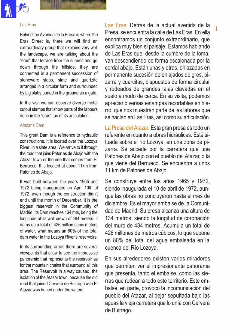
8/3/2019 Libro Senda Del Genaro GR300
http://slidepdf.com/reader/full/libro-senda-del-genaro-gr300 74/156
80 etapa 3
Las Eras. Detrás de la actual avenida de laPresa, se encuentra la calle de Las Eras. En ellaencontramos un conjunto extraordinario, queexplica muy bien el paisaje. Estamos hablandode Las Eras que, desde la cumbre de la loma,
van descendiendo de forma escalonada por lacordal abajo. Están unas y otras, enlazadas enpermanente sucesión de enlajados de gres, pi-zarra y cuarcitas, dispuestos de forma circular y rodeados de grandes lajas clavadas en elsuelo a modo de cerca. En su visita, podemosapreciar diversas estampas recortables en hie-rro, que nos muestran parte de las labores que
se hacían en Las Eras, así como su articulación.
La Presa del Atazar. Esta gran presa es todo unreferente en cuanto a obras hidráulicas. Está si-tuada sobre el río Lozoya, en una zona de pi-zarra. Se accede por la carretera que unePatones de Abajo con el pueblo del Atazar, o laque viene del Berrueco. Se encuentra a unos11 km de Patones de Abajo.
Se construye entre los años 1965 y 1972,
siendo inaugurada el 10 de abril de 1972, aun-
que las obras no concluyeron hasta el mes de
diciembre. Es el mayor embalse de la Comuni-
dad de Madrid. Su presa alcanza una altura de
134 metros, siendo la longitud de coronación
del muro de 484 metros. Acumula un total de
426 millones de metros cúbicos, lo que suponeun 80% del total del agua embalsada en la
cuenca del Río Lozoya.
En sus alrededores existen varios miradores
que permiten ver el impresionante panorama
que presenta, tanto el embalse, como las sie-
rras que rodean a todo este territorio. Este em-
balse, en parte, provocó la incomunicación del
pueblo del Atazar, al dejar sepultada bajo lasaguas la vieja carretera que lo unía con Cervera
de Buitrago.
Las Eras
Behind the Avenida de la Presa is where the
Eras Street is, there we will find an
extraordinary group that explains very well
the landscape, we are talking about the
“eras” that terrace from the summit and go
down through the hillside, they are
connected in a permanent succession of
stoneware slabs, slate and quartzite
arranged in a circular form and surrounded
by big slabs buried in the ground as a gate.
In the visit we can observe diverse metal
cutout stamps that show parts of the labours
done in the “eras”, as of its articulation. Atazar’s Dam
This great Dam is a reference to hydraulic
constructions. It is located over the Lozoya
River, in a slate area. We arrive to it through
the road that joins Patones de Abajo with the
Atazar town or the one that comes from El
Berrueco. It is located at about 11km from
Patones de Abajo.
It was built between the years 1965 and
1972 being inaugurated on April 10th of
1972, even though the construction didn’t
end until the month of December. It is the
biggest reservoir in the Community of
Madrid. Its Dam reaches 134 mts, being the
longitude of its wall crown of 484 meters. It
dams up a total of 426 million cubic meters
of water, what means an 80% of the total
dam water in the Lozoya River’s reservoirs.
In its surrounding areas there are several
viewpoints that allow to see the impressive
panoramic that represents the reservoir as
for the mountain chains that surround all this
area. The Reservoir in a way caused, the
isolation of the Atazar town, because the old
road that joined Cervera de Buitrago with El
Atazar was buried under the waters.
8/3/2019 Libro Senda Del Genaro GR300
http://slidepdf.com/reader/full/libro-senda-del-genaro-gr300 75/156
81 Atazar - Robledillo de La Jara
Itinerario: Senda del Genaro
Municipios: El Atazar - Robledillo de La Jara
Punto de Salida: El Atazar
Distancia: 12.2 km
GR: 300
Punto de llegada: Robledillo
de La Jara
Mapa: IGN-MTN25: 484-II- IV
485-I- III
etapa
Rutómetro
EL ATAZAR
ROBLEDILLO DE LA JARA
IDA / DEPARTURE VUELTA / RETURN
El Atazar . Se sube calle arriba hacia la iglesia, siguiendo
por la avenida de la Presa hacia la salida del pueblo.
El Atazar. We go up the street to the church, continuing
through the Presa Avenue to the town’s exit.
DIST: 0 m. ALT: 986 m.
TIEMPO: 0h 0' FIRME: Sendero
Robledillo de la Jara. Se sale por la Cuesta de San Pedro
y la Calle Jesús del Valle hacia la parte alta del pueblo.
Robledillo de la Jara. We exit through the Cuesta de San
Pedro and Jesus del Valle streets to the upper part of
town.
DIST: 0 m. ALT: 1022 m.
TIEMPO: 0h 0' FIRME: Hormigón
Se deja la avenida de la Presa y se toma el Camino del
Riato.
We leave the Presa Avenue and take the Riato Road.
DIST: 520 m. ALT: 984 m.
TIEMPO: 0h 9' FIRME: Hormigón
Se entronca con la última calle del pueblo y se gira a la
derecha, rumbo al Descansadero.
We connect with the last street of town and turn right on
our way to the resting area.
DIST: 160 m. ALT: 1048 m.
TIEMPO: 0h 4' FIRME: Pista
1 WP 30T 460573 UTM 4531778 1 WP 30T 455921 UTM 4533739
2 WP 30T 460333 UTM 4531690 2 WP 30T 456055 UTM 4533747
8/3/2019 Libro Senda Del Genaro GR300
http://slidepdf.com/reader/full/libro-senda-del-genaro-gr300 76/156
5 WP 30T 457214 UTM 4533461
Collado Fragüela. La ruta senderista gira a la izquierdapor el carril asfaltado, hacia Matachines; la variante deBTT sigue por la carretera, en descenso.Fraguela Hill. The hiker’s route turns left through the
paved trail to Matachines. The BTT variant continuesthrough the road downhill.
DIST: 9240 m. ALT: 1128 m.
TIEMPO: 2h 3' FIRME: Sendero
5 WP 30T 456236 UTM 4533605
Desvío senda de Valdehierro (variante senderista). Se
gira a la derecha, entrando por la pista. La variante de
BTT sigue de frente, carretera arriba.
Detour of the Valdehierro route (hiker’s variant). We turn
right going in through the track. The BTT variant continuesstraight ahead up the road.
DIST: 580 m. ALT: 10029 m.
TIEMPO: 0h 10' FIRME: Pista
4 WP 30T 458613 UTM 4534179
Puente sobre el río Riato; se sigue por la pista principal
hacia adelante.
Bridge over the Riato River, we continue through the main
track straight ahead.
DIST: 5580 m. ALT: 897 m.
TIEMPO: 1h 16' FIRME: Pist
4 WP 30T 456068 UTM 4533584
Se pasa por delante del comienzo de la etapa Robledi-
llo-Cervera de Buitrago, y se sigue por la carretera ade-
lante.
We pass in front of the start of the Robledillo – Cerverade Buitrago Stage and continue through the road ahead.
DIST: 390 m. ALT: 1038 m.
TIEMPO: 0h 9' FIRME: Asfalto
Desvío de las Eras; se sigue por el camino del Riato.
Detour to the Eras, we continue through the Riato road.
DIST: 620 m. ALT: 992 m.
TIEMPO: 0h 11' FIRME: Pista
3 WP 30T 456029 UTM 4533620
Se entronca con la carretera de Robledillo de la Jara a
Puebla de la Sierra. Se gira a la izquierda pasando por
delante del Descansadero.
We link with the Robledillo de la Jara road to Puebla de
la Sierra. We turn left passing in front of the resting area.
DIST: 280 m. ALT: 1040 m.
TIEMPO: 0h 7' FIRME: Asfalto
82 etapa 3
3 WP 30T 460271 UTM 4531637
8/3/2019 Libro Senda Del Genaro GR300
http://slidepdf.com/reader/full/libro-senda-del-genaro-gr300 77/156
8 WP 30T 456980 UTM 4532930
Se cruza un amplio cortafuegos y se sigue, un poco a laderecha, hasta encontrar la Fuente la Rana y entrar enotro estrecho sendero en leve descenso.We cross a wide firewall and continue a bit to the right
until we find the “Fuente de la Rana” (the frog’s fountain)and go into a narrow path in a soft descent.
DIST: 10320 m. ALT: 1085 m.
TIEMPO: 2h 26' FIRME: Sendero
8 WP 30T 456927 UTM 4532987
Fuente la Rana. Se sale al cortafuegos y se sigue de frente
por debajo de los postes de la luz, en fuerte ascenso.
Fuente la Rana. We exit the firewall and continue straight
ahead under the electricity posts in a strong uphill.
DIST: m. ALT: 1079 m.
TIEMPO: 0h 27' FIRME: Sendero
7 WP 30T 457168 UTM 4532800
Se abandona el carril asfaltado para tomar una senda
que desciende y pasa por debajo de los postes de la luz.
We leave the asphalt trail to take a path that goes downhill
and passes under the electricity posts.
DIST: 10050 m. ALT: 1130 m.
TIEMPO: 2h 20' FIRME: Sendero
7 WP 30T 456365 UTM 4533302
Se abandona la pista principal y se gira a la izquierda,
hacia las antenas de Matachines, por una senda con
linde de alambrera.
We will abandon the main track and turn left to the Mata-chines’ antennas through a path with a wire boundary.
DIST: 990 m. ALT: 1018 m.
TIEMPO: 0h 15' FIRME: Sendero
6 WP 30T 457204 UTM 4532858
Se sigue ascendiendo hacia las antenas, dejando un
ramal a la izquierda.
We continue to go uphill to the antennas, leaving a branch
on our left.
DIST: 9910 m. ALT: 1130 m.
TIEMPO: 2h 7' FIRME: Asfalto
Se sigue por la pista principal, dejando un ramal a la de-
recha.
We continue through the main track leaving behind a
branch to our right.
DIST: 720 m. ALT: 1026 m.
TIEMPO: 0h 13' FIRME: Pista
83 Atazar - Robledillo de La Jara
6 WP 30T 456247 UTM 4533494
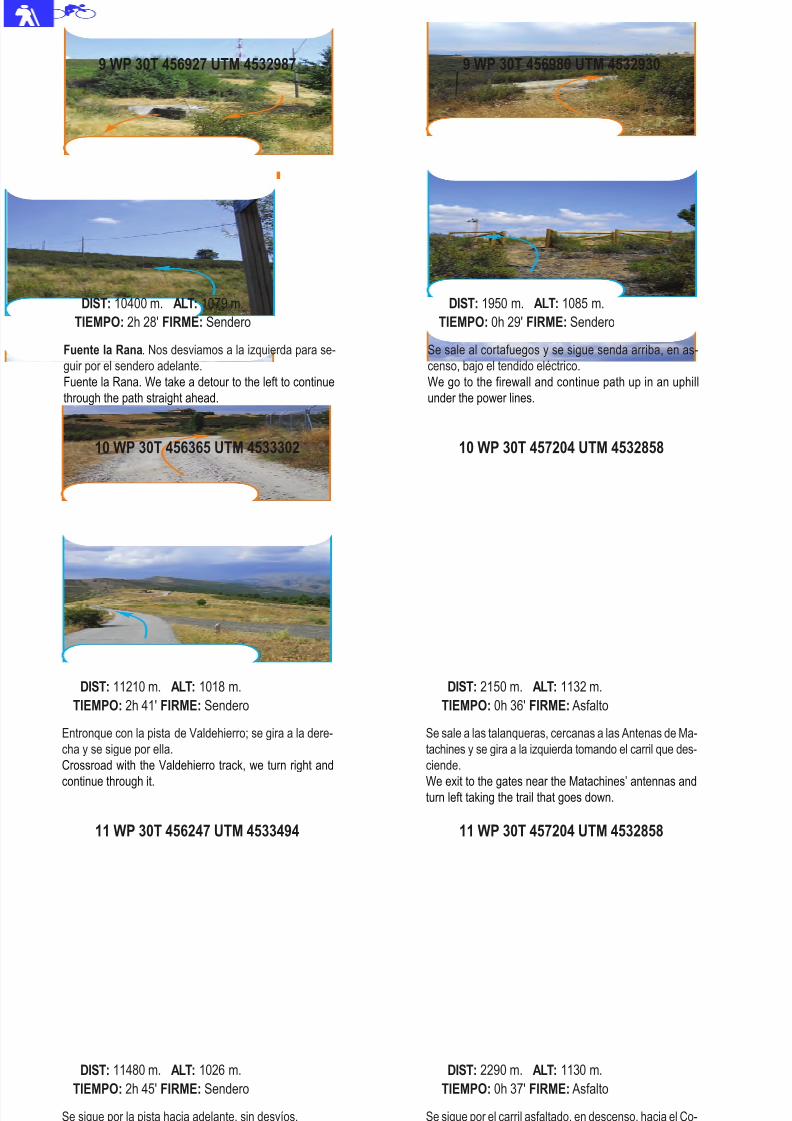
8/3/2019 Libro Senda Del Genaro GR300
http://slidepdf.com/reader/full/libro-senda-del-genaro-gr300 78/156
11 WP 30T 456247 UTM 4533494
Se sigue por la pista hacia adelante, sin desvíos.
We continue through the track straight ahead without any
detours.
DIST: 11480 m. ALT: 1026 m.
TIEMPO: 2h 45' FIRME: Sendero
11 WP 30T 457204 UTM 4532858
Se sigue por el carril asfaltado, en descenso, hacia el Co-
llado de Fragüela.
We continue through the asphalt trail in descent to the
Fragulea Hill.
DIST: 2290 m. ALT: 1130 m.
TIEMPO: 0h 37' FIRME: Asfalto
10 WP 30T 456365 UTM 4533302
Entronque con la pista de Valdehierro; se gira a la dere-
cha y se sigue por ella.
Crossroad with the Valdehierro track, we turn right and
continue through it.
DIST: 11210 m. ALT: 1018 m.
TIEMPO: 2h 41' FIRME: Sendero
10 WP 30T 457204 UTM 4532858
Se sale a las talanqueras, cercanas a las Antenas de Ma-
tachines y se gira a la izquierda tomando el carril que des-
ciende.
We exit to the gates near the Matachines’ antennas andturn left taking the trail that goes down.
DIST: 2150 m. ALT: 1132 m.
TIEMPO: 0h 36' FIRME: Asfalto
Fuente la Rana. Nos desviamos a la izquierda para se-
guir por el sendero adelante.
Fuente la Rana. We take a detour to the left to continue
through the path straight ahead.
DIST: 10400 m. ALT: 1079 m.
TIEMPO: 2h 28' FIRME: Sendero
9 WP 30T 456980 UTM 4532930
Se sale al cortafuegos y se sigue senda arriba, en as-
censo, bajo el tendido eléctrico.
We go to the firewall and continue path up in an uphill
under the power lines.
DIST: 1950 m. ALT: 1085 m.
TIEMPO: 0h 29' FIRME: Sendero
84 etapa 3
9 WP 30T 456927 UTM 4532987
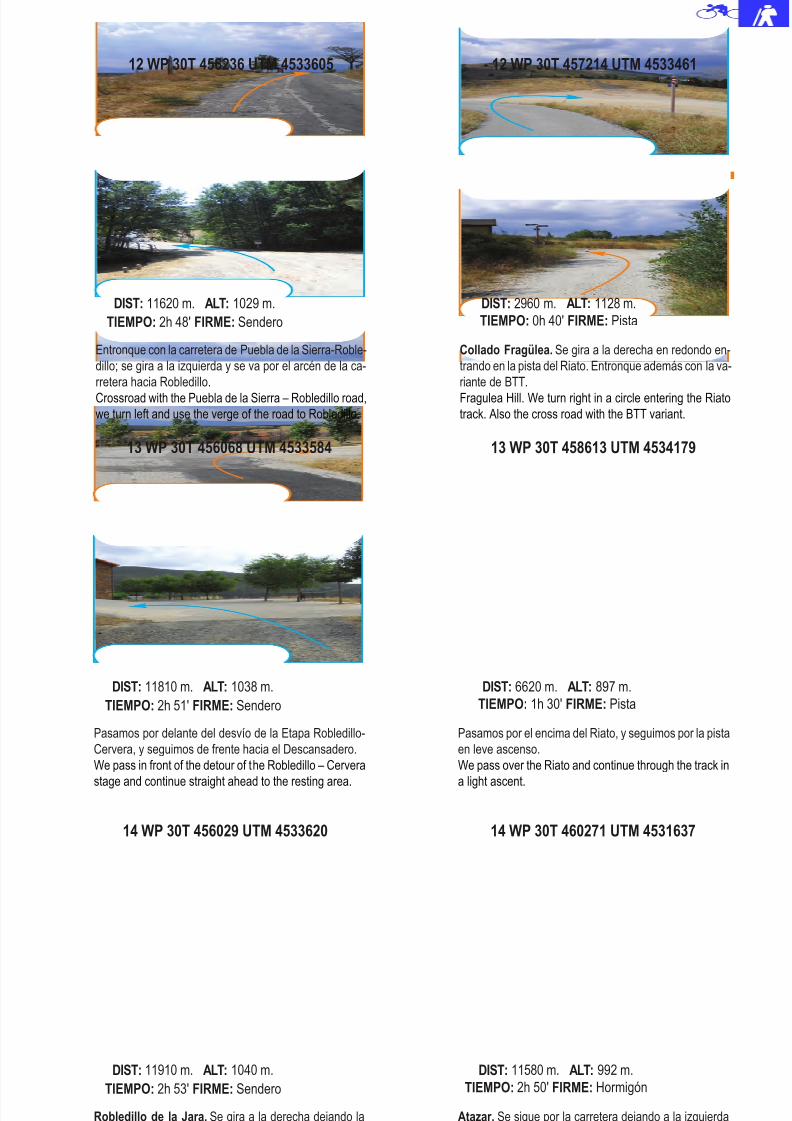
8/3/2019 Libro Senda Del Genaro GR300
http://slidepdf.com/reader/full/libro-senda-del-genaro-gr300 79/156
14 WP 30T 456029 UTM 4533620
Robledillo de la Jara. Se gira a la derecha dejando la
carretera y entrando al pueblo por la zona alta.
Robledillo de la Jara. We turn right leaving the road and
going in the town through the upper area.
DIST: 11910 m. ALT: 1040 m.
TIEMPO: 2h 53' FIRME: Sendero
14 WP 30T 460271 UTM 4531637
Atazar. Se sigue por la carretera dejando a la izquierda
el desvío a las Eras.
Atazar. We continue through the road leaving to the our
left the detour to the Eras.
DIST: 11580 m. ALT: 992 m.
TIEMPO: 2h 50' FIRME: Hormigón
13 WP 30T 456068 UTM 4533584
Pasamos por delante del desvío de la Etapa Robledillo-
Cervera, y seguimos de frente hacia el Descansadero.
We pass in front of the detour of the Robledillo – Cervera
stage and continue straight ahead to the resting area.
DIST: 11810 m. ALT: 1038 m.
TIEMPO: 2h 51' FIRME: Sendero
13 WP 30T 458613 UTM 4534179
Pasamos por el encima del Riato, y seguimos por la pista
en leve ascenso.
We pass over the Riato and continue through the track in
a light ascent.
DIST: 6620 m. ALT: 897 m.
TIEMPO: 1h 30' FIRME: Pista
12 WP 30T 456236 UTM 4533605
Entronque con la carretera de Puebla de la Sierra-Roble-
dillo; se gira a la izquierda y se va por el arcén de la ca-
rretera hacia Robledillo.
Crossroad with the Puebla de la Sierra – Robledillo road,
we turn left and use the verge of the road to Robledillo.
DIST: 11620 m. ALT: 1029 m.
TIEMPO: 2h 48' FIRME: Sendero
Collado Fragülea. Se gira a la derecha en redondo en-
trando en la pista del Riato. Entronque además con la va-
riante de BTT.
Fragulea Hill. We turn right in a circle entering the Riato
track. Also the cross road with the BTT variant.
DIST: 2960 m. ALT: 1128 m.
TIEMPO: 0h 40' FIRME: Pista
85 Atazar - Robledillo de La Jara
12 WP 30T 457214 UTM 4533461

8/3/2019 Libro Senda Del Genaro GR300
http://slidepdf.com/reader/full/libro-senda-del-genaro-gr300 80/156
Robledillo de la Jara. Se abandona la calle para bajar enlazando las calles de Jesús del Valle y la Cuesta deSan Pedro.
Robledillo de la Jara. We leave the street to go down lin-king with the Jesus del Valle and Cuesta de San Pedrostreets.
DIST: 12040 m. ALT: 1048 m.
TIEMPO: 2h 56' FIRME: Sendero
15 WP 30T 460333 UTM 4531690
Se sale a la Avenida de la Presa, y se gira a la izquierda
subiendo por ella hasta la Iglesia.
We exit to the Presa Street and turn left going up until we
get to the church.
DIST: 12060 m. ALT: 998 m.
TIEMPO: 2h 55' FIRME: Hormigón
16 WP 30T 455921 UTM 4533739
Robledillo de la Jara. Se baja por las calles citadas
hasta desembocar ante el Panel de la Etapa.
Robledillo de la Jara. We go down through the mentioned
streets until we end up at the Stage Panel.
DIST: 12200 m. ALT: 1022 m.
TIEMPO: 3h 0' FIRME: Sendero
16 WP 30T 460573 UTM 4531778
Atazar. En la iglesia, se baja por el camino del Cemen-
terio donde se encuentra el panel de la etapa.
Atazar . At the church we go down through the road to the
Cemetery where the stage panel is located.
DIST: 12200 m. ALT: 986 m.
TIEMPO: 3h 0' FIRME: Hormigón
86 etapa 3
15 WP 30T 456055 UTM 4533747
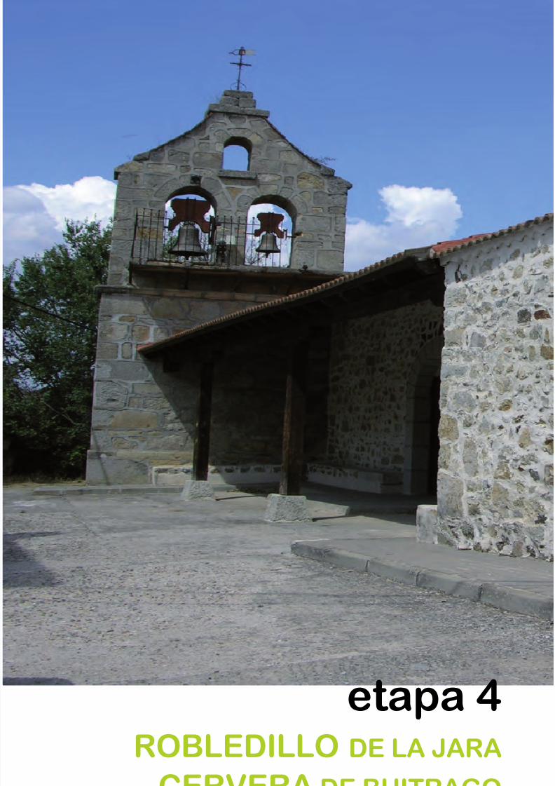
8/3/2019 Libro Senda Del Genaro GR300
http://slidepdf.com/reader/full/libro-senda-del-genaro-gr300 81/156
etapa 4ROBLEDILLO DE LA JARA
CERVERA DE BUITRAGO
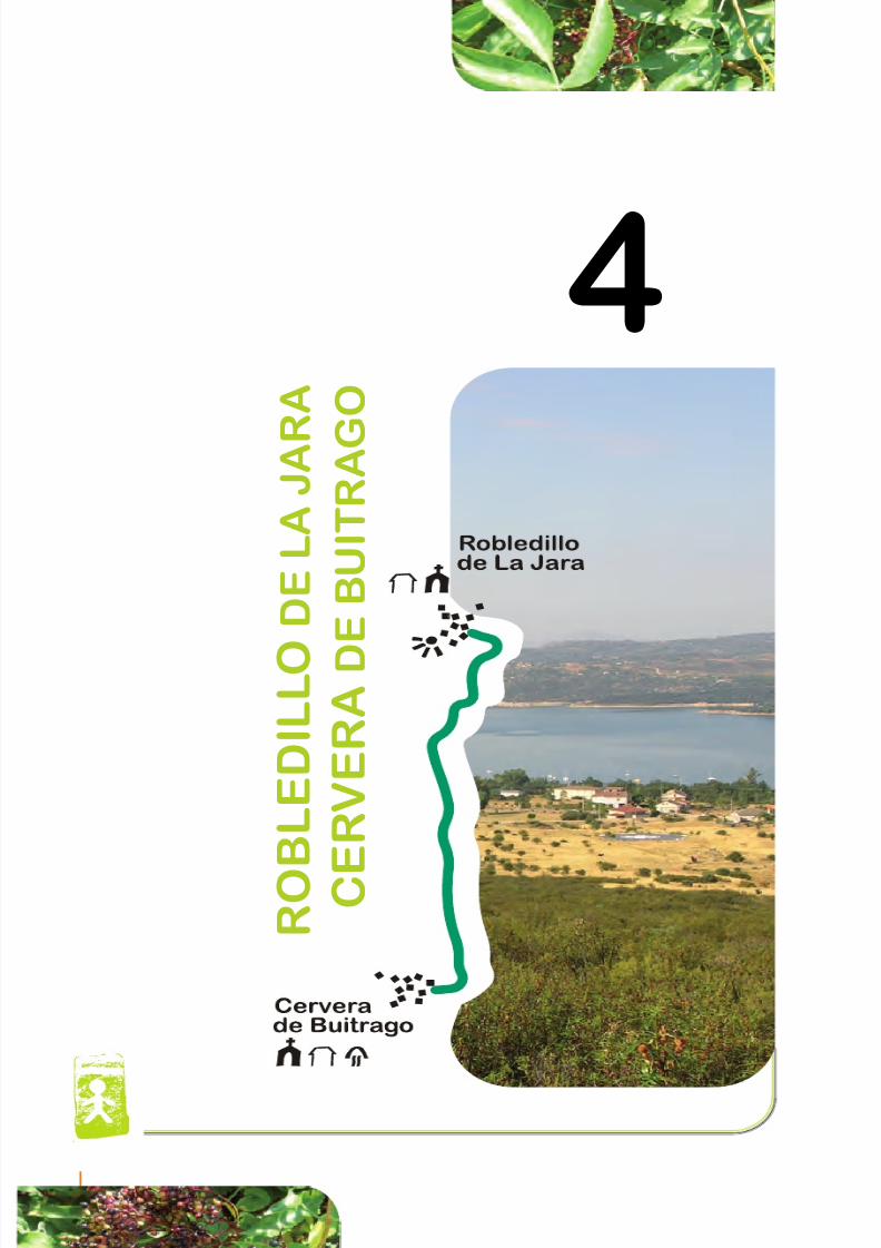
8/3/2019 Libro Senda Del Genaro GR300
http://slidepdf.com/reader/full/libro-senda-del-genaro-gr300 82/156
4
R O B L E D I L L O
D E L A
J A R
A
C E
R V E R A D
E B U I T R A G
O
90 etapa 4
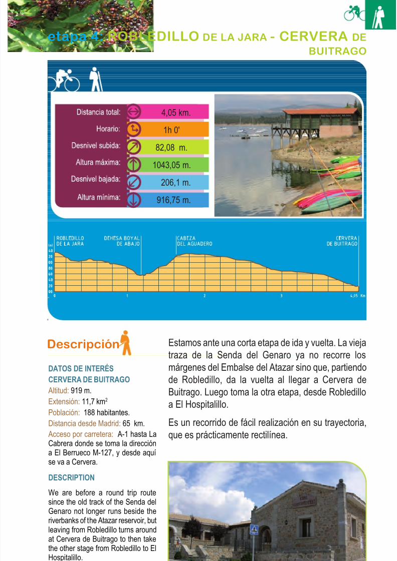
8/3/2019 Libro Senda Del Genaro GR300
http://slidepdf.com/reader/full/libro-senda-del-genaro-gr300 83/156
Descripción
DATOS DE INTERÉSCERVERA DE BUITRAGO
Altitud: 919 m.Extensión: 11,7 km2
Población: 188 habitantes.Distancia desde Madrid: 65 km.Acceso por carretera: A-1 hasta LaCabrera donde se toma la direccióna El Berrueco M-127, y desde aquíse va a Cervera.
DESCRIPTION
We are before a round trip routesince the old track of the Senda delGenaro not longer runs beside theriverbanks of the Atazar reservoir, butleaving from Robledillo turns aroundat Cervera de Buitrago to then takethe other stage from Robledillo to ElHospitalillo.
It is a very easy to do route, itstrajectory is almost in a straight line.
Estamos ante una corta etapa de ida y vuelta. La viejatraza de la Senda del Genaro ya no recorre losmárgenes del Embalse del Atazar sino que, partiendode Robledillo, da la vuelta al llegar a Cervera de
Buitrago. Luego toma la otra etapa, desde Robledilloa El Hospitalillo.
Es un recorrido de fácil realización en su trayectoria,que es prácticamente rectilínea.
91Robledillo de la Jara - Cervera de Buitrago
etapa 4: ROBLEDILLO DE LA JARA - CERVERA DE
BUITRAGO
4,05 km.
1h 0'
82,08 m.
1043,05 m.
206,1 m.
916,75 m.
Ayuntamiento de Cervera de Buitrago

8/3/2019 Libro Senda Del Genaro GR300
http://slidepdf.com/reader/full/libro-senda-del-genaro-gr300 84/156
It presents levels of downhill and uphill at theentrance of the Dehesa Boyal de Abajo andthen downhill and uphill to the Cervera andRobledillo towns. The most interesting viewsare given by the resting area of Robledillo de
la Jara and the hill that goes down toCervera de Buitrago.
At the feet of the Robledillo de la Jara restingarea, we find the Start Panel of this routethat starts precisely a bit further away, for which at the side of the road we take aservice path of a water conduction that wewill recognize by the mushroom lookingmillestones that mark along the path.
It is a light downhill to the Dehesa Boyal thatin old days was a space of free exploitationof exclusive use for the labour cattle of theneighbours all though not always the usesadjust to this definition, in the downhill wecan see on the left the Matachines hill thatis a whole reference before the range thatform the Cancho la Cabrera and La Escrita,places that we will see better when we do
the uphill to Cervera de Buitrago.
La ruta presenta repetidos desniveles de bajaday subida: al entrar en la Dehesa Boyal de Abajoy, más tarde, los tramos que nos llevan a lospueblos de Cervera y Robledillo. Las vistas másinteresantes nos las aportan la zona del des-cansadero de Robledillo de la Jara y la cuerdaque baja hacia Cervera de Buitrago.
Al pie mismo del Descansadero de Robledillode la Jara se ubica el panel de inicio de estaetapa, que arranca, precisamente, un poco másallá. Al pie de la carretera, tomamos un caminode servicio de una conducción de agua, que re-
conoceremos por las setas de hormigón que ja-lonan el trazado.
El descenso liviano hacia la Dehesa Boyal, sedefine como un espacio de aprovechamientogratuito para uso exclusivo de las reses de labor de los vecinos, aunque no siempre los usos seajustaban a esta definición. En la bajada pode-mos ver, a la izquierda, el cerro de Matachines,que es toda una referencia, al frente la cordalque forman el Cancho la Cabeza y la Escrita,lugares que veremos mejor cuando hagamos lasubida hacia Cervera de Buitrago.
92 etapa 4
Alojamiento rural en Cervera de Buitrago
8/3/2019 Libro Senda Del Genaro GR300
http://slidepdf.com/reader/full/libro-senda-del-genaro-gr300 85/156
La llegada a la Dehesa Boyal se reconoce por el arroyo encauzado y el pontón que debemoscruzar. Seguimos de frente hasta darnos de bru-ces con el Descansadero que hay en la umbríade la Dehesa, donde abundan las encinas y losquejigos.
A partir del Descansadero, la ruta toma alturamediante un buen tramo de subida; pasada unaportillera, estaremos en plena cordal de Cabezadel Aguadero y Cabeza Mala. Las vistas desdeaquí son impresionantes: el embalse se nosmuestra en toda su enormidad; la Dehesa de
Santillana; El Berrueco al otro lado del embalse,marcando parte del recorrido que aún nos quedapendiente; y detrás, los sierros de La Cabrera.
Enfrente tenemos el Cancho la Cabeza y la Es-crita, lugar de paso de paisanos y acémilas ca-mino de las tierras planas de Guadalajara; a laizquierda de nuestro recorrido, Matachines yCabeza Antón.
Pasado el Romeral, nos encontramos con lapista que iba hacia El Atazar. La cruzamos y to-mamos la siguiente, que va por la derecha endescenso, hacia Cervera de Buitrago, marcadacon un hito direccional de la Senda del Genaro.Entramos en el pueblo de Cervera por la zonade los alojamientos turísticos y seguimos por la
calle abajo, hacia la fuente y carretera generalque cruza el pueblo, a cuyo pie encontraremosel panel de inicio de la etapa.
La vuelta se realiza por el mismo camino, hastaRobledillo de la Jara.
PARA VER Y VISITAR
Cervera de Buitrago
El término está partido en dos espacios por unacarretera que lleva a la estación náutica, que seubica a la orilla del Embalse del Atazar.
La configuración topográfica de este términodiscurre desde la cota de 1.028 metros de Val-
93Robledillo de la Jara - Cervera de Buitrago
We will recognize the arrival at the DehesaBoyal by the channelled stream and thepontoon that we have to cross and that willleave us in the access to the dehesa, wecontinue ahead on the access road until wehit the Descansadero “resting place” that is
in the shady spot of the Dehesa where holmoak and oaks are abundant.
From the Descansadero the route takesheight by a good uphill tram, we pass a gateand we will be in the depths of the Cabezadel Aguadero and Cabeza Mala range. Theviews from the range are impressive. Thereservoir is shown to us in all its greatness,the Dehesa de Santillana, El Berrueco at the
other side, marking part of the path that westill have to do, and behind, La CabreraMountains.
In front we have the Cancho la Cabeza andthe Escrita, a passing road for the villagersand their mules on their way to the plainlands of Guadalajara and the other wayaround; to the left of our route we haveMatachines and Cabeza Anton.
After the lands covered with rosemary wefind the track that went to the Atazar, wecross it and take the next track downhill toCervera de Buitrago, marked with a directionmilestone of Senda del Genaro, going in thetown through the area of the Cervera’stourist accommodations, we continuethrough the street going down to the fountainand the main road that crosses the town andwhere we will find the Start panel of theroute.
We make our way back using the same roadto Robledillo de la Jara.
WHAT TO SEE AND VISIT
Cervera de Buitrago
The council is divided in two spaces by aroad that goes to the nautical station located
in the riverbank of the Atazar reservoir.The topographic configuration of this councilgoes from the 1.028 meters of elevation of Valdecornoque in the North, to the 974meters of elevation of Cerrillo de la Jara inthe South. This gives as consequence twogeomorphologic configurations, on one side
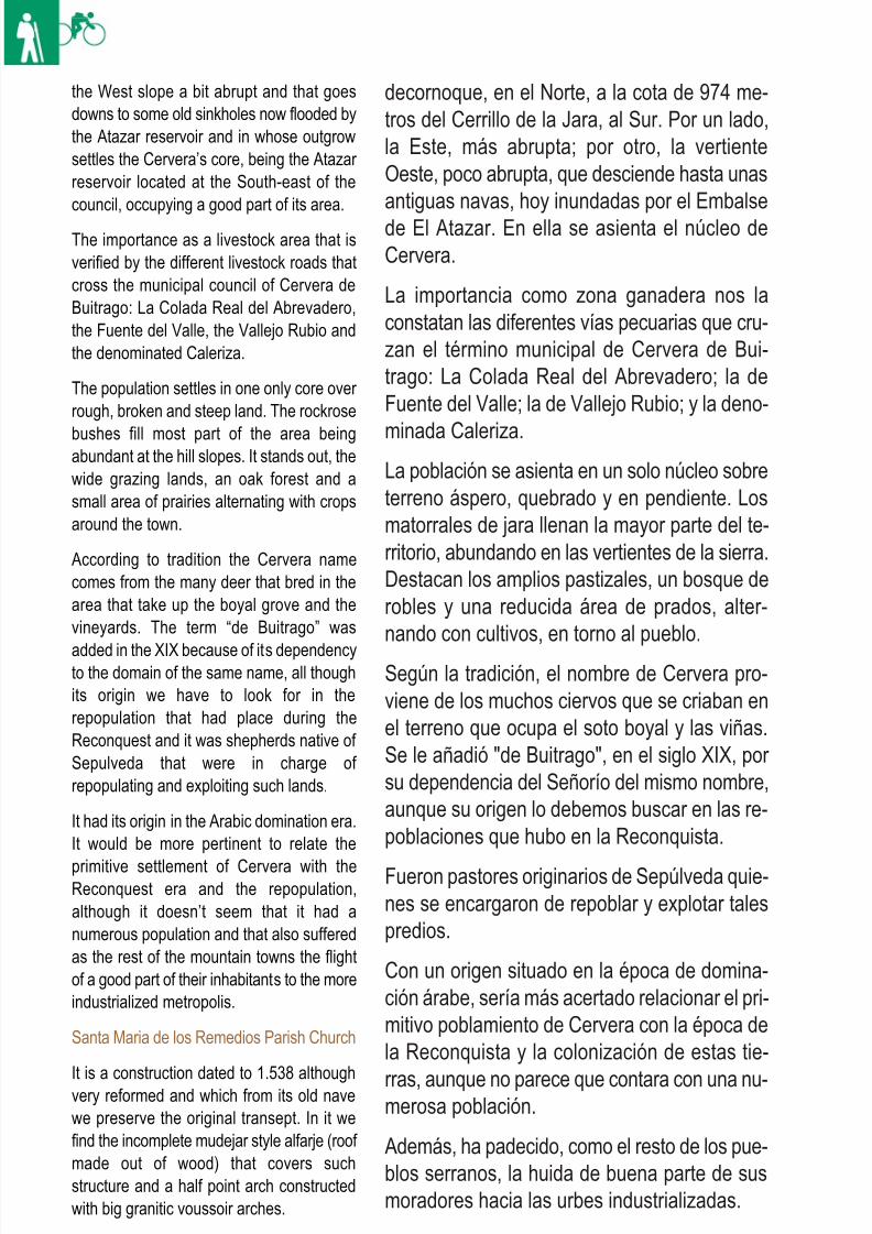
8/3/2019 Libro Senda Del Genaro GR300
http://slidepdf.com/reader/full/libro-senda-del-genaro-gr300 86/156
decornoque, en el Norte, a la cota de 974 me-tros del Cerrillo de la Jara, al Sur. Por un lado,la Este, más abrupta; por otro, la vertienteOeste, poco abrupta, que desciende hasta unasantiguas navas, hoy inundadas por el Embalsede El Atazar. En ella se asienta el núcleo deCervera.
La importancia como zona ganadera nos laconstatan las diferentes vías pecuarias que cru-zan el término municipal de Cervera de Bui-trago: La Colada Real del Abrevadero; la deFuente del Valle; la de Vallejo Rubio; y la deno-
minada Caleriza.La población se asienta en un solo núcleo sobreterreno áspero, quebrado y en pendiente. Losmatorrales de jara llenan la mayor parte del te-rritorio, abundando en las vertientes de la sierra.Destacan los amplios pastizales, un bosque derobles y una reducida área de prados, alter-nando con cultivos, en torno al pueblo.
Según la tradición, el nombre de Cervera pro-viene de los muchos ciervos que se criaban enel terreno que ocupa el soto boyal y las viñas.Se le añadió "de Buitrago", en el siglo XIX, por su dependencia del Señorío del mismo nombre,aunque su origen lo debemos buscar en las re-poblaciones que hubo en la Reconquista.
Fueron pastores originarios de Sepúlveda quie-nes se encargaron de repoblar y explotar talespredios.
Con un origen situado en la época de domina-ción árabe, sería más acertado relacionar el pri-mitivo poblamiento de Cervera con la época dela Reconquista y la colonización de estas tie-
rras, aunque no parece que contara con una nu-merosa población.
Además, ha padecido, como el resto de los pue-blos serranos, la huida de buena parte de susmoradores hacia las urbes industrializadas.
94 etapa 4
the West slope a bit abrupt and that goesdowns to some old sinkholes now flooded bythe Atazar reservoir and in whose outgrowsettles the Cervera’s core, being the Atazar reservoir located at the South-east of thecouncil, occupying a good part of its area.
The importance as a livestock area that isverified by the different livestock roads thatcross the municipal council of Cervera deBuitrago: La Colada Real del Abrevadero,the Fuente del Valle, the Vallejo Rubio andthe denominated Caleriza.
The population settles in one only core over rough, broken and steep land. The rockrose
bushes fill most part of the area beingabundant at the hill slopes. It stands out, thewide grazing lands, an oak forest and asmall area of prairies alternating with cropsaround the town.
According to tradition the Cervera namecomes from the many deer that bred in thearea that take up the boyal grove and thevineyards. The term “de Buitrago” was
added in the XIX because of its dependencyto the domain of the same name, all thoughits origin we have to look for in therepopulation that had place during theReconquest and it was shepherds native of Sepulveda that were in charge of repopulating and exploiting such lands.
It had its origin in the Arabic domination era.It would be more pertinent to relate the
primitive settlement of Cervera with theReconquest era and the repopulation,although it doesn’t seem that it had anumerous population and that also sufferedas the rest of the mountain towns the flightof a good part of their inhabitants to the moreindustrialized metropolis.
Santa Maria de los Remedios Parish Church
It is a construction dated to 1.538 althoughvery reformed and which from its old navewe preserve the original transept. In it wefind the incomplete mudejar style alfarje (roof made out of wood) that covers suchstructure and a half point arch constructedwith big granitic voussoir arches.
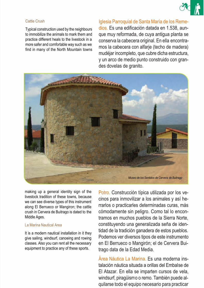
8/3/2019 Libro Senda Del Genaro GR300
http://slidepdf.com/reader/full/libro-senda-del-genaro-gr300 87/156
95Robledillo de la Jara - Cervera de Buitrago
Iglesia Parroquial de Santa María de los Reme-dios. Es una edificación datada en 1.538, aun-que muy reformada, de cuya antigua planta seconserva la cabecera original. En ella encontra-mos la cabecera con alfarje (techo de madera)mudéjar incompleto, que cubre dicha estructura,y un arco de medio punto construido con gran-des dovelas de granito.
Potro. Construcción típica utilizada por los ve-cinos para inmovilizar a los animales y así he-rrarlos o practicarles determinadas curas, máscómodamente sin peligro. Como tal lo encon-tramos en muchos pueblos de la Sierra Norte,constituyendo una generalizada seña de iden-tidad de la tradición ganadera de estos pueblos.Podemos ver diversos tipos de este instrumentoen El Berrueco o Mangirón; el de Cervera Bui-
trago data de la Edad Media.Área Náutica La Marina. Es una moderna ins-talación náutica situada a orillas del Embalse deEl Atazar. En ella se imparten cursos de vela,windsurf, piragüismo o remo. También puede al-quilarse todo el equipo necesario para practicar estos deportes náuticos.
Cattle Crush
Typical construction used by the neighboursto immobilize the animals to mark them andpractice different heals to the livestock in amore safer and comfortable way such as we
find in many of the North Mountain towns
making up a general identity sign of thelivestock tradition of these towns, because
we can see diverse types of this instrumentalong El Berrueco or Mangiron; the cattlecrush in Cervera de Buitrago is dated to theMiddle Ages.
La Marina Nautical Area
It is a modern nautical installation in it theygive sailing, windsurf, canoeing and rowingclasses. Also you can rent all the necessaryequipment to practice any of these sports.
Museo de los Sentidos de Cervera de Buitrago
8/3/2019 Libro Senda Del Genaro GR300
http://slidepdf.com/reader/full/libro-senda-del-genaro-gr300 88/156
8/3/2019 Libro Senda Del Genaro GR300
http://slidepdf.com/reader/full/libro-senda-del-genaro-gr300 89/156
Itinerario: Senda del Genaro
Municipios: Robledillo - CerveraPunto de Salida: Robledillo de la Jara
Distancia: 4.05 km
GR: 300
Punto de llegada: Cervera deBuitrago
Mapa: IGN-MTN25: 484-II- IV
485-I- III
etapa
Rutómetro
ROBLEDILLO DE LA JARA
CERVERA DE BUITRAGO
IDA / DEPARTURE VUELTA / RETURN
1 WP 30T 456070 UTM 4533578
Robledillo de la Jara. Se sale de las inmediaciones delpanel de la etapa, al pie de la carretera y el Descansa-dero, y se gira a la derecha sobre el panel para tomar uncamino en descenso.Robledillo de la Jara. We exit the vicinities of the stagepanel at the foot of the road and the resting area. We turnright passing the panel to take a road downhill.
DIST: 0 m. ALT: 1044 m.TIEMPO: 0h 0' FIRME: Sendero
1 WP 30T 455445 UTM 4530364
Cervera de Buitrago. Se cruza la carretera y se subepor las calles principales hacia lo alto del pueblo.Cervera de Buitrago. We cross the road and go upthrough the main streets to the upper part of town.
DIST: 0 m. ALT: 921 m.TIEMPO: 0h 0' FIRME: Sendero
2 WP 30T 455788 UTM 4532973
Bifurcación. Se toma el ramal de la izquierda, cruzandoun cierre de alambre.Crossroad. We take the branch on the left crossing a wiregate.
DIST: 720 m. ALT: 1006 m.TIEMPO: 0h 10' FIRME: Sendero
2 WP 30T 455876 UTM 4530360
Se sale a la vieja pista que iba hacia El Atazar; se cruzay se sigue por el camino que hay a nuestra izquierda yque desfila por el alto del cordal.We exit to the old track that used to go to El Atazar, wecross it and continue through the road on our left and that
passes through the highest part of the hill.
DIST: 540 m. ALT: 955 m.TIEMPO: 0h 8' FIRME: Pista
97Robledillo de la Jara - Cervera de Buitrago
8/3/2019 Libro Senda Del Genaro GR300
http://slidepdf.com/reader/full/libro-senda-del-genaro-gr300 90/156
5 WP 30T 455741 UTM 4531780
Se cruza la portilla y se sigue recto.We cross the gate and continue straight ahead.
DIST: 2020 m. ALT: 1033 m.TIEMPO: 0h 32' FIRME: Sendero
5 WP 30T 455651 UTM 4532624
Se abandona la pista y se sigue por el pontón que existea la derecha; se toma una fuerte rampa en ascenso.We abandon the track and continue through the pontoonthat is on the right, we take a strong slope uphill.
DIST: 2950 m. ALT: 962 m.TIEMPO: 0h 46' FIRME: Senda
4 WP 30T 455676 UTM 4532560
Bifurcación. Se toma el ramal derecho pasando por de-lante del Descansadero y emprendiendo un fuerte as-censo.
Crossroad. We take the right branch passing in front of the resting area and starting a strong ascent.
DIST: 1220 m. ALT: 963 m.TIEMPO: 0h 19' FIRME: Pista
4 WP 30T 455676 UTM 4532560
Tras el descenso se llega al Descansadero, y se siguede frente por la pista.After the descent we arrive to the resting area and conti-
nue ahead through the track.
DIST: 2830 m. ALT: 963 m.TIEMPO: 0h 45' FIRME: Pista
Se cruza el pontón para entroncar con un camino amplio;se sigue por el ramal de la izquierda.We cross the pontoon to connect with a wide road, wecontinue through the left branch.
DIST: 1100 m. ALT: 964 m.TIEMPO: 0h 17' FIRME: Pista
3 WP 30T 455741 UTM 4531780
Se sigue por la pista cruzando la portilla y comenzamosel descenso hacia el Descansadero.We continue through the track crossing the gate and startthe descent to the resting area.
DIST: 2030 m. ALT: 1033 m.TIEMPO: 0h 35' FIRME: Pista
98 etapa 4
3 WP 30T 455651 UTM 4532624
8/3/2019 Libro Senda Del Genaro GR300
http://slidepdf.com/reader/full/libro-senda-del-genaro-gr300 91/156
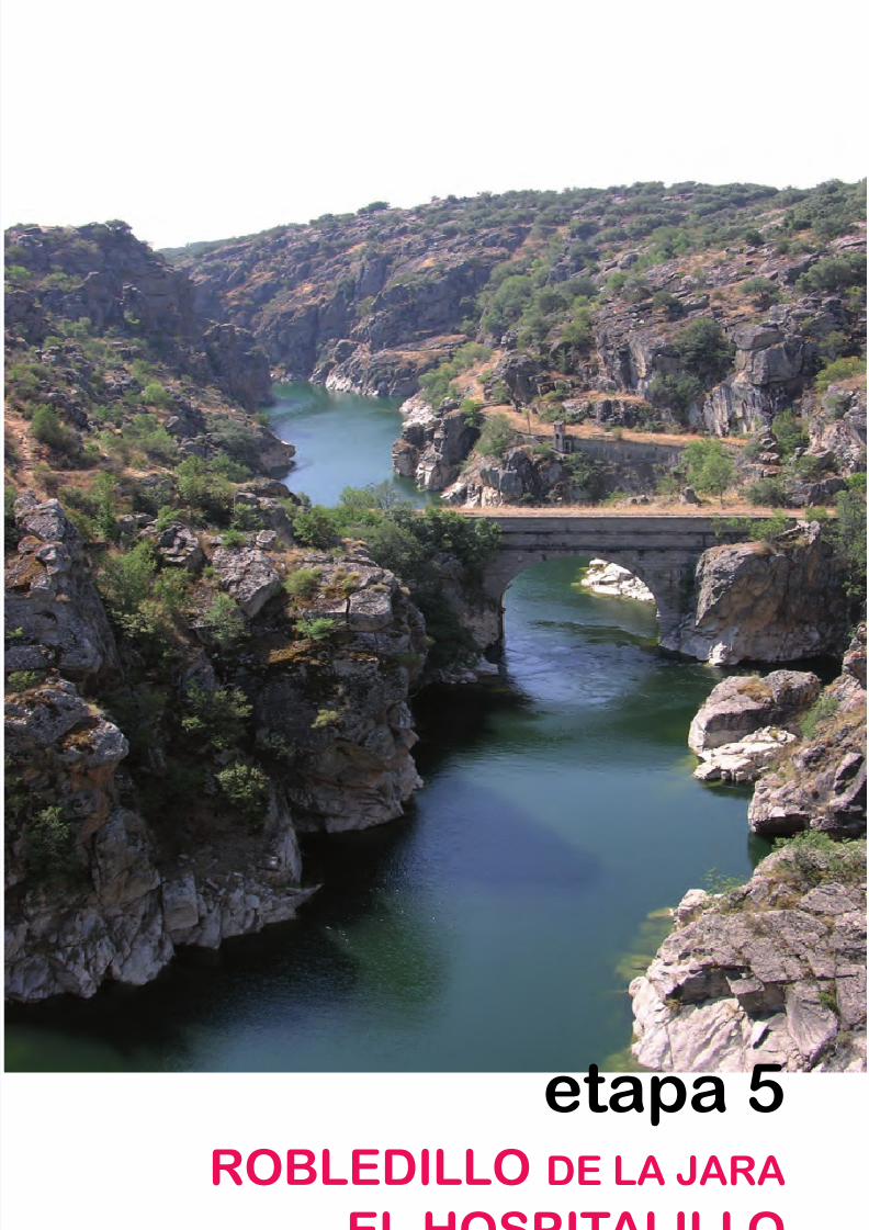
8/3/2019 Libro Senda Del Genaro GR300
http://slidepdf.com/reader/full/libro-senda-del-genaro-gr300 92/156
etapa 5ROBLEDILLO DE LA JARA
EL HOSPITALILLO
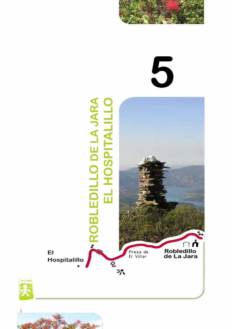
8/3/2019 Libro Senda Del Genaro GR300
http://slidepdf.com/reader/full/libro-senda-del-genaro-gr300 93/156
5
R O
B L E D I L L O
D E L A
J A
R A
E L H O
S P I T A L I L L O
5
102 etapa 5
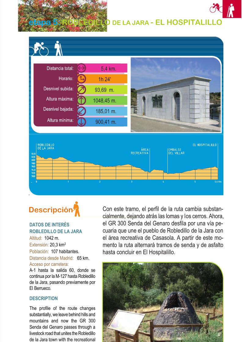
8/3/2019 Libro Senda Del Genaro GR300
http://slidepdf.com/reader/full/libro-senda-del-genaro-gr300 94/156
Descripción
DATOS DE INTERÉSROBLEDILLO DE LA JARA
Altitud: 1042 m.Extensión: 20,3 km2
Población: 107 habitantes.Distancia desde Madrid: 65 km.Acceso por carretera:A-1 hasta la salida 60, donde secontinua por la M-127 hasta Robledillode la Jara, pasando previamente por El Berrueco.
DESCRIPTIONThe profile of the route changessubstantially, we leave behind hills andmountains and now the GR 300Senda del Genaro passes through alivestock road that unites the Robledillode la Jara town with the recreationalarea of Casasola; from this momentthe route will go through parts of track
Con este tramo, el perfil de la ruta cambia substan-cialmente, dejando atrás las lomas y los cerros. Ahora,el GR 300 Senda del Genaro desfila por una vía pe-cuaria que une el pueblo de Robledillo de la Jara con
el área recreativa de Casasola. A partir de este mo-mento la ruta alternará tramos de senda y de asfaltohasta concluir en El Hospitalillo.
103Robledillo de la Jara - El Hospitalillo
etapa 5: ROBLEDILLO DE LA JARA - EL HOSPITALILLO
5,4 km.
1h 24'
93,69 m.
1048,45 m.
185,01 m.
900,41 m.
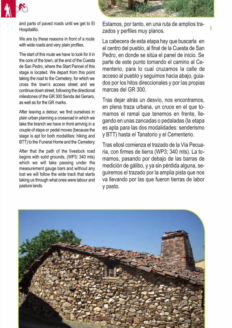
8/3/2019 Libro Senda Del Genaro GR300
http://slidepdf.com/reader/full/libro-senda-del-genaro-gr300 95/156
and parts of paved roads until we get to ElHospitalillo.
We are by these reasons in front of a routewith wide roads and very plain profiles.
The start of this route we have to look for it inthe core of the town, at the end of the Cuestade San Pedro, where the Start Pannel of thisstage is located. We depart from this pointtaking the road to the Cemetery, for which wecross the town’s access street and wecontinue down street, following the directionalmilestones of the GR 300 Senda del Genaro,as well as for the GR marks.
After leaving a detour, we find ourselves inplain urban planning a crossroad in which wetake the branch we have in front arriving in acouple of steps or pedal moves (because thestage is apt for both modalities: hiking andBTT) to the Funeral Home and the Cemetery.
After that the path of the livestock roadbegins with solid grounds, (WP3; 340 mts)which we will take passing under themeasurement gauge bars and without anylost we will follow the wide track that startstaking us through what ones were labour andpasture lands.
Estamos, por tanto, en una ruta de amplios tra-zados y perfiles muy planos.
La cabecera de esta etapa hay que buscarla enel centro del pueblo, al final de la Cuesta de San
Pedro, en donde se sitúa el panel de inicio. Separte de este punto tomando el camino al Ce-menterio, para lo cual cruzamos la calle deacceso al pueblo y seguimos hacia abajo, guia-dos por los hitos direccionales y por las propiasmarcas del GR 300.
Tras dejar atrás un desvío, nos encontramos,en plena traza urbana, un cruce en el que to-
mamos el ramal que tenemos en frente, lle-gando en unas zancadas o pedaladas (la etapaes apta para las dos modalidades: senderismoy BTT) hasta el Tanatorio y el Cementerio.
Tras ellosl comienza el trazado de la Vía Pecua-ria, con firmes de tierra (WP3; 340 mts). La to-mamos, pasando por debajo de las barras demedición de gálibo, y ya sin pérdida alguna, se-
guiremos el trazado por la amplia pista que nosva llevando por las que fueron tierras de labor y pasto.
104 etapa 5
Casa típica situada en
Robledillo de La Jara
8/3/2019 Libro Senda Del Genaro GR300
http://slidepdf.com/reader/full/libro-senda-del-genaro-gr300 96/156
El paisaje es abierto, pudiendo ver algunoselementos de la vida ganadera, como lostinados o los cierres para ganados, situadosa nuestra derecha, más allá del cauce delarroyo Alborrero.
Se sigue por la pista que, tras varios requie-bros, nos coloca como lindero al pinar deCasasola. Seguimos por la pista sin posibilidadde desvío, ahora en leve descenso hasta con-cluir, tras casi 4 kilómetros andados (WP4),ante la carretera M-127, que debemos cruzar,los peatones, con mucho cuidado. Los ciclistasse van por el margen derecho de ésta, hacia eldesvío de Mangirón.
Un vez cruzada la carretera, pronto veremos, alotro lado, en el entorno del Área de Casasola,las señalizaciones del GR. Bordeamos el áreahacia el Oeste, virando sobre ella y dando caraa los barrancos que se abren sobre el brazo deagua que va del Embalse del Villar a El Atazar.
Si tenéis un minuto, merece la pena sentarsey contemplar, no solo la presa, sino las obrasde ingeniería de la zona.
El volteo sobre el pinar de Casasola pronto setermina, pues unas talanqueras nos indican eldesarrollo de la senda, que se echa, laderaabajo, buscando la presa del Villar, que podre-mos contemplar durante la bajada.
Una vez de vuelta a la carretera, cruzamos conprecaución el muro de la presa de El Villar y, alpoco de salir de él, la Senda del Genaro semete por una trocha en ascenso, a modo deatajo, que nos saca de nuevo a la M-127 (WP8;4,6 km). A partir de este momento, un tramo dela ruta irá por el margen de la carretera, por loque se deben extremar las precauciones.
Se pasa por delante de las instalaciones delCanal de Isabel II (WP9; 4,9 km) y se deja elramal asfaltado que va a Mangirón. Seguimoshasta que, un poco más adelante, encontremosa nuestra izquierda el nacimiento de un caminoque nos lleva directos a los paneles de inicio deEl Hospitalillo, punto final de la etapa.
105Robledillo de la Jara - El Hospitalillo
The landscape is open being able to seesome elements of the livestock life like thesheds, or the livestock closing gates, locatedto our right, far away from the Alborrerostream riverbed.
We continue through the track that after some turns leaves us as a boundary line thepine forest of Casasola, we follow the pathwithout any possible detour, now in a lowdescent and in this way until we finish atabout almost 4 kilometres of walking (WP4)before the M-127 road, that we have to cross,the hikers should extreme precautions doingit, the cyclists will go by the right margin of
the road to the Mangiron detour.
Once we have crossed the road, we will soonsee at the other side the signposting of theGR in the surroundings of the Casasola Area,we border this area to the West, turning on itand facing the gullies that open over thewater arm that goes from the Villar reservoir to the Atazar reservoir. If you have a minute
it is worth sitting down to admire not only thedam but also the engineering works of thearea.
The turn around the pine forest of Casasolawill soon come to an end, because somefences will soon indicate the development of the path that will go down hill, searching for the Villar dam that we are going to be able tocontemplate during our way down.
Once we are again at the M-127 road, wecross with precaution the El Villar’s Dam walland soon after exiting it the Senda delGenaro goes in through a narrow path in anascent as a short cut that will take us outagain to the M-127 (WP9; 4,9 km) From thismoment on a part of the route will follow themargin of the paved road, it is because of thiswe have to extreme precautions.
We pass in front of the Canal de Isabel IIinstallations (WP9; 4,9 km) and leave thepaved branch that goes to Mangiron, tocontinue until a bit ahead we find to our leftthe birth of a road that will take us directly tothe El Hospitalillo Start Pannels, and endpoint of our route.
8/3/2019 Libro Senda Del Genaro GR300
http://slidepdf.com/reader/full/libro-senda-del-genaro-gr300 97/156
PARA VER Y VISITAR
Robledillo de la Jara
El pueblo se sitúa en las estribaciones de losllamados Cerros de la Mujer Muerta. Es un te-rritorio atravesado, en dirección Norte-Sur, por una barrera montañosa que oscila y que divideel término en dos vertientes. Una, la oriental,que vierte sus aguas en la cuenca del Riato,afluente del Lozoya, aunque, la actual orogra-fía, marcada con la presencia del Embalse, esdifícil adivinar estas cuestiones. La otra ver-tiente, la occidental, se ubica sobre el propio ríoLozoya, embalsado en esta zona por las dosgrandes presas: El Villar y El Atazar. En ellasvierten sus aguas varios arroyos, como el Abo-rrero y el de la Dehesa, situándose entre ambosel poblamiento de Robledillo, en un terreno des-pejado.
La actual configuración del urbanismo y de la
tierra lo vinculan, a diferencia del resto de lospueblos serranos que configuran la Mancomu-nidad del Embalse del Atazar, con labores decarboneo y explotación forestal, puesto que losequipamiento ganaderos se hallan fuera delpueblo. Además, los huertos de subsistenciatienen escasa incidencia en el paisaje circun-dante, formado por monte bajo, jara y retamas.
La presencia de pinares se localiza en la zonade repoblación, que es la zona de subida desdeel Molino del Riato hacia Matachines. En los va-lles más bajos y encajonados aparecen los ro-bledales autóctonos, mezclados con madroños,encinas...
La presencia de Vías Pecuarias, como la Ca-
ñada Real de La Hiruela, que atraviesa el tér-mino por el noroeste, tras cruzar el Lozoya por el puente medieval de El Villar, nos indica la im-portancia que tuvo este pueblo en la explotaciónlanar. Inicialmente se conocía como Robledillo,suponemos tal topónimo referido a los abundan-tes bosques de robles que poblaron este terri-torio. Luego vendría el calificativo "de la Jara",
que se tomó, únicamente cuando se hizo nece-106 etapa 5
WHAT TO SEE AND VISIT
Robledillo de la Jara
As a town it is located at the foothills of theCerros de la Mujer Muerta. It is a territorycrossed on the North-South by a range of mountains that oscillates and divides thecouncil in to two slopes: an oriental one thatdrops its waters into the Riato’s basin,inflowing of the Lozoya, all though thepresent orography with the presence of theReservoir makes it hard to guess thesematters.
The other slope, the occident one, is locatedover own Lozoya River that is massed in this
area by two big dams: El Villar and El Atazar in which several streams like: Aborrero andthe Dehesa pour out its waters to, locatingin between both of them the Robledillosettlement in a clear terrain.
The present configuration of the urbanplanning and of the land link it in diferenceto the rest of the hillock towns that form theAtazar Reservoir Association, with extraction
of firewood and forest exploitation, due thatthe livestock equipments are outside of thetown and the sustenance orchards have alow incidence in the surrounding landscapeformed by scrub, rockrose and broom.
The presence of pine forests is located in thereforestation area, that is the one to go upfrom the Riato’s Mill to Matachines; in thelower valleys and squeezed in the native oakforests appear, mixed with strawberry treesand holm oaks.
The presence of livestock roads like theCañada Real de La Hiruela that crosses thecouncil on the north-east after crossing theLozoya by the medieval bridge of El Villar indicates to us the importance that this townhad in the wool explotation that also initiallywas known as Robledillo. We suppose thatsuch place name was related to the
abundant oak forests that filled the territory,after the qualification “de la Jara” wouldcome that was took only when it wasnecessary to distinguish it from other townsalso named Robledillo, and that comesfrom the called “Quarto de la Xara” towhich Robledillo belonged to during theadministrative division of the Buitrago Lands.
About the birth of the town it is argued that it
was founded around the XII or XIII centuries,
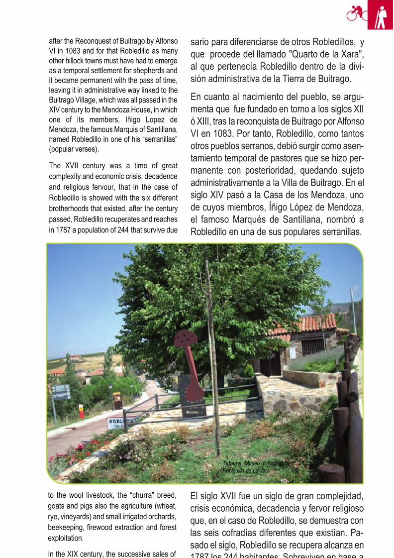
8/3/2019 Libro Senda Del Genaro GR300
http://slidepdf.com/reader/full/libro-senda-del-genaro-gr300 98/156
107Robledillo de la Jara - El Hospitalillo
sario para diferenciarse de otros Robledillos, yque procede del llamado "Quarto de la Xara",al que pertenecía Robledillo dentro de la divi-sión administrativa de la Tierra de Buitrago.
En cuanto al nacimiento del pueblo, se argu-menta que fue fundado en torno a los siglos XIIó XIII, tras la reconquista de Buitrago por AlfonsoVI en 1083. Por tanto, Robledillo, como tantosotros pueblos serranos, debió surgir como asen-tamiento temporal de pastores que se hizo per-manente con posterioridad, quedando sujetoadministrativamente a la Villa de Buitrago. En el
siglo XIV pasó a la Casa de los Mendoza, unode cuyos miembros, Íñigo López de Mendoza,el famoso Marqués de Santillana, nombró aRobledillo en una de sus populares serranillas.
El siglo XVII fue un siglo de gran complejidad,crisis económica, decadencia y fervor religiosoque, en el caso de Robledillo, se demuestra conlas seis cofradías diferentes que existían. Pa-sado el siglo, Robledillo se recupera alcanza en1787 los 244 habitantes. Sobreviven en base ala ganadería lanar (raza churra), al cabrío y al
porcino, a la agricultura (trigo, centeno, viñas y
after the Reconquest of Buitrago by AlfonsoVI in 1083 and for that Robledillo as manyother hillock towns must have had to emergeas a temporal settlement for shepherds andit became permanent with the pass of time,leaving it in administrative way linked to the
Buitrago Village, which was all passed in theXIV century to the Mendoza House, in whichone of its members, Iñigo Lopez deMendoza, the famous Marquis of Santillana,named Robledillo in one of his “serranillas”(popular verses).
The XVII century was a time of greatcomplexity and economic crisis, decadenceand religious fervour, that in the case of
Robledillo is showed with the six differentbrotherhoods that existed, after the centurypassed, Robledillo recuperates and reachesin 1787 a population of 244 that survive due
to the wool livestock, the “churra” breed,goats and pigs also the agriculture (wheat,rye, vineyards) and small irrigated orchards,beekeeping, firewood extraction and forestexploitation.
In the XIX century, the successive sales of Church lands supposed a fundamentalchange to the land and economic structure,
from what it was concentrated only in a few
Taberna Museo Etnográfico,
Robledillo de La Jara
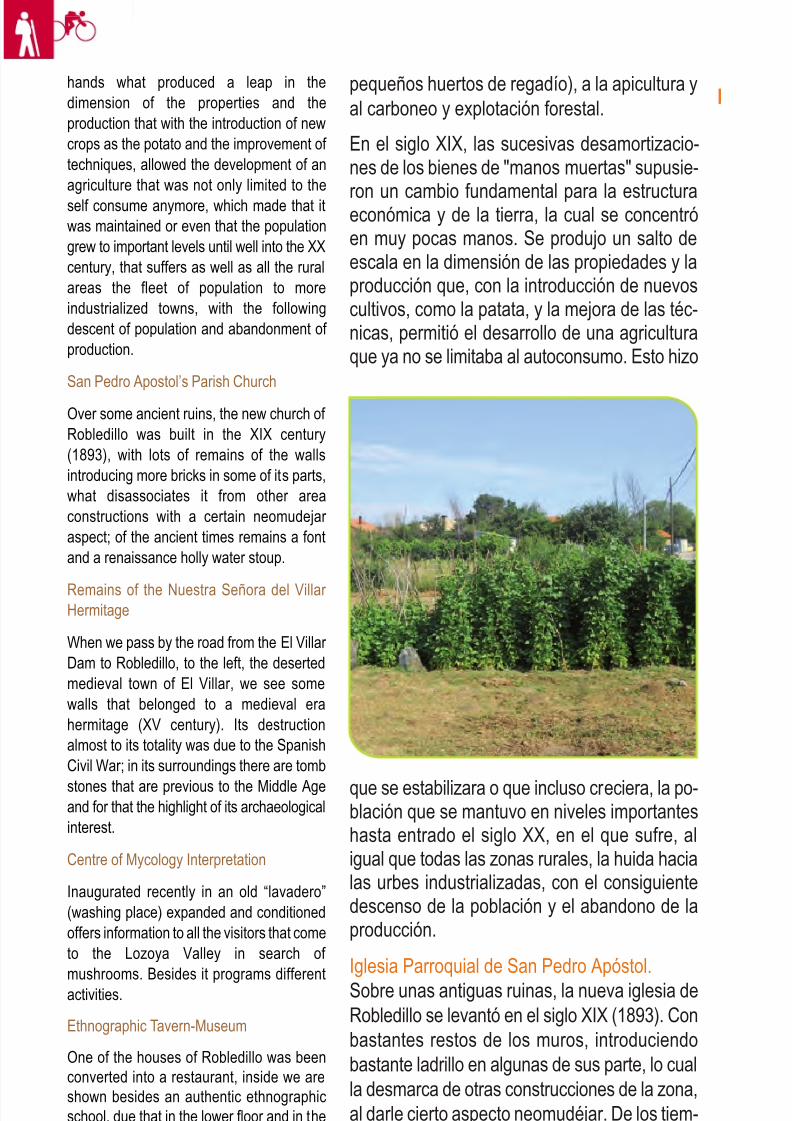
8/3/2019 Libro Senda Del Genaro GR300
http://slidepdf.com/reader/full/libro-senda-del-genaro-gr300 99/156
108 etapa 5
pequeños huertos de regadío), a la apicultura yal carboneo y explotación forestal.
En el siglo XIX, las sucesivas desamortizacio-nes de los bienes de "manos muertas" supusie-
ron un cambio fundamental para la estructuraeconómica y de la tierra, la cual se concentróen muy pocas manos. Se produjo un salto deescala en la dimensión de las propiedades y laproducción que, con la introducción de nuevoscultivos, como la patata, y la mejora de las téc-nicas, permitió el desarrollo de una agriculturaque ya no se limitaba al autoconsumo. Esto hizo
hands what produced a leap in thedimension of the properties and theproduction that with the introduction of newcrops as the potato and the improvement of techniques, allowed the development of anagriculture that was not only limited to theself consume anymore, which made that itwas maintained or even that the populationgrew to important levels until well into the XXcentury, that suffers as well as all the ruralareas the fleet of population to moreindustrialized towns, with the followingdescent of population and abandonment of production.
San Pedro Apostol’s Parish Church
Over some ancient ruins, the new church of Robledillo was built in the XIX century(1893), with lots of remains of the wallsintroducing more bricks in some of its parts,what disassociates it from other areaconstructions with a certain neomudejar aspect; of the ancient times remains a fontand a renaissance holly water stoup.
Remains of the Nuestra Señora del Villar Hermitage
When we pass by the road from the El Villar Dam to Robledillo, to the left, the desertedmedieval town of El Villar, we see somewalls that belonged to a medieval erahermitage (XV century). Its destructionalmost to its totality was due to the SpanishCivil War; in its surroundings there are tomb
stones that are previous to the Middle Ageand for that the highlight of its archaeologicalinterest.
Centre of Mycology Interpretation
Inaugurated recently in an old “lavadero”(washing place) expanded and conditionedoffers information to all the visitors that cometo the Lozoya Valley in search of
mushrooms. Besides it programs differentactivities.
Ethnographic Tavern-Museum
One of the houses of Robledillo was beenconverted into a restaurant, inside we areshown besides an authentic ethnographicschool, due that in the lower floor and in theupper floor there are four thematic spaceswhere we can see how the people that lived
que se estabilizara o que incluso creciera, la po-blación que se mantuvo en niveles importanteshasta entrado el siglo XX, en el que sufre, aligual que todas las zonas rurales, la huida hacialas urbes industrializadas, con el consiguientedescenso de la población y el abandono de laproducción.
Iglesia Parroquial de San Pedro Apóstol.Sobre unas antiguas ruinas, la nueva iglesia deRobledillo se levantó en el siglo XIX (1893). Conbastantes restos de los muros, introduciendobastante ladrillo en algunas de sus parte, lo cualla desmarca de otras construcciones de la zona,al darle cierto aspecto neomudéjar. De los tiem-pos de antaño se conservan una pila bautismaly otra de agua bendita renacentistas.
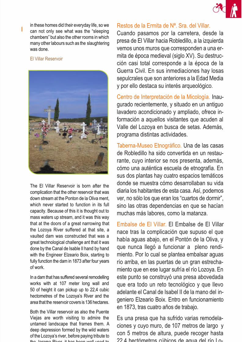
8/3/2019 Libro Senda Del Genaro GR300
http://slidepdf.com/reader/full/libro-senda-del-genaro-gr300 100/156
109Robledillo de la Jara - El Hospitalillo
Restos de la Ermita de Nª. Sra. del Villar.Cuando pasamos por la carretera, desde lapresa de El Villar hacia Robledillo, a la izquierdavemos unos muros que corresponden a una er-mita de época medieval (siglo XV). Su destruc-ción casi total corresponde a la época de laGuerra Civil. En sus inmediaciones hay losassepulcrales que son anteriores a la Edad Mediay por ello destaca su interés arqueológico.
Centro de Interpretación de la Micología. Inau-gurado recientemente, y situado en un antiguolavadero acondicionado y ampliado, ofrece in-
formación a aquellos visitantes que acuden alValle del Lozoya en busca de setas. Además,programa distintas actividades.
Taberna-Museo Etnográfico. Una de las casasde Robledillo ha sido convertida en un restau-rante, cuyo interior se nos presenta, además,cómo una auténtica escuela de etnografía. Ensus dos plantas hay cuatro espacios temáticosdonde se muestra cómo desarrollaban su vidadiaria los habitantes de esta casa. Así, podemosver, no sólo los que eran los “cuartos de dormir”,sino las otras dependencias en que se hacíanmuchas más labores, como la matanza.
Embalse de El Villar. El Embalse de El Villar nace tras la complicación que supuso el que
había aguas abajo, en el Pontón de la Oliva, yque nunca llegó a funcionar a pleno rendi-miento. Por lo cual se plantea embalsar aguasrío arriba, en las puertas de un gran estrecha-miento que en ese lugar sufría el río Lozoya. Eneste punto se construyó una presa abovedadaque era todo un reto tecnológico y que llevoadelante el Canal de Isabel II de la mano del in-
geniero Elzeario Boix. Entro en funcionamientoen 1873, tras cuatro años de trabajo.
Es una presa que ha sufrido varias remodela-ciones y cuyo muro, de 107 metros de largo ycon 5 metros de altura, puede recoger hasta22,4 hectómetros cúbicos de agua del río Lo-zoya. La superficie que ocupa el embalse es de136 hectáreas.
in these homes did their everyday life, so wecan not only see what was the “sleepingchambers” but also the other rooms in whichmany other labours such as the slaughteringwas done.
El Villar Reservoir
The El Villar Reservoir is born after thecomplication that the other reservoir that wasdown stream at the Ponton de la Oliva ment,which never started to function in its fullcapacity. Because of this it is thought out tomass waters up stream, and it was this waythat at the doors of a great narrowing thatthe Lozoya River suffered at that site, avaulted dam was constructed that was agreat technological challenge ant that it wasdone by the Canal de Isable II hand by handwith the Engineer Elzeario Boix, starting tofully function the dam in 1873 after four yearsof work.
In a dam that has suffered several remodellingworks with at 107 meter long wall and50 of height it can pickup up to 22,4 cubichectometres of the Lozoya’s River and thearea that the reservoir covers is 136 hectares.
Both the Villar reservoir as also the PuenteViejas are worth visiting to admire theuntamed landscape that frames them. Adeep depression formed by the wild watersof the Lozoya’s river, before paying tribute tothe Jarama River, it has been well-used toestablish the union between both reservoirs.
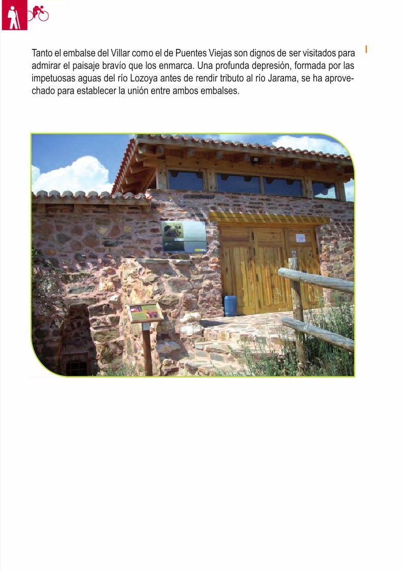
8/3/2019 Libro Senda Del Genaro GR300
http://slidepdf.com/reader/full/libro-senda-del-genaro-gr300 101/156
110 etapa 5
Tanto el embalse del Villar como el de Puentes Viejas son dignos de ser visitados paraadmirar el paisaje bravío que los enmarca. Una profunda depresión, formada por lasimpetuosas aguas del río Lozoya antes de rendir tributo al río Jarama, se ha aprove-chado para establecer la unión entre ambos embalses.
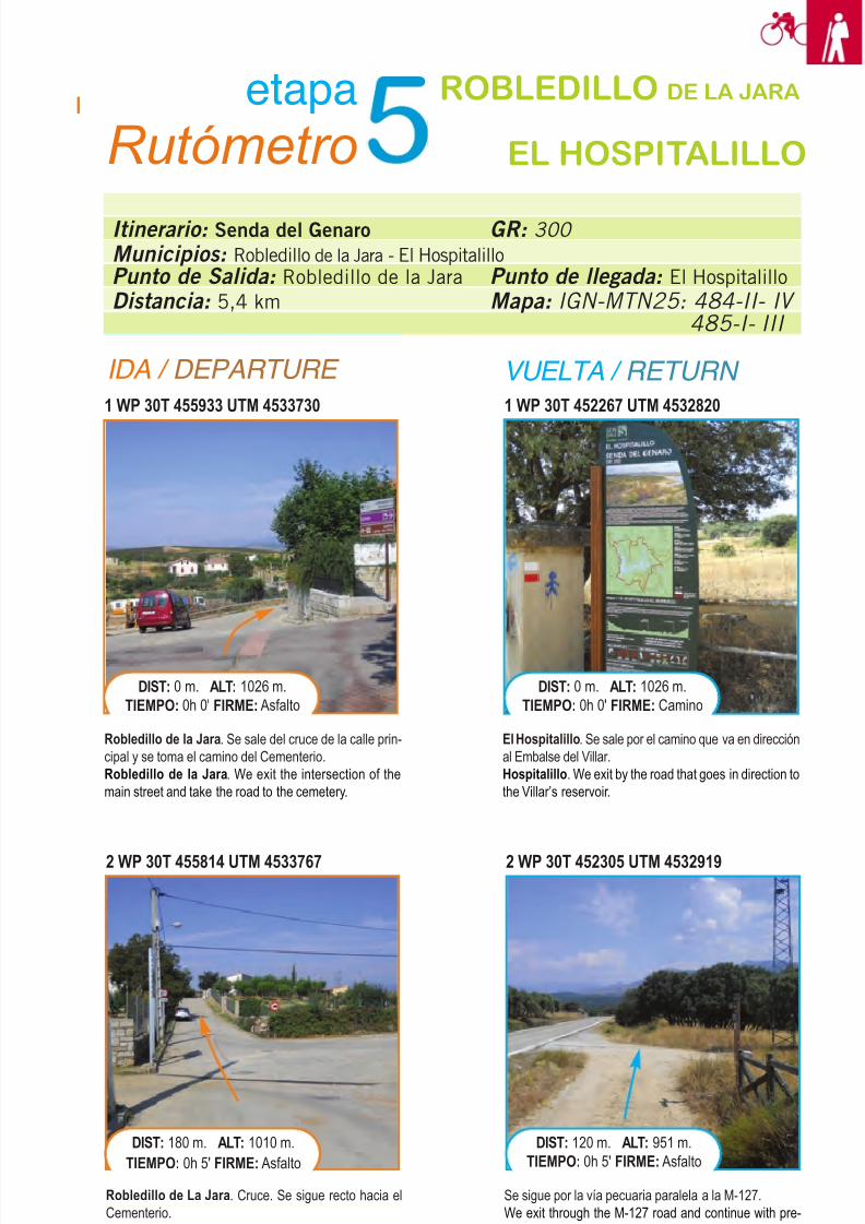
8/3/2019 Libro Senda Del Genaro GR300
http://slidepdf.com/reader/full/libro-senda-del-genaro-gr300 102/156
111Robledillo de la Jara - El Hospitalillo
Itinerario: Senda del Genaro
Municipios: Robledillo de la Jara - El HospitalilloPunto de Salida: Robledillo de la Jara
Distancia: 5,4 km
GR: 300
Punto de llegada: El Hospitalillo
Mapa: IGN-MTN25: 484-II- IV
485-I- III
etapa
Rutómetro
ROBLEDILLO DE LA JARA
EL HOSPITALILLO
IDA / DEPARTURE VUELTA / RETURN
1 WP 30T 455933 UTM 4533730
Robledillo de la Jara. Se sale del cruce de la calle prin-cipal y se toma el camino del Cementerio.Robledillo de la Jara. We exit the intersection of themain street and take the road to the cemetery.
DIST: 0 m. ALT: 1026 m.TIEMPO: 0h 0' FIRME: Asfalto
1 WP 30T 452267 UTM 4532820
El Hospitalillo. Se sale por el camino que va en direcciónal Embalse del Villar.Hospitalillo. We exit by the road that goes in direction tothe Villar’s reservoir.
DIST: 0 m. ALT: 1026 m.TIEMPO: 0h 0' FIRME: Camino
2 WP 30T 455814 UTM 4533767
Robledillo de La Jara. Cruce. Se sigue recto hacia elCementerio.Robledillo de la Jara. Intersection. We continue straightahead to the cemetery.
DIST: 180 m. ALT: 1010 m.TIEMPO: 0h 5' FIRME: Asfalto
2 WP 30T 452305 UTM 4532919
Se sigue por la vía pecuaria paralela a la M-127.We exit through the M-127 road and continue with pre-caution on the verge of the road a few meters.
DIST: 120 m. ALT: 951 m.TIEMPO: 0h 5' FIRME: Asfalto
8/3/2019 Libro Senda Del Genaro GR300
http://slidepdf.com/reader/full/libro-senda-del-genaro-gr300 103/156
5 WP 30T 452820 UTM 4533221
Una vez en el Área Recreativa de Casasola, se bordeaésta hasta dar con la senda que baja abruptamente a laPresa del Villar.Once we are at the Recreational Area we go around it
until we find the path that abruptly goes down to theVillar’s Dam.
DIST: 3940 m. ALT: 933 m.TIEMPO: 0h 56' FIRME: Sendero
5 WP 30T 452639 UTM 4533359
Entronque con la M-127, donde se conecta con las va-riantes BTT. Se gira a la derecha y se cruza la Presa delVillar.Crossroad with the M-17 where it connects with the BTT
variants. We turn to the right and cross the Villar’s Dam.
DIST: 900 m. ALT: 904 m.TIEMPO: 0h 17' FIRME: Asfalto
4 WP 30T 453147 UTM 4533020
Entronque con la carretera M-12. Se cruza para adentrarnosen el pinar del Área Recreativa de Casasola. Las BTT seirán por carretera dirección a la Presa del Villar.Crossroad with the M-12 road. We cross to go into the Re-
creational Area of Cassasola’s pine forest. The BTT variantswill go through the road in direction to the Villar’s Dam.
DIST: 3460 m. ALT: 927 m.TIEMPO: 0h 48' FIRME: Sendero
4 WP 30T 452526 UTM 4533335
Se abandona la M-127 para girar a la derecha por un es-trecho sendero en descenso. Las BTT sigue por la carre-tera hacia la Presa del Villar.We leave the M-127 road to turn right through a narrow
downhill path. The BTT will continue through the road tothe Villar’s Dam.
DIST: 700 m. ALT: 939 m.TIEMPO: 0h 12' FIRME: Senda
Se deja atrás el cementerio y se sigue recto por la VíaPecuaria, camino del Área Recreativa del Villar.We leave behind the cemetery and continue straightahead through the livestock road, in our way to the Re-creational Area of Villar.
DIST: 340 m. ALT: 1011 m.TIEMPO: 0h 8' FIRME: Pista
3 WP 30T 452407 UTM 4533240
Instalaciones del Canal de Isabel II y desvío hacia Man-girón; se pasa ante ellos camino de la Presa del Villar.Canal de Isabel II installations and detour to Mangiron,we pass in front of them on our way to the Villar’s Dam.
DIST: 320 m. ALT: 940 m.TIEMPO: 0h 9' FIRME: Pista
112 etapa 5
3 WP 30T455650 UTM 4533778
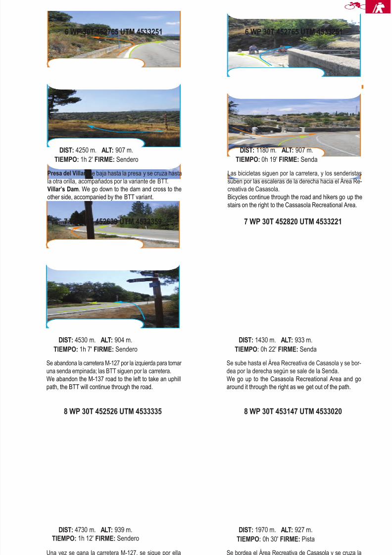
8/3/2019 Libro Senda Del Genaro GR300
http://slidepdf.com/reader/full/libro-senda-del-genaro-gr300 104/156
8 WP 30T 452526 UTM 4533335
Una vez se gana la carretera M-127, se sigue por ellahacia las instalaciones del Canal de Isabel II, juntándoselos dos usos de la Senda, (BTT y sendero).Once we gain the M-127 road we continue through it to
the Canal de Isabel II installations, joining both uses of the Senda (BTT and Hiker).
DIST: 4730 m. ALT: 939 m.TIEMPO: 1h 12' FIRME: Sendero
8 WP 30T 453147 UTM 4533020
Se bordea el Área Recreativa de Casasola y se cruza laM-127 para tomar la Vía Pecuaria que va hacia Robledillo.We go around the Recreational area and cross the M-127road to take the livestock path that goes to Robledillo.
DIST: 1970 m. ALT: 927 m.TIEMPO: 0h 30' FIRME: Pista
7 WP 30T 452639 UTM 4533359
Se abandona la carretera M-127 por la izquierda para tomar una senda empinada; las BTT siguen por la carretera.We abandon the M-137 road to the left to take an uphill
path, the BTT will continue through the road.
DIST: 4530 m. ALT: 904 m.TIEMPO: 1h 7' FIRME: Sendero
7 WP 30T 452820 UTM 4533221
Se sube hasta el Área Recreativa de Casasola y se bor-dea por la derecha según se sale de la Senda.We go up to the Casasola Recreational Area and go
around it through the right as we get out of the path.
DIST: 1430 m. ALT: 933 m.TIEMPO: 0h 22' FIRME: Senda
6 WP 30T 452765 UTM 4533251
Presa del Villar. Se baja hasta la presa y se cruza hastala otra orilla, acompañados por la variante de BTT.Villar’s Dam. We go down to the dam and cross to theother side, accompanied by the BTT variant.
DIST: 4250 m. ALT: 907 m.TIEMPO: 1h 2' FIRME: Sendero
Las bicicletas siguen por la carretera, y los senderistassuben por las escaleras de la derecha hacia el Área Re-creativa de Casasola.Bicycles continue through the road and hikers go up thestairs on the right to the Cassasola Recreational Area.
DIST: 1180 m. ALT: 907 m.TIEMPO: 0h 19' FIRME: Senda
113Robledillo de la Jara - El Hospitalillo
6 WP 30T 452765 UTM 4533251
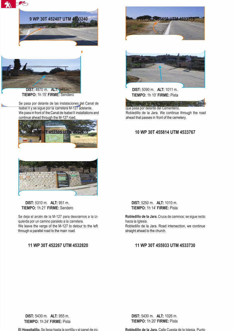
8/3/2019 Libro Senda Del Genaro GR300
http://slidepdf.com/reader/full/libro-senda-del-genaro-gr300 105/156
11 WP 30T 452267 UTM 4532820
El Hospitalillo. Se llega hasta la portilla y el panel de ini-cio de la próxima etapa. Final de etapa.El Hospitalillo. We get to the gate and the start panel of the next stage. End of stage.
DIST: 5430 m. ALT: 955 m.TIEMPO: 1h 24' FIRME: Pista
11 WP 30T 455933 UTM 4533730
Robledillo de la Jara. Calle Cuesta de la Iglesia. Puntofinal de la Etapa.Robledillo de la Jara. Cuesta de la Iglesia street. Endpoint of the stage.
DIST: 5430 m. ALT: 1026 m.TIEMPO: 1h 20' FIRME: Pista
10 WP 30T 452305 UTM 4532919
Se deja el arcén de la M-127 para desviarnos a la iz-quierda por un camino paralelo a la carretera.We leave the verge of the M-127 to detour to the left
through a parallel road to the main road.
DIST: 5310 m. ALT: 951 m.TIEMPO: 1h 21' FIRME: Sendero
10 WP 30T 455814 UTM 4533767
Robledillo de la Jara. Cruce de caminos; se sigue rectohacia la Iglesia.Robledillo de la Jara. Road intersection, we continue
straight ahead to the church.
DIST: 5250 m. ALT: 1010 m.TIEMPO: 1h 14' FIRME: Pista
Se pasa por delante de las instalaciones del Canal deIsabel II y se sigue por la carretera M-127 adelante.We pass in front of the Canal de Isabel II installations andcontinue ahead through the M-127 road.
DIST: 4870 m. ALT: 940 m.TIEMPO: 1h 15' FIRME: Sendero
9 WP 30T 455650 UTM 4533778
Robledillo de la Jara. Se sigue por el camino de frenteque pasa por delante del Cementerio.Robledillo de la Jara. We continue through the roadahead that passes in front of the cemetery.
DIST: 5090 m. ALT: 1011 m.TIEMPO: 1h 10' FIRME: Pista
114 etapa 5
9 WP 30T 452407 UTM 4533240
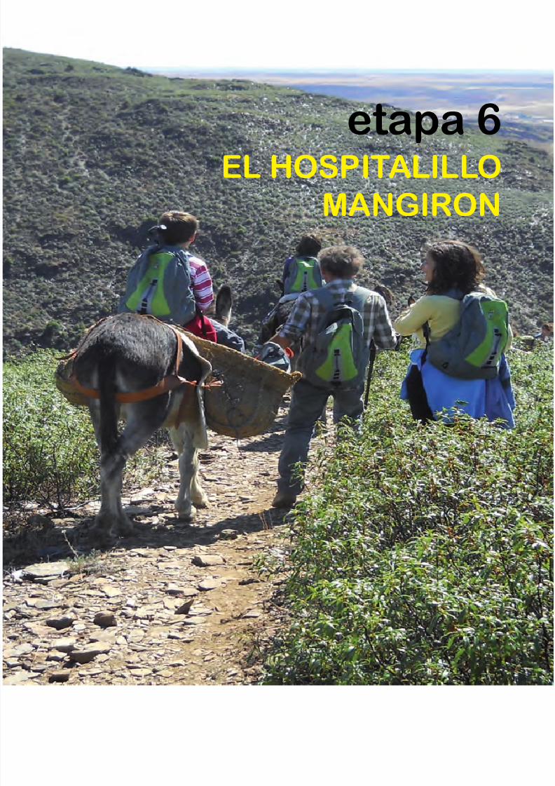
8/3/2019 Libro Senda Del Genaro GR300
http://slidepdf.com/reader/full/libro-senda-del-genaro-gr300 106/156
etapa 6EL HOSPITALILLO
MANGIRON
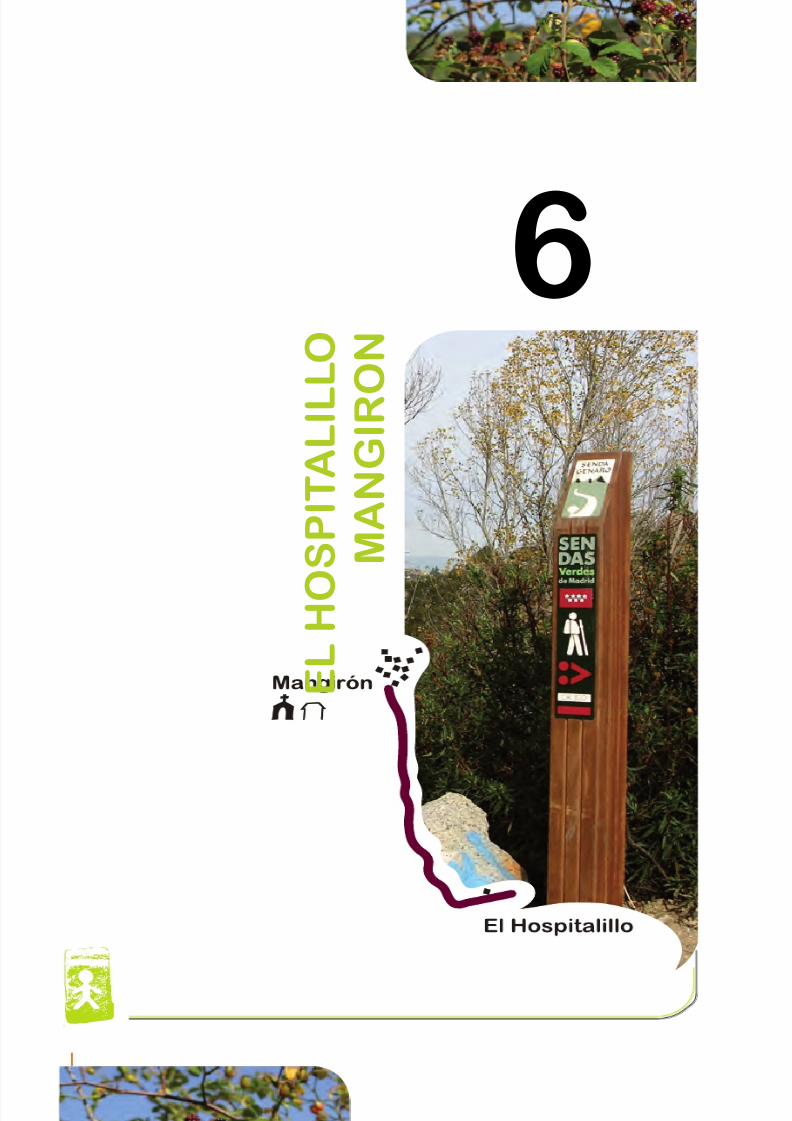
8/3/2019 Libro Senda Del Genaro GR300
http://slidepdf.com/reader/full/libro-senda-del-genaro-gr300 107/156
E L H O
S P I T A L I L L O
M A N G I R O
N
6
118 etapa 6

8/3/2019 Libro Senda Del Genaro GR300
http://slidepdf.com/reader/full/libro-senda-del-genaro-gr300 108/156
Descripción
DATOS DE INTERÉSPUENTES VIEJAS (MANGIRÓN)
Altitud: 1012 m.Extensión: 58 km2
Población: 660 habitantes.
Distancia desde Madrid: 70 km.
Acceso por carretera (Mangirón):
A-1 salida 67 y se toma la carretera
M-135.
DESCRIPTION
As soon as we go down the mountain
we enter specially from Robledillo
into more plain and wooded areas
with a radical change of landscape
and paths. In this occasion we are
before a round trip stage, with almost
any lost and substantial steep.
En cuanto bajamos de la sierra entramos, sobrema-
nera a partir de Robledillo, en zonas más planas y ar-
boladas, con un cambio radical de paisaje y detrazados. En esta ocasión estamos ante una etapa,
también, de ida y vuelta, sin apenas pérdida y sin des-
nivel apreciable.
119El Hospitalillo - Mangiron
etapa 6: EL HOSPITALILLO - MANGIRON
3,03 km.
0h 44'
115,32 m.
1008,55 m.
28,33 m.
921,56 m.
Potro de granito, Mangirón
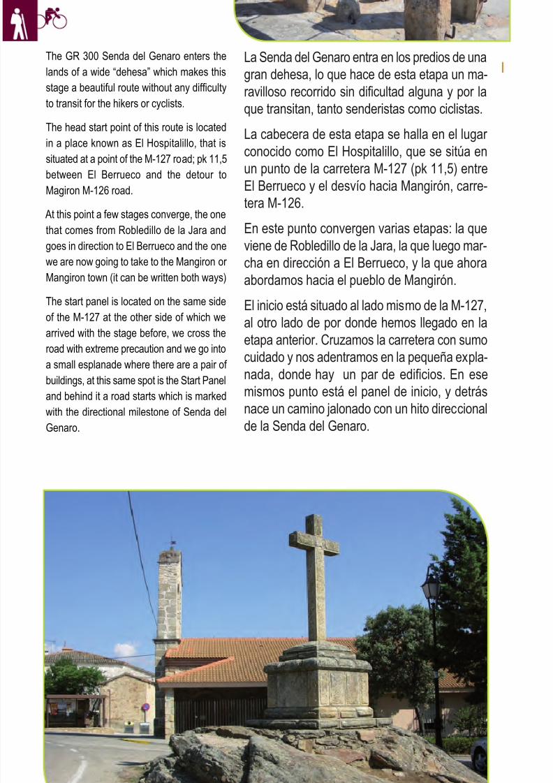
8/3/2019 Libro Senda Del Genaro GR300
http://slidepdf.com/reader/full/libro-senda-del-genaro-gr300 109/156
The GR 300 Senda del Genaro enters the
lands of a wide “dehesa” which makes this
stage a beautiful route without any difficulty
to transit for the hikers or cyclists.
The head start point of this route is located
in a place known as El Hospitalillo, that is
situated at a point of the M-127 road; pk 11,5
between El Berrueco and the detour to
Magiron M-126 road.
At this point a few stages converge, the one
that comes from Robledillo de la Jara and
goes in direction to El Berrueco and the one
we are now going to take to the Mangiron or
Mangiron town (it can be written both ways)
The start panel is located on the same side
of the M-127 at the other side of which we
arrived with the stage before, we cross the
road with extreme precaution and we go into
a small esplanade where there are a pair of
buildings, at this same spot is the Start Panel
and behind it a road starts which is marked
with the directional milestone of Senda delGenaro.
La Senda del Genaro entra en los predios de una
gran dehesa, lo que hace de esta etapa un ma-
ravilloso recorrido sin dificultad alguna y por la
que transitan, tanto senderistas como ciclistas.
La cabecera de esta etapa se halla en el lugar conocido como El Hospitalillo, que se sitúa en
un punto de la carretera M-127 (pk 11,5) entre
El Berrueco y el desvío hacia Mangirón, carre-
tera M-126.
En este punto convergen varias etapas: la que
viene de Robledillo de la Jara, la que luego mar-
cha en dirección a El Berrueco, y la que ahora
abordamos hacia el pueblo de Mangirón.
El inicio está situado al lado mismo de la M-127,
al otro lado de por donde hemos llegado en la
etapa anterior. Cruzamos la carretera con sumo
cuidado y nos adentramos en la pequeña expla-
nada, donde hay un par de edificios. En ese
mismos punto está el panel de inicio, y detrás
nace un camino jalonado con un hito direccionalde la Senda del Genaro.
120 etapa 6
Crucero El Gusin, Mangirón
8/3/2019 Libro Senda Del Genaro GR300
http://slidepdf.com/reader/full/libro-senda-del-genaro-gr300 110/156
Se va pues, la ruta, por entre muros de granito
que cierran las antiguas praderías, con densi-
dad de mata arbórea. Robles melojos (rebollos)
y encinas salpican nuestro recorrido. En un en-
tronque con un camino amplio, se gira por un
desvío que se abre a la derecha, y que se aden-
tra entre la arboleda. El punto exacto para poder
ver bien el giro que toma rumbo Norte (WP3;
470 mts) lo marcan las talanqueras.
A partir de este momento el sendero va menos
encajonado; entra en veredas más abiertas,circundadas por un largo cierre de piedra gra-
nítica. Lo podemos ver a la derecha, y lo per-
demos de vista a la altura del Prado de las
Monjas, lugar en el cual podemos entrever lo
amplio de la Dehesa.
Se nos abren al paso algunos senderos, pero
nuestra ruta sigue sin pérdida, rumbo Norte, pa-
sando, a partir de este momento a las lindes
graníticas que cierran los prados que nos que-
dan a la izquierda. Desde el Gamonal, entrare-
mos en una bella calleja, cerrada a ambos lados
por esas vetustas lajas de granito que dan al
trazado su aire medieval.
121El Hospitalillo - Mangiron
So the path goes in between granitic walls
that close up the old grasslands scattered
with trees. Oaks and holm oaks splash our
route, a junction with a wide road in which
we turn through a detour that opens to the
right and that goes into the wooded area and
that is marked by gates to be able to see
very well the turn that starts going North.
(WP3; 470 mts)
From this moment the path is less narrow
because it goes in more open paths,
surrounded in all case by a granitic wall
closure that we can see to the right and that
we will loose sight of at the Prado de las
Monjas, place where we can see the
wideness of the Dehesa.
Some paths open through out our track, but
our route continues with out a loss going
North, passing from this moment to the
granitic borders that close the meadows that
are to our left, and after Gamonal we will go
in a beautiful road closed on both sides by
this ancient granitic slates that give the route
a medieval air.
It is true that this stage breaks almost
radically with the ones before, so much as
for slopes as for the composition of the
environment, here we are in the open valley,
swarming with “dehesas” and bigger spaces
dedicated to livestock, planted almost in its
totality with oaks and holm oaks, even
though the presence of livestock is residual
or testimonial.
When the path goes in between two walls,
it offers us a beauty of forms and vegetable
structures; moss and lichen colonize all over
this granitic layer, presenting arabesque sets
of thousand forms and tonalities.
We continue walking and soon we come
out at the birth of the Livestock Road (WP4;
2,5 km) a few steps more and we are at the
M-126 road, that we have to cross, extremeout the precautions, we take a road that
goes next to the main road and that takes us
without any problems into Mangiron, just in
front of the Descansadero.
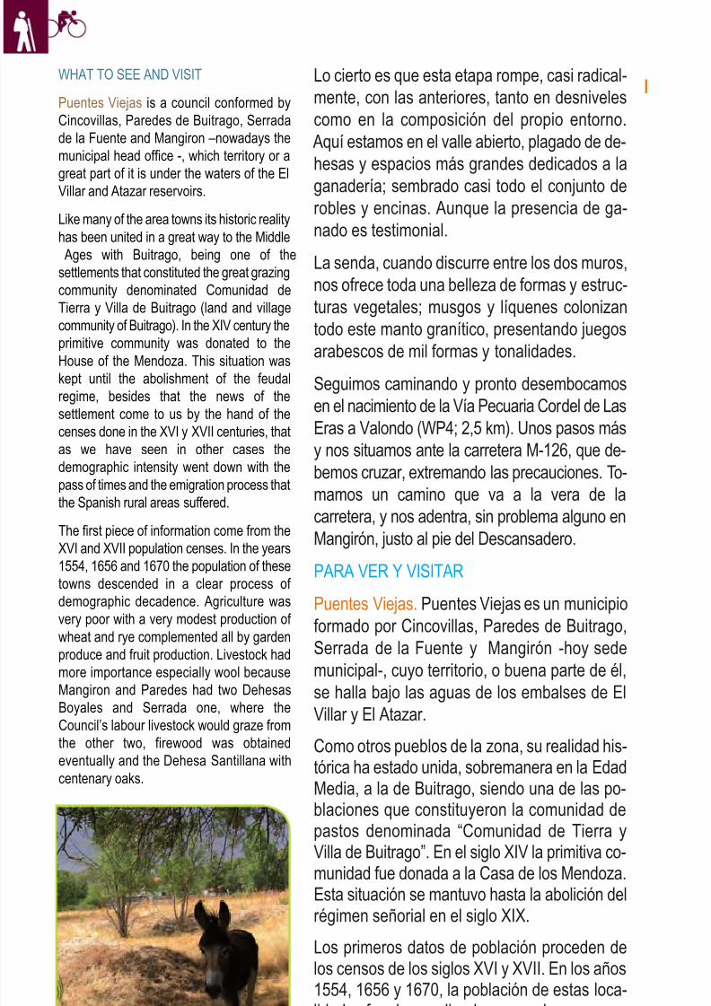
8/3/2019 Libro Senda Del Genaro GR300
http://slidepdf.com/reader/full/libro-senda-del-genaro-gr300 111/156
Lo cierto es que esta etapa rompe, casi radical-
mente, con las anteriores, tanto en desniveles
como en la composición del propio entorno.
Aquí estamos en el valle abierto, plagado de de-
hesas y espacios más grandes dedicados a la
ganadería; sembrado casi todo el conjunto de
robles y encinas. Aunque la presencia de ga-
nado es testimonial.
La senda, cuando discurre entre los dos muros,
nos ofrece toda una belleza de formas y estruc-
turas vegetales; musgos y líquenes colonizan
todo este manto granítico, presentando juegos
arabescos de mil formas y tonalidades.
Seguimos caminando y pronto desembocamos
en el nacimiento de la Vía Pecuaria Cordel de Las
Eras a Valondo (WP4; 2,5 km). Unos pasos más
y nos situamos ante la carretera M-126, que de-
bemos cruzar, extremando las precauciones. To-
mamos un camino que va a la vera de la
carretera, y nos adentra, sin problema alguno en
Mangirón, justo al pie del Descansadero.
PARA VER Y VISITAR
Puentes Viejas. Puentes Viejas es un municipio
formado por Cincovillas, Paredes de Buitrago,
Serrada de la Fuente y Mangirón -hoy sede
municipal-, cuyo territorio, o buena parte de él,
se halla bajo las aguas de los embalses de El
Villar y El Atazar.
Como otros pueblos de la zona, su realidad his-tórica ha estado unida, sobremanera en la EdadMedia, a la de Buitrago, siendo una de las po-blaciones que constituyeron la comunidad depastos denominada “Comunidad de Tierra yVilla de Buitrago”. En el siglo XIV la primitiva co-
munidad fue donada a la Casa de los Mendoza.Esta situación se mantuvo hasta la abolición delrégimen señorial en el siglo XIX.
Los primeros datos de población proceden delos censos de los siglos XVI y XVII. En los años1554, 1656 y 1670, la población de estas loca-lidades fue descendiendo, en un claro procesode decadencia demográfica. La agricultura era
122 etapa 6
WHAT TO SEE AND VISIT
Puentes Viejas is a council conformed by
Cincovillas, Paredes de Buitrago, Serrada
de la Fuente and Mangiron –nowadays the
municipal head office -, which territory or a
great part of it is under the waters of the ElVillar and Atazar reservoirs.
Like many of the area towns its historic reality
has been united in a great way to the Middle
Ages with Buitrago, being one of the
settlements that constituted the great grazing
community denominated Comunidad de
Tierra y Villa de Buitrago (land and village
community of Buitrago). In the XIV century the
primitive community was donated to the
House of the Mendoza. This situation was
kept until the abolishment of the feudal
regime, besides that the news of the
settlement come to us by the hand of the
censes done in the XVI y XVII centuries, that
as we have seen in other cases the
demographic intensity went down with the
pass of times and the emigration process that
the Spanish rural areas suffered.
The first piece of information come from theXVI and XVII population censes. In the years
1554, 1656 and 1670 the population of these
towns descended in a clear process of
demographic decadence. Agriculture was
very poor with a very modest production of
wheat and rye complemented all by garden
produce and fruit production. Livestock had
more importance especially wool because
Mangiron and Paredes had two Dehesas
Boyales and Serrada one, where theCouncil’s labour livestock would graze from
the other two, firewood was obtained
eventually and the Dehesa Santillana with
centenary oaks.
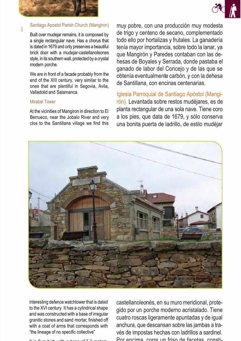
8/3/2019 Libro Senda Del Genaro GR300
http://slidepdf.com/reader/full/libro-senda-del-genaro-gr300 112/156
123El Hospitalillo - Mangiron
muy pobre, con una producción muy modestade trigo y centeno de secano, complementadotodo ello por hortalizas y frutales. La ganaderíatenía mayor importancia, sobre todo la lanar, yaque Mangirón y Paredes contaban con las de-
hesas de Boyales y Serrada, donde pastaba elganado de labor del Concejo y de las que seobtenía eventualmente carbón, y con la dehesade Santillana, con encinas centenarias.
Iglesia Parroquial de Santiago Apóstol (Mangi-
rón). Levantada sobre restos mudéjares, es de
planta rectangular de una sola nave. Tiene coro
a los pies, que data de 1679, y sólo conservauna bonita puerta de ladrillo, de estilo mudéjar
castellanoleonés, en su muro meridional, prote-
gido por un porche moderno acristalado. Tiene
cuatro roscas ligeramente apuntadas y de igual
anchura, que descansan sobre las jambas a tra-
vés de impostas hechas con ladrillos a sardinel.
Por encima, corre un friso de facetas, consti-
tuido por hilada de tres ladrillos superpuestos.
Santiago Apostol Parish Church (Mangiron)
Built over mudejar remains, it is composed by
a single rectangular nave. Has a chorus that
is dated in 1679 and only preserves a beautiful
brick door with a mudejar-castellanoleones
style, in its southern wall, protected by a crystalmodern porche.
We are in front of a facade probably from the
end of the XIII century, very similar to the
ones that are plentiful in Segovia, Avila,
Valladolid and Salamanca.
Mirabel Tower
At the vicinities of Mangiron in direction to El
Berrueco, near the Jobalo River and veryclos to the Santillana village we find this
interesting defence watchtower that is dated
to the XVI century. It has a cylindrical shape
and was constructed with a base of irregular
granitic stones and sand mortar, finished off
with a coat of arms that corresponds with
“the lineage of no specific collective”
It is 8 m high with a base of 5,3 meters,
completely hollow, it was divided in two
Museo de la piedra, Mangirón
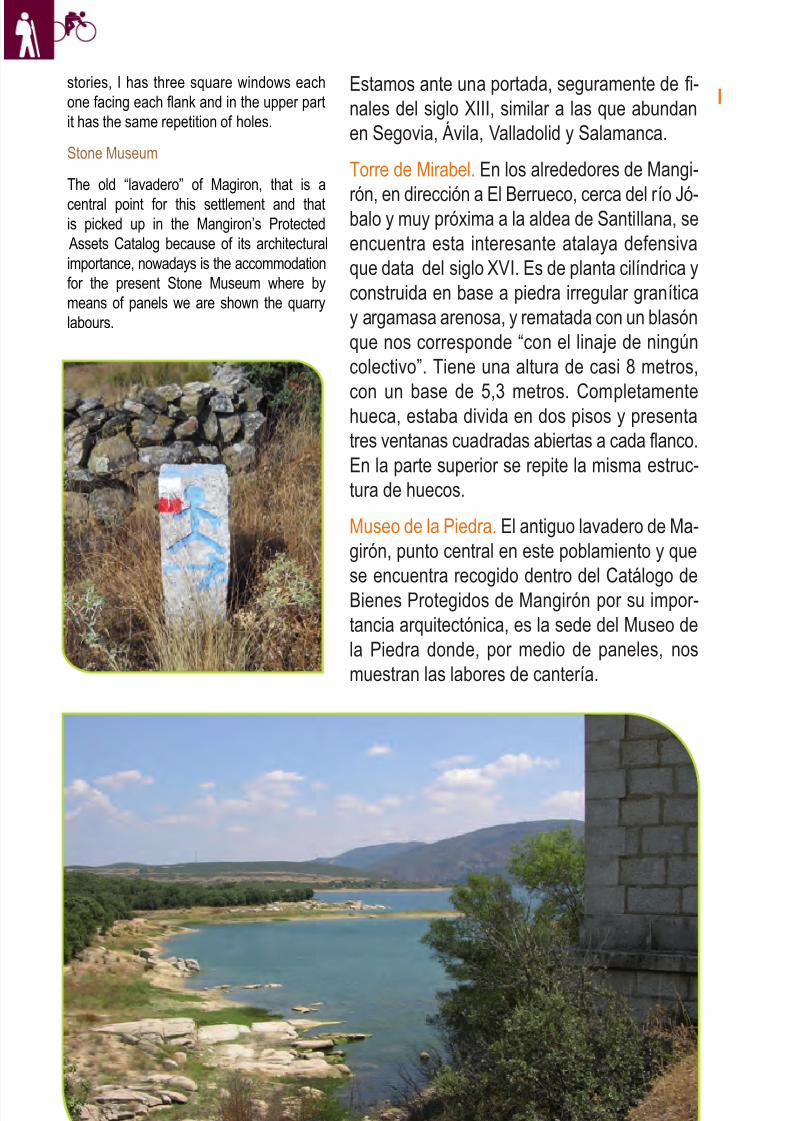
8/3/2019 Libro Senda Del Genaro GR300
http://slidepdf.com/reader/full/libro-senda-del-genaro-gr300 113/156
124 etapa 6
Estamos ante una portada, seguramente de fi-nales del siglo XIII, similar a las que abundanen Segovia, Ávila, Valladolid y Salamanca.
Torre de Mirabel. En los alrededores de Mangi-
rón, en dirección a El Berrueco, cerca del río Jó-balo y muy próxima a la aldea de Santillana, seencuentra esta interesante atalaya defensivaque data del siglo XVI. Es de planta cilíndrica yconstruida en base a piedra irregular graníticay argamasa arenosa, y rematada con un blasónque nos corresponde “con el linaje de ningúncolectivo”. Tiene una altura de casi 8 metros,
con un base de 5,3 metros. Completamentehueca, estaba divida en dos pisos y presentatres ventanas cuadradas abiertas a cada flanco.En la parte superior se repite la misma estruc-tura de huecos.
Museo de la Piedra. El antiguo lavadero de Ma-girón, punto central en este poblamiento y quese encuentra recogido dentro del Catálogo deBienes Protegidos de Mangirón por su impor-tancia arquitectónica, es la sede del Museo dela Piedra donde, por medio de paneles, nosmuestran las labores de cantería.
stories, I has three square windows each
one facing each flank and in the upper part
it has the same repetition of holes.
Stone Museum
The old “lavadero” of Magiron, that is a
central point for this settlement and that
is picked up in the Mangiron’s Protected
Assets Catalog because of its architectural
importance, nowadays is the accommodation
for the present Stone Museum where by
means of panels we are shown the quarry
labours.
8/3/2019 Libro Senda Del Genaro GR300
http://slidepdf.com/reader/full/libro-senda-del-genaro-gr300 114/156
Itinerario: Senda del Genaro
Municipios: El Hospitalillo - MangironPunto de Salida: El HospitalilloDistancia: 3.03 km
GR: 300
Punto de llegada: Mangiron
Mapa: IGN-MTN25: 484-II- IV
485-I- III
etapa
Rutómetro
EL HOSPITALILLO
MANGIRON
IDA / DEPARTURE VUELTA / RETURN
1 WP 30T 452260 UTM 4532836
El Hospitalillo. Seguimos paralelos a la carretera y al
cierre de la finca, camino del cruce con la carretera
R-127.
El Hospitalillo. We continue parallel to the main road and
the private property closure, way to the intersection with
the R-127 road.
DIST: 0 m. ALT: 958 m.
TIEMPO: 0h 0' FIRME: Sendero
1 WP 30T 451190 UTM 4534906
Mangiron. Se parte del Descansadero; se cruza la ca-
rretera y se toma por un lateral de esta.
Mangiron. We start at the resting area. We cross the road
and take a lateral of it.
DIST: 0 m. ALT: 988 m.
TIEMPO: 0h 0' FIRME: Senda
2 WP 30T 452199 UTM 4532800
Se cruza la carretera M-127 y se bordea la nave tomando
un camino que está por encima.
We cross the M-127 and go around the factory taking a
road that is next to it.
DIST: 90 m. ALT: 964 m.
TIEMPO: 0h 1' FIRME: Asfalto
2 WP 30T 451315 UTM 4534612
Se cuza la carretera M-126 y se toma por el camino que
se abre a la derecha.
We cross the M-126 road and take the road that opens
to the right.
DIST: 360 m. ALT: 1000 m.
TIEMPO: 4' FIRME: Camino
125El Hospitalillo - Mangiron
8/3/2019 Libro Senda Del Genaro GR300
http://slidepdf.com/reader/full/libro-senda-del-genaro-gr300 115/156
5 WP 30T 451315 UTM 4534612
Mangiron. Se cruza la carretera M-126 y se sigue por elramal izquierdo para tomar el camino que nace un pocomás allá y que va paralelo a esta.Mangiron. We cross the M-126 road and continue
through the left branch to take the road that starts a bitfurther ahead and that goes parallel to this one.
DIST: 2940 m. ALT: 1000 m.
TIEMPO: 0h 40' FIRME: Sendero
5 WP 30T 452199 UTM 4532800
El Hospitalillo. Se sale a la zona del panel de inicio, al
pie de la carretera de El Berrueco.
El Hospitalillo. We exit to the start panel area at the foot
of the road to El Berrueco.
DIST: 2940 m. ALT: 964 m.
TIEMPO: 0h 40' FIRME: Camino
4 WP 30T 451334 UTM 4534484
Mangiron: Punto de derivación entra la Senda Genaro y
la Vía Pecuaria (naranja).
Mangiron. Derivation point between the Senda del Ge-
naro and the livestock road. (orange).
DIST: 2540 m. ALT: 1007 m.
TIEMPO: 0h 36' FIRME: Sendero
4 WP 30T 451933 UTM 4532674
Entronque con camino; se gira a la izquierda en dirección
al Hospitalillo.
Intersection with a road, we turn left in direction to El Hos-
pitalillo.
DIST: 2560 m. ALT: m.
TIEMPO: 0h 35' FIRME: Camino
Se gira a la derecha, entrando por entre la talanquera,
dejando el camino que llevábamos.
We turn right going in by the gate leaving the road that
we were taking.
DIST: 470 m. ALT: 980 m.
TIEMPO: 0h 11' FIRME: Sendero
3 WP 30T 451334 UTM 4534484
Se sigue de frente entrando en un camino que va entre
muros.
We continue straight ahead entering a road that goes in
between walls.
DIST: 490 m. ALT: 1007 m.
TIEMPO: 0h 6' FIRME: Camino
126 etapa 6
3 WP 30T 451933 UTM 4532674
8/3/2019 Libro Senda Del Genaro GR300
http://slidepdf.com/reader/full/libro-senda-del-genaro-gr300 116/156
6 WP 30T 451190 UTM 4534906
Mangiron. Descansadero y fin de la etapa.
Mangiron. Resting area and end of the stage.
DIST: 3030 m. ALT: 998 m.
TIEMPO: 0h 44' FIRME: Sendero
El Hospitalillo. Fin de la etapa.
El Hospitalillo. End of the stage.
DIST: 3030 m. ALT: 964 m.
TIEMPO: 0h 41' FIRME:
127El Hospitalillo - Mangiron
6 WP 30T 452260 UTM 4532836
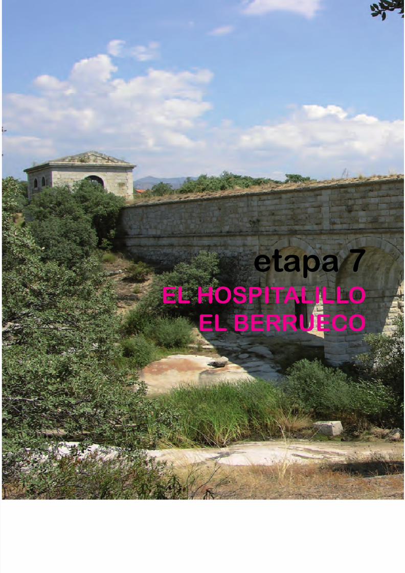
8/3/2019 Libro Senda Del Genaro GR300
http://slidepdf.com/reader/full/libro-senda-del-genaro-gr300 117/156
etapa 7
EL HOSPITALILLOEL BERRUECO
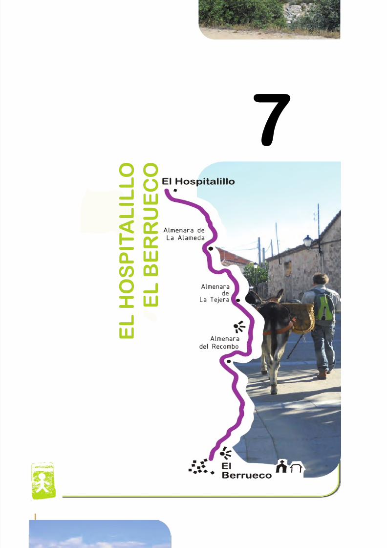
8/3/2019 Libro Senda Del Genaro GR300
http://slidepdf.com/reader/full/libro-senda-del-genaro-gr300 118/156
7
E L H O
S P I T A L I L L O
E L
B E R R U E C
O
7
130 etapa 7
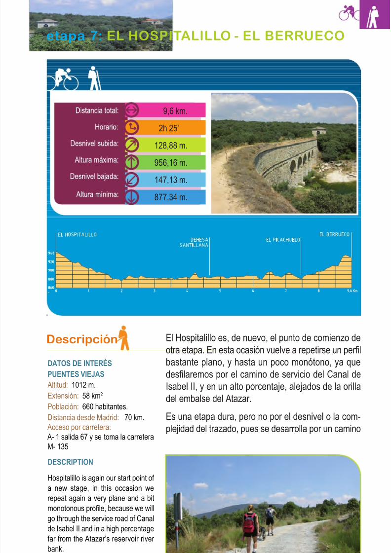
8/3/2019 Libro Senda Del Genaro GR300
http://slidepdf.com/reader/full/libro-senda-del-genaro-gr300 119/156
Descripción
DATOS DE INTERÉSPUENTES VIEJAS
Altitud: 1012 m.Extensión: 58 km2
Población: 660 habitantes.
Distancia desde Madrid: 70 km.
Acceso por carretera:
A- 1 salida 67 y se toma la carretera
M- 135
DESCRIPTION
Hospitalillo is again our start point of
a new stage, in this occasion we
repeat again a very plane and a bit
monotonous profile, because we will
go through the service road of Canal
de Isabel II and in a high percentage
far from the Atazar’s reservoir river
bank.
El Hospitalillo es, de nuevo, el punto de comienzo de
otra etapa. En esta ocasión vuelve a repetirse un perfil
bastante plano, y hasta un poco monótono, ya que
desfilaremos por el camino de servicio del Canal de
Isabel II, y en un alto porcentaje, alejados de la orilladel embalse del Atazar.
Es una etapa dura, pero no por el desnivel o la com-
plejidad del trazado, pues se desarrolla por un camino
131El Hospitalillo - El Berrueco
etapa 7: EL HOSPITALILLO - EL BERRUECO
9,6 km.
2h 25'
128,88 m.
956,16 m.
147,13 m.
877,34 m.
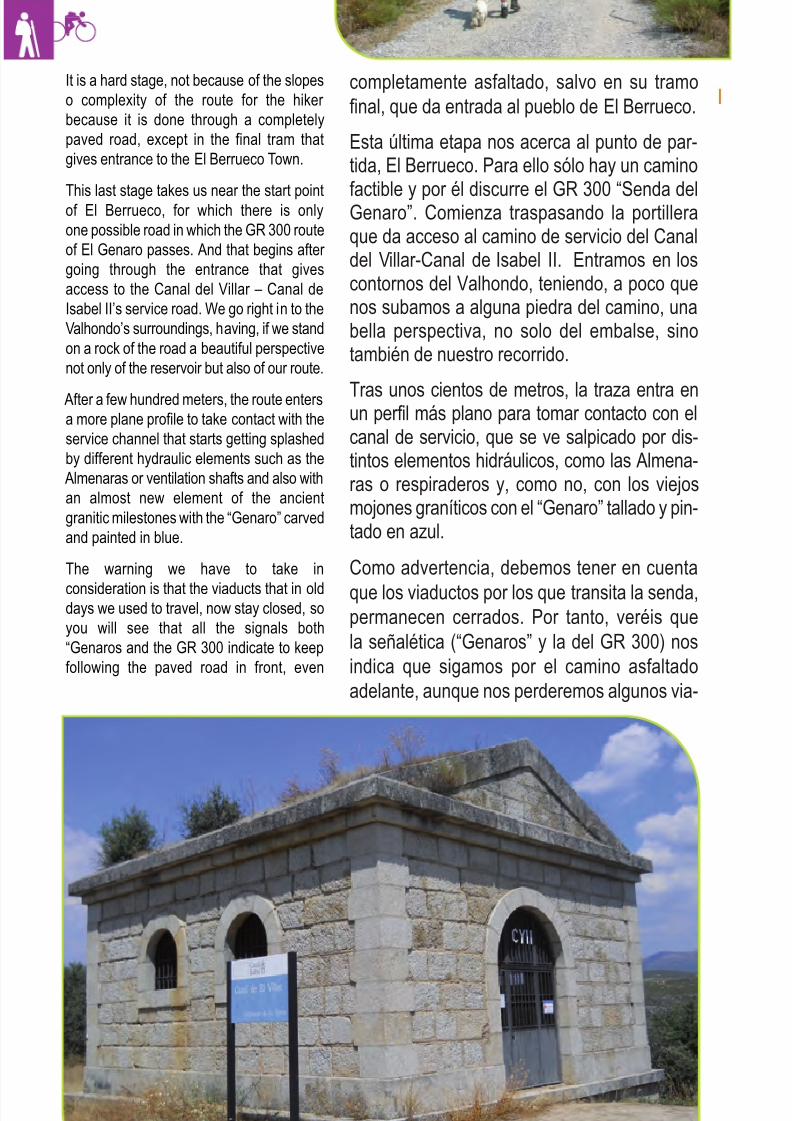
8/3/2019 Libro Senda Del Genaro GR300
http://slidepdf.com/reader/full/libro-senda-del-genaro-gr300 120/156
It is a hard stage, not because of the slopes
o complexity of the route for the hiker
because it is done through a completely
paved road, except in the final tram that
gives entrance to the El Berrueco Town.
This last stage takes us near the start pointof El Berrueco, for which there is only
one possible road in which the GR 300 route
of El Genaro passes. And that begins after
going through the entrance that gives
access to the Canal del Villar – Canal de
Isabel II’s service road. We go right in to the
Valhondo’s surroundings, having, if we stand
on a rock of the road a beautiful perspective
not only of the reservoir but also of our route.
After a few hundred meters, the route enters
a more plane profile to take contact with the
service channel that starts getting splashed
by different hydraulic elements such as the
Almenaras or ventilation shafts and also with
an almost new element of the ancient
granitic milestones with the “Genaro” carved
and painted in blue.
The warning we have to take in
consideration is that the viaducts that in olddays we used to travel, now stay closed, so
you will see that all the signals both
“Genaros and the GR 300 indicate to keep
following the paved road in front, even
completamente asfaltado, salvo en su tramo
final, que da entrada al pueblo de El Berrueco.
Esta última etapa nos acerca al punto de par-tida, El Berrueco. Para ello sólo hay un camino
factible y por él discurre el GR 300 “Senda delGenaro”. Comienza traspasando la portilleraque da acceso al camino de servicio del Canaldel Villar-Canal de Isabel II. Entramos en loscontornos del Valhondo, teniendo, a poco quenos subamos a alguna piedra del camino, unabella perspectiva, no solo del embalse, sinotambién de nuestro recorrido.
Tras unos cientos de metros, la traza entra enun perfil más plano para tomar contacto con elcanal de servicio, que se ve salpicado por dis-tintos elementos hidráulicos, como las Almena-ras o respiraderos y, como no, con los viejosmojones graníticos con el “Genaro” tallado y pin-tado en azul.
Como advertencia, debemos tener en cuenta
que los viaductos por los que transita la senda,permanecen cerrados. Por tanto, veréis que
la señalética (“Genaros” y la del GR 300) nos
indica que sigamos por el camino asfaltado
adelante, aunque nos perderemos algunos via-
132 etapa 7
Almenara del Canal de Isabel II
8/3/2019 Libro Senda Del Genaro GR300
http://slidepdf.com/reader/full/libro-senda-del-genaro-gr300 121/156
ductos, más próximos a la orilla del embalse.
Los veremos desde la distancia, pudiendo con-
templar las almenaras de Tejera (WP8) y Re-
combo (WP11). Estos edificios sirven como
aliviaderos y zonas de control de las aguas. En
las inmediaciones de Recombo, veremos un
viaducto de 58 mts. de longitud.
También podemos ver los respiraderos, unas to-
rretas panzudas que encontramos de forma re-
petida por los aledaños del canal. La obra
cumbre es el viaducto de la Alameda, con 5 ojos
de unos 6 metros de luz cada uno y 103 metros
de longitud, lo que permite el paso del canal por encima del arroyo de la Alameda.
Todo esto, lo vamos a poder contemplar a nues-
tra izquierda; a la derecha, donde el encinar se
hace intenso e inmenso, se encuentra la fa-
mosa dehesa de Santillana y unos hermosos
edificios, que sólo veremos cuando pasamos
por la M-127, entre El Berrueco y la Presa del
Villar).
Nuestra ruta sigue, carril asfaltado adelante,
continuamente jalonada por hitos de piedra y di-
reccionales del GR 300. Ahora los viaductos
están cerrados al paso, por tanto, seguimos
adelante. En el kilometro 7,4 (WP11) un desvío
nos lleva hacia el Restaurante y el Camping del
Picachuelo.
Se sigue por el camino de servicio, dejando
atrás el desvío hacia el Restaurante. En estos
últimos kilómetros circulamos ya con vistas más
francas sobre el contorno, sin que nos moleste
el arbolado y la retama. Podemos ver buena
parte de nuestro recorrido, al menos las cuerdas
por las que circula la Senda del Genaro y, como
no, Cervera de Buitrago y su estación náutica.
Cruzamos la portillera (7,8 km) para seguir por
la carretera que va en dirección a una nueva ur-
banización. Antes de llegar al grueso de las
casas nos desviamos a la izquierda y pasamos
entre unas talanqueras (WP13; 8,1 km) que
133El Hospitalillo - El Berrueco
though we miss some viaducts that stay
more to the reservoir’s shore, we can see
them in the distance being able to
contemplate the Tejera’s almenaras (WP8)
and Recombo (WP11). These buildings
serve as overflow channels and water
control areas such is the case of Recomboin which its vicinity has a 58 meters long
viaduct.
We can also see the ventilation shafts,
potbellied towers that we see in a repeated
way through out the land bordering of the
channel and of course the masterpiece is the
Alameda’s viaduct with 5 eyes of about 6
meters of light each one and 103 meters
long which allows pass of the channel over the Alameda’s stream.
We are going to contemplate all these to our
left, on the right where the grove becomes
intense and vast we find the famous “dehesa
de Santillana” and some beautiful buildings
that we don’t see, all though when we travel
through the M127 between El Berrueco and
the Villar’s Dam we can see them at the foot
of the road.
Our route follows the paved lane in front, that
constantly is marked by granitic milestones
“genaros” and additional direction milestones
of the GR 300 Genaro’s Route; and now t
he viaducts are closed to the pass, so we
fallow the paved lane infront, in the 7,4
kilometer (WP11) there is a detour to the
Restaurant and Trailer park Picachuelo.
So, we continue following the service road,leaving behind the detour to the restaurant,
in these last few trams we walk with very
franc views of the landmark, the woodland
and the broom don’t bother us anymore and
we can now see a good part of our route, at
least the lines in which the GR 300 Genaro’s
route passes and also Cervera de Buitrago
and its nautical station.
We cross the gate at 7,8 km to continue
through the road in front that goes in
direction to a new suburb, before we get to
the houses we detour to the left to pass
between some gates (WP13; 8,1 km) that
shows us the entrance, we go deep between
orchards and fields, an old road that starts
taking some height until it comes out to the
M-127 road at the El Berrueco’s doors.
(WP15).
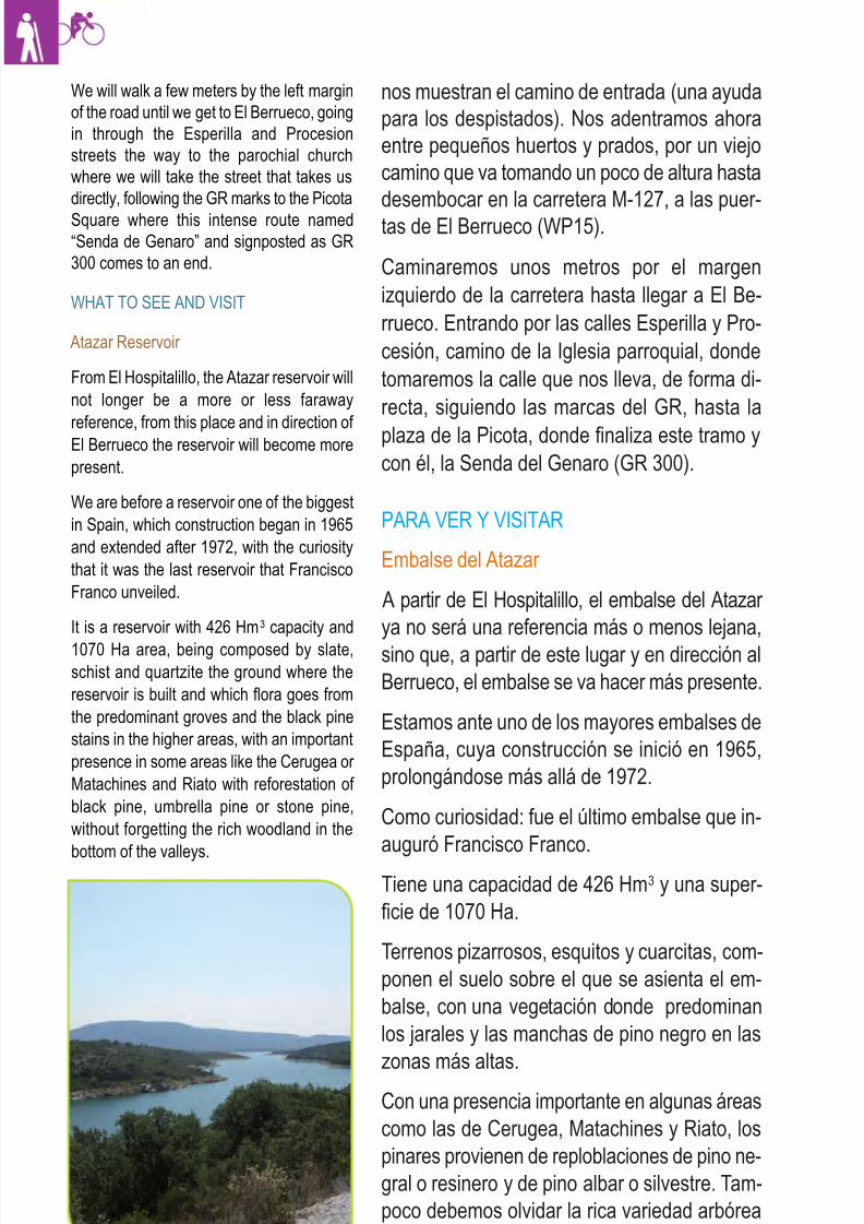
8/3/2019 Libro Senda Del Genaro GR300
http://slidepdf.com/reader/full/libro-senda-del-genaro-gr300 122/156

8/3/2019 Libro Senda Del Genaro GR300
http://slidepdf.com/reader/full/libro-senda-del-genaro-gr300 123/156
135El Hospitalillo - El Berrueco
Dehesa de Santillana
Uno de los elementos que llaman la atención al
viajero, sobremanera cuando arriba a El Be-
rrueco o a Mangirón, son unas llamativas cons-
trucciones a la par de la carretera. Son los
predios de la Dehesa de Santillana. En sus te-
rrenos cerrados al público (se trata de una finca
particular) se hallaba la aldea de Santillana que,
según cuentas las leyendas, desapareció sin
motivo aparente. Como tal aldea contaba con
iglesia parroquial que, con el paso del tiempo,
se convirtió en la Ermita de Santa Juliana, encuyo seno se veneraba la Virgen del Socorro.
Todo ello, desaparecido en el siglo XIX, con-
forma una preciosa dehesa, rica en valores ci-
negéticos, que fue mencionada en el Libro de
Montería de Alfonso X.
Santillana’s Dehesa
One of the things that calls great attention to
the traveller when we get up to El Berrueco
or to Mangiron is to contemplate some eye-
catching constructions next to the road, this
are precisely the Santillana’s Dehesa lands,in its closed to the public territories due to it
being a private property, there the Santillana
Village used to stand and according to the
legends it disappear with out any apparent
motive, because this village had a parochial
church what with the pass of time became
the Santa Juliana’s Hermitage and which
was the centre to venerate the Virgen del
Socorro.
All that disappeared in the XIX century and
conforms a beautiful Dehesa rich in hunting
values that was mentioned in the book of
hunting by Alfonso X (Monteria de Alfonso X).
Respiradero Canal Isabel II
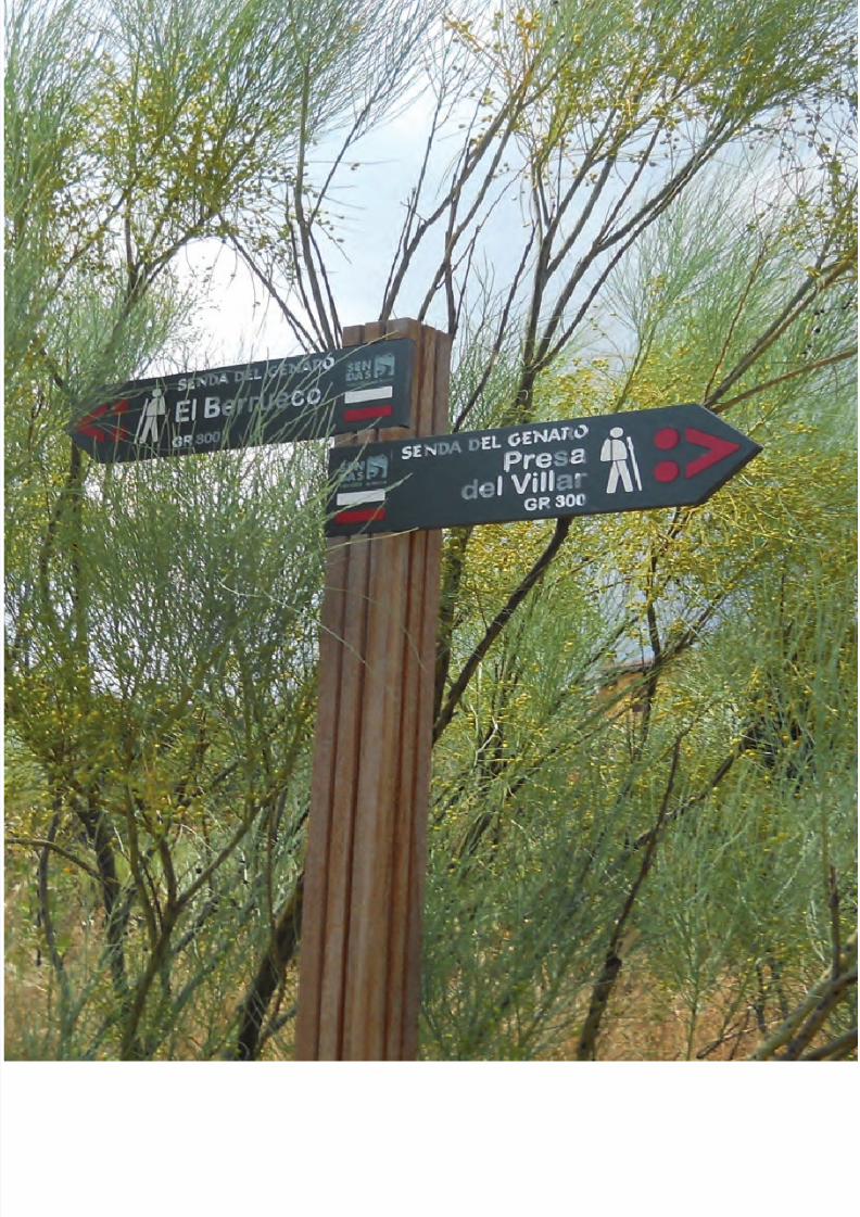
8/3/2019 Libro Senda Del Genaro GR300
http://slidepdf.com/reader/full/libro-senda-del-genaro-gr300 124/156
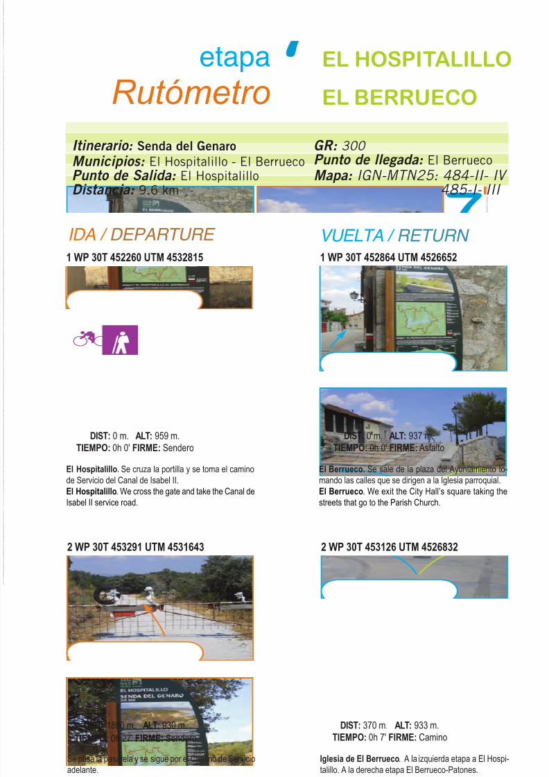
8/3/2019 Libro Senda Del Genaro GR300
http://slidepdf.com/reader/full/libro-senda-del-genaro-gr300 125/156
IDA / DEPARTURE VUELTA / RETURN
1 WP 30T 452260 UTM 4532815
El Hospitalillo. Se cruza la portilla y se toma el camino
de Servicio del Canal de Isabel II.
El Hospitalillo. We cross the gate and take the Canal de
Isabel II service road.
DIST: 0 m. ALT: 959 m.
TIEMPO: 0h 0' FIRME: Sendero
1 WP 30T 452864 UTM 4526652
El Berrueco. Se sale de la plaza del Ayuntamiento to-
mando las calles que se dirigen a la Iglesia parroquial.
El Berrueco. We exit the City Hall’s square taking the
streets that go to the Parish Church.
DIST: 0 m. ALT: 937 m.
TIEMPO: 0h 0' FIRME: Asfalto
2 WP 30T 453291 UTM 4531643
Se pasa la pasarela y se sigue por el Camino de Servicio
adelante.
We pass the barrier and continue through the service road
straight ahead.
DIST: 1890 m. ALT: 930 m.
TIEMPO: 0h 27' FIRME: Sendero
2 WP 30T 453126 UTM 4526832
Iglesia de El Berrueco. A la izquierda etapa a El Hospi-
talillo. A la derecha etapa El Berrueco-Patones.
El Berrueco’s Church. To the left we have the stage El
Hospitalillo. To the right we have the stage El Berrueco –
Patones.
DIST: 370 m. ALT: 933 m.
TIEMPO: 0h 7' FIRME: Camino
Itinerario: Senda del Genaro
Municipios: El Hospitalillo - El BerruecoPunto de Salida: El HospitalilloDistancia: 9.6 km
GR: 300
Punto de llegada: El Berrueco
Mapa: IGN-MTN25: 484-II- IV
485-I- III
etapa
Rutómetro
EL HOSPITALILLO
EL BERRUECO
137El Hospitalillo - El Berrueco
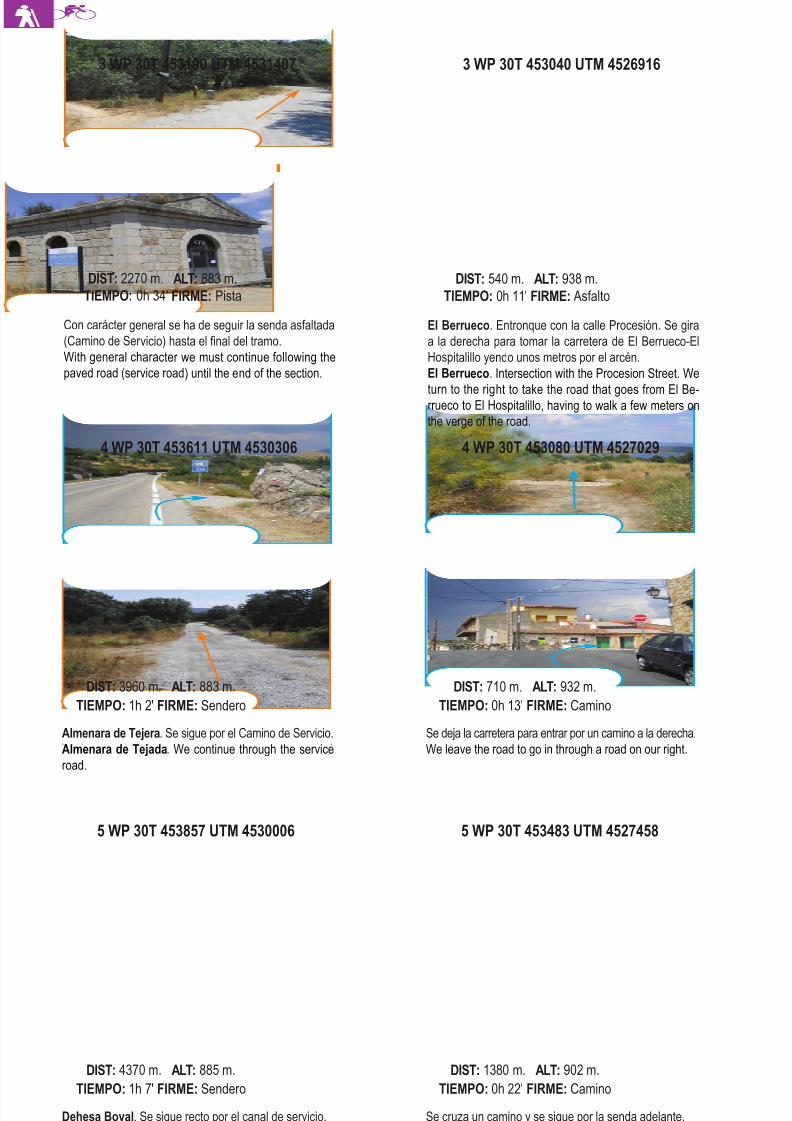
8/3/2019 Libro Senda Del Genaro GR300
http://slidepdf.com/reader/full/libro-senda-del-genaro-gr300 126/156
5 WP 30T 453857 UTM 4530006
Dehesa Boyal. Se sigue recto por el canal de servicio.
Dehesa Boyal. We continue straight ahead through the
service channel.
DIST: 4370 m. ALT: 885 m.
TIEMPO: 1h 7' FIRME: Sendero
5 WP 30T 453483 UTM 4527458
Se cruza un camino y se sigue por la senda adelante.
We cross a road and continue through the path ahead.
DIST: 1380 m. ALT: 902 m.
TIEMPO: 0h 22' FIRME: Camino
4 WP 30T 453611 UTM 4530306
Almenara de Tejera. Se sigue por el Camino de Servicio.
Almenara de Tejada. We continue through the service
road.
DIST: 3960 m. ALT: 883 m.
TIEMPO: 1h 2' FIRME: Sendero
4 WP 30T 453080 UTM 4527029
Se deja la carretera para entrar por un camino a la derecha.
We leave the road to go in through a road on our right.
DIST: 710 m. ALT: 932 m.
TIEMPO: 0h 13' FIRME: Camino
Con carácter general se ha de seguir la senda asfaltada
(Camino de Ser vicio) hasta el final del tramo.
With general character we must continue following the
paved road (service road) until the end of the section.
DIST: 2270 m. ALT: 883 m.
TIEMPO: 0h 34' FIRME: Pista
3 WP 30T 453040 UTM 4526916
El Berr ueco. Entronque con la calle Procesión. Se gira
a la derecha para tomar la carretera de El Berrueco-El
Hospitalillo yendo unos metros por el arcén.
El Berrueco. Intersection with the Procesion Street. We
turn to the right to take the road that goes from El Be-rrueco to El Hospitalillo, having to walk a few meters on
the verge of the road.
DIST: 540 m. ALT: 938 m.
TIEMPO: 0h 11' FIRME: Asfalto
138 etapa 7
3 WP 30T 453190 UTM 4531407
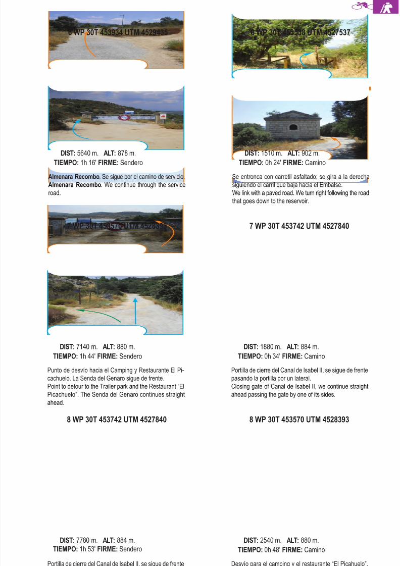
8/3/2019 Libro Senda Del Genaro GR300
http://slidepdf.com/reader/full/libro-senda-del-genaro-gr300 127/156
8 WP 30T 453742 UTM 4527840
Portilla de cierre del Canal de Isabel II, se sigue de frente
pasando la portilla por un lateral.
Closing gate of the Canal de Isabel II, we continue straight
ahead passing the gate from one of the sides.
DIST: 7780 m. ALT: 884 m.
TIEMPO: 1h 53' FIRME: Sendero
8 WP 30T 453570 UTM 4528393
Desvío para el camping y el restaurante “El Picahuelo”.
La Senda del Genaro, sigue de frente.
Detour to the trailer park and the restaurant “ El Pica-
chuelo”. The Senda del Genaro continues straight ahead.
DIST: 2540 m. ALT: 880 m.
TIEMPO: 0h 48' FIRME: Camino
7 WP 30T 453570 UTM 4528393
Punto de desvío hacia el Camping y Restaurante El Pi-
cachuelo. La Senda del Genaro sigue de frente.
Point to detour to the Trailer park and the Restaurant “El
Picachuelo”. The Senda del Genaro continues straightahead.
DIST: 7140 m. ALT: 880 m.
TIEMPO: 1h 44' FIRME: Sendero
7 WP 30T 453742 UTM 4527840
Portilla de cierre del Canal de Isabel II, se sigue de frente
pasando la portilla por un lateral.
Closing gate of Canal de Isabel II, we continue straight
ahead passing the gate by one of its sides.
DIST: 1880 m. ALT: 884 m.
TIEMPO: 0h 34' FIRME: Camino
6 WP 30T 453934 UTM 4529435
Almenara Recombo. Se sigue por el camino de servicio.
Almenara Recombo. We continue through the service
road.
DIST: 5640 m. ALT: 878 m.
TIEMPO: 1h 16' FIRME: Sendero
Se entronca con carretil asfaltado; se gira a la derecha
siguiendo el carril que baja hacia el Embalse.
We link with a paved road. We turn right following the road
that goes down to the reservoir.
DIST: 1510 m. ALT: 902 m.
TIEMPO: 0h 24' FIRME: Camino
139El Hospitalillo - El Berrueco
6 WP 30T 453538 UTM 4527537
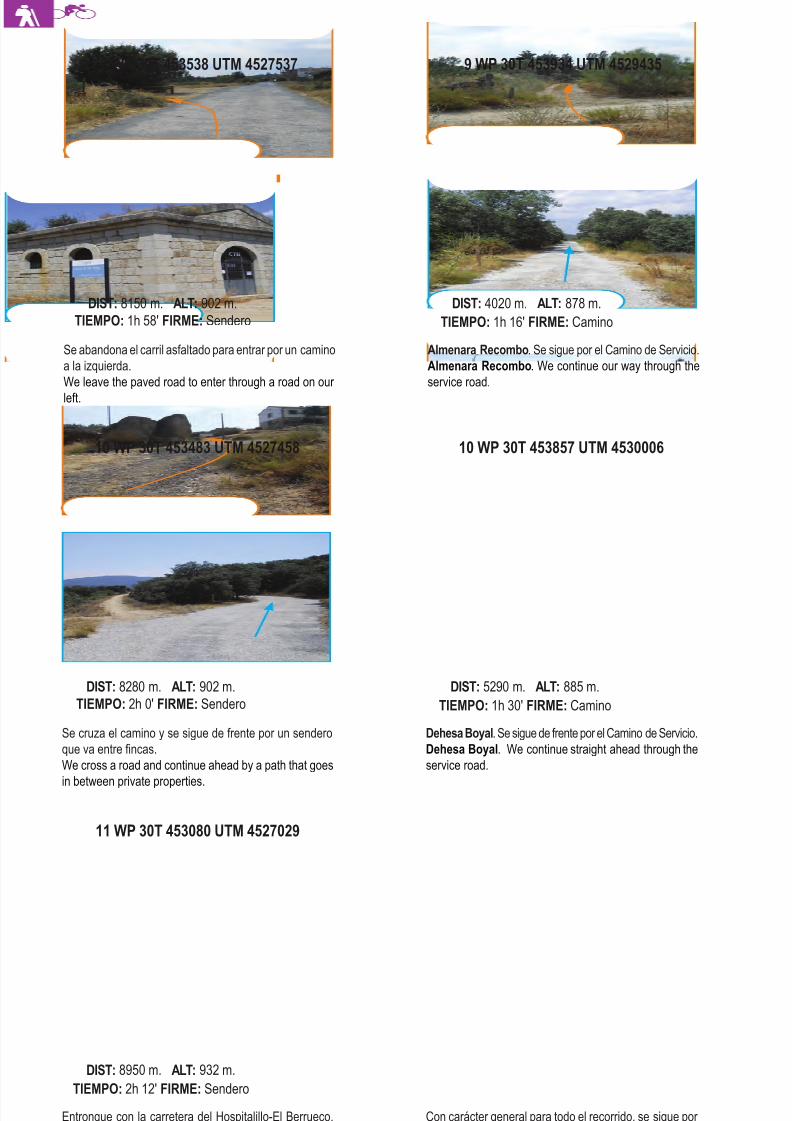
8/3/2019 Libro Senda Del Genaro GR300
http://slidepdf.com/reader/full/libro-senda-del-genaro-gr300 128/156
11 WP 30T 453080 UTM 4527029
Entronque con la carretera del Hospitalillo-El Berrueco,
se gira a la izquierda y se continúa por el arcén de ésta.
Crossroad with the road main road of Hospitalillo – El Be-
rrueco, we turn left and continue through the verge of the
road.
DIST: 8950 m. ALT: 932 m.
TIEMPO: 2h 12' FIRME: Sendero
Con carácter general para todo el recorrido, se sigue por
el Camino de Servicio del Canal de Isabel II, dejando los
caminos laterales que van por encima de los viaductos.
With general character for the totality of the route, we con-
tinue through the service road of Canal de Isabel II, lea-ving alone the lateral roads that go over the viaducts.
10 WP 30T 453483 UTM 4527458
Se cruza el camino y se sigue de frente por un sendero
que va entre fincas.
We cross a road and continue ahead by a path that goes
in between private properties.
DIST: 8280 m. ALT: 902 m.
TIEMPO: 2h 0' FIRME: Sendero
10 WP 30T 453857 UTM 4530006
Dehesa Boyal. Se sigue de frente por el Camino de Servicio.
Dehesa Boyal. We continue straight ahead through the
service road.
DIST: 5290 m. ALT: 885 m.
TIEMPO: 1h 30' FIRME: Camino
Se abandona el carril asfaltado para entrar por un camino
a la izquierda.
We leave the paved road to enter through a road on our
left.
DIST: 8150 m. ALT: 902 m.
TIEMPO: 1h 58' FIRME: Sendero
9 WP 30T 453934 UTM 4529435
Almenara Recombo. Se sigue por el Camino de Servicio.
Almenara Recombo. We continue our way through the
service road.
DIST: 4020 m. ALT: 878 m.
TIEMPO: 1h 16' FIRME: Camino
140 etapa 7
9 WP 30T 453538 UTM 4527537
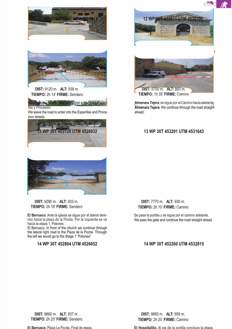
8/3/2019 Libro Senda Del Genaro GR300
http://slidepdf.com/reader/full/libro-senda-del-genaro-gr300 129/156
14 WP 30T 452864 UTM 4526652
El Berrueco. Plaza La Picota. Final de etapa.
El Berrueco. Plaza de la Picota. End of the stage.
DIST: 9660 m. ALT: 937 m.
TIEMPO: 2h 25' FIRME: Sendero
14 WP 30T 452260 UTM 4532815
El Hospitalillo. Al pie de la portilla concluye la etapa,
donde encontramos el panel de inicio.
El Hospitalillo. At the foot of the gate our stage comes
to an end, here we will find the start panel.
DIST: 9660 m. ALT: 959 m.
TIEMPO: 2h 20' FIRME: Camino
13 WP 30T 453126 UTM 4526832
El Berrueco. Ante la iglesia se sigue por el lateral dere-cho hacia la plaza de la Picota. Por la izquierda se vahacia la etapa 1, Patones.El Berrueco. In front of the church we continue throughthe lateral right road to the Plaza de la Picota. Throughthe left we would go to the Stage 1 “Patones”
DIST: 9290 m. ALT: 933 m.
TIEMPO: 2h 18' FIRME: Sendero
13 WP 30T 453291 UTM 4531643
Se pasa la portilla y se sigue por el camino adelante.
We pass the gate and continue the road straight ahead.
DIST: 7770 m. ALT: 930 m.
TIEMPO: 2h 10' FIRME: Camino
12 WP 30T 453040 UTM 4526916
Se abandona la carretera para entrar a las calles Esperi-
llas y Procesión.
We leave the road to enter into the Esperillas and Proce-
sion streets.
DIST: 9120 m. ALT: 938 m.
TIEMPO: 2h 14' FIRME: Sendero
Almenara Tejera, se sigue por el Camino hacia adelante.
Almenara Tejera. We continue through the road straight
ahead.
DIST: 5700 m. ALT: 883 m.
TIEMPO: 1h 35' FIRME: Camino
141El Hospitalillo - El Berrueco
12 WP 30T 453611 UTM 4530306
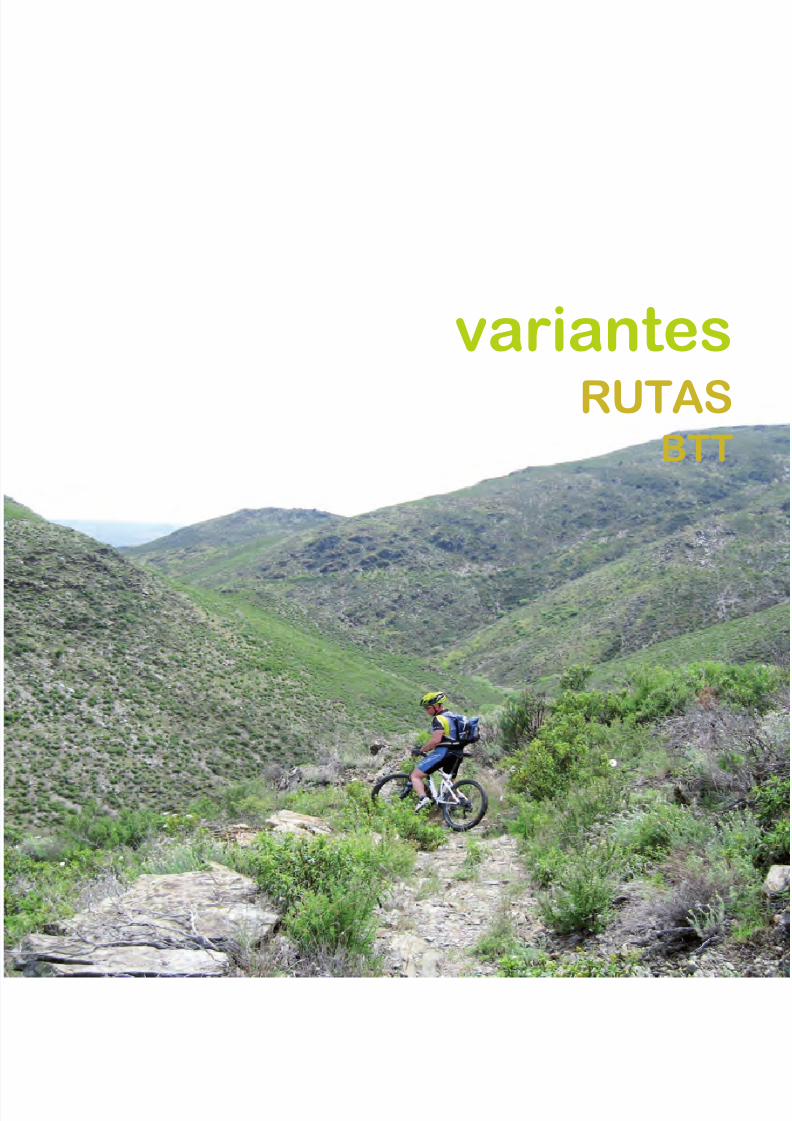
8/3/2019 Libro Senda Del Genaro GR300
http://slidepdf.com/reader/full/libro-senda-del-genaro-gr300 130/156
variantes
RUTASBTT
8/3/2019 Libro Senda Del Genaro GR300
http://slidepdf.com/reader/full/libro-senda-del-genaro-gr300 131/156
BTT
V a r i a n t e s
R U
T A S
B T T
144 Variantes BTT
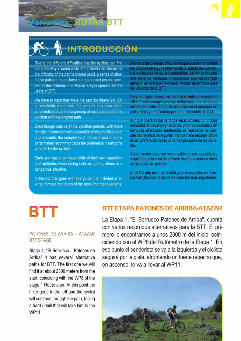
8/3/2019 Libro Senda Del Genaro GR300
http://slidepdf.com/reader/full/libro-senda-del-genaro-gr300 132/156
BTT
Variantes: RUTAS BTT
Debido a las diversas dificultades que pueden encontrar los ciclistas en algunos tramos de la Senda del Genaro,o a la dificultad de su uso compartido, se han propuestouna serie de variantes o recorridos alternativos (por ejemplo, en la etapa Patones-El Atazar) específicos paralos usuarios de la BTT.
Debemos advertir que, mientras el trazado senderista delGR300 está completamente señalizado, las variantessólo tienen indicadores direccionales en el arranque decada tramo y en el entronque con el recorrido original.
Aunque, fuera de los periodos vacacionales, con mayor densidad de usuarios y usuarias, y con una conduccióntranquila, el trazado senderistas es realizable, la com-plejidad técnica de algunos tramos hace recomendableel uso preferente de las variantes por parte de los ciclis-tas.
Cada usuario ha de ser responsable de sus capacidadesy aptitudes a la hora de afrontar riesgos o poner a otrosen situación de peligro.
En el CD que acompaña esta guía se incluyen, en diver-
sos formatos, los tracks de las variantes mas importantes.
INTRODUCCIÓN
BTT
PATONES DE ARRIBA – ATAZAR
BTT STAGE
Stage 1, “El Berrueco – Patones deArriba” it has several alternativepaths for BTT. The first one we willfind it at about 2300 meters from thestart, coinciding with the WP8 of thestage 1 Route plan. At this point thehiker goes to the left and the cyclist
will continue through the path, facinga hard uphill that will take him to theWP11.
BTT ETAPA PATONES DE ARRIBA-ATAZAR
La Etapa 1, "El Berrueco-Patones de Arriba", cuentacon varios recorridos alternativos para la BTT. El pri-mero lo encontramos a unos 2300 m del inicio, coin-cidiendo con el WP8 del Rutómetro de la Etapa 1. Enese punto el senderista se va a la izquierda y el ciclistaseguirá por la pista, afrontando un fuerte repecho que,en ascenso, le va a llevar al WP11.
145Introducción
Variantes: RUTAS BTT
INTRODUCCIÓN
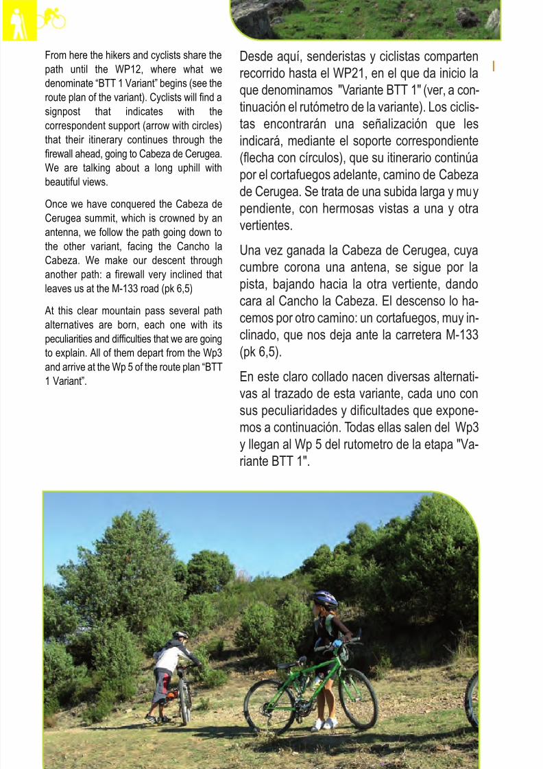
8/3/2019 Libro Senda Del Genaro GR300
http://slidepdf.com/reader/full/libro-senda-del-genaro-gr300 133/156
From here the hikers and cyclists share thepath until the WP12, where what wedenominate “BTT 1 Variant” begins (see theroute plan of the variant). Cyclists will find asignpost that indicates with thecorrespondent support (arrow with circles)that their itinerary continues through thefirewall ahead, going to Cabeza de Cerugea.We are talking about a long uphill withbeautiful views.
Once we have conquered the Cabeza deCerugea summit, which is crowned by anantenna, we follow the path going down tothe other variant, facing the Cancho laCabeza. We make our descent throughanother path: a firewall very inclined thatleaves us at the M-133 road (pk 6,5)
At this clear mountain pass several pathalternatives are born, each one with itspeculiarities and difficulties that we are goingto explain. All of them depart from the Wp3and arrive at the Wp 5 of the route plan “BTT1 Variant”.
Desde aquí, senderistas y ciclistas compartenrecorrido hasta el WP21, en el que da inicio laque denominamos "Variante BTT 1" (ver, a con-tinuación el rutómetro de la variante). Los ciclis-tas encontrarán una señalización que lesindicará, mediante el soporte correspondiente(flecha con círculos), que su itinerario continúapor el cortafuegos adelante, camino de Cabezade Cerugea. Se trata de una subida larga y muypendiente, con hermosas vistas a una y otravertientes.
Una vez ganada la Cabeza de Cerugea, cuya
cumbre corona una antena, se sigue por lapista, bajando hacia la otra vertiente, dandocara al Cancho la Cabeza. El descenso lo ha-cemos por otro camino: un cortafuegos, muy in-clinado, que nos deja ante la carretera M-133(pk 6,5).
En este claro collado nacen diversas alternati-vas al trazado de esta variante, cada uno consus peculiaridades y dificultades que expone-mos a continuación. Todas ellas salen del Wp3y llegan al Wp 5 del rutometro de la etapa "Va-riante BTT 1".
146 Variantes BTT
8/3/2019 Libro Senda Del Genaro GR300
http://slidepdf.com/reader/full/libro-senda-del-genaro-gr300 134/156
Alternativa A. Los ciclistas pueden cruzan la ca-rretera y subir por la pista que sigue al frente,por Cabeza de Peña Alta. Se trata de otro fortí-simo repecho, que pide meter todo el desarrolloposible. Tiene luego una fuerte bajada, haciauna amplia vaguada, antes de afrontar una ul-tima y fortísima pendiente, por un cortafuegos,hacia Braña Grande. A esta amplia vaguada-collado llegan las tres alternativas que plantea-mos, y que confluyen en un único trazado haciaPatones.
Alternativa B. Nace en el PK 6.5 de la M-133,
tras bajar de Cabeza de Cerugea. Cruza la ca-rretera y, en lugar de afrontar la subida (alter-nativa A), continúa por la pista de la derecha,que va hacia el Cordal del Alto de BrañaGrande. Una vez encontremos una cadenavemos que, a la izquierda, nace un sendero, untanto estrecho y técnico, que se dirige hacia lavaguada antes citada, en la cual se encuentran
todas la alternativas.Alternativa C. Creemos que es la más prácticay factible. Una vez llegamos a la carreteraM-133, seguimos por ella, girando a la iz-quierda, rumbo a El Atazar. Tras descender unos dos kilómetros, en una cerrada curva, seabre una pista a la derecha que, de formasuave, va subiendo por el pinar hacia el puntode encuentro con las alternativas propuestas.
A partir de este momento solo habrá un trazadoque, tras una fuerte subida y posterior descensosuave, cambia el rumbo que llevábamos yenfila, tras cruzar otra cadena que corta el pasoa los vehículos, una bajada más pronunciada,por un valle intermedio, que nos dejará ante el
WP28 del rutómetro de la Etapa 1.
147Introducción
Alternative A: Cyclists can cross the roadand go up through the path that continuesahead by the Cabeza de Peña Alta. It isanother very hard uphill that requires the useof all the possible gear ratio. After that we
have a strong downhill to a wide stream bed,before facing another hard uphill through afirewall that goes to Braña Grande. To thiswide stream bed – mountain pass, the threealternatives we are suggesting arrive to andcome together in an only path to Patones.
Alternative B: Starts at the PK 6.5 of the M-133, after getting down from Cabeza de
Peña Alta. Cross the road and instead of taking the uphill (alternative A) continuethrough the path on the right that goes to theCordal del Alto de Braña Grande. Once wehave found a chain we can see that on theleft a path begins, a bit narrow and techniquethat goes to the stream bed alreadymentioned in which all the alternatives meet.
Alternative C: We believe it is the mostfeasible and practical. Once we arrive to theM-133 we continue on it turning left indirection to El Atazar. After descending about2 kilometres, in a closed turn, a track openson the right that in a smooth way starts goingup to the pine forest to take us to the meetingwith all the alternatives proposed.
From this moment on there will only be onepath that after a strong uphill and afterwardsdescent changes the course we had andheads after crossing another chain thatblocks the way to the vehicles, another morepronounced downhill through anintermediate valley that will leave us at theWP28 of the Stage 1 route plan.
8/3/2019 Libro Senda Del Genaro GR300
http://slidepdf.com/reader/full/libro-senda-del-genaro-gr300 135/156
BTT ETAPA PATONES DE ARRIBA-
ATAZAR
Desde Patones, la variante sigue el mismo ca-mino que lleva la Senda del Genaro, por la calle
Real arriba, hacia la zona del depósito de agua.La Senda del Genaro se habrá ido por la iz-quierda, por las Eras hacia el Cancho la Ca-beza. Nuestra ruta sigue las marcas del GR 10,ya muy viejas y poco perceptibles y, tras ganar el depósito de agua, nos lleva, en descenso, por un sendero "trialero" que nos deja ante una ex-plotación apícola. Se vira un poco a la izquierda,
para tomar la pista que sube por encima de lasabejas. A partir de ese momento, el recorridoentronca con una pista de servicio del Canal deIsabel II - Canal del Jarama, con el Cerro delCorral del Alto a nuestra izquierda. Seguimospor el carril asfaltado, en ascenso, tras las mar-cas del GR 10, a base de pintadas mal hechas,que nos llevan a una zona plana, por encima
del Canal de Cabarrús. Al final del tramo vere-mos, abajo, las casas del Pontón de la Oliva.Se vira, ahora, a la izquierda, para tomar unafuerte bajada y, de esta manera, bordear por en-cima de la minicentral del Atazar.
Se llega a la carretera M-134, que cruzamospara tomar una pista que sale a la izquierda,
junto a un desvencijado panel de ruta. Nosadentramos en un largo valle que va en buscadel río Lozoya. Se trata de una bajada bonitacon un "ciclado" de lo mas atractivo. A la alturade Las Chozas llegaremos a la par del río, pe-daleando sin problemas por la amplia pista, conel río como compañero. El Lozoya va dandovueltas y más vueltas, tras bordear la Cabeza
del Molino, y nos lleva hasta una señal de laSenda del Genaro (Wp 19 del rutómetro quedescribe la etapa "Patones de Arriba-Atazar").
En este punto se nos plantean dos opciones:seguir por el vado, como indica la señalización,o buscar el puente del Embalse de la Parra.
BTT PATONES DE ARRIBA – ATAZAR
STAGE
From Patones, the variant follows the sameroad as the Senda del Genaro, up through
the Real Street to the water deposit area.The Senda del Genaro will go to the leftthrough the Eras going to the Cancho laCabeza. Our route will follow the signpostsof the GR 10, very old and hard to noticeafter getting to the water deposit it takes usin a descent through a track that leaves usat the beekeeping exploitation. We turn alittle to the left to take the path that goes over
the bees. From this moment the pathconnects with a service path of the Canal deIsabel II – Canal del Jarama, with the Corraldel Alto Mountain to our left. We continue onthe paved road in ascent, after the GR 10signposts, very badly painted, that will takeus to a plain area over the Canal deCabarrus. At the end of the section we willsee down below the houses of Ponton de la
Oliva. We now turn to the left to take a strongdownhill and in this way skirt around over thesmall hydraulic central of Atazar.
We arrive at the M-134 that we cross to takea track that opens to our left, next to a ricketyroute panel. We go into a long valley thatsearches for the Lozoya River. It is a lovelydownhill with a most attractive ride. At the
Las Chozas we will be alongside the river,pedalling without any problems thanks to thewide track with the river as our companion.The Lozoya turns and bends, after skirtingaround the Cabeza de Molino it takes us toa signpost of the Senda del Genaro (Wp 19route plan that describes the “Patones deArriba – Atazar” stage).
At this point we have two options, follow theford like the signposts indicate or to llok for the Embalse de la Parra bridge.
148 Variantes BTT

8/3/2019 Libro Senda Del Genaro GR300
http://slidepdf.com/reader/full/libro-senda-del-genaro-gr300 136/156
Hayamos optado por una u otra, enseguida nosencontraremos en el WP21 de la Etapa 2. En esepunto, el recorrido sigue por una senda estrechaque bordea los barrancos del Lozoya. La variantede BTT, sin embargo, opta por tomar la pista quesube por la Era del Cura hacia la Alomohadilla;larga y mantenida, pero de fácil realización.
No matter which one we chose, immediatelywe will find ourselves at the WP21 of thestage 2. In this point the route continuesthrough a narrow path that skirts around theLozoya Gullies. Although the BTT variantchooses to take the path that goes up
through the Era del Cura to Almohadilla along and maintained path but of easyrealization.
We will get to the moment in which we willfind the path that comes from Atazar indirection to Alpedrete. At this point we turnright through a plain ride over the pine forestof the Casucho stream.
We continue road ahead until we find a fork.There both options are valid, both will meetagain. We recommend the path that is to our left, because of its more rural character andless busy. After a few kilometres we connectagain with the trail we left behind andcontinue through the principal track thattakes us to the Atazar town. It is a long pathwith some plain rides and some uphills. TheAtazar town even though we can see it soon
it will be a while until we get there.
149Introducción
Llegará un momento en que nos encontraremoscon la pista que viene del Atazar, en direccióna Alpedrete. En ese punto se gira a la derecha,yendo, en pleno llaneo, por encima del pinar delarroyo del Casucho.
Seguimos, pista adelante, hasta encontrarnoscon una bifurcación. Ante ella, cualquiera de lasdos opciones son válidas, ambas se encuentranmás adelante. Recomendamos el recorrido quenace a la izquierda, por su carácter más rural ymenos transitado. Tras unos kilómetros, conec-tamos con la pista que hemos dejado, y segui-
mos por la pista principal, que nos lleva haciael pueblo del Atazar. Se trata de un largo reco-rrido con "llaneos" y alguna que otra subida. Elpueblo de Atazar, aunque lo veremos muypronto, se hará de rogar.
8/3/2019 Libro Senda Del Genaro GR300
http://slidepdf.com/reader/full/libro-senda-del-genaro-gr300 137/156
8/3/2019 Libro Senda Del Genaro GR300
http://slidepdf.com/reader/full/libro-senda-del-genaro-gr300 138/156
Itinerario: Senda del Genaro
Municipios: El Berrueco - Patones de Arriba
Punto de Salida: Patones de Arriba
Distancia: 10.3 Km. Horario: 1h 13'
GR: 300
Punto de llegada: El Berrueco
Mapa: IGN-MTN25: 484-II- IV
485-I- III
variantes
BTTEL BERRUECO
PATONES DE ARRIBA
IDA / DEPARTURE VUELTA / RETURN
1 WP 30T 455476 UTM 4525331
Empezamos el rutómetro en este punto que correspondecon el Wp de 19 del rutómetro de la etapa El Berrueco-Patones, se toma el camino que va hacia Cabeza deCerugea.We start our route map at this point matching with the Wp19 of the El Berrueco-Patones stage’s route map. Wetake the road that goes to Cabeza de Cerugea.
DIST: 0 m. ALT: 991 m.TIEMPO: 0h 0' FIRME: Pista
Subida continuada hasta desembocar de nuevo en el cor-tafuegos, tras cruzar un cierre de alambre de espino.Continued uphill, until we reach again the firewall, after crossing a wire closure.
2 WP 30T 456033 UTM 4525634
En el cortafuego, la Senda del Genaro gira a la derecha yla variante de BTT sigue recta hacia Cabeza de Cerugea.At the firewall, the Senda del Genaro turns right and theBTT variant continues straight to Cabeza de Cerugea.
DIST: 830 m. ALT: 1074 m.TIEMPO: 0h 12' FIRME: Pista
Vistas sobre el Embalse del Atazar.Views over the Atazar Reservoir
151El Berrueco - Patones de Arriba
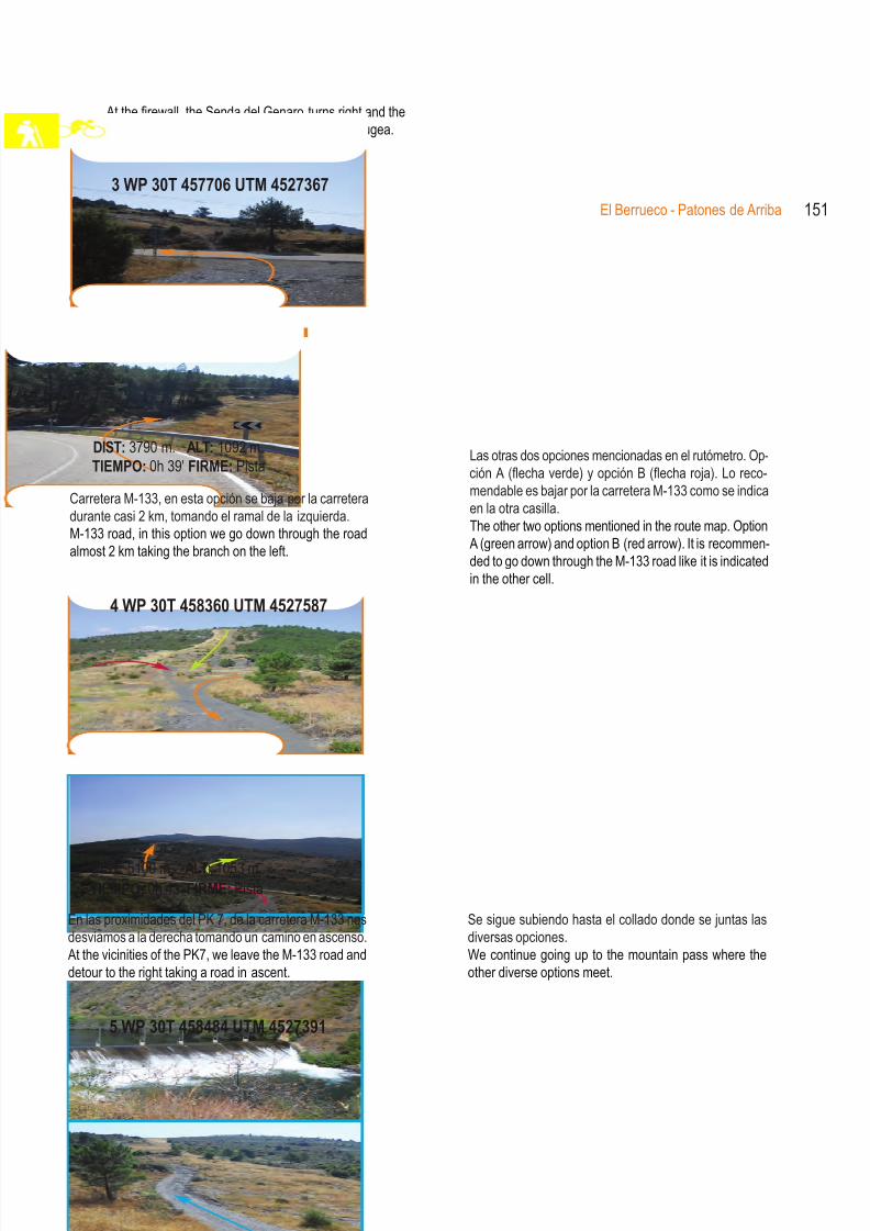
8/3/2019 Libro Senda Del Genaro GR300
http://slidepdf.com/reader/full/libro-senda-del-genaro-gr300 139/156
3 WP 30T 457706 UTM 4527367
Variantes BTT152
Las otras dos opciones mencionadas en el rutómetro. Op-ción A (flecha verde) y opción B (flecha roja). Lo reco-mendable es bajar por la carretera M-133 como se indicaen la otra casilla.The other two options mentioned in the route map. Option
A (green arrow) and option B (red arrow). It is recommen-ded to go down through the M-133 road like it is indicatedin the other cell.
DIST: 3790 m. ALT: 1092 m.TIEMPO: 0h 39' FIRME: Pista
Se sigue subiendo hasta el collado donde se juntas lasdiversas opciones.We continue going up to the mountain pass where the
other diverse options meet.
DIST: 5100 m. ALT: 1053 m.TIEMPO: 0h 43' FIRME: Pista
4 WP 30T 458360 UTM 4527587
Una vez en la vaguada se debe subir por el cortafuegosarriba.Once on the stream bed we must go up through thefirewall.
DIST: 5350 m. ALT: 1093 m.TIEMPO: 0h 46' FIRME: Pista
5 WP 30T 458484 UTM 4527391
Carretera M-133, en esta opción se baja por la carreteradurante casi 2 km, tomando el ramal de la izquierda.M-133 road, in this option we go down through the roadalmost 2 km taking the branch on the left.
En las proximidades del PK 7, de la carretera M-133 nosdesviamos a la derecha tomando un camino en ascenso.At the vicinities of the PK7, we leave the M-133 road and
detour to the right taking a road in ascent.
Vaguada, confluencia de las opciones. Una vez llegado aeste punto la ruta sube hacia el Alto de Braña Grande.Stream bed point of confluence of the options. In this pointthe route goes uphill to the Alto de Braña Grande.
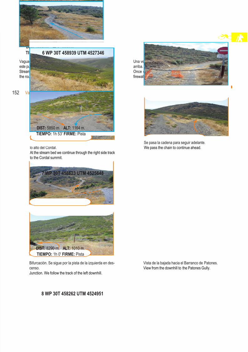
8/3/2019 Libro Senda Del Genaro GR300
http://slidepdf.com/reader/full/libro-senda-del-genaro-gr300 140/156
En la vaguada se sigue por la pista de la derecha hacialo alto del Cordal.At the stream bed we continue through the right side trackto the Cordal summit.
El Berrueco - Patones de Arriba 153
Se pasa la cadena para seguir adelante.We pass the chain to continue ahead.
DIST: 5850 m. ALT: 1164 m.TIEMPO: 1h 53' FIRME: Pista
6 WP 30T 458939 UTM 4527346
Vista de la bajada hacia el Barranco de Patones.View from the downhill to the Patones Gully.
DIST: 8290 m. ALT: 1010 m.TIEMPO: 1h 0' FIRME: Pista
7 WP 30T 458623 UTM 4525648
Este es el Wp 28 del rutómetro de la Topoguía corres-pondiente a la Etapa El Berrueco-Patones. La flecha na-ranja nos indica el trayecto que trae la Senda del Genaro.This is the Wp 28 of the route map corresponding to theEl Berrueco – Patones stage in the topographic guide.
The orange arrow indicates the path that the Senda delGenaro has.
DIST: 9290 m. ALT: 866 m.TIEMPO: 1h 10' FIRME: Pista
8 WP 30T 458262 UTM 4524951
Bifurcación. Se sigue por la pista de la izquierda en des-censo.Junction. We follow the track of the left downhill.
Entronque con el GR 300. Senda del Genaro, se siguepor la derecha, hasta Patones.Junction with the GR 300, Senda del Genaro, we continueto the right until we get to Patones.
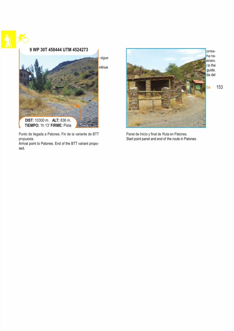
8/3/2019 Libro Senda Del Genaro GR300
http://slidepdf.com/reader/full/libro-senda-del-genaro-gr300 141/156
Punto de llegada a Patones. Fin de la variante de BTTpropuesta.Arrival point to Patones. End of the BTT variant propo-sed.
DIST: 10300 m. ALT: 836 m.TIEMPO: 1h 13' FIRME: Pista
Panel de Inicio y final de Ruta en Patones.Start point panel and end of the route in Patones.
154 Variantes BTT
9 WP 30T 458444 UTM 4524273
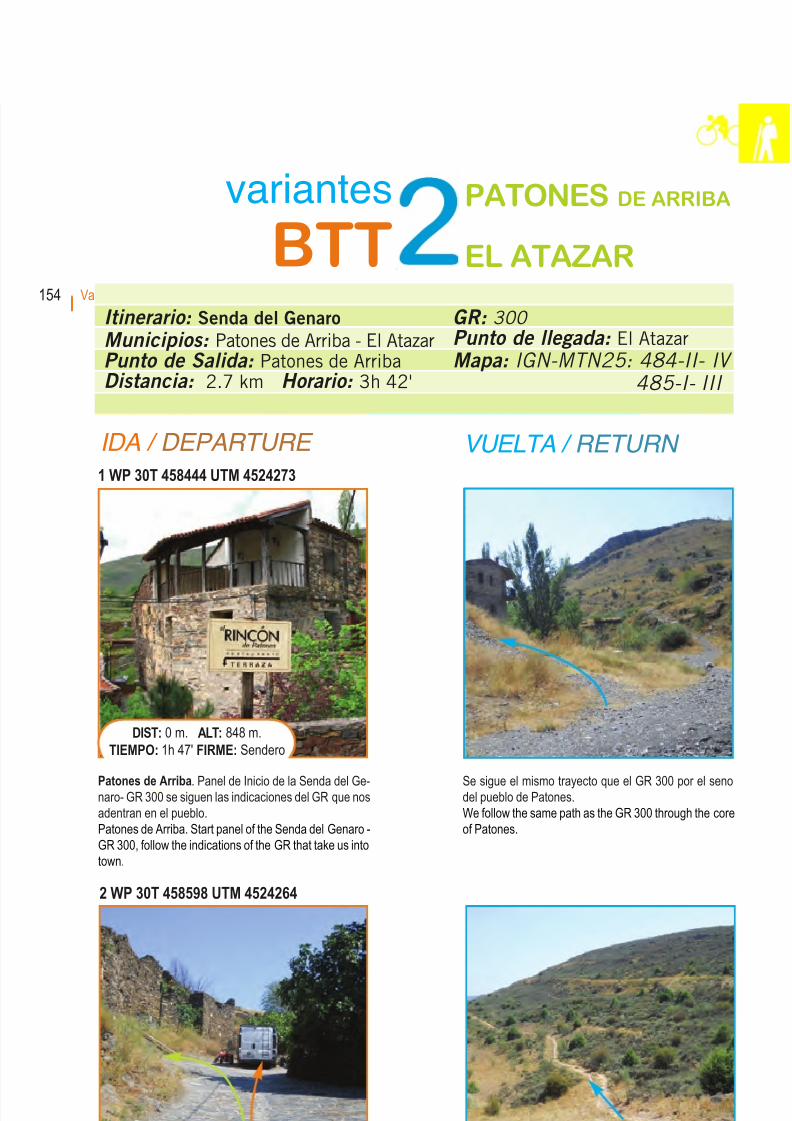
8/3/2019 Libro Senda Del Genaro GR300
http://slidepdf.com/reader/full/libro-senda-del-genaro-gr300 142/156
IDA / DEPARTURE VUELTA / RETURN
1 WP 30T 458444 UTM 4524273
Patones de Arriba. Panel de Inicio de la Senda del Ge-naro- GR 300 se siguen las indicaciones del GR que nosadentran en el pueblo.Patones de Arriba. Start panel of the Senda del Genaro -GR 300, follow the indications of the GR that take us intotown.
DIST: 0 m. ALT: 848 m.TIEMPO: 1h 47' FIRME: Sendero
Se sigue el mismo trayecto que el GR 300 por el senodel pueblo de Patones.We follow the same path as the GR 300 through the coreof Patones.
2 WP 30T 458598 UTM 4524264
En la parte alta de la calle, el GR 300 gira a la izquierda ,y la variante de BTT se va a la derecha para empatar conel camino que sale del pueblo.At the high part of the street, the GR 300 turns left andthe BTT variant goes to the right to pair with the road that
comes from the town.
DIST: 400 m. ALT: 811 m.TIEMPO: 0h 6' FIRME: Hormigón
Se sigue por el camino arriba hacia la EDAR de Patones,tomando este sendero marcado como GR 10.We continue through the road uphill to the EDAR of Pa-tones taking this path marked as GR 10.
Itinerario: Senda del Genaro
Municipios: Patones de Arriba - El Atazar
Punto de Salida: Patones de Arriba
Distancia: 2.7 km Horario: 3h 42'
GR: 300
Punto de llegada: El Atazar
Mapa: IGN-MTN25: 484-II- IV
485-I- III
variantes
BTTPATONES DE ARRIBA
EL ATAZAR
155Patones de Arriba - El Atazar
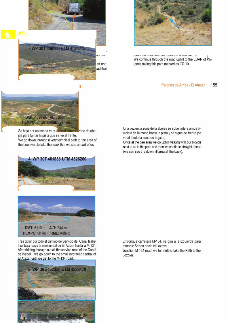
8/3/2019 Libro Senda Del Genaro GR300
http://slidepdf.com/reader/full/libro-senda-del-genaro-gr300 143/156
5 WP 30 T462350 UTM 4529178
Punto de encuentro con la Senda del Genaro (WP 19 dela Senda del Genaro) y dos opciones, por la derecha paracruzar por el vado del Lozoya, de frente por el puente delEmbalse de la Parra.Meeting point with the Senda del Genaro (WP 19 of theSenda del Genaro) and two options, through the right tocross by the Lozoya ford, in front by the Embalse de laParra’s bridge.
DIST: 13230 m. ALT: 746 m.TIEMPO: 1h 50' FIRME: Pista
Opción embalse. Si el río va muy lleno, se sigue defrente por la pista hasta este puente que se cruza haciael WP 21 de la Senda del Genaro Etapa Patones-Atazar.Reservoir Option: If the river’s waters are too high, wecontinue straight ahead through the track to the bridgewhich we will cross to the WP 21 of the Senda del Genaro
Patones – Atazar stage.
4 WP 30T 461838 UTM 4526260
Tras ciclar por todo el camino de Servicio del Canal IsabelII se baja hacia la minicentral de El Atazar hasta la M-134.After ridding through out all the service road of the Canal
de Isabel II we go down to the small hydraulic central of El Atazar until we get to the M-134 road.
DIST: 6110 m. ALT: 744 m.TIEMPO: 0h 46' FIRME: Asfalto
Entronque carretera M-134, se gira a la izquierda paratomar le Senda hacia el Lozoya.Junction M-134 road, we turn left to take the Path to the
Lozoya.
Se baja por un senda muy técnica hacia la zona de abe- jas para tomar la pista que se ve al frente.We go down through a very technical path to the area of the beehives to take the track that we see ahead of us.
DIST: 1520 m. ALT: 855 m.TIEMPO: 0h 20' FIRME: Sendero
3 WP 30T 459700 UTM 4524773
156 Variantes BTT
Una vez en la zona de la abejas se sube ladera arriba bi-cicleta de la mano hasta la pista y se sigue de frente (seve al fondo la zona de bajada).
Once at the bee area we go uphill walking with our bicyclenext to us to the path and then we continue straight ahead(we can see the downhill area at the back).
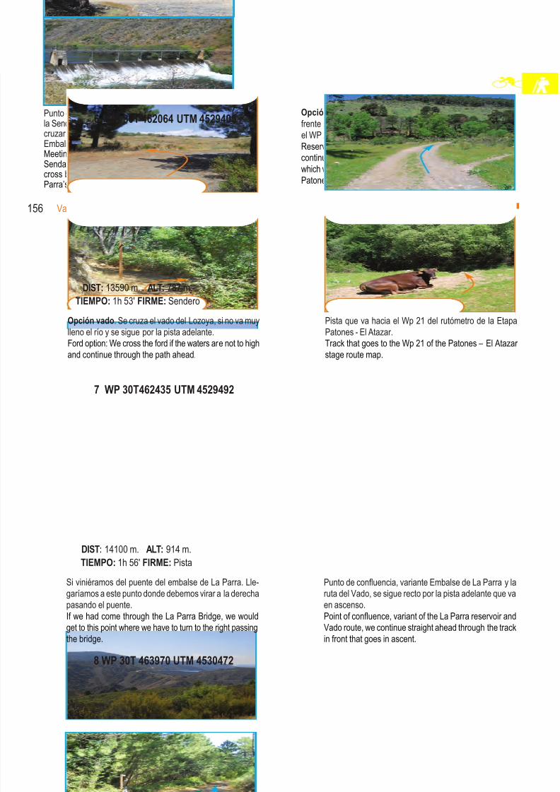
8/3/2019 Libro Senda Del Genaro GR300
http://slidepdf.com/reader/full/libro-senda-del-genaro-gr300 144/156
8 WP 30T 463970 UTM 4530472
Entronque con la pista que viene de Alpedrete, se siguepor la margen izquierda por la que se rueda unos cuantoskilómetros.Junction with the track that comes from Alpedrete, we
continue through the left margin in which we ride for a fewkilometres.
DIST: 16550 m. ALT: 951 m.TIEMPO: 2h 15' FIRME: Pista
7 WP 30T462435 UTM 4529492
Si viniéramos del puente del embalse de La Parra. Lle-garíamos a este punto donde debemos virar a la derechapasando el puente.If we had come through the La Parra Bridge, we would
get to this point where we have to turn to the right passingthe bridge.
DIST: 14100 m. ALT: 914 m.TIEMPO: 1h 56' FIRME: Pista
Punto de confluencia, variante Embalse de La Parra y laruta del Vado, se sigue recto por la pista adelante que vaen ascenso.Point of confluence, variant of the La Parra reservoir and
Vado route, we continue straight ahead through the trackin front that goes in ascent.
6 WP 30T 462064 UTM 4529405
Opción vado. Se cruza el vado del Lozoya, si no va muylleno el río y se sigue por la pista adelante.Ford option: We cross the ford if the waters are not to highand continue through the path ahead.
DIST: 13590 m. ALT: 787 m.TIEMPO: 1h 53' FIRME: Sendero
Pista que va hacia el Wp 21 del rutómetro de la EtapaPatones - El Atazar.Track that goes to the Wp 21 of the Patones – El Atazar stage route map.
157Patones de Arriba - El Atazar 157Patones de Arriba - El Atazar
Vista sobre los cordales de El Atazar.View of the El Atazar mountain range.
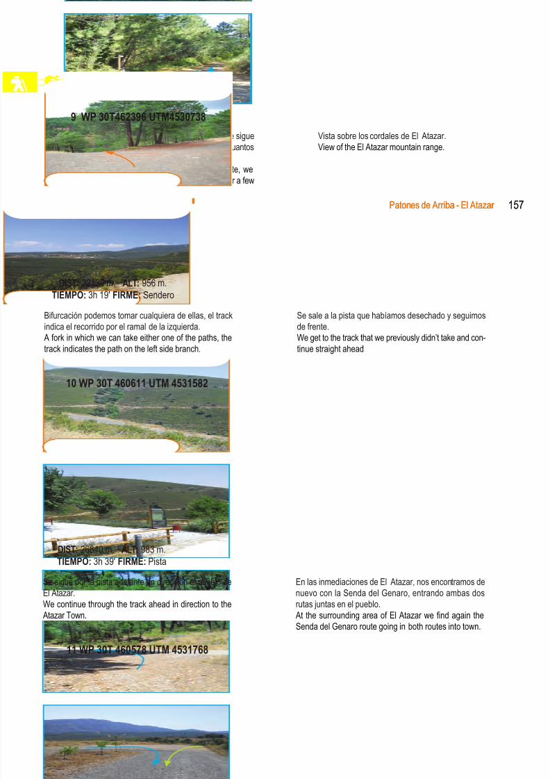
8/3/2019 Libro Senda Del Genaro GR300
http://slidepdf.com/reader/full/libro-senda-del-genaro-gr300 145/156
11 WP 30T 460578 UTM 4531768
Vista del recorrido que hemos traído hasta El Atazar.View of the road we have used to El Atazar
DIST: 27700 m. ALT: 988 m.TIEMPO: 3h 42' FIRME: Sendero
Final de etapa en El Atazar.End point at El Atazar.
10 WP 30T 460611 UTM 4531582
Se sigue por la pista adelante en dirección al pueblo deEl Atazar.We continue through the track ahead in direction to the
Atazar Town.
DIST: 26840 m. ALT: 983 m.TIEMPO: 3h 39' FIRME: Pista
En las inmediaciones de El Atazar, nos encontramos denuevo con la Senda del Genaro, entrando ambas dosrutas juntas en el pueblo.
At the surrounding area of El Atazar we find again theSenda del Genaro route going in both routes into town.
Bifurcación podemos tomar cualquiera de ellas, el trackindica el recorrido por el ramal de la izquierda.A fork in which we can take either one of the paths, thetrack indicates the path on the left side branch.
DIST: 22130 m. ALT: 956 m.TIEMPO: 3h 19' FIRME: Sendero
Se sale a la pista que habíamos desechado y seguimosde frente.We get to the track that we previously didn’t take and con-tinue straight ahead
9 WP 30T462396 UTM4530738
158 Variantes BTT
8/3/2019 Libro Senda Del Genaro GR300
http://slidepdf.com/reader/full/libro-senda-del-genaro-gr300 146/156
159Directorio
Servicios: Alojamientos, restaurantes y otros
Services: Accommodations, restaurants and others
El Atazar
Alojamientos rurales / Rural Accommodations
Alojamientos Turísticos Los CerrillosCamino del Cerrillo, 1, 3 y 5Información y reservas / Information and reserves: 620.878.713e-mail: [email protected] Alojamientos adosados, capacidad para 4 personas cada uno, divididos en dos plantas, con chimeneay terraza con barbacoa. Merendero común.Three lodgings joint with capacity for 4 people each one, divided in two floors with terrace-view point and
chimney. Open air café - common dinner.
Alojamientos Turísticos Las ErasC/ Eras, 27Información y reservas / Information and reserves: 620.878.713e-mail: [email protected] alojamientos de 2-3 personas cada uno, independientes o comunicados entre sí, con chimenea.Three lodgings for 2-3 people each one, independent or communicated between them, with chimney.
Alojamientos Turísticos La Casa del Cura
C/ Higueras, 10 - 12Información y reservas / Information and reserves: 620.878.713e-mail: [email protected] alojamientos de 4-6 personas cada uno, casa antigua rehabilitada de arquitectura tradicional, con chi-menea, patio común y barbacoa.Two lodgings for 4-6 people each one, traditional architecture house reha-bilitated with chimney, common patio and grill.
El JaralC/ Moral, 6Información y reservas / Information and reserves: 627.552.595
Web: www.eljaral.comTres alojamientos para 2-4 personas cada uno, con chimenea y jacuzzi. Casa de nueva construcción hechaen pizarra.Three accommodations for 2-4 people each one, with chimney and jacuzzi. New constructionhouse built with slate.
Restaurantes / Restaurants
Mesón El Atazar Avda. Presa de El Atazar, 1
Información y reservas / Information and reserves: 918.686.024Comida casera tradicional como las migas, los judiones y el chuletón.Home cooked traditional food like migas,
judiones and chuleton.
Asador Los Riscos de El Atazar Travesía de la Cuesta, 3Información y reservas / Information and reserves: 918.686.140 – 913.130.899Asador al más puro estilo segoviano, construido en pizarra. Especializado en asados de cordero y cabrito.Grill to the most pure segoviano style, built with slate. Specialized in roasted lamb and roasted little lamb.
8/3/2019 Libro Senda Del Genaro GR300
http://slidepdf.com/reader/full/libro-senda-del-genaro-gr300 147/156
160 Directorio
El Berrueco
Alojamientos rurales / Rural Accommodations
La Casona de la DehesaAvda. Generalísimo, 22.Información y reservas / Information and reserves: 918.686.218Tipo: Hotel rural/ Rural hotelWeb: www.lacasonadeladehesa.esSeis habitaciones dobles. Situado frente a la Dehesa el Boyal, tiene dos suites con jacuzzi.Six double bedrooms. Located in front of the Dehesa Boyal, it has two suites with jacuzzi.
El CastilloC/ El CastilloInformación y reservas / Information and reserves: 918.686.136Web: www.cbaquanor.es / email: [email protected] de 6 casas rurales con capacidad para 5 personas cada una.A six house rural complex, with capacity for 5 people each one.
La IglesiaC/ La Iglesia, s/nInformación y reservas / Information and reserves: 918.686.136Web: www.cbaquanor.es / email: [email protected] alojamientos con capacidad para 2 personas cada uno.Two accommodations, with capacity for 2 people each one.
La DehesaInformación y reservas / Information and reserves: 918.686.136Web: www.cbaquanor.esemail: [email protected] de 14 alojamientos tipo estudio y dúplex abuhardillado con capacidad para 2 personas cada uno deellos. A building with 14 accommodations, divided in lofts and sloping ceiling duplex, with capacity for 2 peoplein each one.
Camping El PicachueloCtra. Berrueco-Cervera Km 1.500Información y reservas / Information and reserves: 918.686.136Web: www.cbaquanor.es / email: [email protected] una capacidad de 600 plazas distribuidas en 140 puntos de acampada/ 115 caravanas. Con piscina,bar-cafetería, supermercado, duchas con agua caliente, pistas de tenis, fútbol, baloncesto, zona infantil…It has capacity for 600 places distributed in 140 points of camping and 115 for caravans. With swimmingpool, bar-cafeteria, supermarket, hot running water showers, tennis courts, soccer courts, basketball, chil-dren’s area...
Alojamiento Antigua Casa de Teléfonos
M-133, 28189 Patones, EspañaInformación y reservas / Information and reserves: 918.686.136Web: www.cbaquanor.es / e-mail: [email protected] pleno casco urbano se encuentra la antigua casa de teléfonos de El Berrueco.Este alojamiento está formado por dos casas de una sola planta adosadas e independientes con capacidadpara 2 plazas cada una. Disponen de salón con cocina americana, habitación con cama de matrimonio,cuarto de baño completo con bañera, microondas, ropa de cama, calefacción menaje y TV. Se admintenanimales. Located in the downtown area we find the El Berrueco’s old phone house. This lodging is formedby two houses of a single floor, semi-detached houses totally independent from each other with a capacityfor 2 people each one. Both have American kitchens, bedroom with double bed, complete bathroom with
bathtub, microwave oven, bedding, heating, household items and TV. Animals are admitted.
8/3/2019 Libro Senda Del Genaro GR300
http://slidepdf.com/reader/full/libro-senda-del-genaro-gr300 148/156
8/3/2019 Libro Senda Del Genaro GR300
http://slidepdf.com/reader/full/libro-senda-del-genaro-gr300 149/156
162 Directorio
250 plazas distribuidas en 50 puntos de acampada y 50 caravanas. Piscina, bar-cafetería, supermercado,lavandería… 250 places distributed in 50 points of camping and 50 points for caravans. With swimming pool,bar-cafeteria, supermarket and laundry mat.
Descansadero El EgíoC/ Pozo, 33
Información y reservas / Information and reserves: 647.966.040Web: www.cerveradebuitrago.org12 alojamientos para 4 personas cada uno y 4 alojamientos para 6 personas cada uno. Calefacción central,agua caliente, cocina y baños individuales.12 accommodations for 4 people each one and 4 accommodationsfor 6 people each one. Central heat, hot running water, kitchen and private bathrooms.
Los CamarotesC/ Iglesia, s/nInformación y reservas / Information and reserves: 647.966.040Web: www.cerveradebuitrago.org
Ocho alojamientos rurales tipo dúplex abuhardillado, con capacidad para dos personas cada uno. Cada alo- jamiento dispone de dos plantas, en la planta bajo cubierta se encuentran el dormitorio y la bañera de hidro-masaje. La planta baja consta de salón con TV y chimenea, cocina americana y aseo. Fabulosas vistas alembalse de El Atazar. 8 rural accommodations sloping ceiling duplex, with capacity for 2 people each one.Each accommodation has two floors, in the upper floor the bedroom and hydro massage bathtub. In thelower level a sitting room with TV, chimney, American kitchen and half bathroom. Great views of the Atazar Reservoir.
Albergue municipal de CerveraAvda. de la Iglesia, s/n
Tel. 918.686.136www.cbaquanor.es / email: [email protected] de 60 plazas en habitaciones de 15, 12 y 8 persona cada una.It has capacity for 60 places, distributed in rooms for 15, 12 and 8 people.
Restaurantes/ Restaurants
Bar - Restaurante El LagoIglesia, 10
28193 Cervera de BuitragoTlfno.: 918.687.136 / 619. 286.262Web: www.cerveradebuitrago.orgEspecialidad en asados en horno de leña y postres caseros. Ofrece al visitante la posibilidad de alojamientoen 10 habitaciones como pensión de primera categoría.Cierra el mes de septiembre.Specialized in log oven roasting and home made dessertss. It offers the visitor the posiblility of accomodationsin 10 bedrooms as a first catergory pension. Closes during the month of September.
Actividades Náuticas/ Nautical Activities
NortesportInstalaciones Náuticas La Marina/ Nautical Instalations La Marina28193 Cervera de BuitragoTlfno.: 918.687.153 / 616.585.826Web: www.sierranorte.com/nortesportEspecializada en actividades náuticas, Nortesport ofrece la posibilidad de alquilar Kayaks, canoas, etc. uorganizar rutas guiadas por el embalse. Esta empresa también imparte cursos de inicación o perfecciona-miento. sSpecialized in nautical activities, Nortesport offers the possibility of renting Kayaks, canoes, etc. or organize guided tours through the reservoir. This company also gives initiation or perfecting courses.
8/3/2019 Libro Senda Del Genaro GR300
http://slidepdf.com/reader/full/libro-senda-del-genaro-gr300 150/156
163Directorio
ATV CerveraIglesia, s/n28193 Cervera de BuitragoTlfno.: 619.286.262Web: www.cerveradebuitrago.orgActividades para empresas, piraguas, mountain bike, equitación, alquiler de quad. Organiza excursiones
guiadas y rutas a caballo y cicloturismo. Además dispone de circuito cerrado donde monitores especializadosimparten clases de iniciación en esta materia.We offer activities for companies, canoe, mountain bike, hor-seback riding, ATV’s rentals. We organize guided tours, horseback ridding routes, bicycle touring. Also hasa closed circuit where specialized monitors give out initiation classes.
Club Náutico de CerveraTlfno.: 918.687.988Fax: 913.501.356Web: www.cerveradebuitrago.orgOfrece la práctica de diversas actividades náuticas, y también imparte clases de iniciación a la vela.
We offer the practice of different nautical activities and also we give out sail initiation classes.
Meridiano RaidÁrea Náutica “La Marina”Tlfno.: 917.337.906 / 635.445.033Web: www.meridianoraid.com / e-mail: [email protected] y venta de piraguas y material deportivo. Organización de eventos deportivos y raids de aventura.Rocódromo artificial para escalada, descenso de barrancos, orientación… Sale and rent of canoes and sportsmaterials. Organization of sport events and adventure raids. Climbing wall, ravine descent, orientation.
Patones
Alojamientos rurales / Rural accommodations
Alojamientos rurales de PatonesC/ Las Escuelas y C/ Baile, 6-8.Información y reservas / Information and reserves: 918.432.134 / 918.432.906Web: www.patones.net / e-mail. [email protected] apartamentos rurales con capacidad que varían entre dos y cuatro personas.10 Rural apartment with capacities that vary between 2 and 4 people.
Hotel Rural El Tiempo PerdidoC/ Travesía del Ayuntamiento, 7.Información y reservas / Information and reserves: 918.432.152Web: www.tiempoperdido.es / e-mail: [email protected] habitaciones dobles y dos suites. Dispone de los restaurantes el Poleo y el Jardín de El Poleo.5 double bedrooms and 2 suites. It has 2 restaurants: El Poleo and El Jardín del Poleo.
Hotel Rural La FuenteC/ Despeñadero, 7.
Información y reservas / Information and reserves: 918.432.949 - 659.399.069 - 646.545.433Web: www.hotelrurallafuente.es / e-mail: [email protected] habitaciones dobles, zonas comunes, sauna, zona wifi y cocina...4 double bedroom, commune areas, sauna, Wi-Fi area and kitchen...
Casa Rural El EnsueñoC/ Buenavista, 6.Patones de Arriba.Información y reservas / Information and reserves: 649.507.556Web: http://casaruralelensueno.blogspot.com
Capacidad 6 plazas / Capacity for 6 people.
8/3/2019 Libro Senda Del Genaro GR300
http://slidepdf.com/reader/full/libro-senda-del-genaro-gr300 151/156
164 Directorio
Patones de Arriba
Restaurantes/ Restaurants
Restaurante El Abuelo ManoloC/ Buenavista, 29.
Información y reservas / Information and reserves: 918.432.947Parrilladas, migas, asados de cordero y cochinillo / Grills, migas, roasted lamb and suckling pig.
Restaurante El AlquimistaC/ Chopo, 22.Información y reservas / Information and reserves: 918.432.938Pintxos y platos de temporada, postres caseros y salón de Té. / Pintxos and season dishes, home-madedesserts and Tea room.
Restaurante El Bodegón
Trv. del Arroyo, 5.Información y reservas / Information and reserves: 620.257.27130 plazas [Reservar]Judiones y rabo de toro / Butter beans and bull’s tail.
Restaurante La CabañaC/ Las Azas, 11Información y reservas / Information and reserves: 918.432.14065 plazas [Reservar] / 65 places [Reservation in advance needed]Migas con uvas, carnes a la brasa y tarta de chocolate caliente.Migas with grapes, grilled meat and hot chocolate cake.
Restaurante La Terraza de la CabañaC/ Las Azas, 11Información y reservas / Information and reserves: 918.432.03765 plazas [Reservar] / 65 places [Reservation in advance needed]Migas con uvas, carnes a la brasa y tarta de chocolate caliente.Migas with grapes, grilled meat and hot chocolate cake.
Restaurante El ChiscónTrav. De la Iglesia 2.Información y reservas / Information and reserves: 918.432.16630 plazas / placesMigas, carnes, tarta de queso y arándanos / Migas, meat, cheese cake and cranberries.
Restaurante Las ErasC/ Las Eras, s/n.Información y reservas / Information and reserves: 918.432.126100 plazas [Reservar] / 100 places [Reservation in advance needed]Asados, carnes a la brasa y repostería casera / Roasts, grilled meat and home made desserts.
Restaurante El PoleoTrv. del Arroyo, 3.Información y reservas / Information and reserves: 918.432.10150 plazas [Reservar] / 50 places [Reservation in advance needed]Endivias caramelizadas con queso de cabra fundido. Restaurante.Caramelized chicory with goat’s grilled cheese, Restaurant.
8/3/2019 Libro Senda Del Genaro GR300
http://slidepdf.com/reader/full/libro-senda-del-genaro-gr300 152/156
165Directorio
Restaurante El Jardín de El PoleoTrv. del Arroyo, 3.nformación y reservas / Information and reserves: 918.432.10170 plazas [Reservar] / 70 places [Reservation in advance needed]Judiones con matanza, cabrito asado y profiteroles / Butter beans with cold meats, grilled lamb and profiterole.
Restaurante El Rey de PatonesC/ Azas, 16.nformación y reservas / Information and reserves: 918.432.037 / 69693649260 plazas [Reservar] / 60 places [Reservation in advance needed]Migas, fabes, carnes a la brasa y postres artesanales / Migas, fabes, grilled meats and handmade desserts.
Terraza El Rey de PatonesC/ Azas, 16.nformación y reservas / Information and reserves: 918.432.037 / 696936492
60 plazas [Reservar] / 60 places [Reservation in advance needed]Ensalada de higos caramelizados y crepes rellenos de boletus.Caramelized fig salad and crepes filled with boletus.
El Rincón de PatonesTrv. del Arroyo, 16.nformación y reservas / Information and reserves: 918.432.04280 plazas [Reservar] / 80 places [Reservation in advance needed]Migas, cabrito y carnes rojas y lujuria de chocolate / Migas, lamb, red meats and chocolate lust.
Restaurante La Terraza de PatonesC/ Pizarro, s/n.Información y reservas / Information and reserves: 607.488.90160 plazas [Reservar] / 60 places [Reservation in advance needed]Migas con huevo de corral, carnes al carbón de encina y tarta de queso.Migas with farmyard eggs, holm oak grilled meats and cheese cake.
Patones de Abajo
Restaurante La ColmenaAv. de Madrid, 48.Información y reservas / Information and reserves: 918.432.07840 plazas [Reservar] / 40 places [Reservation in advance needed]Judiones, cordero asado y tarta de queso / Butter beans, roasted lamb and cheese cake.
Bar ManoloAv. de Madrid, 82.Información y reservas / Information and reserves: 918.432.09160 plazas / 60 placesRaciones y bocadillos / Portions and sandwiches (bocadillos).
Bar MelonesAv. de Madrid, 83.Tlfno.: 918.432.107Raciones y bocadillos, venta de pan y otros productos / Portions and sandwiches (bocadillos), bread sale andother products.
8/3/2019 Libro Senda Del Genaro GR300
http://slidepdf.com/reader/full/libro-senda-del-genaro-gr300 153/156
8/3/2019 Libro Senda Del Genaro GR300
http://slidepdf.com/reader/full/libro-senda-del-genaro-gr300 154/156
167Directorio
Paredes de Buitrago
Alojamientos Rurales / Rural accommodations
Alojamientos La Luna y el Sol
C/La luna, 39-41Información y reservas / Information and reserves: 622.232.328Web: www.elbulin.es / [email protected] Alojamientos con capacidad para 4 y 6 personas cada uno / 2 lodging with capacity for 4 and 6 people eachone
Restaurantes/ Restaurants
Bar de ParedesC/ Rincón de la Iglesia
Tlfno.: 918.687.105Tapas y raciones / Tapas and portions.
Serrada de la Fuente
Alojamientos Rurales / Rural accomodations
La Posada de PeñapardaPlaza Constitución s/n (Serrada)
Información y reservas / Information and reserves: 638.532.153Web: www.laposadapenhaparda.es5 alojamientos para 10 personas, es una casa rural ideal para grupos.5 accommodations for 10 people it is an ideal rural house for groups.
Centro de Turismo Las RunasC/ Baja, 38 (Serrada)Información y reservas / Information and reserves: 608.335.084 / 669.761.119Web: www.lasrunas.esAlojamiento para 4 personas, una casita de piedra situada en la zona de los embalses, un lugar perfecto para
disfrutar de la paz y el descanso.Accommodations for 4 people, a little stone house located in the reservoirsarea, a perfect place to enjoy of peace and rest.
Restaurantes / Restaurants
La Posada de PeñapardaPlaza de la Constitución s/nInformación y reservas / Information and reserves: 638.532.153Web: www.laposadadepenhaparda.esEspecialidades en carnes de la sierra, judiones y picadillo. Exposiciones de elementos tradicionales. Abiertode Viernes a Domingo. Entre semana bajo petición. Speciality in “carnes de la sierra”, butter beans and picadillo.Exhibit of traditional elements. Open from Friday to Sunday. During the week only by petition.
Bares
Bar la PlazaC/ Real s/nDespacho de pan y droguería. Todos los días / Bread sale and drugstore. Every day.
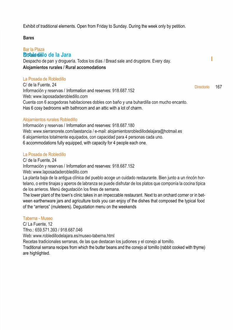
8/3/2019 Libro Senda Del Genaro GR300
http://slidepdf.com/reader/full/libro-senda-del-genaro-gr300 155/156
Robledillo de la Jara
Alojamientos rurales / Rural accomodations
La Posada de RobledilloC/ de la Fuente, 24Información y reservas / Information and reserves: 918.687.152Web: www.laposadaderobledillo.comCuenta con 6 acogedoras habitaciones dobles con baño y una buhardilla con mucho encanto.Has 6 cosy bedrooms with bathroom and an attic with a lot of charm.
Alojamientos rurales RobledilloInformación y reservas / Information and reserves: 918.687.180Web: www.sierranorete.com/laestancia / e-mail: [email protected] alojamientos totalmente equipados, con capacidad para 4 personas cada uno.6 accommodations fully equipped, with capacity for 4 people each one.
La Posada de RobledilloC/ de la Fuente, 24Información y reservas / Information and reserves: 918.687.152Web: www.laposadaderobledillo.comLa planta baja de la antigua clínica del pueblo acoge un cuidado restaurante. Bien junto a un rincón hor-telano, o entre tinajas y aperos de labranza se puede disfrutar de los platos que componía la cocina típicade los arrieros. Menú degustación los fines de semana.The lower plant of the town’s clinic takes in an impeccable restaurant. Next to an orchard corner or in bet-ween earthenware jars and agriculture tools you can enjoy of the dishes that composed the typical foodof the “arrieros” (muleteers). Degustation menu on the weekends
Taberna - MuseoC/ La Fuente, 12Tlfno.: 659.571.393 / 918.687.046Web: www.robledillodelajara.es/museo-taberna.htmlRecetas tradicionales serranas, de las que destacan los judiones y el conejo al tomillo.Traditional serrana recipes from which the butter beans and the conejo al tomillo (rabbit cooked with thyme)are highlighted.
168 Variantes BTT
8/3/2019 Libro Senda Del Genaro GR300
http://slidepdf.com/reader/full/libro-senda-del-genaro-gr300 156/156